Franklin County, Vermont
| Franklin County, Vermont | |
|---|---|
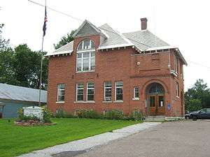 St. Albans Town Hall. | |
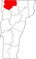 Location in the U.S. state of Vermont | |
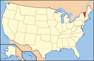 Vermont's location in the U.S. | |
| Founded | 1796 |
| Named for | Benjamin Franklin |
| Largest city | St. Albans |
| Area | |
| • Total | 692 sq mi (1,792 km2) |
| • Land | 634 sq mi (1,642 km2) |
| • Water | 58 sq mi (150 km2), 8.4% |
| Population (est.) | |
| • (2015) | 48,799 |
| • Density | 76.7/sq mi (29.6/km2) |
| Congressional district | At-large |
| Time zone | Eastern: UTC−5/−4 |
Franklin County is a county in the state of Vermont, in the United States. As of the 2010 census, the population was 47,746.[1] Its county seat is the city of St. Albans.[2] It borders the Canadian province of Quebec. The county was created in 1792 and organized in 1796.[3][4] Franklin County is part of the Burlington metropolitan area.
History
Franklin County is one of several Vermont counties created from land originally ceded by the state of New York on January 15, 1777 when Vermont declared itself to be a state distinct from New York.[5][6][7] The land originally was contested by Massachusetts, New Hampshire, and New Netherland, but it remained undelineated until July 20, 1764, when King George III established the boundary between New Hampshire and New York along the west bank of the Connecticut River, north of Massachusetts and south of the parallel of 45 degrees north latitude. New York assigned the land gained to Albany County.[8][9] On March 12, 1772 Albany County was partitioned to create Charlotte County,[10] and this situation remained until Vermont's independence from New York and Britain. However, this did not end the contest.
On September 3, 1783, as a result of the signing of the Treaty of Paris the Revolutionary War ended with Great Britain recognizing the independence of the United States. Vermont's border with Quebec was established at 45 degrees north latitude.[11][12] In 1792, Franklin County was formed from part of Chittenden County.[4]
The county's namesake is Benjamin Franklin.[13]
in 2008, the federal government declared the county a disaster area after severe storms and flooding June 14–17.[14]
Geography
According to the U.S. Census Bureau, the county has an area of 692 square miles (1,790 km2), of which 634 square miles (1,640 km2) is land and 58 square miles (150 km2) (8.4%) is water.[15]
Adjacent counties and municipalities
- Orleans County - east
- Lamoille County - southeast
- Chittenden County - southwest
- Grand Isle County - west
- Le Haut-Richelieu Regional County Municipality, Quebec - northwest
- Brome-Missisquoi Regional County Municipality, Quebec - north
National protected area
Demographics
| Historical population | |||
|---|---|---|---|
| Census | Pop. | %± | |
| 1800 | 8,282 | — | |
| 1810 | 16,615 | 100.6% | |
| 1820 | 17,192 | 3.5% | |
| 1830 | 24,525 | 42.7% | |
| 1840 | 24,531 | 0.0% | |
| 1850 | 28,586 | 16.5% | |
| 1860 | 27,231 | −4.7% | |
| 1870 | 30,291 | 11.2% | |
| 1880 | 30,225 | −0.2% | |
| 1890 | 29,755 | −1.6% | |
| 1900 | 30,198 | 1.5% | |
| 1910 | 29,866 | −1.1% | |
| 1920 | 30,026 | 0.5% | |
| 1930 | 29,975 | −0.2% | |
| 1940 | 29,601 | −1.2% | |
| 1950 | 29,894 | 1.0% | |
| 1960 | 29,474 | −1.4% | |
| 1970 | 31,282 | 6.1% | |
| 1980 | 34,788 | 11.2% | |
| 1990 | 39,980 | 14.9% | |
| 2000 | 45,417 | 13.6% | |
| 2010 | 47,746 | 5.1% | |
| Est. 2016 | 48,915 | [16] | 2.4% |
| U.S. Decennial Census[17] 1790–1960[18] 1900–1990[19] 1990–2000[20] 2010–2014[1] | |||
2010 census
As of the 2010 United States Census, there were 47,746 people, 18,513 households, and 12,939 families residing in the county.[21] The population density was 75.3 inhabitants per square mile (29.1/km2). There were 21,588 housing units at an average density of 34.1 per square mile (13.2/km2).[22] Of the 18,513 households, 34.9% had children under the age of 18 living with them, 53.7% were married couples living together, 10.7% had a female householder with no husband present, 30.1% were non-families, and 22.7% of all households were made up of individuals. The average household size was 2.55 and the average family size was 2.97. The median age was 39.6 years.[21]
The median income for a household in the county was $53,623 and the median income for a family was $63,009. Males had a median income of $43,155 versus $36,940 for females. The per capita income for the county was $24,767. About 7.2% of families and 10.5% of the population were below the poverty line, including 13.8% of those under age 18 and 8.7% of those age 65 or over.[23]
Politics
In 1828, Franklin County was won by National Republican Party candidate John Quincy Adams
In 1832, the county was won by Anti-Masonic Party candidate William Wirt.
In 1836, the county was won by Democratic Party candidate Martin Van Buren
From William Henry Harrison in 1840 to Winfield Scott in 1852, the county would vote the Whig Party candidates.
From John C. Frémont in 1856 to Herbert Hoover in 1928 (barring 1912, where the county was won by Progressive Party candidate and former president Theodore Roosevelt), the Republican Party would have a 72 year winning streak in the county.
In 1932, the county was won by Democratic candidate Franklin D. Roosevelt and would be won by him in all four of his presidential runs from 1932 to 1944. During that time, Franklin County, along with Chittenden and Grand Isle Counties would become Democratic enclaves in an otherwise Republican-voting Vermont. The county would also be won by Harry S. Truman in 1948.
Dwight D. Eisenhower was able to win back Franklin County for the Republicans during the 1952 and 1956 elections.
The county would go to Democratic candidates John F. Kennedy in 1960, Lyndon B. Johnson in 1964, and Hubert H. Humphrey in 1968.
Incumbent President Richard Nixon would carry the county in 1972 as would Gerald Ford in 1976.
In 1980 and 1984, the county was won by Republican Ronald Reagan, who would become the last Republican presidential candidate to win Franklin County.
Since Michael Dukakis won the county in 1988, it has been won by Democratic candidates ever since.
| Year | Republican | Democratic | Third parties |
|---|---|---|---|
| 2016 | 40.9% 8,752 | 43.7% 9,351 | 15.5% 3,308 |
| 2012 | 37.2% 7,405 | 60.6% 12,057 | 2.1% 426 |
| 2008 | 36.6% 7,853 | 61.4% 13,179 | 2.0% 428 |
| 2004 | 44.9% 8,936 | 53.2% 10,598 | 1.9% 386 |
| 2000 | 43.7% 8,395 | 49.6% 9,514 | 6.7% 1,285 |
| 1996 | 28.5% 4,617 | 54.2% 8,790 | 17.3% 2,799 |
| 1992 | 29.3% 5,484 | 42.7% 8,004 | 28.1% 5,263 |
| 1988 | 49.2% 7,293 | 49.7% 7,372 | 1.1% 169 |
| 1984 | 59.6% 8,683 | 39.5% 5,755 | 0.9% 124 |
| 1980 | 44.6% 5,998 | 44.0% 5,914 | 11.4% 1,533 |
| 1976 | 51.6% 6,190 | 46.8% 5,610 | 1.6% 186 |
| 1972 | 67.2% 8,109 | 32.3% 3,898 | 0.5% 58 |
| 1968 | 44.7% 5,218 | 51.6% 6,027 | 3.7% 436 |
| 1964 | 27.0% 3,261 | 73.0% 8,823 | 0.0% 2 |
| 1960 | 43.7% 5,444 | 56.4% 7,028 | |
| 1956 | 59.6% 7,125 | 40.5% 4,840 | |
| 1952 | 57.8% 6,949 | 41.8% 5,018 | 0.4% 51 |
| 1948 | 46.9% 4,897 | 52.2% 5,455 | 0.9% 92 |
| 1944 | 42.0% 4,374 | 58.0% 6,036 | 0.0% 1 |
| 1940 | 41.2% 5,258 | 58.3% 7,439 | 0.5% 63 |
| 1936 | 44.6% 5,507 | 55.2% 6,817 | 0.3% 36 |
| 1932 | 44.3% 4,999 | 54.8% 6,179 | 1.0% 108 |
| 1928 | 52.2% 6,031 | 47.4% 5,477 | 0.4% 40 |
| 1924 | 67.1% 4,594 | 24.1% 1,649 | 8.8% 604 |
| 1920 | 66.7% 4,869 | 32.1% 2,342 | 1.2% 87 |
| 1916 | 56.4% 2,796 | 42.5% 2,107 | 1.1% 54 |
| 1912 | 33.2% 1,433 | 30.5% 1,317 | 36.4% 1,571 |
| 1908 | 66.8% 2,360 | 29.7% 1,048 | 3.5% 123 |
| 1904 | 72.2% 2,522 | 25.2% 881 | 2.6% 89 |
| 1900 | 66.4% 2,738 | 31.9% 1,316 | 1.7% 71 |
| 1896 | 72.2% 3,444 | 24.1% 1,150 | 3.8% 179 |
| 1892 | 63.2% 2,540 | 33.7% 1,353 | 3.1% 125 |
| 1888 | 67.3% 3,121 | 29.0% 1,343 | 3.7% 171 |
Economy
Personal income
The median income for a household in the county was $41,659, and the median income for a family was $46,733. Males had a median income of $32,009 versus $24,078 for females. The per capita income for the county was $17,816. About 7.00% of families and 9.00% of the population were below the poverty line, including 10.40% of those under age 18 and 10.30% of those age 65 or over.
Industry
In 2009, the county had the most dairy farms in the state, 239 out of 1,078.[25]
Communities
City
Towns
Villages
Villages are census divisions, but have no separate corporate existence from the towns they are in.
- Enosburg Falls - village of Enosburgh
- Swanton Village - village of Swanton
Census-designated places
See also
References
- 1 2 "State & County QuickFacts". United States Census Bureau. Archived from the original on July 10, 2011. Retrieved December 30, 2013.
- ↑ "Find a County". National Association of Counties. Archived from the original on 2011-05-31. Retrieved 2011-06-07.
- ↑ "Vermont: Individual County Chronologies". Vermont Atlas of Historical County Boundaries. The Newberry Library. 2008. Retrieved June 30, 2015.
- 1 2 Aldrich, Lewis Cass (1891). History of Franklin and Grand Isle counties, Vermont. Syracuse, NY: D. Mason & Co. Retrieved June 30, 2015.
- ↑ Slade, William, Jr., comp. Vermont State Papers: Being a collection of Records and Documents Connected with the Assumption and Establishment of Government by the People of Vermont, Together with the Journal of the Council of Safety, the First Constitution, the Early Journals of the General Assembly, and the Laws from the Year 1779 to 1786, Inclusive. Middlebury, 1823. P. 70-73.
- ↑ Van Zandt, Franklin K. Boundaries of the United States and the Several States. Geological Survey Professional Paper 909. Washington, DC; Government Printing Office, 1976. The Standard Compilation for its subject. P. 64.
- ↑ Williamson, Chilton. Vermont in Quandary: 1763-1825. Growth of Vermont series, Number 4. Montpelier: Vermont Historical Series, 1949. PP. 82-84; map facing 95, 100-102, 112-113.
- ↑ Slade, William, Jr., comp. Vermont State Papers: Being a collection of Records and Documents Connected with the Assumption and Establishment of Government by the People of Vermont, Together with the Journal of the Council of Safety, the First Constitution, the Early Journals of the General Assembly, and the Laws from the Year 1779 to 1786, Inclusive. Middlebury, 1823. P. 13-19.
- ↑ Van Zandt, Franklin K. Boundaries of the United States and the Several States. Geological Survey Professional Paper 909. Washington, DC; Government Printing Office, 1976. The Standard Compilation for its subject. P. 63.
- ↑ New York Colonial Laws, Chapter 1534; Section 5; Paragraph 321)
- ↑ Van Zandt, Franklin K. Boundaries of the United States and the Several States. Geological Survey Professional Paper 909. Washington, DC; Government Printing Office, 1976. The Standard Compilation for its subject. P. 12.
- ↑ Parry, Clive, ed. Consolidated Treaty Series. 231 Volumes. Dobbs Ferry, New York; Oceana Publications, 1969-1981. Volume 48; pp. 481; 487; 491-492.
- ↑ Gannett, Henry (1905). The Origin of Certain Place Names in the United States. Govt. Print. Off. p. 131.
- ↑ Sutkoski, Matt (August 1, 2008). Summer has been wet one for the ages. Burlington Free Press.
- ↑ "2010 Census Gazetteer Files". United States Census Bureau. August 22, 2012. Retrieved June 29, 2015.
- ↑ "Population and Housing Unit Estimates". Retrieved June 9, 2017.
- ↑ "U.S. Decennial Census". United States Census Bureau. Archived from the original on May 12, 2015. Retrieved June 29, 2015.
- ↑ "Historical Census Browser". University of Virginia Library. Retrieved June 29, 2015.
- ↑ Forstall, Richard L., ed. (March 27, 1995). "Population of Counties by Decennial Census: 1900 to 1990". United States Census Bureau. Retrieved June 29, 2015.
- ↑ "Census 2000 PHC-T-4. Ranking Tables for Counties: 1990 and 2000" (PDF). United States Census Bureau. April 2, 2001. Retrieved June 29, 2015.
- 1 2 "DP-1 Profile of General Population and Housing Characteristics: 2010 Demographic Profile Data". United States Census Bureau. Retrieved 2016-01-20.
- ↑ "Population, Housing Units, Area, and Density: 2010 - County". United States Census Bureau. Retrieved 2016-01-20.
- ↑ "DP03 SELECTED ECONOMIC CHARACTERISTICS – 2006-2010 American Community Survey 5-Year Estimates". United States Census Bureau. Retrieved 2016-01-20.
- ↑ Leip, David. "Dave Leip's Atlas of U.S. Presidential Elections". uselectionatlas.org. Retrieved 11 April 2018.
- ↑ Lefebvre, Paul (February 11, 2009). Average Vermont farmer expected to lose $92,000. the Chronicle.
External links
- Franklin County Chamber of Commerce
- National Register of Historic Places listing for Franklin Co., Vermont
Places adjacent to Franklin County, Vermont | ||||||||||
|---|---|---|---|---|---|---|---|---|---|---|
| ||||||||||
Municipalities and communities of Franklin County, Vermont, United States | ||
|---|---|---|
| City | | |
| Towns | ||
| Villages | ||
| CDP | ||
| Unincorporated communities | ||
Montpelier (capital) | |
| Regions | |
| Counties | |
| Cities | |
| Towns (pop. >5000) | |
| Festivals | |
| Topics |
|
| Society |
|