List of Farm to Market Roads in Texas (1800–1899)
|
Texas Farm to Market Road and Ranch to Market Road markers | |
| Highway names | |
|---|---|
| Interstates | Interstate Highway X (IH-X, I-X) |
| US Highways | U.S. Highway X (US X) |
| State | State Highway X (SH X) |
| Loops: | Loop X |
| Spurs: | Spur X |
| Farm or Ranch to Market Roads: |
Farm to Market Road X (FM X) Ranch-to-Market Road X (RM X) |
| Park Roads: | Park Road X (PR X) |
| System links | |
Farm to Market Roads in Texas are owned and maintained by the Texas Department of Transportation (TxDOT).
FM 1800
| |
|---|---|
| Location | Stephens County |
| Length | 0.924 mi[1] (1.487 km) |
| Existed | December 22, 1993[1]–present |
FM 1800/RM 1800 (1951)
| |
|---|---|
| Location | Martin, Midland and Glasscock counties |
| Existed | December 18, 1951–May 16, 1984 |
The original FM 1800 was designated on December 18, 1951 from FM 307 north to the Martin County line. On February 21, 1952 the road was extended 2.8 miles north to US 80 (now IH 20) at Stanton. On August 20, 1952 the road was extended south and southeast to SH 158, 4 miles east of the Midland County line, replacing FM 1857. On October 31, 1957 the road was extended southeast 6 miles from SH 158. A year later the road was extended southeast via Stiles to RM 33, 12.5 miles north of Big Lake, replacing RM 2404, and FM 1800 was changed to RM 1800.[2] RM 1800 was cancelled on May 16, 1984 and transferred to SH 137.[3]
FM 1801
| |
|---|---|
| Location | Wood County |
| Length | 6.283 mi[4] (10.112 km) |
| Existed | November 20, 1951[4]–present |
FM 1802
| |
|---|---|
| Location | Wheeler County |
| Length | 0.984 mi[5] (1.584 km) |
| Existed | November 20, 1951[5]–present |
FM 1803
| |
|---|---|
| Location | Henderson County |
| Length | 8.335 mi[6] (13.414 km) |
| Existed | October 31, 1958[6]–present |
FM 1803 (1951)
| |
|---|---|
| Location | Smith County |
| Existed | November 20, 1951[6]–October 30, 1957 |
The original FM 1803 was designated on November 20, 1951 from US 271, 2 miles north of Tyler, south to SH 64. On December 10, 1954 the road was extended south, west, north and east to FM 1803 0.1 mile south of the point of beginning, replacing FM 845 and completing the loop around Tyler. FM 1803 was cancelled on October 30, 1957 and transferred to Loop 323.
FM 1804
| |
|---|---|
| Location | Smith and Wood counties |
| Length | 7.806 mi[7] (12.563 km) |
| Existed | November 20, 1951[7]–present |
FM 1805
| |
|---|---|
| Location | Van Zandt and Smith counties |
| Length | 5.241 mi[8] (8.435 km) |
| Existed | November 20, 1951[8]–present |
FM 1806
| |
|---|---|
| Location | Montague County |
| Length | 14.296 mi[9] (23.007 km) |
| Existed | December 17, 1952[9]–present |
Farm to Market Road 1806 (FM 1806) is a two-lane, state-maintained highway that connects the farming areas of west central Montague County to the county seat, Montague. FM 1806 also intersects with U.S. Highway 81 (US 81) leading to the Ringgold and Bowie, and other various county secondary roads. FM 1806 runs from a point 2.9 miles (4.7 km) west of US 81, near Stoneburg, to State Highway 59 (SH 59) and SH 175 in Montague.
The current FM 1806 was designated on December 17, 1952 from US 81 in Stoneburg northeastward and eastward 4 miles (6.4 km). On November 21, 1956, FM 1806 extended to SH 59/SH 175, replacing FM 2188. In 1977, FM 1806 extended west to its current western terminus.[9]
FM 1806 (1951)
| |
|---|---|
| Location | Johnson County |
| Existed | November 20, 1951[9]–December 17, 1952 |
FM 1806 was originally designated on November 20, 1951 on a route from SH 171 to FM 110 (now FM 4) in Johnson County; this route was transferred to FM 916 on December 17, 1952.
FM 1807
| |
|---|---|
| Location | Johnson and Ellis counties |
| Length | 9.255 mi[10] (14.894 km) |
| Existed | 1951[10]–present |
FM 1808
| |
|---|---|
| Location | Mitchell County |
| Length | 8.400 mi[11] (13.518 km) |
| Existed | September 29, 1954[11]–present |
FM 1808 (1951)
| |
|---|---|
| Location | Mitchell County |
| Existed | November 20, 1951–February 24, 1953 |
The original FM 1808 was designated on November 20, 1951 from US 80 (now IH 20 Business) at Westbrook to a point 5.8 miles south. On December 17, 1952 the road was extended 3 miles south to SH 101 (now SH 163). FM 1808 was cancelled on February 24, 1953 and transferred to FM 670.
FM 1809
| |
|---|---|
| Location | Nolan County |
| Length | 2.721 mi[12] (4.379 km) |
| Existed | 1951[12]–present |
FM 1810
| |
|---|---|
| Location | Jack and Wise counties |
| Length | 27.724 mi[13] (44.617 km) |
| Existed | August 24, 1955[13]–present |
FM 1810 (1951)
| |
|---|---|
| Location | Wilbarger County |
| Existed | November 20, 1951–October 18, 1954 |
The original FM 1810 was designated on November 20, 1951 from US 287, 3.5 miles east of Vernon, northeast to Kingola. FM 1810 was cancelled on October 18, 1954 and became a portion of FM 1763.
FM 1811
| |
|---|---|
| Location | Wilbarger and Wichita counties |
| Length | 16.911 mi[14] (27.216 km) |
| Existed | 1951[14]–present |
FM 1812
| |
|---|---|
| Location | Fisher and Jones counties |
| Length | 25.415 mi[15] (40.901 km) |
| Existed | September 29, 1954[15]–present |
FM 1812 (1951)
| |
|---|---|
| Location | Wichita County |
| Existed | November 20, 1951[15]–February 25, 1954 |
The original FM 1812 was designated on November 20, 1951 from SH 25 southwest to US 287 in Electra. FM 1812 was cancelled on February 25, 1954 and transferred to SH 25 when it was rerouted. The old route on 5th street, Avenue C, Waggoner Street, Glisson Street, and Main Street was given to the city.
FM 1813
| |
|---|---|
| Location | Wichita County |
| Length | 1.898 mi[16] (3.055 km) |
| Existed | 1951[16]–present |
FM 1814
| |
|---|---|
| Location | Wichita County |
| Length | 2.173 mi[17] (3.497 km) |
| Existed | 1951[17]–present |
FM 1815
| |
|---|---|
| Location | Montague County |
| Length | 4.727 mi[18] (7.607 km) |
| Existed | November 20, 1951[18]–present |
Farm to Market Road 1815 (FM 1815) is a two-lane, state-maintained highway that connects FM 1956 with U.S. Highway 82 (US 82) in north central Montague County. Farming areas and Bonita are serviced by the road, as well as other various county secondary roads.
FM 1815 begins at an intersection with US 82, heading north on a two-lane undivided road. The road heads through open farmland with some woods and homes, turning southeast and curving northeast through the residential community of Bonita. The highway continues north through more rural areas. FM 1815 reaches its northern terminus at an intersection with FM 1956.[18][19][20]
The area developed after the arrival of the Missouri–Kansas–Texas Railroad through north central Montague County, connecting Nocona with Saint Jo. FM 1815 was first designated on November 20, 1951, running from US 82 to a point 2.3 miles (3.7 km) to the north. The highway was extended north to its current terminus at a road intersection on November 21, 1956.[18] The road would become part of FM 1956 on October 31, 1957 (when the junction was the east end), and on October 31, 1958 (when FM 1956 extended east from FM 1815)
Major intersections
The entire route is in Montague County.
| Location | mi[18] | km | Destinations | Notes | |
|---|---|---|---|---|---|
| Bonita | 0.000 | 0.000 | |||
| | 4.727 | 7.607 | |||
| 1.000 mi = 1.609 km; 1.000 km = 0.621 mi | |||||
FM 1816
| |
|---|---|
| Location | Montague County |
| Length | 17.853 mi[21] (28.732 km) |
| Existed | November 20, 1951[21]–present |
Farm to Market Road 1816 (FM 1816) is a two-lane, state-maintained highway in Montague County. It runs from State Highway 59 (SH 59) in Bowie to an intersection 1.1 miles (1.8 km) north of U.S. Highway 82 (US 82). FM 1816 also intersects with FM 1806 east of Stoneburg and other various county secondary roads. The road generally parallels US 81 through central Montague County.
FM 1816 was designated on November 20, 1951 from US 82 north 1.1 miles (1.8 km). On August 24, 1955, FM 1816 extended south 5.0 miles (8.0 km). On November 21, 1956, FM 1816 extended south to FM 1806. On October 31, 1958, FM 1816 extended south to SH 59, replacing FM 1935.
FM 1817
| |
|---|---|
| Location | Anderson County |
| Length | 8.86 mi[22] (14.26 km) |
| Existed | 1951[22]–present |
FM 1818
| |
|---|---|
| Location | Angelina County |
| Length | 20.792 mi[23] (33.461 km) |
| Existed | 1951[23]–present |
FM 1819
| |
|---|---|
| Location | Angelina and Cherokee counties |
| Length | 7.122 mi[24] (11.462 km) |
| Existed | 1951[24]–present |
FM 1820
Farm to Market Road 1820 (FM 1820) is a designation that has been used twice. No highway currently uses the FM 1820 designation.[25]
FM 1820 (1951)
| |
|---|---|
| Location | Shelby County |
| Existed | November 20, 1951–August 13, 1968 |
FM 1820 was first designated on November 20, 1951, running from SH 87 at Shlebyville northeastward to Carroll Church at a distance of 6.4 miles (10.3 km). The highway was extended 5.4 miles (8.7 km) to FM 139 at Pauls Store on August 24, 1955. FM 1820 was cancelled and became a portion of FM 417 on August 13, 1968.[26]
FM 1820 (1978)
| |
|---|---|
| Location | Wise County |
| Existed | April 25, 1978–November 19, 1996 |
The second FM 1820 was designated on April 25, 1978, running near the Lake Bridgeport Dam southeastward to US 380 at a distance of 1.1 miles (1.8 km). The highway was extended 1.8 miles (2.9 km) northward to FM 1658 on July 29, 1993. FM 1820 was cancelled on November 19, 1996, with the mileage being transferred to FM 1658.[27]
FM 1821
| |
|---|---|
| Location | Palo Pinto County |
| Length | 5.838 mi[28] (9.395 km) |
| Existed | January 29, 1959[28]–present |
Farm to Market Road 1821 (FM 1821) is located entirely in Palo Pinto County.
FM 1821 begins at an intersection with FM 1195 near Mineral Wells Airport. The highway starts out running in a west direction along MH 379, then turns north onto Garrett Morris Parkway. FM 1821 travels through more rural areas of Mineral Wells before running near a subdivision and retail center near US 180. The highway leaves the Mineral Wells city limits just north of an intersection with FM 3027 and passes near a subdivision before the route becomes more rural. FM 1821 turns west at Hayes Road and continues to travel in a westward direction, ending at an intersection with US 281.
The current FM 1821 was designated on January 29, 1959, running from US 180 east of Mineral Wells southward and eastward to FM 1195 along a former routing of that highway.[29] On September 27, 1960, the highway was extended northward to US 281 with an overlap with US 180. FM 1821 was routed off of US 180 on November 5, 1971.
- Junction list
The entire route is in Palo Pinto County.
| Location | mi[30] | km | Destinations | Notes | |
|---|---|---|---|---|---|
| Mineral Wells | 0.0 | 0.0 | |||
| 2.3 | 3.7 | ||||
| 3.3 | 5.3 | ||||
| | 5.9 | 9.5 | |||
| 1.000 mi = 1.609 km; 1.000 km = 0.621 mi | |||||
FM 1821 (1951)
| |
|---|---|
| Location | Shelby County |
| Existed | November 20, 1951–November 28, 1958 |
The first FM 1821 was designated on November 20, 1951, running from SH 7 near Center southward to Jericho at a distance of 3.7 miles (6.0 km). The highway was cancelled on November 28, 1958, with the mileage being transferred to FM 711.[31]
FM 1822
| |
|---|---|
| Location | Jackson County |
| Length | 7.598 mi[32] (12.228 km) |
| Existed | 1951[32]–present |
FM 1823
| |
|---|---|
| Location | Jackson County |
| Length | 6.93 mi[33] (11.15 km) |
| Existed | 1951[33]–present |
FM 1824
| |
|---|---|
| Location | Erath County |
| Length | 4.518 mi[34] (7.271 km) |
| Existed | December 17, 1952[34]–present |
FM 1824 (1951)
| |
|---|---|
| Location | Blanco County |
| Existed | November 20, 1951–January 29, 1953 |
FM 1825
| |
|---|---|
| Location | Travis County |
| Length | 3.913 mi[35] (6.297 km) |
| Existed | November 20, 1951[36]–present |
Farm to Market Road 1825 (FM 1825) is a 4.683-mile (7.537 km) state-maintained farm to market road located in Travis County of the U.S. state of Texas.[35] FM 1825 begins in far north Austin at Interstate Highway 35 (I‑35) Exit #247. It proceeds north and then east 3.9 miles (6.3 km) into Pflugerville, within which it is named Pecan Street. FM 1825 ends in Pflugerville at an intersection with FM 685. FM 1825 also includes a short 0.8-mile (1.3 km) unsigned spur along Vision Drive that acts as a bypass for the north/south section running parallel to I‑35.
As designated on November 20, 1951, FM 1825 originally included only the segment from Three Points Road eastward, which intersected with U.S. Highway 81 (US 81) at the time. On January 18, 1960, the alignment of US 81 was altered to align with I‑35. At this point, FM 1825 was extended south 1.1 miles (1.8 km) to intersect with the new I‑35 alignment, and Three Points Road between FM 1825 and I‑35 was added as an unsigned spur.[36] On June 27, 1995, FM 1825 was redesignated as Urban Road 1825 (UR 1825). As with most other Urban Roads, no signage changes have been made to indicate the new name.[36][35]
Major intersections
The entire route is in Travis County.
| Location | mi[37] | km | Destinations | Notes | |
|---|---|---|---|---|---|
| Austin | 0.0– 0.3 | 0.0– 0.48 | I-35 exit 247 | ||
| 0.9 | 1.4 | ||||
| Pflugerville | 3.9 | 6.3 | |||
| 1.000 mi = 1.609 km; 1.000 km = 0.621 mi | |||||
FM 1826
| |
|---|---|
| Location | Travis County |
| Existed | November 20, 1951–September 29, 1954[38] |
FM 1826 was designated on November 20, 1951, from US 290 southwestward to the Travis-Hays County Line. The route was extended into Hays County, to FM 966 near Driftwood, on September 29, 1954; the same day also saw the designation changed from an FM to an RM.[38]
RM 1826
| |
|---|---|
| Location | Hays and Travis counties |
| Length | 12.088 mi[38] (19.454 km) |
| Existed | September 29, 1954[38]–present |
Ranch to Market Road 1826 (RM 1826) is a 12.09-mile (19.46 km) state-maintained east-west ranch to market road located in Travis and Hays counties of the U.S. state of Texas.[38]
RM 1826 begins at an intersection with RM 150 just north of Driftwood.[39] The route proceeds northeast 8.4 miles (13.5 km), entering Travis County to intersect the stub end of the southern segment of State Highway 45 (SH 45).[40] It continues northeast 3.7 miles (6.0 km) along the Austin city limits to its northern terminus, along U.S. Highway 290 (US 290) west of its intersection with SH 71 in the Oak Hill neighborhood of Austin.[38]
FM 1826 was designated on November 20, 1951, from US 290 southwestward to the Travis-Hays County Line. The route was extended into Hays County, to FM 966 near Driftwood, on September 29, 1954; the same day also saw the designation changed from an FM to an RM.[38] FM 966 would be canceled and combined with FM 150 on May 25, 1955, and that would be changed to RM 150 on October 1, 1956.[41]
Major intersections
| County | Location | mi[42] | km | Destinations | Notes |
|---|---|---|---|---|---|
| Hays | | 0.0 | 0.0 | Southern terminus | |
| | 1.3 | 2.1 | |||
| Travis | Austin | 8.5 | 13.7 | ||
| 12.1 | 19.5 | Northern terminus | |||
| 1.000 mi = 1.609 km; 1.000 km = 0.621 mi | |||||
FM 1827
| |
|---|---|
| Location | Collin County |
| Length | 10.784 mi[43] (17.355 km) |
| Existed | 1951[43]–present |
FM 1828
| |
|---|---|
| Location | Schleicher County |
| Length | 16.099 mi[44] (25.909 km) |
| Existed | October 31, 1957[44]–present |
FM 1828 (1951)
| |
|---|---|
| Location | Collin County |
| Existed | November 20, 1951–May 20, 1955 |
The first use of the FM 1828 designation was on November 20, 1951 in Collin County, from SH 24 west of McKinney north to a road intersection. FM 1828 was cancelled on May 20, 1955 and became a portion of FM 1461.
FM 1828 (1955)
| |
|---|---|
| Location | San Jacinto County |
| Existed | August 24, 1955–December 17, 1956 |
The next use of the FM 1826 designation was on August 24, 1955 in San Jacinto County, from SH 150, 2 miles south of Coldspring, south to a road intersection. FM 1828 was cancelled on December 17, 1956 and became a portion of FM 2025.
FM 1829
| |
|---|---|
| Location | Coryell County |
| Length | 7.129 mi[45] (11.473 km) |
| Existed | December 17, 1952[45]–present |
FM 1829 (1951)
| |
|---|---|
| Location | Denton County |
| Existed | November 20, 1951–December 17, 1952 |
The original FM 1829 was designated on November 20, 1951 from SH 110 in Pilot Point west to a road intersection. FM 1829 was cancelled on January 29, 1953 and transferred to FM 455.
FM 1830
| |
|---|---|
| Location | Denton County |
| Length | 5.477 mi[46] (8.814 km) |
| Existed | 1951[46]–present |
Farm to Market Road 1830 (FM 1830) is located entirely in Denton County.
FM 1830 begins at an intersection with FM 407 in Argyle. The highway travels in a northern direction along the eastern edge of the town, leaving the city limits at an intersection with Hickory Hill Road. FM 1830 travels through areas that feature a mix between subdivisions and farm land, entering Denton near Ryan Road. The highway travels through less developed areas of the city, ending at an intersection with US 377.
FM 1830 was designated on November 20, 1951, traveling from US 377 southward to a road intersection at a distance of 6.2 miles (10.0 km). The highway was extended 2.0 miles (3.2 km) southward to FM 1078 at Bartonville on December 17, 1952. The section of FM 1830 between FM 1172 and FM 1078 was cancelled and transferred to FM 407 (along with all of FM 1172 and FM 1078) on January 6, 1955, decreasing the route's length by 2.6 miles (4.2 km).[47] The entire highway was internally re-designated as Urban Road 1830 by TxDOT on June 27, 1995.[48]
- Junction list
The entire route is in Denton County.
| Location | mi[46] | km | Destinations | Notes | |
|---|---|---|---|---|---|
| Argyle | 0.000 | 0.000 | |||
| Denton | 5.477 | 8.814 | |||
| 1.000 mi = 1.609 km; 1.000 km = 0.621 mi | |||||
FM 1831
| |
|---|---|
| Location | Crosby County |
| Length | 7.554 mi[49] (12.157 km) |
| Existed | 1951[49]–present |
FM 1832
| |
|---|---|
| Location | Callahan County |
| Existed | November 20, 1951–January 28, 1953 |
On November 20, 1951, Farm to Market Road 1832 was originally designated as a 6.0-mile (9.7 km) road linking the former U.S. Route 80 (now Interstate 20) 1.0 mile (1.6 km) east of Putnam to a road intersection in eastern Callahan County. On December 17, 1952, FM 1832 extended to US 380 near Moran. That designation was dropped on January 28, 1953 when the road was assigned as an extension of FM 880.
RM 1832
| |
|---|---|
| Location | Jeff Davis County |
| Length | 10.859 mi[50] (17.476 km) |
| Existed | March 26, 1953[50]–present |
Ranch to Market Road 1832, Ranch Road 1832, or RM 1832 is a 10.9-mile (17.5 km) route maintained by the Texas Department of Transportation (TxDOT) that connects the Boy Scouts of America's Buffalo Trails Scout Ranch to State Highway 17 (SH 17) about 25.1 miles (40.4 km) north of Fort Davis.[51] The road is part of the state's Farm and Ranch to Market Road System.
RM 1832 is located entirely within Jeff Davis County. The rural road does not pass through any cities or towns but instead winds through ranch land along its length with no highway intersections beyond its terminus at SH 17.
On March 26, 1953, FM 1832 was re-designated as the present route in Jeff Davis County. This was to be cancelled and given to Jeff Davis County when construction is completed.[52] When this route was constructed by September 20, 1954, FM 1832 was cancelled. On September 20, 1955, the state again assumed control over the road and its designation was restored. On October 27, 1959, the road was given its current ranch to market designation.
FM 1833
| |
|---|---|
| Location | Nueces County |
| Length | 7.717 mi[53] (12.419 km) |
| Existed | October 28, 1953[53]–present |
FM 1833 (1951)
| |
|---|---|
| Location | Fisher County |
| Existed | November 20, 1951–November 4, 1953 |
The original FM 1833 was designated on November 20, 1951 from FM 57 at Sylvester to a point 8.6 miles southeast. FM 1833 was cancelled on November 4, 1953 and transferred to FM 1085.
FM 1834
| |
|---|---|
| Location | Willacy County |
| Length | 2.045 mi[54] (3.291 km) |
| Existed | June 28, 1963[54]–present |
FM 1834 (1951)
| |
|---|---|
| Location | Haskell County |
| Existed | December 11, 1951–October 22, 1962 |
The original FM 1834 was designated on December 11, 1951 from FM 618 to a point 0.8 mile west as a replacement of a section of FM 618. On November 21, 1956 the road was extended 9.1 miles northwest to Haskell. FM 1834 was cancelled on October 22, 1962 and transferred to FM 600.
FM 1835
| |
|---|---|
| Location | Stonewall and Jones counties |
| Length | 36.047 mi[55] (58.012 km) |
| Existed | 1951[55]–present |
FM 1836
| |
|---|---|
| Location | Kaufman County |
| Length | 15.708 mi[56] (25.280 km) |
| Existed | 1951[56]–present |
FM 1837
| |
|---|---|
| Location | Kaufman County |
| Existed | November 20, 1951–January 29, 1953 |
On November 20, 1951, Farm to Market Road 1837 was originally designated as a 4.8-mile (7.7 km) road in Kaufman County. The original route extended southeastward 4.8 miles from U.S. Route 80 1.0 mile (1.6 km) east of Terrell. That designation was canceled on January 29, 1953 when the original road was added as an extension to FM 429.
RM 1837
| |
|---|---|
| Location | Jeff Davis County |
| Length | 3.383 mi[57] (5.444 km) |
| Existed | September 20, 1955[57]–present |
Ranch to Market Road 1837, Ranch Road 1837, or RM 1837 is a road maintained by the Texas Department of Transportation (TxDOT) connecting the Girl Scouts of the USA's Camp Mitre Peak to State Highway 118 (SH 118) 14.2 miles (22.9 km) south of Fort Davis.[58] The road is part of the state's Farm and Ranch to Market Road System. RM 1837 is located entirely within Jeff Davis County.
On March 26, 1953, the route number was assigned to the present route in Jeff Davis County, and was to be cancelled and relinquished back to county administration upon completion. Because the route was completed by September 20, 1954, the route was cancelled and relinquished back to county administration that day. On September 20, 1955, the state again assumed control over the road's maintenance, and the road was again designated as FM 1837. The road was given its current ranch to market designation on October 1, 1959.[57]
FM 1838
| |
|---|---|
| Location | Navarro County |
| Length | 9.353 mi[59] (15.052 km) |
| Existed | 1951[59]–present |
FM 1839
| |
|---|---|
| Location | Navarro County |
| Length | 5.813 mi[60] (9.355 km) |
| Existed | 1951[60]–present |
FM 1840
| |
|---|---|
| Location | Bowie County |
| Length | 13.818 mi[61] (22.238 km) |
| Existed | 1951[61]–present |
FM 1841
| |
|---|---|
| Location | Cass County |
| Length | 22.247 mi[62] (35.803 km) |
| Existed | 1951[62]–present |
FM 1842
| |
|---|---|
| Location | Lamb County |
| Length | 11.408 mi[63] (18.359 km) |
| Existed | 1951[63]–present |
FM 1843
| |
|---|---|
| Location | Lamb County |
| Length | 5.785 mi[64] (9.310 km) |
| Existed | November 20, 1951[64]–present |
Farm to Market Road 1843 (FM 1843) is a farm-to-market road in Texas that serves Lamb County. The road begins off of U.S. Highway 84 in Sudan, and continues east until ending at FM 1055 north of Amherst. FM 1843 was designated on November 20, 1951 along its current route.
Major intersections
The entire route is in Lamb County.
| Location | mi[64] | km | Destinations | Notes | |
|---|---|---|---|---|---|
| Sudan | 0.000 | 0.000 | Western terminus | ||
| | 5.785 | 9.310 | Eastern terminus | ||
| 1.000 mi = 1.609 km; 1.000 km = 0.621 mi | |||||
FM 1844
| |
|---|---|
| Location | Upshur and Gregg counties |
| Length | 11.196 mi[65] (18.018 km) |
| Existed | November 20, 1951[65]–present |
Farm to Market Road 1844 (FM 1844) is a Farm to Market Road in Texas, running from U.S. Highway 271 (US 271) in Union Grove east to US 259 near Judson. FM 1844 was designated on November 20, 1951 from US 271 in Union Grove to FM 1403 (now SH 300). On December 16 of that year, FM 1844 extended to SH 26 (now US 259) at Judson. On November 5, 1971, it extended from old US 259 to new US 259.
Major intersections
| County | Location | mi | km | Destinations | Notes |
|---|---|---|---|---|---|
| Upshur | Union Grove | ||||
| East Mountain | |||||
| Gregg | Judson | ||||
| | |||||
| | |||||
| 1.000 mi = 1.609 km; 1.000 km = 0.621 mi | |||||
FM 1845
| |
|---|---|
| Location | Upshur and Gregg counties |
| Length | 9.702 mi[66] (15.614 km) |
| Existed | November 20, 1951[66]–present |
Farm to Market Road 1845 (FM 1845) is a Farm to Market Road in Texas, running from U.S. Highway 80 (US 80) in Longview northwest to FM 726 near East Mountain. It is known as Pine Tree Road in Longview.
FM 1845 was designated on November 20, 1951 from FM 1844 south to the Gregg county line. On September 25, 1952, it extended south to State Highway 26 (SH 26; later US 259; this section now part of SH 31). On July 28, 1953, FM 1845 extended to SH 149, replacing FM 1919 on that route. On November 3, 1969, it extended south over the old location of SH 149 to Interstate Highway 20 (I‑20). On October 26, 1983, it extended northwest 0.6 miles (0.97 km) to East Mountain. On February 26, 1986, FM 1845 extended northwest to FM 726. On March 25, 1992, the section from US 80 to I‑20 was transferred to Loop 281. On June 27, 1995, the section from FM 2275 to US 80 became an urban road.
Major intersections
| County | Location | mi | km | Destinations | Notes |
|---|---|---|---|---|---|
| Gregg | Longview | ||||
| Upshur | East Mountain | ||||
| | |||||
| 1.000 mi = 1.609 km; 1.000 km = 0.621 mi | |||||
FM 1846
| |
|---|---|
| Location | Cameron County |
| Length | 7.483 mi[67] (12.043 km) |
| Existed | 1951[67]–present |
FM 1847
| |
|---|---|
| Location | Cameron County |
| Length | 27.764 mi[68] (44.682 km) |
| Existed | November 20, 1951[68]–present |
Farm to Market Road 1847 (FM 1847) is a farm to market road in Cameron County, Texas. FM 1847 was originally designated on November 20, 1951 from a road intersection southward 4.1 miles (6.6 km) to State Highway 100 (SH 100) in Los Fresnos, Texas. On December 17, 1952 it was extended 10.7 miles (17.2 km) south to SH 48, and the north end became part of FM 732 (which had its east end there). On October 26, 1954, this section of FM 732 became part of FM 510 which had extended west. On June 28, 1963 it was extended another 5.6 miles (9.0 km) northward to FM 2358, with another extension northward to Arroyo Colorado on November 10, 1967, replacing part of FM 2358, which was canceled as the remainder west to FM 803 became part of FM 106 as several farm to market roads in the area were changed. The road at the north end would become part of FM 2925 (which ended there) on November 3, 1972. FM 2925 extended east from FM 1847 on May 7, 1974, so the roads were no longer end to end. The portion south of FM 3248 was transferred to the new Urban Road 1847 (UR 1847) on June 27, 1995.[69]
FM 1848
| |
|---|---|
| Location | Freestone and Leon counties |
| Length | 9.646 mi[70] (15.524 km) |
| Existed | May 6, 1964[70]–present |
FM 1848 (1951)
| |
|---|---|
| Location | Cottle County |
| Existed | November 20, 1951–September 14, 1963 |
The original FM 1848 was designated on November 20, 1951 from FM 1038 south to Sneedville. FM 1848 was cancelled on September 14, 1963 and transferred to FM 1168.
FM 1849
| |
|---|---|
| Location | Brown County |
| Length | 4.113 mi[71] (6.619 km) |
| Existed | 1951[71]–present |
FM 1850
| |
|---|---|
| Location | Brown County |
| Length | 2.901 mi[72] (4.669 km) |
| Existed | 1951[72]–present |
FM 1851
| |
|---|---|
| Location | McCulloch and Mason counties |
| Length | 7.524 mi[73] (12.109 km) |
| Existed | 1951[73]–present |
FM 1852
| |
|---|---|
| Location | Stephens and Eastland counties |
| Length | 14.79 mi[74] (23.80 km) |
| Existed | 1951[74]–present |
FM 1853
| |
|---|---|
| Location | Stephens and Eastland counties |
| Length | 13.056 mi[75] (21.012 km) |
| Existed | 1951[75]–present |
FM 1854
| |
|---|---|
| Location | Caldwell County |
| Length | 13.74 mi[76] (22.11 km) |
| Existed | 1951[76]–present |
FM 1855
| |
|---|---|
| Location | Burnet County |
| Existed | November 20, 1951–October 1, 1956 |
RM 1855
| |
|---|---|
| Location | Burnet County |
| Length | 1.614 mi[77] (2.597 km) |
| Existed | October 1, 1956[77]–present |
FM 1856
| |
|---|---|
| Location | Nolan County |
| Length | 10.008 mi[78] (16.106 km) |
| Existed | 1951[78]–present |
FM 1857
| |
|---|---|
| Location | Cherokee County |
| Length | 10.326 mi[79] (16.618 km) |
| Existed | December 17, 1952[79]–present |
FM 1857 (1951)
| |
|---|---|
| Location | Howard County |
| Existed | November 20, 1951[79]–by January 18, 1952 |
The first use of the FM 1857 designation was in Howard County, from US 87 northwest of Big Spring northeast to FM 1584 at Vealmoor. FM 1857 was cancelled by January 18, 1952 and transferred to FM 669.[80]
FM 1857 (1952)
| |
|---|---|
| Location | Glasscock County |
| Existed | January 18, 1952[79]–September 1952 |
The next use of the FM 1857 designation was in Glasscock County, from SH 158, 4 miles east of the Midland County line, northwest to a road intersection. FM 1857 was cancelled in September 1952 and transferred to FM 1800 (now SH 137).
FM 1858
| |
|---|---|
| Location | McLennan County |
| Length | 10.881 mi[81] (17.511 km) |
| Existed | October 31, 1958[81]–present |
FM 1858 (1951)
| |
|---|---|
| Location | Austin County |
| Existed | November 20, 1951–April 24, 1953 |
The original FM 1858 was designated on November 20, 1951 from SH 159, 3 miles east of Nelsonville, southwest to a road intersection. On December 17, 1952 the road was extended southwest 2.6 miles to FM 1094. FM 1858 was cancelled on April 24, 1953 and eliminated from the highway system.
FM 1859
| |
|---|---|
| Location | Bosque County |
| Length | 0.291 mi[82] (0.468 km) |
| Existed | 1951[82]–present |
FM 1860
| |
|---|---|
| Location | McLennan County |
| Length | 17.587 mi[83] (28.304 km) |
| Existed | 1951[83]–present |
FM 1861
| |
|---|---|
| Location | Van Zandt and Henderson counties |
| Length | 14.537 mi[84] (23.395 km) |
| Existed | 1951[84]–present |
FM 1862
| |
|---|---|
| Location | Jackson and Matagorda counties |
| Length | 12.055 mi[85] (19.401 km) |
| Existed | 1951[85]–present |
FM 1863
| |
|---|---|
| Location | Comal and Bexar counties |
| Length | 17.097 mi[86] (27.515 km) |
| Existed | December 17, 1952[86]–present |
Farm to Market Road 1863 (FM 1863) is a 17.097-mile (27.515 km) farm to market road located primarily in Comal County, Texas.[86] FM 1863 begins in Bulverde, at an interchange with U.S. Highway 281 (US 281), and travels east through the southern portion of the city. Due to the manner in which the route was constructed, the route briefly enters Bexar County before returning to Comal County.[87] It has an intersection with FM 3009 near the Bulverde city limits. It continues eastward, eventually entering New Braunfels and ending at a junction with State Highway 46 (SH 46).[86]
The current designation for FM 1863 was introduced on December 17, 1952; at that time, the route's western terminus was listed as a "road intersection" 5 miles (8.0 km) west of SH 46. The designation was extended to the west 4.4 miles (7.1 km) on October 13, 1954. On November 21, 1956, the route was extended northwest 5 miles (8.0 km), and then extended westward to US 281 on October 31, 1957.[86]
Major intersections
| County | Location[87] | mi[88] | km | Destinations | Notes | |||
|---|---|---|---|---|---|---|---|---|
| Comal | Bulverde | 0.0 | 0.0 | Western terminus | ||||
| Bexar |
No major junctions | |||||||
| Comal | Bulverde | 8.6 | 13.8 | |||||
| New Braunfels | 17.1 | 27.5 | Eastern terminus | |||||
| 1.000 mi = 1.609 km; 1.000 km = 0.621 mi | ||||||||
FM 1863 (1951)
| |
|---|---|
| Location | Nacogdoches County |
| Existed | November 20, 1951–December 17, 1952 |
A previous route known as FM 1863 was designated on November 20, 1951 in Nacogdoches County from SH 21 near Chireno northward 6.3 miles (10.1 km) to a road intersection. On December 17, 1952, that route's mileage was transferred to FM 1274;on June 18, 1964, FM 1274 was cancelled and mileage was transferred to FM 95. FM 1274 was then designated on a road in Coleman County.[89]
FM 1864
| |
|---|---|
| Location | Callahan and Eastland counties |
| Length | 9.875 mi[90] (15.892 km) |
| Existed | 1951[90]–present |
FM 1865
| |
|---|---|
| Location | Terrell and Val Verde counties |
| Existed | November 20, 1951–October 17, 1959 |
The current RM 1865 was established on November 21, 1951 as FM 1865. On October 17, 1959, this route was designated RM 1865.
RM 1865
| |
|---|---|
| Location | Terrell and Val Verde counties |
| Length | 2.815 mi[91] (4.530 km) |
| Existed | October 17, 1959[91]–present |
Ranch to Market Road 1865 (RM 1865) is a short Ranch to Market Road in Terrell and Val Verde counties in the U.S. state of Texas maintained by the Texas Department of Transportation (TxDOT). The southern terminus of RM 1865 is in Terrell County at US 90 near the Val Verde County line. The route travels north, then northeast into Val Verde County before ending at the Union Pacific Railroad in Pumpville.[91][92][93] The current RM 1865 was established on November 21, 1951 as FM 1865. On October 17, 1959, this route was designated RM 1865.[91]
Major intersections
| County | Location | mi[91] | km | Destinations | Notes |
|---|---|---|---|---|---|
| Terrell | | 0.000 | 0.000 | Southern terminus | |
| Val Verde | Pumpville | 2.815 | 4.530 | Pumpville Road | Northern terminus |
| 1.000 mi = 1.609 km; 1.000 km = 0.621 mi | |||||
FM 1866
| |
|---|---|
| Location | Zavala County |
| Length | 7.28 mi[94] (11.72 km) |
| Existed | 1951[94]–present |
FM 1867
| |
|---|---|
| Location | Zavala and Dimmit counties |
| Length | 21.149 mi[95] (34.036 km) |
| Existed | 1951[95]–present |
FM 1868
| |
|---|---|
| Location | Dickens County |
| Length | 10.05 mi[96] (16.17 km) |
| Existed | 1951[96]–present |
FM 1869
| |
|---|---|
| Location | Williamson |
| Existed | November 20, 1951–October 1, 1956 |
FM 1869 was first designated in Williamson County on November 20, 1951, running from SH 29 in Liberty Hill to SH 74 (now US 183).[97] The designation was changed from an FM to an RM on October 1, 1956.
RM 1869
| |
|---|---|
| Location | Burnet and Williamson counties |
| Length | 12.732 mi[98] (20.490 km) |
| Existed | October 1, 1956[98]–present |
Ranch to Market Road 1869 (RM 1869) is a ranch to market road in Burnet and Williamson counties, Texas.[98] RM 1869 begins in Burnet County at an intersection with RM 1174 south of Bertram, within the Balcones Canyonlands National Wildlife Refuge.[99] The route travels east into Williamson County, crossing State Highway 29 (SH 29) in Liberty Hill, before turning to the northeast and ending at a junction with U.S. Highway 183 (US 183).[98]
On October 1, 1956, RM 1869 was redesignated from FM 1869, but only running from SH 29 to SH 74 (now US 183). The westward extension into Burnet County to a county road occurred on November 21 of that year.[98] On October 31, 1957, the road at the west end was designated as RM 1174.
Major intersections
| County | Location | mi[100] | km | Destinations | Notes |
|---|---|---|---|---|---|
| Burnet | | 0.0 | 0.0 | Western terminus | |
| Williamson | Liberty Hill | 9.4 | 15.1 | ||
| 10.1 | 16.3 | ||||
| | 12.7 | 20.4 | Eastern terminus | ||
| 1.000 mi = 1.609 km; 1.000 km = 0.621 mi | |||||
FM 1870
| |
|---|---|
| Location | Hopkins County |
| Length | 6.414 mi[101] (10.322 km) |
| Existed | December 18, 1953[101]–present |
FM 1870 (1951)
| |
|---|---|
| Location | Bastrop County |
| Existed | November 20, 1951–November 13, 1953 |
The original FM 1870 was designated on November 20, 1951 from SH 71, 1.3 miles north of Smithville, towards Winchester to a point 6.8 miles east. FM 1870 was cancelled on November 13, 1953 and transferred to FM 153.
FM 1871
| |
|---|---|
| Location | Mason County |
| Existed | November 20, 1951–October 1, 1956 |
RM 1871
| |
|---|---|
| Location | Mason and Kimble counties |
| Length | 27.087 mi[102] (43.592 km) |
| Existed | October 1, 1956[102]–present |
FM 1872
| |
|---|---|
| Location | Polk County |
| Length | 0.783 mi[103] (1.260 km) |
| Existed | 1951[103]–present |
FM 1873
| |
|---|---|
| Location | Live Oak County |
| Length | 11.444 mi[104] (18.417 km) |
| Existed | 1951[104]–present |
FM 1874
| |
|---|---|
| Location | Runnels County |
| Length | 2.009 mi[105] (3.233 km) |
| Existed | October 31, 1958[105]–present |
FM 1874 (1951)
| |
|---|---|
| Location | Baylor County |
| Existed | November 20, 1951–October 18, 1954 |
The original FM 1874 was designated on November 20, 1951 from FM 422, 1 mile west of England, south to SH 199 (now SH 114). FM 1874 was cancelled on October 18, 1954 and became a portion of FM 1790.
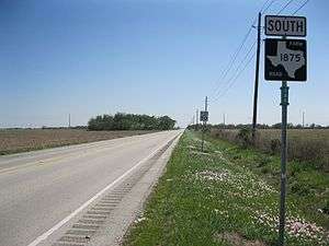
FM 1875
| |
|---|---|
| Location | Fort Bend County |
| Length | 4.596 mi[106] (7.397 km) |
| Existed | November 20, 1951[106]–present |
Farm to Market Road 1875 (FM 1875) is a state highway in the U.S. state of Texas that stays completely within Fort Bend County. The two-lane highway begins at State Highway Loop 540 (Loop 540) southwest of Beasley and heads generally northwest to U.S. Route 90 Alternate (US 90A) at a location east of Tavener.
FM 1875 begins at a stop sign on Loop 540 southwest of Beasley. The highway immediately crosses the Union Pacific Railroad tracks and heads straight to the northwest for about 2.75 miles (4.43 km). In this stretch, the road passes Ward Airpark on the right at Kovar Road. At Drachenberg Road, FM 1875 curves briefly to the northeast for 0.25 miles (0.40 km) before swinging back to the northwest again. After heading northwest for 0.65 miles (1.05 km), the highway turns and goes north by northwest for the final 1.0 mile (1.6 km) before ending at a stop sign at US 90A. North of Drachenberg Road, FM 1875 is also known as Beasley Road.[107]
FM 1875 was first designated on November 20, 1951, to run about 4.8 miles (7.7 km) from US 90A near Tavener to US 59 near Beasley.[106] On April 14, 1980 a 3.1 miles (5.0 km) section of US 59 near Beasley became Loop 540.[108]
Major intersections
The entire route is in Fort Bend County.
| Location | mi[106] | km | Destinations | Notes | |
|---|---|---|---|---|---|
| Beasley | 0.000 | 0.000 | Southern terminus of FM 1875 | ||
| Tavener | 4.596 | 7.397 | Northern terminus of FM 1875 | ||
| 1.000 mi = 1.609 km; 1.000 km = 0.621 mi | |||||
FM 1876
| |
|---|---|
| Location | Harris and Fort Bend counties |
| Length | 5.594 mi[109] (9.003 km) |
| Existed | 1951[109]–present |
Farm to Market Road 1876 is located in Harris and Fort Bend counties. It runs from Bellaire Boulevard south to US 90A.
FM 1876 was designated on November 20, 1951, from US 59 (now US 90A) near Sugarland northward 3.4 miles to the Harris County line. On October 31, 1958 the road was extended 6.4 miles north to FM 1093. On November 24, 1959 the road was relocated in Harris County, shortening the route by 2 miles. On September 25, 1962, the section in Harris County was cancelled, bringing the route back to its 1951 configuration. On May 25, 1976 the road was extended north 2.2 miles into Harris County to the intersection of Synott Road and Bellaire Boulevard. The final change was on June 27, 1995, when the entire route was transferred to UR 1876.
FM 1877
| |
|---|---|
| Location | Angelina County |
| Length | 1.116 mi[110] (1.796 km) |
| Existed | 1951[110]–present |
FM 1878
| |
|---|---|
| Location | Nacogdoches County |
| Length | 14.764 mi[111] (23.760 km) |
| Existed | 1951[111]–present |
FM 1879
| |
|---|---|
| Location | Dallam County |
| Length | 12.799 mi[112] (20.598 km) |
| Existed | 1951[112]–present |
FM 1880
| |
|---|---|
| Location | Delta County |
| Length | 1.232 mi[113] (1.983 km) |
| Existed | 1951[113]–present |
FM 1881
| |
|---|---|
| Location | Swisher County |
| Length | 13.408 mi[114] (21.578 km) |
| Existed | April 24, 1953[114]–present |
FM 1881 (1951)
| |
|---|---|
| Location | Wise County |
| Existed | November 20, 1951–February 6, 1953 |
The original FM 1881 was designated on November 20, 1951 from SH 24 (now US 385) at Chico east to a road intersection. FM 1881 was cancelled on February 6, 1953 and transferred to FM 1655.
FM 1882
| |
|---|---|
| Location | Ector County |
| Length | 12.156 mi[115] (19.563 km) |
| Existed | October 28, 1953[115]–present |
FM 1882 (1951-1953)
| |
|---|---|
| Location | Wise County |
| Existed | November 20, 1951–February 6, 1953 |
The first use of the FM 1882 designation was in Wise County, from SH 24 in Decatur south to a road intersection. FM 1882 was cancelled on February 6, 1953 and transferred to FM 730.
FM 1882 (1953)
| |
|---|---|
| Location | Ellis County |
| Existed | March 26, 1953–November 19, 1953 |
The next use of the FM 1882 designation was in Ellis County, from US 77 in Milford southeast to the Hill County line. Seven months later FM 1882 was cancelled to FM 308.
FM 1883
| |
|---|---|
| Location | Clay County |
| Length | 9.746 mi[116] (15.685 km) |
| Existed | November 20, 1951[116]–present |
Farm to Market Road 1883 (FM 1883) is a two-lane, state-maintained highway that connects farming areas in south central Clay County with a 0.156-mile (0.251 km) spur connection to the small, unincorporated town of Deer Creek.
FM 1883 begins at an intersection with FM 172 in Clay County, heading south on a two-lane undivided road. The road heads south through open farmland with some trees, turning to the east. After passing through several miles of more rural areas, FM 1883 ends at an intersection with State Highway 148 (SH 148). East of here, the road becomes Lower Slobovia Road.[116][117][118]
FM 1883 was designated on November 20, 1951 from FM 172 southwest to Deer Creek, replacing a former portion of FM 172. On April 29, 1952, FM 1883 was rerouted to end at SH 148. On November 24, 1959, it was rerouted from 0.2 miles (0.32 km) south of Deer Creek to FM 172, while the old route became a spur connection.[116]
Major intersections
The entire route is in Clay County.
| Location | mi[116] | km | Destinations | Notes | |
|---|---|---|---|---|---|
| | 0.000 | 0.000 | |||
| | 9.746 | 15.685 | |||
| 1.000 mi = 1.609 km; 1.000 km = 0.621 mi | |||||
FM 1884
| |
|---|---|
| Location | Parker County |
| Length | 7.925 mi[119] (12.754 km) |
| Existed | 1951[119]–present |
FM 1885
| |
|---|---|
| Location | Palo Pinto and Parker counties |
| Length | 15.474 mi[120] (24.903 km) |
| Existed | 1951[120]–present |
FM 1886
| |
|---|---|
| Location | Tarrant and Parker counties |
| Length | 9.806 mi[121] (15.781 km) |
| Existed | 1951[121]–present |
FM 1887
| |
|---|---|
| Location | Waller County |
| Length | 13.694 mi[122] (22.038 km) |
| Existed | 1951[122]–present |
FM 1888
Farm to Market Road 1888 (FM 1888) is a designation that has been used three times. No highway currently uses the FM 1888 designation.
FM 1888 (1951)
| |
|---|---|
| Location | Bandera and Medina counties |
| Existed | November 20, 1951–May 25, 1953 |
FM 1888 was first designated on November 20, 1951, running from FM 470 at Tarpley southward to the Medina county line at a distance of 2.5 miles (4.0 km). The highway was extended 24.7 miles (39.8 km) to US 90 in Hondo a month later on December 18. FM 1888 was cancelled and transferred to FM 462 on May 25, 1953.[123]
FM 1888 (1953)
| |
|---|---|
| Location | Falls County |
| Existed | June 23, 1953–December 13, 1956 |
FM 1888 was designated a second time in 1953, running from FM 413 southward to Eloise at a distance of 1.2 miles (1.9 km). The highway was cancelled and transferred to FM 1373 in 1956.[124]
FM 1888 (1958)
| |
|---|---|
| Location | Hill County |
| Existed | October 31, 1958–July 24, 1963 |
FM 1888 was designated for a third time on October 31, 1958, running from FM 308 at Penelope eastward to a road intersection at a distance of 4.2 miles (6.8 km); part of this route was transferred from Spur 224.[125] The highway was extended 4.3 miles (6.9 km) to SH 171 in Hubbard on November 24, 1959. FM 1888 was deleted on July 24, 1963, with the mileage being transferred to FM 2114.[126]
RM 1888
| |
|---|---|
| Location | Blanco, Kendall and Gillespie counties |
| Length | 16.273 mi[127] (26.189 km) |
| Existed | May 6, 1964[127]–present |
RM 1888 is in [Blanco County, Texas|Blanco]], Kendall and Gillespie counties. It runs from RM 1623 westward to RM 1376. RM 1888 was designated on May 6, 1964, from RM 1623, 5 miles west of Blanco, westward 3.5 miles. On June 1, 1965, RM 1888 extended west to RM 1376.
FM 1889
| |
|---|---|
| Location | Nueces County |
| Length | 4.069 mi[128] (6.548 km) |
| Existed | 1951[128]–present |
FM 1890
| |
|---|---|
| Location | Colorado County |
| Length | 3.397 mi[129] (5.467 km) |
| Existed | 1951[129]–present |
FM 1891
| |
|---|---|
| Location | Lavaca County |
| Length | 9.131 mi[130] (14.695 km) |
| Existed | 1951[130]–present |
Farm to Market Road 1891 (FM 1891) runs 9.131 miles (14.695 km) from U.S. Route 90 Alternate (US 90A) north then west to Texas State Highway 95 (SH 95). It starts about 6.5 miles (10.5 km) east of Shiner, near Wied and ends north of Shiner. On November 20, 1951, FM 1891 was designated to run from former Texas State Highway 200 (now US 90A) north for 2.4 miles (3.9 km). On December 17, 1952 it was extended an additional 3.8 miles (6.1 km) northwest. On September 26, 1954, it was extended an additional 3.6 miles (5.8 km) west to SH 95.
FM 1892
| |
|---|---|
| Location | Anderson County |
| Length | 0.884 mi[131] (1.423 km) |
| Existed | May 2, 1962[131]–present |
Farm to Market Road 1892 (FM 1892) runs 0.884 miles (1.423 km) from east of Frankston, Texas north, then east, to a boat ramp just west of the dam at Lake Palestine.
FM 1892 (1951-1952)
| |
|---|---|
| Location | Atascosa County |
| Existed | December 18, 1951–December 17, 1952 |
The first use of the FM 1892 designation was in Atascosa County, from US 281, 1.8 miles south of the Bexar County line, east to a county road. On April 29, 1952 the road was extended 2.1 miles east to the Wilson County line. FM 1892 was cancelled on December 17, 1952 and transferred to FM 536.
FM 1892 (1952-1960)
| |
|---|---|
| Location | Kendall County |
| Existed | December 17, 1952–October 18, 1960 |
The next use of the FM 1892 designation was in Kendall County, from FM 473 (now RM 473) at Sisterdale south 5.5 miles toward Boerne. On October 28, 1953 the road was extended another 5 miles south, and an additional 2.5 miles south to US 87 on October 13, 1954. On September 21, 1955 a section from FM 473 to a point 4 miles north was added, creating a concurrency with FM 473. On November 21, 1956 the road was extended north 1 mile. FM 1892 was cancelled on October 18, 1960 and transferred to RM 1376.
FM 1893
| |
|---|---|
| Location | Trinity County |
| Length | 0.788 mi[132] (1.268 km) |
| Existed | 1951[132]–present |
FM 1894
| |
|---|---|
| Location | Cochran County |
| Length | 3.202 mi[133] (5.153 km) |
| Existed | 1951[133]–present |
FM 1895
| |
|---|---|
| Location | Kaufman County |
| Length | 7.538 mi[134] (12.131 km) |
| Existed | March 26, 1953[134]–present |
FM 1895 (1951)
| |
|---|---|
| Location | La Salle County |
| Existed | November 20, 1951–January 29, 1953 |
FM 1896
| |
|---|---|
| Location | Franklin and Titus counties |
| Length | 11.169 mi[135] (17.975 km) |
| Existed | 1951[135]–present |
FM 1897
| |
|---|---|
| Location | Grayson County |
| Length | 5.581 mi[136] (8.982 km) |
| Existed | 1951[136]–present |
FM 1898
| |
|---|---|
| Location | Kleberg County |
| Length | 3.413 mi[137] (5.493 km) |
| Existed | October 28, 1953[137]–present |
FM 1898 (1951)
| |
|---|---|
| Location | Grayson County |
| Existed | November 20, 1951–November 12, 1953 |
FM 1899
| |
|---|---|
| Location | Mitchell County |
| Length | 8.758 mi[138] (14.095 km) |
| Existed | October 31, 1958[138]–present |
FM 1899 (1951)
| |
|---|---|
| Location | Hartley County |
| Existed | November 20, 1951–December 7, 1953 |
FM 1899 (1953)
| |
|---|---|
| Location | Taylor County |
| Existed | October 29, 1953–September 2, 1955 |
Notes
References
- 1 2 Transportation Planning and Programming Division (n.d.). "Farm to Market Road No. 1800". Highway Designation Files. Texas Department of Transportation. Retrieved June 22, 2018.
- ↑ Transportation Planning and Programming Division (n.d.). "Ranch to Market Road No. 2404". Highway Designation Files. Texas Department of Transportation. Retrieved June 22, 2018.
- ↑ Transportation Planning and Programming Division (n.d.). "State Highway No. 137". Highway Designation Files. Texas Department of Transportation. Retrieved June 22, 2018.
- 1 2 Transportation Planning and Programming Division (n.d.). "Farm to Market Road No. 1801". Highway Designation Files. Texas Department of Transportation. Retrieved June 22, 2018.
- 1 2 Transportation Planning and Programming Division (n.d.). "Farm to Market Road No. 1802". Highway Designation Files. Texas Department of Transportation. Retrieved June 21, 2018.
- 1 2 3 Transportation Planning and Programming Division (n.d.). "Farm to Market Road No. 1803". Highway Designation Files. Texas Department of Transportation. Retrieved June 21, 2018.
- 1 2 Transportation Planning and Programming Division (n.d.). "Farm to Market Road No. 1804". Highway Designation Files. Texas Department of Transportation. Retrieved June 21, 2018.
- 1 2 Transportation Planning and Programming Division (n.d.). "Farm to Market Road No. 1805". Highway Designation Files. Texas Department of Transportation. Retrieved June 21, 2018.
- 1 2 3 4 Transportation Planning and Programming Division (n.d.). "Farm to Market Road No. 1806". Highway Designation Files. Texas Department of Transportation. Retrieved June 6, 2018.
- 1 2 Transportation Planning and Programming Division (n.d.). "Farm to Market Road No. 1807". Highway Designation Files. Texas Department of Transportation. Retrieved June 22, 2018.
- 1 2 Transportation Planning and Programming Division (n.d.). "Farm to Market Road No. 1808". Highway Designation Files. Texas Department of Transportation. Retrieved June 22, 2018.
- 1 2 Transportation Planning and Programming Division (n.d.). "Farm to Market Road No. 1809". Highway Designation Files. Texas Department of Transportation. Retrieved June 22, 2018.
- 1 2 Transportation Planning and Programming Division (n.d.). "Farm to Market Road No. 1810". Highway Designation Files. Texas Department of Transportation. Retrieved June 22, 2018.
- 1 2 Transportation Planning and Programming Division (n.d.). "Farm to Market Road No. 1811". Highway Designation Files. Texas Department of Transportation. Retrieved June 22, 2018.
- 1 2 3 Transportation Planning and Programming Division (n.d.). "Farm to Market Road No. 1812". Highway Designation Files. Texas Department of Transportation. Retrieved June 22, 2018.
- 1 2 Transportation Planning and Programming Division (n.d.). "Farm to Market Road No. 1813". Highway Designation Files. Texas Department of Transportation. Retrieved June 22, 2018.
- 1 2 Transportation Planning and Programming Division (n.d.). "Farm to Market Road No. 1814". Highway Designation Files. Texas Department of Transportation. Retrieved June 22, 2018.
- 1 2 3 4 5 Transportation Planning and Programming Division (n.d.). "Farm to Market Road No. 1815". Highway Designation Files. Texas Department of Transportation. Retrieved June 6, 2018.
- ↑ Google (October 24, 2011). "overview of Farm to Market Road 1815" (Map). Google Maps. Google. Retrieved October 24, 2011.
- ↑ Transportation Planning and Programming Division (2014). Texas County Mapbook (PDF) (Map) (2014 ed.). 1:120,000. Texas Department of Transportation. p. 353. Retrieved June 11, 2018.
- 1 2 Transportation Planning and Programming Division (n.d.). "Farm to Market Road No. 1816". Highway Designation Files. Texas Department of Transportation. Retrieved June 6, 2018.
- 1 2 Transportation Planning and Programming Division (n.d.). "Farm to Market Road No. 1817". Highway Designation Files. Texas Department of Transportation. Retrieved June 24, 2018.
- 1 2 Transportation Planning and Programming Division (n.d.). "Farm to Market Road No. 1818". Highway Designation Files. Texas Department of Transportation. Retrieved June 24, 2018.
- 1 2 Transportation Planning and Programming Division (n.d.). "Farm to Market Road No. 1819". Highway Designation Files. Texas Department of Transportation. Retrieved June 24, 2018.
- ↑ Transportation Planning and Programming Division (n.d.). "Farm to Market Road No. 1820". Highway Designation Files. Texas Department of Transportation. Retrieved June 28, 2018.
- ↑ Transportation Planning and Programming Division (n.d.). "Farm to Market Road No. 417". Highway Designation Files. Texas Department of Transportation. Retrieved June 24, 2018.
- ↑ Transportation Planning and Programming Division (n.d.). "Farm to Market Road No. 1658". Highway Designation Files. Texas Department of Transportation. Retrieved June 24, 2018.
- 1 2 Transportation Planning and Programming Division (n.d.). "Farm to Market Road No. 1821". Highway Designation Files. Texas Department of Transportation. Retrieved June 24, 2018.
- ↑ Transportation Planning and Programming Division (n.d.). "Farm to Market Road No. 1195". Highway Designation Files. Texas Department of Transportation. Retrieved June 24, 2018.
- ↑ Google (June 24, 2018). "Route of FM 1821" (Map). Google Maps. Google. Retrieved June 24, 2018.
- ↑ Transportation Planning and Programming Division (n.d.). "Farm to Market Road No. 711". Highway Designation Files. Texas Department of Transportation. Retrieved June 24, 2018.
- 1 2 Transportation Planning and Programming Division (n.d.). "Farm to Market Road No. 1822". Highway Designation Files. Texas Department of Transportation. Retrieved June 24, 2018.
- 1 2 Transportation Planning and Programming Division (n.d.). "Farm to Market Road No. 1823". Highway Designation Files. Texas Department of Transportation. Retrieved June 24, 2018.
- 1 2 Transportation Planning and Programming Division (n.d.). "Farm to Market Road No. 1824". Highway Designation Files. Texas Department of Transportation. Retrieved June 24, 2018.
- 1 2 3 Transportation Planning and Programming Division (n.d.). "Urban Road No. 1825". Highway Designation Files. Texas Department of Transportation. Retrieved June 6, 2018.
- 1 2 3 Transportation Planning and Programming Division (n.d.). "Farm to Market Road No. 1825". Highway Designation Files. Texas Department of Transportation. Retrieved June 6, 2018.
- ↑ Google (June 24, 2018). "Route of FM 1825" (Map). Google Maps. Google. Retrieved June 24, 2018.
- 1 2 3 4 5 6 7 Transportation Planning and Programming Division (n.d.). "Ranch to Market Road No. 1826". Highway Designation Files. Texas Department of Transportation. Retrieved June 6, 2018.
- ↑ Transportation Planning and Programming Division (2014). Texas County Mapbook (PDF) (Map) (2014 ed.). 1:120,000. Texas Department of Transportation. p. 367. Retrieved June 6, 2018.
- ↑ Transportation Planning and Programming Division (2014). Texas County Mapbook (PDF) (Map) (2014 ed.). 1:120,000. Texas Department of Transportation. p. 366. Retrieved June 6, 2018.
- ↑ Transportation Planning and Programming Division (n.d.). "Farm to Market Road No. 966". Highway Designation Files. Texas Department of Transportation. Retrieved January 9, 2011.
- ↑ Google (June 6, 2018). "Overview map of Farm to Market Road 1826 Distances Between Interchanges" (Map). Google Maps. Google. Retrieved June 6, 2018.
- 1 2 Transportation Planning and Programming Division (n.d.). "Farm to Market Road No. 1827". Highway Designation Files. Texas Department of Transportation. Retrieved June 24, 2018.
- 1 2 Transportation Planning and Programming Division (n.d.). "Farm to Market Road No. 1828". Highway Designation Files. Texas Department of Transportation. Retrieved June 24, 2018.
- 1 2 Transportation Planning and Programming Division (n.d.). "Farm to Market Road No. 1829". Highway Designation Files. Texas Department of Transportation. Retrieved June 24, 2018.
- 1 2 3 Transportation Planning and Programming Division (n.d.). "Farm to Market Road No. 1830". Highway Designation Files. Texas Department of Transportation. Retrieved June 24, 2018.
- ↑ Transportation Planning and Programming Division (n.d.). "Farm to Market Road No. 407". Highway Designation Files. Texas Department of Transportation. Retrieved June 24, 2018.
- ↑ Transportation Planning and Programming Division (n.d.). "Urban Road No. 1830". Highway Designation Files. Texas Department of Transportation. Retrieved June 24, 2018.
- 1 2 Transportation Planning and Programming Division (n.d.). "Farm to Market Road No. 1831". Highway Designation Files. Texas Department of Transportation. Retrieved June 24, 2018.
- 1 2 Transportation Planning and Programming Division (n.d.). "Ranch to Market Road No. 1832". Highway Designation Files. Texas Department of Transportation. Retrieved June 6, 2018.
- ↑ Google (December 6, 2009). "SH 17 between Fort Davis and RM 1832" (Map). Google Maps. Google. Retrieved December 6, 2009.
- ↑ (PDF) https://publicdocs.txdot.gov/minord/MinuteOrderDocLib/003676444.pdf. Missing or empty
|title=(help) - 1 2 Transportation Planning and Programming Division (n.d.). "Farm to Market Road No. 1833". Highway Designation Files. Texas Department of Transportation. Retrieved June 24, 2018.
- 1 2 Transportation Planning and Programming Division (n.d.). "Farm to Market Road No. 1834". Highway Designation Files. Texas Department of Transportation. Retrieved June 24, 2018.
- 1 2 Transportation Planning and Programming Division (n.d.). "Farm to Market Road No. 1835". Highway Designation Files. Texas Department of Transportation. Retrieved June 24, 2018.
- 1 2 Transportation Planning and Programming Division (n.d.). "Farm to Market Road No. 1836". Highway Designation Files. Texas Department of Transportation. Retrieved June 25, 2018.
- 1 2 3 Transportation Planning and Programming Division (n.d.). "Ranch to Market Road No. 1837". Highway Designation Files. Texas Department of Transportation. Retrieved June 6, 2018.
- ↑ Google (December 6, 2009). "SH 118 between junction of RM 1837 and Fort Davis" (Map). Google Maps. Google. Retrieved December 6, 2009.
- 1 2 Transportation Planning and Programming Division (n.d.). "Farm to Market Road No. 1838". Highway Designation Files. Texas Department of Transportation. Retrieved June 25, 2018.
- 1 2 Transportation Planning and Programming Division (n.d.). "Farm to Market Road No. 1839". Highway Designation Files. Texas Department of Transportation. Retrieved June 25, 2018.
- 1 2 Transportation Planning and Programming Division (n.d.). "Farm to Market Road No. 1840". Highway Designation Files. Texas Department of Transportation. Retrieved June 25, 2018.
- 1 2 Transportation Planning and Programming Division (n.d.). "Farm to Market Road No. 1841". Highway Designation Files. Texas Department of Transportation. Retrieved June 25, 2018.
- 1 2 Transportation Planning and Programming Division (n.d.). "Farm to Market Road No. 1842". Highway Designation Files. Texas Department of Transportation. Retrieved June 25, 2018.
- 1 2 3 Transportation Planning and Programming Division (n.d.). "Farm to Market Road No. 1843". Highway Designation Files. Texas Department of Transportation. Retrieved June 6, 2018.
- 1 2 Transportation Planning and Programming Division (n.d.). "Farm to Market Road No. 1844". Highway Designation Files. Texas Department of Transportation. Retrieved June 6, 2018.
- 1 2 Transportation Planning and Programming Division (n.d.). "Farm to Market Road No. 1845". Highway Designation Files. Texas Department of Transportation. Retrieved June 6, 2018.
- 1 2 Transportation Planning and Programming Division (n.d.). "Farm to Market Road No. 1846". Highway Designation Files. Texas Department of Transportation. Retrieved June 24, 2018.
- 1 2 Transportation Planning and Programming Division (n.d.). "Farm to Market Road No. 1847". Highway Designation Files. Texas Department of Transportation. Retrieved June 6, 2018.
- ↑ Transportation Planning and Programming Division (n.d.). "Urban Road No. 1847". Highway Designation Files. Texas Department of Transportation. Retrieved June 6, 2018.
- 1 2 Transportation Planning and Programming Division (n.d.). "Farm to Market Road No. 1848". Highway Designation Files. Texas Department of Transportation. Retrieved June 28, 2018.
- 1 2 Transportation Planning and Programming Division (n.d.). "Farm to Market Road No. 1849". Highway Designation Files. Texas Department of Transportation. Retrieved June 28, 2018.
- 1 2 Transportation Planning and Programming Division (n.d.). "Farm to Market Road No. 1850". Highway Designation Files. Texas Department of Transportation. Retrieved June 28, 2018.
- 1 2 Transportation Planning and Programming Division (n.d.). "Farm to Market Road No. 1851". Highway Designation Files. Texas Department of Transportation. Retrieved June 28, 2018.
- 1 2 Transportation Planning and Programming Division (n.d.). "Farm to Market Road No. 1852". Highway Designation Files. Texas Department of Transportation. Retrieved June 28, 2018.
- 1 2 Transportation Planning and Programming Division (n.d.). "Farm to Market Road No. 1853". Highway Designation Files. Texas Department of Transportation. Retrieved June 28, 2018.
- 1 2 Transportation Planning and Programming Division (n.d.). "Farm to Market Road No. 1856". Highway Designation Files. Texas Department of Transportation. Retrieved June 28, 2018.
- 1 2 Transportation Planning and Programming Division (n.d.). "Ranch to Market Road No. 1855". Highway Designation Files. Texas Department of Transportation. Retrieved June 28, 2018.
- 1 2 Transportation Planning and Programming Division (n.d.). "Farm to Market Road No. 1856". Highway Designation Files. Texas Department of Transportation. Retrieved June 28, 2018.
- 1 2 3 4 Transportation Planning and Programming Division (n.d.). "Farm to Market Road No. 1857". Highway Designation Files. Texas Department of Transportation. Retrieved June 22, 2018.
- ↑ Transportation Planning and Programming Division (n.d.). "Farm to Market Road No. 669". Highway Designation Files. Texas Department of Transportation. Retrieved June 29, 2018.
- 1 2 Transportation Planning and Programming Division (n.d.). "Farm to Market Road No. 1858". Highway Designation Files. Texas Department of Transportation. Retrieved June 29, 2018.
- 1 2 Transportation Planning and Programming Division (n.d.). "Farm to Market Road No. 1859". Highway Designation Files. Texas Department of Transportation. Retrieved June 29, 2018.
- 1 2 Transportation Planning and Programming Division (n.d.). "Farm to Market Road No. 1860". Highway Designation Files. Texas Department of Transportation. Retrieved June 29, 2018.
- 1 2 Transportation Planning and Programming Division (n.d.). "Farm to Market Road No. 1861". Highway Designation Files. Texas Department of Transportation. Retrieved June 29, 2018.
- 1 2 Transportation Planning and Programming Division (n.d.). "Farm to Market Road No. 1862". Highway Designation Files. Texas Department of Transportation. Retrieved June 29, 2018.
- 1 2 3 4 5 Transportation Planning and Programming Division (n.d.). "Farm to Market Road No. 1863". Highway Designation Files. Texas Department of Transportation. Retrieved June 7, 2018.
- 1 2 Transportation Planning and Programming Division (2014). Texas County Mapbook (PDF) (Map) (2014 ed.). 1:120,000. Texas Department of Transportation. p. 338. Retrieved June 7, 2018.
- ↑ Google (January 5, 2011). "Overview map of Farm to Market Road 1863 Distances Between Interchanges" (Map). Google Maps. Google. Retrieved January 5, 2011.
- ↑ Transportation Planning and Programming Division (n.d.). "Farm to Market Road No. 1274". Highway Designation Files. Texas Department of Transportation. Retrieved June 7, 2018.
- 1 2 Transportation Planning and Programming Division (n.d.). "Farm to Market Road No. 1864". Highway Designation Files. Texas Department of Transportation. Retrieved June 25, 2018.
- 1 2 3 4 5 Transportation Planning and Programming Division (n.d.). "Ranch to Market Road No. 1865". Highway Designation Files. Texas Department of Transportation. Retrieved June 7, 2018.
- ↑ Transportation Planning and Programming Division (2014). Texas County Mapbook (PDF) (Map) (2014 ed.). 1:120,000. Texas Department of Transportation. p. 138. Retrieved June 7, 2018.
- ↑ Transportation Planning and Programming Division (2014). Texas County Mapbook (PDF) (Map) (2014 ed.). 1:120,000. Texas Department of Transportation. p. 139. Retrieved June 7, 2018.
- 1 2 Transportation Planning and Programming Division (n.d.). "Farm to Market Road No. 1866". Highway Designation Files. Texas Department of Transportation. Retrieved June 28, 2018.
- 1 2 Transportation Planning and Programming Division (n.d.). "Farm to Market Road No. 1867". Highway Designation Files. Texas Department of Transportation. Retrieved June 28, 2018.
- 1 2 Transportation Planning and Programming Division (n.d.). "Farm to Market Road No. 1868". Highway Designation Files. Texas Department of Transportation. Retrieved June 28, 2018.
- ↑ Transportation Planning and Programming Division (n.d.). "State Highway No. 74". Highway Designation Files. Texas Department of Transportation. Retrieved January 13, 2011.
- 1 2 3 4 5 Transportation Planning and Programming Division (n.d.). "Ranch to Market Road No. 1869". Highway Designation Files. Texas Department of Transportation. Retrieved June 7, 2018.
- ↑ Transportation Planning and Programming Division (2014). Texas County Mapbook (PDF) (Map) (2014 ed.). 1:120,000. Texas Department of Transportation. p. 365. Retrieved June 7, 2018.
- ↑ Google (January 13, 2011). "Overview map of Ranch to Market Road 1869 Distances Between Interchanges" (Map). Google Maps. Google. Retrieved January 13, 2011.
- 1 2 Transportation Planning and Programming Division (n.d.). "Farm to Market Road No. 1870". Highway Designation Files. Texas Department of Transportation. Retrieved June 28, 2018.
- 1 2 Transportation Planning and Programming Division (n.d.). "Ranch to Market Road No. 1871". Highway Designation Files. Texas Department of Transportation. Retrieved June 28, 2018.
- 1 2 Transportation Planning and Programming Division (n.d.). "Farm to Market Road No. 1872". Highway Designation Files. Texas Department of Transportation. Retrieved June 29, 2018.
- 1 2 Transportation Planning and Programming Division (n.d.). "Farm to Market Road No. 1873". Highway Designation Files. Texas Department of Transportation. Retrieved June 29, 2018.
- 1 2 Transportation Planning and Programming Division (n.d.). "Farm to Market Road No. 1874". Highway Designation Files. Texas Department of Transportation. Retrieved June 29, 2018.
- 1 2 3 4 Transportation Planning and Programming Division (n.d.). "Farm to Market Road No. 1875". Highway Designation Files. Texas Department of Transportation. Retrieved June 8, 2018.
- ↑ Google (March 27, 2013). "Farm to Market Road 1875" (Map). Google Maps. Google. Retrieved March 27, 2013.
- ↑ Transportation Planning and Programming Division (n.d.). "State Highway Loop No. 540". Highway Designation Files. Texas Department of Transportation. Retrieved March 27, 2013.
- 1 2 Transportation Planning and Programming Division (n.d.). "Farm to Market Road No. 1876". Highway Designation Files. Texas Department of Transportation. Retrieved June 29, 2018.
- 1 2 Transportation Planning and Programming Division (n.d.). "Farm to Market Road No. 1877". Highway Designation Files. Texas Department of Transportation. Retrieved June 29, 2018.
- 1 2 Transportation Planning and Programming Division (n.d.). "Farm to Market Road No. 1878". Highway Designation Files. Texas Department of Transportation. Retrieved June 29, 2018.
- 1 2 Transportation Planning and Programming Division (n.d.). "Farm to Market Road No. 1879". Highway Designation Files. Texas Department of Transportation. Retrieved June 29, 2018.
- 1 2 Transportation Planning and Programming Division (n.d.). "Farm to Market Road No. 1880". Highway Designation Files. Texas Department of Transportation. Retrieved June 29, 2018.
- 1 2 Transportation Planning and Programming Division (n.d.). "Farm to Market Road No. 1881". Highway Designation Files. Texas Department of Transportation. Retrieved June 26, 2018.
- 1 2 Transportation Planning and Programming Division (n.d.). "Farm to Market Road No. 1882". Highway Designation Files. Texas Department of Transportation. Retrieved June 28, 2018.
- 1 2 3 4 5 Transportation Planning and Programming Division (n.d.). "Farm to Market Road No. 1883". Highway Designation Files. Texas Department of Transportation. Retrieved June 8, 2018.
- ↑ Google (October 26, 2011). "overview of Farm to Market Road 1883" (Map). Google Maps. Google. Retrieved October 26, 2011.
- ↑ Transportation Planning and Programming Division (2014). Texas County Mapbook (PDF) (Map) (2014 ed.). 1:120,000. Texas Department of Transportation. p. 324. Retrieved June 8, 2018.
- 1 2 Transportation Planning and Programming Division (n.d.). "Farm to Market Road No. 1884". Highway Designation Files. Texas Department of Transportation. Retrieved June 29, 2018.
- 1 2 Transportation Planning and Programming Division (n.d.). "Farm to Market Road No. 1885". Highway Designation Files. Texas Department of Transportation. Retrieved June 29, 2018.
- 1 2 Transportation Planning and Programming Division (n.d.). "Farm to Market Road No. 1886". Highway Designation Files. Texas Department of Transportation. Retrieved June 29, 2018.
- 1 2 Transportation Planning and Programming Division (n.d.). "Farm to Market Road No. 1887". Highway Designation Files. Texas Department of Transportation. Retrieved June 29, 2018.
- ↑ Transportation Planning and Programming Division (n.d.). "Farm to Market Road No. 462". Highway Designation Files. Texas Department of Transportation. Retrieved June 22, 2018.
- ↑ Transportation Planning and Programming Division (n.d.). "Farm to Market Road No. 1373". Highway Designation Files. Texas Department of Transportation. Retrieved June 22, 2018.
- ↑ Transportation Planning and Programming Division (n.d.). "State Highway Spur No. 224". Highway Designation Files. Texas Department of Transportation. Retrieved June 22, 2018.
- ↑ Transportation Planning and Programming Division (n.d.). "Farm to Market Road No. 2114". Highway Designation Files. Texas Department of Transportation. Retrieved June 22, 2018.
- 1 2 Transportation Planning and Programming Division (n.d.). "Ranch to Market Road No. 1888". Highway Designation Files. Texas Department of Transportation. Retrieved June 22, 2018.
- 1 2 Transportation Planning and Programming Division (n.d.). "Farm to Market Road No. 1889". Highway Designation Files. Texas Department of Transportation. Retrieved June 25, 2018.
- 1 2 Transportation Planning and Programming Division (n.d.). "Farm to Market Road No. 1890". Highway Designation Files. Texas Department of Transportation. Retrieved June 25, 2018.
- 1 2 Transportation Planning and Programming Division (n.d.). "Farm to Market Road No. 1891". Highway Designation Files. Texas Department of Transportation. Retrieved June 25, 2018.
- 1 2 Transportation Planning and Programming Division (n.d.). "Farm to Market Road No. 1892". Highway Designation Files. Texas Department of Transportation. Retrieved June 11, 2018.
- 1 2 Transportation Planning and Programming Division (n.d.). "Farm to Market Road No. 1893". Highway Designation Files. Texas Department of Transportation. Retrieved June 29, 2018.
- 1 2 Transportation Planning and Programming Division (n.d.). "Farm to Market Road No. 1894". Highway Designation Files. Texas Department of Transportation. Retrieved June 29, 2018.
- 1 2 Transportation Planning and Programming Division (n.d.). "Farm to Market Road No. 1895". Highway Designation Files. Texas Department of Transportation. Retrieved June 29, 2018.
- 1 2 Transportation Planning and Programming Division (n.d.). "Farm to Market Road No. 1896". Highway Designation Files. Texas Department of Transportation. Retrieved June 29, 2018.
- 1 2 Transportation Planning and Programming Division (n.d.). "Farm to Market Road No. 1897". Highway Designation Files. Texas Department of Transportation. Retrieved June 29, 2018.
- 1 2 Transportation Planning and Programming Division (n.d.). "Farm to Market Road No. 1898". Highway Designation Files. Texas Department of Transportation. Retrieved June 29, 2018.
- 1 2 Transportation Planning and Programming Division (n.d.). "Farm to Market Road No. 1899". Highway Designation Files. Texas Department of Transportation. Retrieved June 29, 2018.