St. Jo, Texas
| Saint Jo, Texas | |
|---|---|
| City | |
.jpg) | |
 Location of Saint Jo, Texas | |
 | |
| Coordinates: 33°41′41″N 97°31′25″W / 33.69472°N 97.52361°WCoordinates: 33°41′41″N 97°31′25″W / 33.69472°N 97.52361°W | |
| Country | United States |
| State | Texas |
| County | Montague |
| Area | |
| • Total | 1.1 sq mi (2.8 km2) |
| • Land | 1.1 sq mi (2.8 km2) |
| • Water | 0.0 sq mi (0.0 km2) |
| Elevation | 1,142 ft (348 m) |
| Population (2000) | |
| • Total | 977 |
| • Density | 911.5/sq mi (351.9/km2) |
| Time zone | UTC-6 (Central (CST)) |
| • Summer (DST) | UTC-5 (CDT) |
| FIPS code | 48-64184[1] |
| GNIS feature ID | 1367166[2] |
Saint Jo is a city in Montague County, Texas, United States. The population was 977 at the 2000 census.
History
Established in 1856, the city was originally known as Head of Elm, named for its location at the headwaters of the Elm Fork of the Trinity River.
There are two conflicting stories as to how Head of Elm became Saint Jo, both of which involve Joe Howell, who originally laid out the town.
One revolves around a Tennessean named Irby Holt Boggess giving leadership in partnership with Howell in or around 1872. This was displayed in the Stonewall Saloon Museum on the town square of Saint Jo in 1986 and is incorporated in a story about Boggess.
The other involves Howell's personal beliefs. He was an avid opponent of alcoholic beverage sales, and was given the pejorative nickname "Saint Jo", which stuck to both Howell and the town he founded. Saint Jo remained a "dry" city until a May 2009 vote allowed the sale of alcoholic beverages for off-premises consumption.
The Real Chisholm Trail Symposium met in St. Jo on May 6, 2017. Program participants included representatives of the West Texas Historical Association, the Trail Drivers Association, and the Fort Sill Museum in Fort Sill, Oklahoma. Gary and Margaret Kraisinger, the joint authors of the 2004 book The Western: The Greatest Texas Cattle Trail, 1874 - 1886, also appeared.[3]
BoHo Saint Jo is a collaborative event held semiannually in downtown Saint Jo in conjunction with the retail clothing store Panache. The event attracts local vendors to the area to showcase their locally sourced goods.[4]
Geography
Saint Jo is located at 33°41′41″N 97°31′25″W / 33.69472°N 97.52361°W (33.694829, -97.523488).[5]
According to the United States Census Bureau, the city has a total area of 1.1 square miles (2.8 km2), all of it land.
Demographics
| Historical population | |||
|---|---|---|---|
| Census | Pop. | %± | |
| 1880 | 342 | — | |
| 1890 | 710 | 107.6% | |
| 1900 | 825 | 16.2% | |
| 1910 | 822 | −0.4% | |
| 1920 | 985 | 19.8% | |
| 1930 | 960 | −2.5% | |
| 1940 | 1,010 | 5.2% | |
| 1950 | 1,147 | 13.6% | |
| 1960 | 977 | −14.8% | |
| 1970 | 1,054 | 7.9% | |
| 1980 | 1,071 | 1.6% | |
| 1990 | 1,048 | −2.1% | |
| 2000 | 977 | −6.8% | |
| 2010 | 1,043 | 6.8% | |
| Est. 2016 | 1,018 | [6] | −2.4% |
| U.S. Decennial Census[7] | |||
As of the census[1] of 2000, there were 977 people, 404 households, and 271 families residing in the city. The population density was 911.5 people per square mile (352.5/km²). There were 470 housing units at an average density of 438.5 per square mile (169.6/km²). The racial makeup of the city was 96.11% White, 0.20% African American, 0.82% Native American, 0.10% Asian, 1.43% from other races, and 1.33% from two or more races. Hispanic or Latino of any race were 4.30% of the population.
There were 404 households out of which 31.9% had children under the age of 18 living with them, 49.0% were married couples living together, 13.4% had a female householder with no husband present, and 32.9% were non-families. 30.9% of all households were made up of individuals and 17.1% had someone living alone who was 65 years of age or older. The average household size was 2.40 and the average family size was 3.00.
In the city, the population was spread out with 27.3% under the age of 18, 7.1% from 18 to 24, 25.2% from 25 to 44, 20.7% from 45 to 64, and 19.8% who were 65 years of age or older. The median age was 38 years. For every 100 females, there were 88.2 males. For every 100 females age 18 and over, there were 84.4 males.
The median income for a household in the city was $27,045, and the median income for a family was $35,500. Males had a median income of $31,711 versus $20,859 for females. The per capita income for the city was $15,225. About 13.5% of families and 15.5% of the population were below the poverty line, including 21.5% of those under age 18 and 13.9% of those age 65 or over.
Education
Saint Jo is served by the Saint Jo Independent School District.
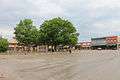
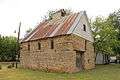
Photo gallery
.jpg)
.jpg)
.jpg)
.jpg)
_2.jpg)
References
- 1 2 "American FactFinder". United States Census Bureau. Retrieved 2008-01-31.
- ↑ "US Board on Geographic Names". United States Geological Survey. 2007-10-25. Retrieved 2008-01-31.
- ↑ Tai Kreidler, executive director of West Texas Historical Association, email, April 28, 2017.
- ↑ https://www.bohosaintjo.com/fall-2016-show
- ↑ "US Gazetteer files: 2010, 2000, and 1990". United States Census Bureau. 2011-02-12. Retrieved 2011-04-23.
- ↑ "Population and Housing Unit Estimates". Retrieved June 9, 2017.
- ↑ "Census of Population and Housing". Census.gov. Retrieved June 4, 2015.
External links
Municipalities and communities of Montague County, Texas, United States | ||
|---|---|---|
| Cities |  | |
| CDPs | ||
| Other unincorporated communities | ||
| Ghost town | ||