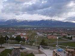
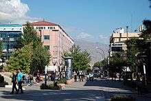
Erzincan
| Erzincan | |
|---|---|
| Municipality | |
 View of Erzincan | |
 Erzincan | |
| Coordinates: 39°44′47″N 39°29′29″E / 39.74639°N 39.49139°ECoordinates: 39°44′47″N 39°29′29″E / 39.74639°N 39.49139°E | |
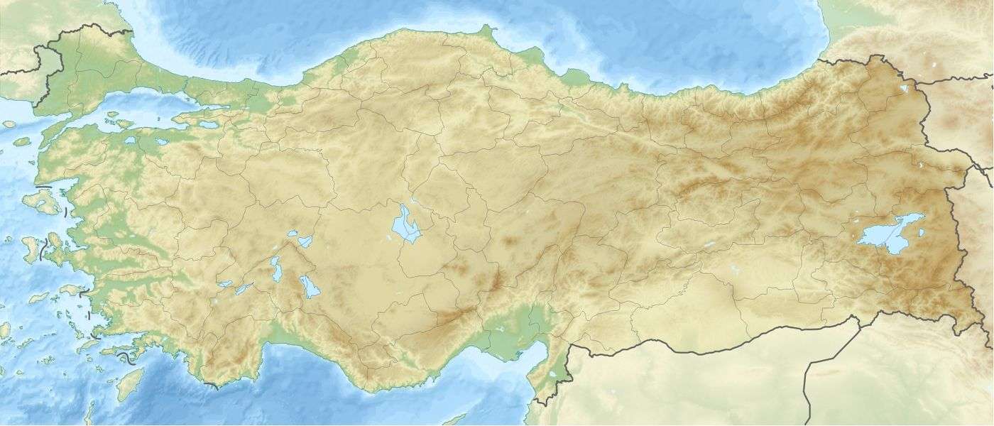
| Country | Turkey |
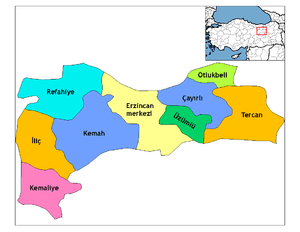
| Province | Erzincan |
| Government | |
| • Mayor | Cemalettin Başsoy (AKP) |
| Area[1] | |
| • District | 1,622.08 km2 (626.29 sq mi) |
| Elevation | 1,185 m (3,888 ft) |
| Population (2012)[2] | |
| • Urban | 96,474 |
| • District | 144,545 |
| • District density | 89/km2 (230/sq mi) |
| Website | www.erzincan.bel.tr |
Erzincan (pronounced [æɾˈzindʒan])[3] (Armenian: Երզնկա, Yerznka) is the capital of Erzincan Province in northeastern Turkey. Nearby cities include Erzurum, Sivas, Tunceli, Bingöl, Elâzığ, Malatya, Gümüşhane, Bayburt, and Giresun. Located at an altitude of 1,185 meters above sea level, the city's climate produces snowy winters and warm summers.
The city is notable for handcrafted copper goods and a special cheese called "tulum peyniri" in Turkish. It is a significant road and rail junction and was once noted for its silverware. Current industries include sugar refining and textile industries. The city is home to the headquarters of the Turkish Third Army.
History
Acilisene, the ancient city that is now Erzincan, was the site of the Peace of Acilisene by which in AD 387 Armenia was divided into two vassal states, a smaller one dependent on the Byzantine Empire and a larger one dependent on Persia.[4][5] This is the name (Ἀκιλισηνή in Greek) by which it is called by Strabo in his Geography, 11.4.14. The etymological origin of the word is disputed, but it is agreed that the city was once called Erez. For a while it was called Justinianopolis in honour of Emperor Justinian. In more recent Greek it has been called as Κελτζηνή (Keltzene) and Κελεζηνή (Kelezene)[6]
In the Armenian language, the 5th-century Life of Mashtots called it Yekeghiats[7] In the more recent past, it was known in Armenian as Երզնկա (Yerznka)[8]
In the settlement of Erez, at a yet unidentified site, there was a pre-Christian shrine dedicated to the Armenian goddess Anahit. A text of Agathangelos reports that during the first year of his reign, King Trdat of Armenia went to Erez and visited Anahit's temple to offer sacrifice. He ordered Gregory the Illuminator, who was secretly a Christian, to make an offering at its altar. When Gregory refused, he was taken captive and tortured, starting the events that would end with Trdat's conversion to Christianity some 14 years later.[9] After that conversion, during the Christianisation of Armenia, the temple at Erez was destroyed and its property and lands were given to Gregory. It later became known for its extensive monasteries.
It is hard to tell when Acilisene became a bishopric. The first whose name is known is of the mid-5th century: Ioannes, who in 459 signed the decree of Patriarch Gennadius I of Constantinople against the simoniacs. Georgius or Gregorius (both forms are found) was one of the Fathers of the Second Council of Constantinople (553), appearing as "bishop of Justinianopolis". Theodorus was at the Third Council of Constantinople in 681, signing as "bishop of Justinianopolis or the region of Ecclenzine". Georgius was at the Photian Council of Constantinople (879). Until the 10th century, the diocese itself appears in none of the Notitiae Episcopatuum. At the end of that century, they present it as an autocephalous archdiocese, and those of the 11th century present it as a metropolitan see with 21 suffragans. This was the time of greatest splendour of Acilisene, which ended with the decisive defeat of the Byzantines by the Seljuq Turks at the Battle of Manzikert in 1071. After the 13th century, there is no mention of diocesan bishops of Acilisene and the see no longer appears in Notitiae Episcopatuum.[6][10] No longer a residential bishopric, Acilisene is today listed by the Catholic Church as a titular see.[11]
In 1071 Erzincan was absorbed into the Mengüçoğlu under the Seljuk Sulëiman Kutalmish. Marco Polo, who wrote about his visit to Erzincan, said that the "people of the country are Armenians" and that Erzincan was the "noblest of cities" which contained the See of an Archbishop.[12] In 1243 it was destroyed in fighting between the Seljuks under Kaykhusraw II and the Mongols. However, by 1254 its population had recovered enough that William of Rubruck was able to say an earthquake had killed more than 10,000 people. During this period, the city reached a level of semi-independence under the rule of Armenian princes.[13]
Erzincan was one of the most pivotal towns in Safavid history. It was there, in the summer of 1500, that about 7,000 Qizilbash forces, consisting of the Ustaclu, Shamlu, Rumlu, Tekelu, Zhulkadir, Afshar, Qajar and Varsak tribes, responded to the invitation of Ismail I,[14] whom would aid in him establishing his dynasty.
Battle of Erzincan

The Battle of Erzincan took place during the Caucasus Campaign of the First World War. In 1916 Erzincan was the headquarters for the Turkish Third Army commanded by Kerim Pasha. The Russian General Nikolai Yudenich led the Russian Caucasus Army who captured Mama Hatun on 12 July 1916. They then gained the heights of Naglika and took a Turkish position on the banks of the Durum Durasi river, with their cavalry breaking through the Boz-Tapa-Meretkli line. They then advanced on Erzincan arriving by 25 June and taking the city in two days. The city was relatively untouched by battle and Yudenich seized large quantities of supplies. Despite the strategic advantages gained from this victory, Yudenich made no more significant advances and his forces were reduced due to Russian reverses further north.[15]
Colonel Kâzım Karabekir was appointed the commander of the First Caucasian Army Corps. Aware of the withdrawal of the Russian Army following the Russian Revolution, they retook Erzincan in February 1918.
Erzincan Soviet
A short-lived soviet council had been at Erzincan between 1916-1921. Mainly today's Erzincan and Tunceli provinces were under Russian occupation. After the revolution, Bolshevik soldiers take control on officers and liberate that area among people. Arşak Cemalyan who is a Bolshevik soldier, call Kurd, Turk and Armenian representatives to be in charge of administration of Erzincan Soviet.[16][17]
1939 Erzincan earthquake
The city was completely destroyed by a major earthquake on December 27, 1939. The sequence of seven violent shocks, the biggest measuring 7.8 on the moment magnitude scale, was the most powerful one to strike Turkey in recent history. The first stage of the earthquake killed about 8,000 people. The next day, it was reported that the death toll had risen to 20,000. An emergency relief operation began. By the end of the year, 32,962 had died due to more earthquakes and several floods. So extensive was the damage to Erzincan city that its old site was entirely abandoned and a new town was founded a little further to the north.
Climate
Erzincan has a continental climate (Köppen climate classification Dsa) with freezing, snowy winters and hot and dry summers. Spring is the wettest season whilst late summer is the driest. The lowest temperature recorded was −32.5 °C (−26.5 °F) in January 1950. The highest temperature recorded was 40.6 °C (105.1 °F) in July 2000. The highest snow thickness recorded was 74 cm (29.1 inches) in February 1950.
| Climate data for Erzincan (Averages 1960–2012) (Extremes 1929–2016) | |||||||||||||
|---|---|---|---|---|---|---|---|---|---|---|---|---|---|
| Month | Jan | Feb | Mar | Apr | May | Jun | Jul | Aug | Sep | Oct | Nov | Dec | Year |
| Record high °C (°F) | 14.0 (57.2) |
17.2 (63) |
25.2 (77.4) |
30.4 (86.7) |
33.8 (92.8) |
35.6 (96.1) |
40.6 (105.1) |
40.5 (104.9) |
36.6 (97.9) |
31.4 (88.5) |
24.9 (76.8) |
23.2 (73.8) |
40.6 (105.1) |
| Average high °C (°F) | 1.7 (35.1) |
3.7 (38.7) |
9.9 (49.8) |
16.7 (62.1) |
22.1 (71.8) |
26.9 (80.4) |
31.4 (88.5) |
31.7 (89.1) |
27.3 (81.1) |
20.0 (68) |
11.5 (52.7) |
4.6 (40.3) |
17.3 (63.1) |
| Daily mean °C (°F) | −2.9 (26.8) |
−1.2 (29.8) |
4.4 (39.9) |
10.7 (51.3) |
15.6 (60.1) |
20.0 (68) |
24.0 (75.2) |
23.7 (74.7) |
18.9 (66) |
12.1 (53.8) |
5.2 (41.4) |
0.1 (32.2) |
10.9 (51.6) |
| Average low °C (°F) | −6.9 (19.6) |
−5.5 (22.1) |
−0.5 (31.1) |
5.0 (41) |
8.8 (47.8) |
12.3 (54.1) |
15.6 (60.1) |
15.2 (59.4) |
10.7 (51.3) |
5.9 (42.6) |
0.6 (33.1) |
−3.5 (25.7) |
4.8 (40.7) |
| Record low °C (°F) | −32.5 (−26.5) |
−32.4 (−26.3) |
−22.4 (−8.3) |
−11.1 (12) |
−4.2 (24.4) |
2.0 (35.6) |
4.8 (40.6) |
5.9 (42.6) |
0.3 (32.5) |
−6.8 (19.8) |
−17.4 (0.7) |
−25.9 (−14.6) |
−32.5 (−26.5) |
| Average precipitation mm (inches) | 28.1 (1.106) |
30.3 (1.193) |
41.2 (1.622) |
53.8 (2.118) |
54.5 (2.146) |
30.2 (1.189) |
11.4 (0.449) |
6.8 (0.268) |
14.3 (0.563) |
43.4 (1.709) |
39.3 (1.547) |
28.8 (1.134) |
382.1 (15.044) |
| Average precipitation days | 9.6 | 9.3 | 11.6 | 14.1 | 14.5 | 9.2 | 3.3 | 2.6 | 4.3 | 8.8 | 8.8 | 10.1 | 106.2 |
| Mean monthly sunshine hours | 89.9 | 106.4 | 158.1 | 171 | 226.3 | 288 | 328.6 | 310 | 261 | 192.2 | 126 | 74.4 | 2,331.9 |
| Source: Devlet Meteoroloji İşleri Genel Müdürlüğü [18] | |||||||||||||
Economy
Mulberry tree plantations were found in Erzincan in the early 20th century, which were used in sericulture.[19]
Notable people
- Hovhannes Erznkatsi Blouz (1230?–1293), Armenian scholar, poet, philosopher, orator
- Konstantin Erznkatsi (1250?–1314/1328), Armenian poet
- Sibel Arslan (born 1980), Swiss-Turkish politician and lawyer
- Kutluğ Ataman, Turkish filmmaker and contemporary artist.
- Ali Ekber Çiçek, folk musician, was born in 1935 in Erzincan.
- Mustafa Sarıgül, politician, was born in Erzincan.
- Varaztad Kazanjian, Armenian-American dentist who was one of the pioneers of plastic surgery
- Soghomon Tehlirian, Armenian activist
- Voskan Martikian, Armenian politician and writer
- Yıldırım Akbulut, former prime minister of Turkey
- Osman Nuri Koptagel, military officer in the Ottoman and Turkish armies
- Mustafa Kutlu, Turkish writer
- Hekimoğlu İsmail, Turkish writer
- Vecdi Gönül, Turkish cabinet minister
- Binali Yıldırım, Turkish Prime minister
- Hafız Şerif, early folk musician
- Sılbıslı Salih, early folk musician
- Aşık Ali Serdari, Turkish poet
- Kadir Savun, Turkish actor
References
- ↑ "Area of regions (including lakes), km²". Regional Statistics Database. Turkish Statistical Institute. 2002. Retrieved 2013-03-05.
- ↑ "Population of province/district centers and towns/villages by districts - 2012". Address Based Population Registration System (ABPRS) Database. Turkish Statistical Institute. Retrieved 2013-02-27.
- ↑ Barış Kabak and Irene Vogel, "The phonological word and stress assignment in Turkish", Phonology 18 (2001), p. 325.
- ↑ Suny, Ronald Grigor (1994). The Making of the Georgian Nation. Indiana University Press. p. 22. ISBN 978-0-25320915-3.
- ↑ A. J. Hacikyan; Gabriel Basmajian; Edward S. Franchuk; Nourhan Ouzounian, eds. (2000). The Heritage of Armenian Literature: From the Oral Tradition to the Golden Age. Detroit: Wayne State University Press. p. 378. ISBN 9780814328156.
- 1 2 Raymond Janin, v. Celtzene ou Celezene in Dictionnaire d'Histoire et de Géographie ecclésiastiques, vol. XII, Paris 1953, coll. 130–131
- ↑ A. J. Hacikyan; Gabriel Basmajian; Edward S. Franchuk; Nourhan Ouzounian, eds. (2000). The Heritage of Armenian Literature: From the Oral Tradition to the Golden Age. Detroit: Wayne State University Press. p. 169. ISBN 9780814328156.
- ↑ "AGMI identified new unknown photo documents on Armenian genocide". Armenian Genocide Museum-Institute. Retrieved 18 October 2013.
...in the region of Yerznka (modern day Erzincan)...
- ↑ Vreg Nersessian, "Treasures From the Ark", 2001, p114-115
- ↑ Michel Lequien, Oriens christianus in quatuor Patriarchatus digestus, Paris 1740, Vol. I, coll. 435–436
- ↑ Annuario Pontificio 2013 (Libreria Editrice Vaticana 2013 ISBN 978-88-209-9070-1), p. 823
- ↑ Polo, Marco (1993). "Description of the Greater Hermenia". In Yule, Sir Henry ,; Cordier, Henri. The Travels of Marco Polo ([Repr. of the 3. ed.,] London 1903. ed.). New York: Courier Corporation. p. 45. ISBN 0486275868.
- ↑ (in Armenian) Baghdasaryan, Ye. M. "Երզնկայի հայկական իշխանությունը XIII-XIV դարերում" (The Armenian Principality of Yerznka in the 13th–14th Centuries). Lraber Hasarakakan Gitutyunneri. No. 2., 1970, pp. 36–44.
- ↑ Faruk Sümer, Safevi Devletinin Kuruluşu ve Gelişmesinde Anadolu Türklerinin Rolü, Türk Tarih Kurumu Yayınları, Ankara, 1992, p. 15. (in Turkish)
- ↑ World War I: A Student Encyclopedia by John S.D. Eisenhower (Foreword), Spencer Tucker, Priscilla Mary Roberts (Ed.s)
- ↑ (in Turkish) Karabekir, Kâzım. Erzincan ve Erzurum'un Kurtuluşu: Sarıkamış, Kars ve Ötesi (The Liberation of Erzincan and Erzurum: Sarıkamış, Kars and Beyond). Erzurum Ticaret ve Sanayi Odası Araştırma, Geliştirme ve Yardımlaşma Vakfı, 1990, p. 377. ISBN 978-975-512-072-0.
- ↑ “Ekim Devrimi Tartışmaları 2009: Ekim Devrimi ve İki Cumhuriyet” panel, Köz Gazetesi, 15 November 2009, Yüz Çiçek Açsın Kültür Merkezi - Okmeydanı, İstanbul.
- ↑ İl ve İlçelerimize Ait İstatistiki Veriler- Meteoroloji Genel Müdürlüğü Archived 2011-04-30 at the Wayback Machine.. Dmi.gov.tr. Retrieved on 2012-05-13.
- ↑ Prothero, W. G. (1920). Armenia and Kurdistan. London: H.M. Stationery Office. p. 64.
External links
| Wikimedia Commons has media related to Erzincan. |