Ağrı Province
| Ağrı Province Ağrı ili | |
|---|---|
| Province of Turkey | |
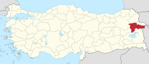 Location of Ağrı Province in Turkey | |
| Country | Turkey |
| Region | Northeast Anatolia |
| Subregion | Ağrı |
| Government | |
| • Electoral district | Ağrı |
| Area | |
| • Total | 11,376 km2 (4,392 sq mi) |
| Population (2009)[1] | |
| • Total | 542,255 |
| • Density | 48/km2 (120/sq mi) |
| Area code(s) | 0472 |
| Vehicle registration | 04 |
The Ağrı Province (Turkish: Ağrı ili) is a province in eastern Turkey, bordering Iran to the east, Kars to the north, Erzurum to the northwest, Muş and Bitlis to the southwest, Van to the south, and Iğdır to the northeast. It has an area of 11,376 km² and a population of 542,022 (2010 est). A majority of the province's population is Kurdish.[2] The region also has got a sizeable Azerbaijani (Qarapapak) minority.[3][4][5][6][7][8]
The provincial capital is Ağrı, situated on a 1,650 m. high plateau.
Districts

Ağrı province is divided into eight districts (capital district in bold):
Geography
Ağrı is named after the nearby majestic Mount Ararat, a 5,137 metres (16,854 ft) high stratovolcano, the highest mountain in Turkey and a national symbol to Armenians. It can be climbed from here and can be seen from parts of Azerbaijan, Iran, Georgia, and Armenia. The nearest town to the mountain is Doğubayazıt.
46% of the province is mountainous, 29% is plain, 18% is plateau, and 7% high meadow. As well as Ararat there are many other peaks over 3,000m, including Aladağlar and Tendürek. The plains are fertile, being covered in volcanic deposits, and are used for growing grains and grazing. Various tributaries of the Murat River (which later feeds the Euphrates) flow through the area and water these plains. The high meadows are used for grazing.
The weather here is very cold (temperatures as low as -10 °C (14 °F) in winter) and the mountainsides are mainly bare. There are a number of important passes and routes through the mountains.
History
The plateau of Ağrı was controlled by the Kingdom of Urartu until its transition to the Kingdom of Armenia. The area was coveted by many as a gateway between east and west. It was conquered numerous times by Assyrians, Greeks, Romans, Byzantines, Arabs, Georgians, Mongols, Persians, and finally by the Seljuq and Ottoman Turks.
The first Muslims in the area were the Abbasids in 872. The Turkish tribes began to pass through in huge numbers following the defeat of the Byzantine armies at Malazgirt in 1071, sometimes pursued by Mongols. The land was brought into the Ottoman Empire by Sultan Selim I following the Battle of Chaldiran. The region retained a large Armenian population until the Armenian Genocide of 1915.
Recent events
On August 19, 2006, a Tabriz–Ankara gas pipeline exploded in the province. Turkish authorities suspect separatist PKK was behind the incident.[9]
Ağrı today
The economy is mainly agricultural. People also live by grazing animals. Ağrı also attracts tourists to the mountain, for climbing and trekking in summers, and skiing in winters. Places of interest include:
- Ishak Pasha Palace and what some claim to be the second-largest meteor crater in the world which in fact is the crater of Mount Tendürek in Doğubayazıt
- Aznavur Tepe in Patnos
- The tomb of Ahmedi Hani in Doğubayazıt
Coordinates: 39°40′N 43°10′E / 39.667°N 43.167°Efamous People
Adem Kılıççı Turkish Boxer of Qarapapak Heritage
Demographics
The population of Ağrı is stable around 550 thousand since 2000. Ağrı has the second highest total fertility rate in Turkey, with 3,69 children per woman (only Şanlıurfa province has a higher fertility rate). The crude birth rate is 28,3‰ in 2016, down from 31,1‰ in 2011. The crude death rate is 3,4‰, down from 4,7‰ in 2011. The natural growth rate is 24,9‰, down from 26,4‰ in 2011. Ağrı has a slightly higher infant mortality rate at 14,1‰ (compared to the Turkish average at 10,0‰), down from 22,0‰ in 2011. Many people leave the remote rural areas of the province Ağrı in search for a better life in the metropolitan areas (such as Istanbul and Ankara). That is the reason why the population growth is very minimal.
A majority of its population, approximately 315 thousand people, live in urban areas (59%) up from only 53 thousand people in 1965 (22% of its population). That means a sixfold increase of the urban population. The urbanisation rate is still increasing. However, Ağrı remains predominantly agricultural because a large minority lives in rural areas and works in agriculture. The rural population grew minimal from 193 thousand to 221 thousand in the period from 1965 to 2017. Three districts with the largest population have an urban majority, while in the other five districts with the smallest population have a rural majority.
| District | Total | Urban | Rural |
|---|---|---|---|
| Ağrı | 149,581 | 117,431 | 32,150 |
| Patnos | 120,654 | 65,530 | 55,124 |
| Doğubayazıt | 120,320 | 79,349 | 40,971 |
| Diyadin | 42,340 | 20,387 | 21,953 |
| Eleşkirt | 33,940 | 16,042 | 17,898 |
| Tutak | 30,699 | 6,741 | 23,958 |
| Taşlıçay | 20,490 | 6,129 | 14,361 |
| Hamur | 18,261 | 3,198 | 15,063 |
| Province | 536,285 | 314,807 | 221,478 |
The suicide rate increased from 4,37 per hundred thousand inhabitants in 2011 to 5,32 per hundred thousand inhabitants in 2016.
References
- ↑ Turkish Statistical Institute, MS Excel document – Population of province/district centers and towns/villages and population growth rate by provinces
- ↑ Watts, Nicole F. (2010). Activists in Office: Kurdish Politics and Protest in Turkey (Studies in Modernity and National Identity). Seattle: University of Washington Press. p. 167. ISBN 978-0-295-99050-7.
- ↑ "Azerbaijani in agri".
- ↑ "AZERI in agri".
- ↑ "Karapapak in ağri".
- ↑ "Ağri,karapapak".
- ↑ "Ağrı'da 'Şah Bezeme' Geleneği Yüz Yıllardır Devam Ediyor". m.haberler.com.
- ↑ https://www.sondakika.com/. "Ağrı'da 'Şah Bezeme' Geleneği Yüz Yıllardır Devam Ediyor". m.sondakika.com.
- ↑ "Gas pipeline explodes in Turkish rebel region". CNN. 2006-08-19. Archived from the original on 2006-08-24. Retrieved 2008-04-04.
External links
| ||
Metropolitan municipalities are bolded. | ||