Bayburt
| Bayburt | |
|---|---|
| Municipality | |
.jpg) | |
 Bayburt | |
| Coordinates: 40°15′35″N 40°13′40″E / 40.25972°N 40.22778°ECoordinates: 40°15′35″N 40°13′40″E / 40.25972°N 40.22778°E | |
| Country | Turkey |
| Province | Bayburt |
| Government | |
| • Mayor | Mete Memiş (AKP) |
| Area[1] | |
| • District | 2,655.41 km2 (1,025.26 sq mi) |
| Elevation | 1,555 m (5,102 ft) |
| Population (2012)[2] | |
| • Urban | 35,947 |
| • District | 61,354 |
| • District density | 23/km2 (60/sq mi) |
| Website | www.bayburt-bld.gov.tr |
Bayburt is a city in northeast Turkey lying on the Çoruh River and is the provincial capital of Bayburt Province.
Bayburt was once an important center on the ancient Silk Road. It was visited by Marco Polo and Evliya Çelebi. Remains of its medieval castle still exist. There are several historical mosques, Turkish baths, and tombs in the city. There are also ancient historical sites such as the Çatalçeşme Underground Complex and natural wonders like the Sirakayalar Waterfall in the other parts of the province.
Name
The name of the town was formerly written in English as Baiburt.[3][4] It was known as Paipert under the Byzantines. The name derives from the medieval Armenian Baydbert (Բայտբերդ), which derives from its ancient name Ambatavan (Ամբատավան).
History
.jpg)
Bayburt strattles the Çoruh amid an open and fertile plateau on the route between Trabzon and Erzurum.[4] It was founded by the Azzi people. It was subsequently settled or conquered by the Cimmerians in the 8th century BC, the Medes in the 7th century BC, then the Persians, Pontus, Rome, the Byzantines, the Bagratid Armenian Kingdom, the Seljuk Turks, the Aq Qoyunlu, Safavid Persia, and then the Ottoman Turks.
The town was the site of an Armenian fortress in the 1st century and may have been the Baiberdon fortified by the emperor Justinian.[3] It was a stronghold of the Genovese in the late Middle Ages[3] and prospered in the late 13th and early 14th century because of the commerce between Trebizond and Persia.[5] It contained a mint under the Seljuks and Ilkhanids.[5] From c. 1243 to 1266, Bayburt was under brief control of the Georgian princes of Samtskhe. A Christian church within the Bayburt castle was built in the 13th century under the Trapezuntine or Georgian influence.[6]
Under Ottoman rule, the town was the center of the Bayburt Sanjak in Erzurum Eyalet. When Erzurum was devastated in the early 16th century, Bayburt served for a time as the de facto capital of the province.[5] The area was raided by the Safavids in 1553. Bayburt was captured by a Russian army under General Paskevich[4] and its fortifications thoroughly demolished in 1829.[3] It was the furthest westward reach of the Russians during that campaign.[4] The British traveller William John Hamilton commented on the ruins in the 1840s,[7] though the population grew to 6000 by the 1870s.[3] The bazaar, however, remained poor and the town long lacked industry.[4] Prior to the First World War, the population of 10,000 was mostly Turkish with some Armenians.[4]
Climate
Bayburt has a continental climate with freezing cold winters, the majority of the time snowing heavily. Summers are warm with cool nights. The climate is best described as humid continental by the Köppen Climate System Dfb, on the border of Dsb.[8] Most of the precipitation occurs in late spring and early summer. The lowest temperature recorded was -31.3 °C (-24.3 °F) in January 1972. The highest temperature recorded was 37.1 °C (98.8 °F) in August 2006. The highest snow thickness recorded was 110 cm (43.3 inches) in March 1976.
| Climate data for Bayburt (1960-2012) | |||||||||||||
|---|---|---|---|---|---|---|---|---|---|---|---|---|---|
| Month | Jan | Feb | Mar | Apr | May | Jun | Jul | Aug | Sep | Oct | Nov | Dec | Year |
| Record high °C (°F) | 10.3 (50.5) |
13.9 (57) |
21.2 (70.2) |
25.3 (77.5) |
29.6 (85.3) |
32.4 (90.3) |
36.2 (97.2) |
37.1 (98.8) |
33.3 (91.9) |
28.8 (83.8) |
20.0 (68) |
18.2 (64.8) |
37.1 (98.8) |
| Average high °C (°F) | −1.3 (29.7) |
0.2 (32.4) |
5.4 (41.7) |
12.7 (54.9) |
18.0 (64.4) |
22.4 (72.3) |
26.9 (80.4) |
27.3 (81.1) |
23.3 (73.9) |
16.7 (62.1) |
8.6 (47.5) |
1.7 (35.1) |
13.5 (56.3) |
| Daily mean °C (°F) | −6.5 (20.3) |
−5.3 (22.5) |
0.0 (32) |
7.0 (44.6) |
11.7 (53.1) |
15.4 (59.7) |
19.0 (66.2) |
18.8 (65.8) |
14.7 (58.5) |
9.2 (48.6) |
2.6 (36.7) |
−3.2 (26.2) |
7 (44.5) |
| Average low °C (°F) | −10.9 (12.4) |
−9.8 (14.4) |
−4.5 (23.9) |
1.7 (35.1) |
5.5 (41.9) |
8.2 (46.8) |
11.0 (51.8) |
10.8 (51.4) |
7.1 (44.8) |
3.4 (38.1) |
−1.9 (28.6) |
−7.1 (19.2) |
1.1 (34) |
| Record low °C (°F) | −31.3 (−24.3) |
−27.6 (−17.7) |
−28.3 (−18.9) |
−12.7 (9.1) |
−4.4 (24.1) |
−1.6 (29.1) |
0.2 (32.4) |
2.4 (36.3) |
−2.1 (28.2) |
−10.6 (12.9) |
−23.6 (−10.5) |
−29.0 (−20.2) |
−31.3 (−24.3) |
| Average precipitation mm (inches) | 26.5 (1.043) |
28.2 (1.11) |
39.7 (1.563) |
62.8 (2.472) |
68.6 (2.701) |
52.0 (2.047) |
20.6 (0.811) |
14.2 (0.559) |
20.7 (0.815) |
44.4 (1.748) |
34.2 (1.346) |
28.8 (1.134) |
440.7 (17.349) |
| Average precipitation days | 11.2 | 10.9 | 12.4 | 13.9 | 15.4 | 10.5 | 5.1 | 4.3 | 4.7 | 8.7 | 9.1 | 10.7 | 116.9 |
| Source: Devlet Meteoroloji İşleri Genel Müdürlüğü [9] | |||||||||||||
Sights
Nature
Bayburt has several parks and open spaces like ''Aslan dağı Ormanı '' (Lion Mount Forest ) "Gençlik Parkı" (Youth Park), "Şehit Nusret Bahçesi" (Martyr Nusret Gardens) and "Yenişehir Parkı" (New City Park). The city has 535.780m² of nursery areas, where young plants are raised for the forests of Bayburt. Also there are two caves that visitors can see the interesting natural shapes of the stones. These caves are, "Çimağıl Mağarası" and "Helva Köyü Buz Mağarası".[10]
Castle

Bayburt Castle stands on the steep rocks north of Bayburt. It was held by the Bagratuni Dynasty in the 9th, 10th, and 11th centuries. It was completely rebuilt by the Saltuk ruler Mugis-al-Din Tugrul Sah between 1200 and 1230, as attested by an inscription in the walls of the castle. The massive size of its walls and the quality of its masonry place it amongst the finest of all the castles in Anatolia but for its destruction by the Russians[5] during the early nineteenth century.[11] Rebuilding was done during the Ottoman period.[5] The castle was inhabited till the destruction[5] of 1829.[4]
Aydıntepe Underground City
Located 45 km from Bayburt, the site consists of rock-cut galleries, vaulted rooms and wider spaces excavated out of natural rock, without using any building material within 2-2.5 meters from the surface in the tuff. Vaulted galleries about one meter wide and 2 to 2.5 meters tall are expanding on both sides.[12]
Museum
Baksı Museum
The Baksı Museum stands near the Black Sea, 45 km from Bayburt on a hilltop overlooking the Çoruh Valley. Rising in what used to be called Baksı and is now the village of Bayraktar, this unusual museum offers contemporary art and traditional handicrafts side by side under one roof.[13]
Sports
SKI
Kop Mountain Ski Resort
Winter tourism center of this city. Far away 40 km in city center.
Swimming
There are many indoor swimming pools in the city.
Semi-Olympic swimming pool
The city center is opposite the Yenişehir Park. The pool water is kept at the same level in summer and winter so that the users can enjoy the pool in the best possible way. This pool have standard Semi-olympic swimming pool. Pool measures 12,5 meters X 25 meters and has a depth of 2 meters.
University guest house
Public use is on. Indoor swimming pool measures 5 meters X 15 meters and has a depth of 1.55 meters.
There is also a turkish bath, a fin bath and a sauna with the pool.
Football
There is a professional football stadium in the city and many private artificial carpet sites.
Teams
Bayburtspor
The city has one football club currently competing in the Turkish Amateur Football Championship, struggling for promotion to the Turkish Third League, called Bayburtspor.
Şalcilarspor played in the Second League between 1986-1988.
Education
Bayburt University
Bayburt University is located at the center of the city, university has several faculties such as Engineering, Arts and Sciences and Administrative Sciences. There are also several vocational schools.
Transportation
"Bayburt Otobus Terminali", located in the south of the city, is the main port to Bayburt.
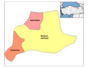
Population
Notable people
- Irsadi Baba
- Suat Türker
- Dede Korkut
- Bayburtlu Kara Ibrahim Pasha
- Hovhannes Çamaşırciyan
- Krikor Amirian
Twin cities
Bayburt is twinned with:
See also
- Bayburt Museum of Modern Arts
- Şehit Osman Hill
- Arpalı Kasabası
Notes
- ↑ "Area of regions (including lakes), km²". Regional Statistics Database. Turkish Statistical Institute. 2002. Retrieved 2013-03-05.
- ↑ "Population of province/district centers and towns/villages by districts - 2012". Address Based Population Registration System (ABPRS) Database. Turkish Statistical Institute. Retrieved 2013-02-27.
- 1 2 3 4 5 EB (1878).
- 1 2 3 4 5 6 7 EB (1911).
- 1 2 3 4 5 6 Sinclair, T.A. (1989). Eastern Turkey: An Architectural & Archaeological Survey, Volume I. Pindar Press. pp. 284–289. ISBN 9780907132325.
- ↑ Peacock, Andrew (2012). "Between Georgia and the Islamic world: the atabegs of Samc'xe and the Turks". In Beyazit, Deniz. At the Crossroads of Empires: 14th-15th century Eastern Anatolia. Varia Anatolica. 25. Paris and Istanbul: Institut français d'études anatoliennes. pp. 49–70. ISBN 978-2-36245-002-0.
- ↑ Hamilton, William John (1842). Researches in Asia Minor, Pontus, and Armenia. Murray. pp. 231–233. .
- ↑ Climate Summary for Bayburt
- ↑ "İl ve İlçelerimize Ait İstatistiki Veriler- Meteoroloji Genel Müdürlüğü". Dmi.gov.tr. 1996-10-25. Archived from the original on 30 April 2011. Retrieved 2011-03-20.
- ↑
- ↑ David Winfield, "A Note on the South-Eastern Borders of the Empire of Trebizond in the Thirteenth Century", Anatolian Studies, 12 (1962), p. 166
- ↑ "Aydıntepe Yeraltı Şehri". www.aydintepeyeraltisehri.com. Retrieved 2016-12-06.
- ↑ "Baksı Müzesi". en.baksi.org. Retrieved 2016-12-06.
References
| Wikimedia Commons has media related to Bayburt. |

| Authority control |
|---|