Enlarged Erie Canal Historic District (Discontiguous)
|
Enlarged Erie Canal Historic District (Discontiguous) | |
 Lock 15 | |
  | |
| Location | City of Cohoes, roughly from S to NW city boundary, Cohoes, New York |
|---|---|
| Coordinates | 42°46′39″N 73°42′11″W / 42.77750°N 73.70306°WCoordinates: 42°46′39″N 73°42′11″W / 42.77750°N 73.70306°W |
| Area | 9.9 acres (4.0 ha) |
| Built | 1836 |
| Architect | Merriam, Carr & Co.; Barker and Smith |
| NRHP reference # | 04000434[1] |
| Added to NRHP | May 14, 2004 |
Enlarged Erie Canal Historic District (Discontiguous) is a national historic district located at Cohoes in Albany County, New York. It includes two contributing buildings and 10 contributing structures. It encompasses resources associated with the Enlarged Erie Canal, 1835-1862, Locks 9 through 18, and located within the City of Cohoes. The district includes five numbered units with each unit representing a cohesive grouping of resources highlighted by one or more extant canal locks. Each unit consists of at least one remaining lock and the associated elements including sections of towpath, berm walls, engineering features, and canal prism.[2]
- Unit 1: Lock 9
- Unit 2: Lock 10
- Unit 3: Locks 14 and 15
- Unit 4: Lock 17
- Unit 5: Lock 18
It was listed on the National Register of Historic Places in 2004.[1]
Gallery
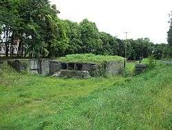
 Lock 9
 Lock 10
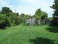
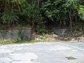 Lock 14
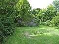 Lock 17
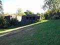 Lock 18
References
- 1 2 National Park Service (2009-03-13). "National Register Information System". National Register of Historic Places. National Park Service.
- ↑ William E. Krattinger (n.d.). "National Register of Historic Places Registration: Enlarged Erie Canal Historic District (Discontiguous)". New York State Office of Parks, Recreation and Historic Preservation. Retrieved 2010-10-18. See also: "Accompanying five photos".
| Topics |   | |
|---|---|---|
| Lists by county |
| |
| Lists by city | ||
| Other lists | ||
| ||
This article is issued from
Wikipedia.
The text is licensed under Creative Commons - Attribution - Sharealike.
Additional terms may apply for the media files.