Electoral district of Whitsunday
| Whitsunday Queensland—Legislative Assembly | |||||||||||||||
|---|---|---|---|---|---|---|---|---|---|---|---|---|---|---|---|
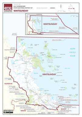 Electoral map of Whitsunday 2017 | |||||||||||||||
| State | Queensland | ||||||||||||||
| MP | Jason Costigan | ||||||||||||||
| Party | Liberal National | ||||||||||||||
| Namesake | Whitsunday Island | ||||||||||||||
| Electors | 32,156 (2015) | ||||||||||||||
| Area | 27,761 km2 (10,718.6 sq mi) | ||||||||||||||
| Coordinates | 20°35′S 149°2′E / 20.583°S 149.033°ECoordinates: 20°35′S 149°2′E / 20.583°S 149.033°E | ||||||||||||||
| |||||||||||||||

Electoral map of Whitsunday 2008
Whitsunday is an electoral division in the Legislative Assembly of Queensland, Queensland, Australia.
It extends from the northern suburbs of Mackay to Bowen and Proserpine as well as east to the Whitsunday Islands.
Members for Whitsunday
| Member | Party affiliation | Period | |
|---|---|---|---|
| Lloyd Roberts | Country Party | 1950–1961 | |
| Ron Camm | Country | 1961–1974 | |
| National | 1974–1980 | ||
| Geoff Muntz | National | 1980–1989 | |
| Independent | 1989 | ||
| Lorraine Bird | Labor | 1989–1998 | |
| Harry Black | One Nation | 1998–1999 | |
| City Country Alliance | 1999–2001 | ||
| Jan Jarratt | Labor | 2001–2012 | |
| Jason Costigan | Liberal National | 2012–present |
Election results
| Party | Candidate | Votes | % | ± | |
|---|---|---|---|---|---|
| Liberal National | Jason Costigan | 8,774 | 32.2 | −9.5 | |
| Labor | Bronwyn Taha | 8,503 | 31.2 | −4.7 | |
| One Nation | Noel Skippen | 5,471 | 20.1 | +20.1 | |
| Katter's Australian | Jenny Whitney | 2,499 | 9.2 | +9.2 | |
| Greens | Imogen Lindenberg | 1,562 | 5.7 | −0.9 | |
| Independent | Dan Van Blarcom | 477 | 1.7 | +1.7 | |
| Total formal votes | 27,286 | 96.0 | −1.9 | ||
| Informal votes | 1,147 | 4.0 | +1.9 | ||
| Turnout | 28,433 | 86.3 | −0.1 | ||
| Two-party-preferred result | |||||
| Liberal National | Jason Costigan | 13,829 | 50.7 | +0.1 | |
| Labor | Bronwyn Taha | 13,457 | 49.3 | −0.1 | |
| Liberal National hold | Swing | +0.1 | |||
References
External links
- Electorate Profile (Antony Green, ABC)
This article is issued from
Wikipedia.
The text is licensed under Creative Commons - Attribution - Sharealike.
Additional terms may apply for the media files.