Electoral district of Currumbin
| Currumbin Queensland—Legislative Assembly | |||||||||||||||
|---|---|---|---|---|---|---|---|---|---|---|---|---|---|---|---|
 Electoral map of Currumbin 2017 | |||||||||||||||
| State | Queensland | ||||||||||||||
| MP | Jann Stuckey | ||||||||||||||
| Party | Liberal National | ||||||||||||||
| Namesake | Currumbin | ||||||||||||||
| Electors | 33,782 (2017) | ||||||||||||||
| Area | 126 km2 (48.6 sq mi) | ||||||||||||||
| Coordinates | 28°10′S 153°25′E / 28.167°S 153.417°ECoordinates: 28°10′S 153°25′E / 28.167°S 153.417°E | ||||||||||||||
| |||||||||||||||

Electoral map of Currumbin 2008
Currumbin is an electoral district of the Legislative Assembly in the Australian state of Queensland.
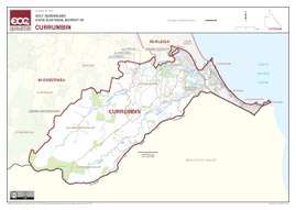
The district lies in the south-east corner of the state, along the New South Wales border. The district takes in southern parts of the Gold Coast and much of its hinterland. It includes the suburbs of Currumbin, Coolangatta, Elanora and Tugun as well as the rural Currumbin Valley and Tallebudgera Valley. The electorate was first contested in 1986.
Members for Currumbin
| Member | Party | Term | |
|---|---|---|---|
| Leo Gately | National | 1986–1989 | |
| Trevor Coomber | Liberal | 1989–1992 | |
| Merri Rose | Labor | 1992–2004 | |
| Jann Stuckey | Liberal | 2004–2008 | |
| Liberal National | 2008–present | ||
Election results
| Party | Candidate | Votes | % | ± | |
|---|---|---|---|---|---|
| Liberal National | Jann Stuckey | 13,215 | 47.7 | +1.8 | |
| Labor | Georgi Leader | 9,874 | 35.6 | +5.9 | |
| Greens | David Wyatt | 3,249 | 11.7 | +0.4 | |
| Independent | Andrew Semple | 1,375 | 5.0 | +5.0 | |
| Total formal votes | 27,713 | 95.3 | −2.3 | ||
| Informal votes | 1,352 | 4.7 | +2.3 | ||
| Turnout | 29,065 | 84.5 | +1.6 | ||
| Two-party-preferred result | |||||
| Liberal National | Jann Stuckey | 14,775 | 53.3 | −2.4 | |
| Labor | Georgi Leader | 12,938 | 46.7 | +2.4 | |
| Liberal National hold | Swing | −2.4 | |||
References
External links
- Electorate Profile (Antony Green, ABC)
This article is issued from
Wikipedia.
The text is licensed under Creative Commons - Attribution - Sharealike.
Additional terms may apply for the media files.