Wayne County, Nebraska
| Wayne County, Nebraska | |
|---|---|
_from_SE_1.JPG) Wayne County Courthouse in Wayne | |
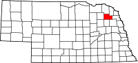 Location in the U.S. state of Nebraska | |
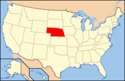 Nebraska's location in the U.S. | |
| Founded | 1870 |
| Named for | Anthony Wayne |
| Seat | Wayne |
| Largest city | Wayne |
| Area | |
| • Total | 443 sq mi (1,147 km2) |
| • Land | 443 sq mi (1,147 km2) |
| • Water | 0.4 sq mi (1 km2), 0.09% |
| Population | |
| • (2010) | 9,595 |
| • Density | 22/sq mi (8/km2) |
| Congressional district | 3rd |
| Time zone | Central: UTC−6/−5 |
| Website |
www |
Wayne County is a county in the U.S. state of Nebraska. As of the 2010 census, the population was 9,595.[1] Its county seat is Wayne.[2]
In the Nebraska license plate system, Wayne County is represented by the prefix 27 (it had the 27th-largest number of vehicles registered in the state when the license plate system was established in 1922).
History
Wayne County was organized by a proclamation of Governor David Butler in the fall of 1870. As the county was settled, precincts were formed and boundaries defined. Precincts were named for officials, early settlers, and neighborhood creeks. There are 13 precincts in Wayne County.
Wayne County, like the City of Wayne, was named for the Revolutionary War hero General Anthony Wayne.[3]
Geography
According to the U.S. Census Bureau, the county has a total area of 443 square miles (1,150 km2), of which 443 square miles (1,150 km2) is land and 0.4 square miles (1.0 km2) (0.09%) is water.[4]
Major highways
Adjacent counties
- Dixon County (northeast)
- Thurston County (east)
- Cuming County (southeast)
- Stanton County (south)
- Pierce County (west)
- Cedar County (north)
Demographics
| Historical population | |||
|---|---|---|---|
| Census | Pop. | %± | |
| 1870 | 182 | — | |
| 1880 | 813 | 346.7% | |
| 1890 | 6,189 | 661.3% | |
| 1900 | 9,862 | 59.3% | |
| 1910 | 10,397 | 5.4% | |
| 1920 | 9,725 | −6.5% | |
| 1930 | 10,566 | 8.6% | |
| 1940 | 9,880 | −6.5% | |
| 1950 | 10,129 | 2.5% | |
| 1960 | 9,959 | −1.7% | |
| 1970 | 10,400 | 4.4% | |
| 1980 | 9,858 | −5.2% | |
| 1990 | 9,364 | −5.0% | |
| 2000 | 9,851 | 5.2% | |
| 2010 | 9,595 | −2.6% | |
| Est. 2016 | 9,365 | [5] | −2.4% |
| U.S. Decennial Census[6] 1790-1960[7] 1900-1990[8] 1990-2000[9] 2010-2013[1] | |||
As of the census[10] of 2000, there were 9,851 people, 3,437 households, and 2,206 families residing in the county. The population density was 22 people per square mile (9/km²). There were 3,662 housing units at an average density of 8 per square mile (3/km²). The racial makeup of the county was 96.78% White, 0.94% Black or African American, 0.35% Native American, 0.35% Asian, 0.01% Pacific Islander, 0.85% from other races, and 0.72% from two or more races. 1.48% of the population were Hispanic or Latino of any race. 57.5% were of German, 6.0% Irish and 5.9% Swedish ancestry according to Census 2000.
There were 3,437 households out of which 30.50% had children under the age of 18 living with them, 56.20% were married couples living together, 5.40% had a female householder with no husband present, and 35.80% were non-families. 25.10% of all households were made up of individuals and 10.60% had someone living alone who was 65 years of age or older. The average household size was 2.51 and the average family size was 3.02.
In the county, the population was spread out with 21.60% under the age of 18, 25.40% from 18 to 24, 21.20% from 25 to 44, 18.00% from 45 to 64, and 13.70% who were 65 years of age or older. The median age was 28 years. For every 100 females there were 92.30 males. For every 100 females age 18 and over, there were 92.30 males.
The median income for a household in the county was $32,366, and the median income for a family was $43,840. Males had a median income of $27,848 versus $20,376 for females. The per capita income for the county was $14,644. About 7.40% of families and 14.50% of the population were below the poverty line, including 10.60% of those under age 18 and 7.20% of those age 65 or over.
Communities
Several towns in Wayne County's early history no longer exist. LaPorte had nearly 300 citizens at one time and was home to a temporary courthouse until the railroad chose a different route. Towns such as Taffe, Logan City, Apex, Melvin, Weber and Spring Branch no longer exist.
Precincts
There are currently 13 precincts in Wayne County. They were named for officials, early settlers or neighborhood creeks.[11]
- Brenna: F.E. Moses, who was the first settler in the precinct, was allowed by County Commissioners to name the precinct and he chose to name it after his sister, Brenna.
- Chapin: named for Arthur T. Chapin, an early settler.
- Deer Creek: named for the plentiful supply of deer horns found scattered over the prairies in about 1884.
- Garfield: named for James A. Garfield who became the 20th president of the United States.
- Hancock: named for Brigadier General Winfield Scott Hancock, one of the heroes of the Civil War Battle of Gettysburg. He was also a Democratic candidate for president against James A. Garfield.
- Hoskins: first named Spring Branch, but was later named for Mr. Hoskins who was secretary for Mr. Peavy, a member of the land company that laid out the village of Hoskins.
- Hunter: Cyrus E. Hunter, one of the first settlers, who came from Lee County, Illinois.
- Logan: thought to be named for John A. Logan, who was the vice presidential candidate with presidential candidate James G. Blaine. Blaine ran against Grover Cleveland, who was elected president.
- Leslie: said by some early settlers to be named for a judge who served Wayne County in pioneer times. Dr. G.E. Condra of Lincoln says the precinct was named after a post office.
- Plum Creek: so named because of wild plums which were growing on the banks of the creek in early days.
- Sherman: named for General Sherman of Civil War fame.
- Strahan: named for J.M. Strahan, who was an early settler there.
- Wilbur: carries the name of Russell H. Wilbur, who was a pioneer in the precinct.
See also
References
| Wikimedia Commons has media related to Wayne County, Nebraska. |
- 1 2 "State & County QuickFacts". United States Census Bureau. Retrieved September 22, 2013.
- ↑ "Find a County". National Association of Counties. Retrieved 2011-06-07.
- ↑ Chicago and North Western Railway Company (1908). A History of the Origin of the Place Names Connected with the Chicago & North Western and Chicago, St. Paul, Minneapolis & Omaha Railways. p. 165.
- ↑ "2010 Census Gazetteer Files". United States Census Bureau. August 22, 2012. Archived from the original on November 13, 2013. Retrieved December 12, 2014.
- ↑ "Population and Housing Unit Estimates". Retrieved June 9, 2017.
- ↑ "U.S. Decennial Census". United States Census Bureau. Retrieved December 12, 2014.
- ↑ "Historical Census Browser". University of Virginia Library. Retrieved December 12, 2014.
- ↑ "Population of Counties by Decennial Census: 1900 to 1990". United States Census Bureau. Retrieved December 12, 2014.
- ↑ "Census 2000 PHC-T-4. Ranking Tables for Counties: 1990 and 2000" (PDF). United States Census Bureau. Retrieved December 12, 2014.
- ↑ "American FactFinder". United States Census Bureau. Retrieved 2008-01-31.
- ↑ "Wayne County Precincts". County of Wayne, NE. Retrieved 24 August 2014.
Places adjacent to Wayne County, Nebraska | ||||||||||
|---|---|---|---|---|---|---|---|---|---|---|
| ||||||||||
Municipalities and communities of Wayne County, Nebraska, United States | ||
|---|---|---|
| Cities | ||
| Villages | ||
| Unincorporated community | ||
| Footnotes | ‡This populated place also has portions in an adjacent county or counties | |