Courcelles, Charente-Maritime
| Courcelles | |
|---|---|
| Commune | |
 | |
 Courcelles Location within Nouvelle-Aquitaine region  Courcelles | |
| Coordinates: 45°57′13″N 0°28′19″W / 45.9536°N 0.4719°WCoordinates: 45°57′13″N 0°28′19″W / 45.9536°N 0.4719°W | |
| Country | France |
| Region | Nouvelle-Aquitaine |
| Department | Charente-Maritime |
| Arrondissement | Saint-Jean-d'Angély |
| Canton | Matha |
| Intercommunality | Canton de Saint-Jean-d'Angély |
| Government | |
| • Mayor (2008–2014) | Philippe Harmegnie |
| Area1 | 6.77 km2 (2.61 sq mi) |
| Population (2008)2 | 434 |
| • Density | 64/km2 (170/sq mi) |
| Time zone | UTC+1 (CET) |
| • Summer (DST) | UTC+2 (CEST) |
| INSEE/Postal code | 17125 /17400 |
| Elevation |
15–68 m (49–223 ft) (avg. 20 m or 66 ft) |
|
1 French Land Register data, which excludes lakes, ponds, glaciers > 1 km2 (0.386 sq mi or 247 acres) and river estuaries. 2 Population without double counting: residents of multiple communes (e.g., students and military personnel) only counted once. | |
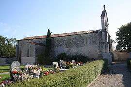
Courcelles is a commune in the Charente-Maritime department in southwestern France.
Geography
The village lies on the right bank of the Boutonne, which forms most of the commune's eastern border.
Population
| Historical population | ||
|---|---|---|
| Year | Pop. | ±% |
| 1962 | 290 | — |
| 1968 | 335 | +15.5% |
| 1975 | 354 | +5.7% |
| 1982 | 461 | +30.2% |
| 1990 | 494 | +7.2% |
| 1999 | 436 | −11.7% |
| 2008 | 434 | −0.5% |
See also
References
| Wikimedia Commons has media related to Courcelles (Charente-Maritime). |
This article is issued from
Wikipedia.
The text is licensed under Creative Commons - Attribution - Sharealike.
Additional terms may apply for the media files.