Dompierre-sur-Mer
| Dompierre-sur-Mer | |
|---|---|
| Commune | |
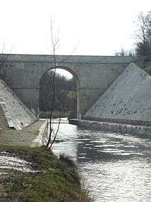 The Canal de Marans and its bridge | |
 Dompierre-sur-Mer Location within Nouvelle-Aquitaine region  Dompierre-sur-Mer | |
| Coordinates: 46°11′19″N 1°03′49″W / 46.1886°N 1.0636°WCoordinates: 46°11′19″N 1°03′49″W / 46.1886°N 1.0636°W | |
| Country | France |
| Region | Nouvelle-Aquitaine |
| Department | Charente-Maritime |
| Arrondissement | La Rochelle |
| Canton | Aytré |
| Intercommunality | CA La Rochelle |
| Government | |
| • Mayor (2008–2014) | Michel-Martial Durieux |
| Area1 | 18.35 km2 (7.08 sq mi) |
| Population (2008)2 | 5,280 |
| • Density | 290/km2 (750/sq mi) |
| Time zone | UTC+1 (CET) |
| • Summer (DST) | UTC+2 (CEST) |
| INSEE/Postal code | 17142 /17139 |
| Elevation | 4–35 m (13–115 ft) |
|
1 French Land Register data, which excludes lakes, ponds, glaciers > 1 km2 (0.386 sq mi or 247 acres) and river estuaries. 2 Population without double counting: residents of multiple communes (e.g., students and military personnel) only counted once. | |
Dompierre-sur-Mer is a commune in the Charente-Maritime department in southwestern France.
Population
| Historical population | ||
|---|---|---|
| Year | Pop. | ±% |
| 1962 | 1,789 | — |
| 1968 | 1,947 | +8.8% |
| 1975 | 2,928 | +50.4% |
| 1982 | 3,472 | +18.6% |
| 1990 | 3,627 | +4.5% |
| 1999 | 4,305 | +18.7% |
| 2008 | 5,280 | +22.6% |
Personalities
- Auguste-Louis de Rossel de Cercy
- Jacques Archambault, Early settler of New France with his wife and seven children. Dug first well in Ville-Marie Montreal for Paul Chomedey de Maisonneuve.
See also
References
| Wikimedia Commons has media related to Dompierre-sur-Mer. |
This article is issued from
Wikipedia.
The text is licensed under Creative Commons - Attribution - Sharealike.
Additional terms may apply for the media files.