Le Mung
| Le Mung | |
|---|---|
| Commune | |
 | |
 Le Mung Location within Nouvelle-Aquitaine region  Le Mung | |
| Coordinates: 45°52′32″N 0°42′43″W / 45.8756°N 0.7119°WCoordinates: 45°52′32″N 0°42′43″W / 45.8756°N 0.7119°W | |
| Country | France |
| Region | Nouvelle-Aquitaine |
| Department | Charente-Maritime |
| Arrondissement | Saint-Jean-d'Angély |
| Canton | Saint-Jean-d'Angély |
| Government | |
| • Mayor (2014–2020) | Jean-Louis Richaudeau |
| Area1 | 7.52 km2 (2.90 sq mi) |
| Population (2013)2 | 300 |
| • Density | 40/km2 (100/sq mi) |
| Time zone | UTC+1 (CET) |
| • Summer (DST) | UTC+2 (CEST) |
| INSEE/Postal code | 17252 /17350 |
| Elevation |
1–12 m (3.3–39.4 ft) (avg. 5 m or 16 ft) |
|
1 French Land Register data, which excludes lakes, ponds, glaciers > 1 km2 (0.386 sq mi or 247 acres) and river estuaries. 2 Population without double counting: residents of multiple communes (e.g., students and military personnel) only counted once. | |
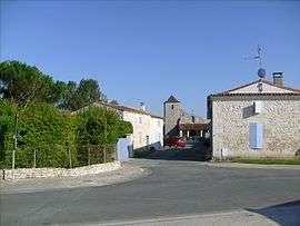
Le Mung is a commune in the Charente-Maritime department in southwestern France.
Population
| Historical population | ||
|---|---|---|
| Year | Pop. | ±% |
| 1962 | 202 | — |
| 1968 | 223 | +10.4% |
| 1975 | 198 | −11.2% |
| 1982 | 253 | +27.8% |
| 1990 | 275 | +8.7% |
| 1999 | 264 | −4.0% |
| 2008 | 262 | −0.8% |
| 2013 | 300 | +14.5% |
See also
References
External links
| Wikimedia Commons has media related to Le Mung. |
This article is issued from
Wikipedia.
The text is licensed under Creative Commons - Attribution - Sharealike.
Additional terms may apply for the media files.