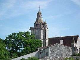
Fléac-sur-Seugne
| Fléac-sur-Seugne | |
|---|---|
| Commune | |
 | |
 Fléac-sur-Seugne Location within Nouvelle-Aquitaine region  Fléac-sur-Seugne | |
| Coordinates: 45°32′06″N 0°32′17″W / 45.535°N 0.5381°WCoordinates: 45°32′06″N 0°32′17″W / 45.535°N 0.5381°W | |
| Country | France |
| Region | Nouvelle-Aquitaine |
| Department | Charente-Maritime |
| Arrondissement | Jonzac |
| Canton | Pons |
| Intercommunality | Haute-Saintonge |
| Government | |
| • Mayor (2008–2014) | Daniel Frédéric |
| Area1 | 8.28 km2 (3.20 sq mi) |
| Population (2008)2 | 350 |
| • Density | 42/km2 (110/sq mi) |
| Time zone | UTC+1 (CET) |
| • Summer (DST) | UTC+2 (CEST) |
| INSEE/Postal code | 17159 /17800 |
| Elevation | 11–56 m (36–184 ft) |
|
1 French Land Register data, which excludes lakes, ponds, glaciers > 1 km2 (0.386 sq mi or 247 acres) and river estuaries. 2 Population without double counting: residents of multiple communes (e.g., students and military personnel) only counted once. | |
Fléac-sur-Seugne is a commune in the Charente-Maritime department in southwestern France.
Geography
The Seugne forms all of the commune's western border.
Population
| Historical population | ||
|---|---|---|
| Year | Pop. | ±% |
| 1946 | 402 | — |
| 1954 | 376 | −6.5% |
| 1962 | 370 | −1.6% |
| 1968 | 356 | −3.8% |
| 1975 | 310 | −12.9% |
| 1982 | 295 | −4.8% |
| 1990 | 340 | +15.3% |
| 1999 | 319 | −6.2% |
| 2008 | 350 | +9.7% |
See also
References
| Wikimedia Commons has media related to Fléac-sur-Seugne. |
This article is issued from
Wikipedia.
The text is licensed under Creative Commons - Attribution - Sharealike.
Additional terms may apply for the media files.