Saint-Rogatien
| Saint-Rogatien | |
|---|---|
| Commune | |
 The town hall of Saint-Rogatien | |
 Saint-Rogatien Location within Nouvelle-Aquitaine region  Saint-Rogatien | |
| Coordinates: 46°09′08″N 1°04′15″W / 46.1522°N 1.0708°WCoordinates: 46°09′08″N 1°04′15″W / 46.1522°N 1.0708°W | |
| Country | France |
| Region | Nouvelle-Aquitaine |
| Department | Charente-Maritime |
| Arrondissement | La Rochelle |
| Canton | La Jarrie |
| Intercommunality | CA La Rochelle |
| Area1 | 5.19 km2 (2.00 sq mi) |
| Population (2008)2 | 1,841 |
| • Density | 350/km2 (920/sq mi) |
| Time zone | UTC+1 (CET) |
| • Summer (DST) | UTC+2 (CEST) |
| INSEE/Postal code | 17391 /17220 |
| Elevation |
9–33 m (30–108 ft) (avg. 16 m or 52 ft) |
|
1 French Land Register data, which excludes lakes, ponds, glaciers > 1 km2 (0.386 sq mi or 247 acres) and river estuaries. 2 Population without double counting: residents of multiple communes (e.g., students and military personnel) only counted once. | |
Saint-Rogatien is a commune in the Charente-Maritime department in the Nouvelle-Aquitaine region in southwestern France.
Besides the town, the town includes the area of Casse-Mortier and part of the village Pommerou, shared with the town of Clavette.[1] Its inhabitants are called Rogatons and Rogatonnes.[2]
Gallery
.JPG) St Rogatien church
St Rogatien church Eglise de Saint-Rogatien
.JPG) Memorial stone
Memorial stone.JPG) The Mairie in Saint-Rogatien
The Mairie in Saint-Rogatien
Église Saint-Rogatien-Saint-Donatien
.JPG)
This church built of limestone in the 12th century and renovated in the 19th century is dedicated to Nantes' two martyrs, partially destroyed during the Wars of Religion, it is largely late medieval but retains its Romanesque portal and an Gothic trefoil recess. The choir stalls were rebuilt in large part to the late Middle Ages. A granite tithe measure from the fifteenth or sixteenth century, is used as the church font. In 1871, a bell tower was installed. In 1884, a restoration project was planned but didn't eventuate till 1987, when the facade was restored, the west weakened by weathering.
Population

In 2012, the municipality had 1,956 inhabitants. The evolution of the number of inhabitants is known throughout the population censuses conducted in the town since 1793. From the twenty-first century, actual census towns with less than 10,000 inhabitants are held every five years, unlike other cities that have a sample survey every year.
| Historical population | ||
|---|---|---|
| Year | Pop. | ±% |
| 1793 | 411 | — |
| 1800 | 299 | −27.3% |
| 1806 | 362 | +21.1% |
| 1821 | 436 | +20.4% |
| 1831 | 448 | +2.8% |
| 1836 | 449 | +0.2% |
| 1841 | 467 | +4.0% |
| 1846 | 470 | +0.6% |
| 1851 | 506 | +7.7% |
| 1856 | 456 | −9.9% |
| 1861 | 490 | +7.5% |
| 1866 | 479 | −2.2% |
| 1872 | 464 | −3.1% |
| 1876 | 515 | +11.0% |
| 1886 | 389 | −24.5% |
| 1891 | 355 | −8.7% |
| 1896 | 375 | +5.6% |
| 1901 | 323 | −13.9% |
| 1906 | 324 | +0.3% |
| 1911 | 339 | +4.6% |
| 1921 | 303 | −10.6% |
| 1926 | 293 | −3.3% |
| 1931 | 299 | +2.0% |
| 1936 | 309 | +3.3% |
| 1946 | 303 | −1.9% |
| 1954 | 296 | −2.3% |
| 1962 | 346 | +16.9% |
| 1968 | 357 | +3.2% |
| 1975 | 557 | +56.0% |
| 1982 | 753 | +35.2% |
| 1990 | 1,272 | +68.9% |
| 1999 | 1,805 | +41.9% |
| 2005 | 1,803 | −0.1% |
| 2006 | 1,808 | +0.3% |
| 2008 | 1,841 | +1.8% |
| 2010 | 1,920 | +4.3% |
| 2012 | 1,956 | +1.9% |
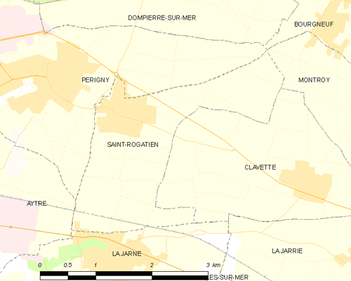
Map of the Commune
See also
References
External links
| Wikimedia Commons has media related to Saint-Rogatien. |