Saint-Bonnet-sur-Gironde
| Saint-Bonnet-sur-Gironde | |
|---|---|
| Commune | |
 | |
 Saint-Bonnet-sur-Gironde Location within Nouvelle-Aquitaine region  Saint-Bonnet-sur-Gironde | |
| Coordinates: 45°21′19″N 0°39′32″W / 45.3553°N 0.6589°WCoordinates: 45°21′19″N 0°39′32″W / 45.3553°N 0.6589°W | |
| Country | France |
| Region | Nouvelle-Aquitaine |
| Department | Charente-Maritime |
| Arrondissement | Jonzac |
| Canton | Pons |
| Intercommunality | Haute-Saintonge |
| Government | |
| • Mayor (2008–2014) | Roland Pelletant |
| Area1 | 30.60 km2 (11.81 sq mi) |
| Population (2008)2 | 859 |
| • Density | 28/km2 (73/sq mi) |
| Time zone | UTC+1 (CET) |
| • Summer (DST) | UTC+2 (CEST) |
| INSEE/Postal code | 17312 /17150 |
| Elevation |
0–87 m (0–285 ft) (avg. 9 m or 30 ft) |
|
1 French Land Register data, which excludes lakes, ponds, glaciers > 1 km2 (0.386 sq mi or 247 acres) and river estuaries. 2 Population without double counting: residents of multiple communes (e.g., students and military personnel) only counted once. | |
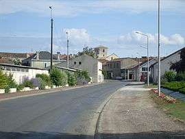
Saint-Bonnet-sur-Gironde is a commune in the Charente-Maritime department in the Nouvelle-Aquitaine region in southwestern France. It is situated on the right (east) bank of the river Gironde.
Population
| Historical population | ||
|---|---|---|
| Year | Pop. | ±% |
| 1962 | 988 | — |
| 1968 | 1,003 | +1.5% |
| 1975 | 901 | −10.2% |
| 1982 | 899 | −0.2% |
| 1990 | 819 | −8.9% |
| 1999 | 838 | +2.3% |
| 2008 | 859 | +2.5% |
See also
References
External links
| Wikimedia Commons has media related to Saint-Bonnet-sur-Gironde. |
This article is issued from
Wikipedia.
The text is licensed under Creative Commons - Attribution - Sharealike.
Additional terms may apply for the media files.