Conshohocken, Pennsylvania
| Borough of Conshohocken | |
|---|---|
| Borough | |
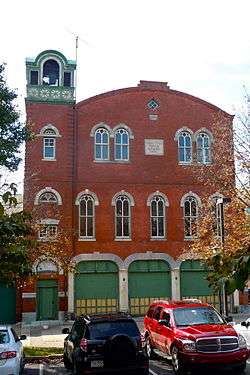 Washington Hose Company, a historic fire station | |
| Nickname(s): Conshy | |
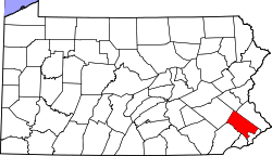
 Location of Conshohocken in Montgomery County, Pennsylvania. | |
 Conshohocken Location of Conshohocken in Pennsylvania  Conshohocken Conshohocken (the US) | |
| Coordinates: 40°04′38″N 75°18′7″W / 40.07722°N 75.30194°WCoordinates: 40°04′38″N 75°18′7″W / 40.07722°N 75.30194°W | |
| Country | United States |
| State | Pennsylvania |
| County | Montgomery |
| Founded | 1830 |
| Incorporated | 1850 |
| Government | |
| • Type | Council-manager |
| • Mayor | Yaniv Aronson |
| Area[1] | |
| • Total | 1.03 sq mi (2.68 km2) |
| • Land | 1.00 sq mi (2.58 km2) |
| • Water | 0.04 sq mi (0.09 km2) |
| Elevation | 197 ft (60 m) |
| Population (2010) | |
| • Total | 7,833 |
| • Estimate (2016)[2] | 7,982 |
| • Density | 7,998.00/sq mi (3,088.80/km2) |
| Time zone | UTC-5 (EST) |
| • Summer (DST) | UTC-4 (EDT) |
| ZIP code | 19428 |
| Area code(s) | 610 and 484 |
| FIPS code | 42-15848 |
| Website |
www |
Conshohocken (/ˌkɒnʃəˈhɒkən/ kon-shə-HOK-ən; Lenape: Kanshihakink)[3] is a borough on the Schuylkill River in Montgomery County, Pennsylvania, in suburban Philadelphia. Historically a large mill town and industrial and manufacturing center, after the decline of industry in recent years Conshohocken has developed into a center of riverfront commercial and residential development.[4] In the regional slang, it is sometimes referred to by the colloquial nickname Conshy (/ˈkɒnʃi/ KON-shee).[5] The name "Conshohocken" comes from the Unami language, from either Kanshi'hak'ing, meaning "Elegant-ground- place",[6] or, more likely, Chottschinschu'hak'ing, which means "Big-trough-ground-place" or "Large-bowl-ground-place", referring to the big bend in the Tulpe'hanna (Turtle River, or modern Schuylkill River).[7]
In 1940, a New York Times columnist noted lightheartedly that "Some of the residents of Conshohocken, Pa. are concerned because Kitty Foyle's father, in Christopher Morley's novel Kitty Foyle (Lippincott), uses the name of their town as a swear word. Others think that it may help advertise the town. One thing is sure—it makes a rattling good cuss-word."[8]
The sister community of West Conshohocken is located on the opposite side of the Schuylkill River.
Geography
Conshohocken is located at 40°4′38″N 75°18′7″W / 40.07722°N 75.30194°W (40.077135, -75.302009).[9]
According to the United States Census Bureau, the borough has a total area of 1.0 square mile (2.6 km2), of which, 1.0 square mile (2.6 km2) of it is land and 0.04 square miles (0.10 km2) of it (2.97%) is water.
Conshohocken fronts the Schuylkill River. A rather sharp bend in the river at Conshohocken gives the Schuylkill Expressway, which hugs the far bank, a curve that is well known to regional radio listeners as the Conshohocken curve (it is a staple of traffic reports). Railroad tracks line both river banks, reflecting the valley's heavy industrial past as well as its continuing rail activity including CSX and SEPTA. A rail trail portion of the Schuylkill River Trail also passes through.
Politics and history
The place was first settled about 1820, and was for several years known as Matson’s Ford; in 1830 it was laid out as a town and received its present name, a Native American word meaning “pleasant valley.”[10]
Conshohocken has a city manager form of government with a mayor and a seven-member borough council. The mayor is Yaniv Aronson.
The borough is part of the Thirteenth Congressional District (represented by Rep. Brendan Boyle), the 148th State House District (represented by Rep. Mary Jo Daley) and the 7th State Senate District (represented by Sen. Vincent Hughes).
Demographics
| Historical population | |||
|---|---|---|---|
| Census | Pop. | %± | |
| 1850 | 727 | — | |
| 1860 | 1,741 | 139.5% | |
| 1870 | 3,071 | 76.4% | |
| 1880 | 4,561 | 48.5% | |
| 1890 | 5,470 | 19.9% | |
| 1900 | 5,762 | 5.3% | |
| 1910 | 7,480 | 29.8% | |
| 1920 | 8,481 | 13.4% | |
| 1930 | 10,815 | 27.5% | |
| 1940 | 10,776 | −0.4% | |
| 1950 | 10,922 | 1.4% | |
| 1960 | 10,259 | −6.1% | |
| 1970 | 10,195 | −0.6% | |
| 1980 | 8,599 | −15.7% | |
| 1990 | 8,064 | −6.2% | |
| 2000 | 7,589 | −5.9% | |
| 2010 | 7,883 | 3.9% | |
| Est. 2016 | 7,982 | [2] | 1.3% |
| Sources:[11][12][13][14] | |||
As of the 2010 census, the borough was 88.7% White, 6.5% Black or African American, 0.1% Native American, 1.8% Asian, and 1.7% were two or more races. 3.5% of the population were of Hispanic or Latino ancestry .
As of the census[13] of 2000, there were 7,589 people, 3,329 households, and 1,834 families residing in the borough. The population density was 7,720.4 people per square mile (2,989.9/km2). There were 3,518 housing units at an average density of 3,578.9 per square mile (1,386.0/km2). The racial makeup of the borough was 89.88% White, 7.77% African American, 0.08% Native American, 0.84% Asian, 0.01% Pacific Islander, 0.49% from other races, and 0.92% from two or more races. Hispanic or Latino of any race were 1.34% of the population.
There were 3,329 households, out of which 22.9% had children under the age of 18 living with them, 36.5% were married couples living together, 14.1% had a female householder with no husband present, and 44.9% were non-families. 36.0% of all households were made up of individuals, and 12.6% had someone living alone who was 65 years of age or older. The average household size was 2.27 and the average family size was 3.02.
In the borough the population was spread out, with 20.8% under the age of 18, 8.8% from 18 to 24, 35.9% from 25 to 44, 19.4% from 45 to 64, and 15.1% who were 65 years of age or older. The median age was 35 years. For every 100 females, there were 94.2 males. For every 100 females age 18 and over, there were 91.1 males.
The median income for a household in the borough was $43,599, and the median income for a family was $50,601. Males had a median income of $36,299 versus $30,541 for females. The per capita income for the borough was $22,128. About 4.2% of families and 5.8% of the population were below the poverty line, including 6.9% of those under age 18 and 12.7% of those age 65 or over.
According to the 2013 American Community Survey 5-Year Estimate,[15] the median household income in the borough had risen to $73,750. The median income for a family was $88,049, and the per capita income was $41,144. 5.3% of families and 7.7% of the population were below the poverty line, including 11.3% of children under age 18 and 6.3% of those age 65 and over.
| Year | Republican | Democratic |
|---|---|---|
| 2016 | 31.9% 1,568 | 62.2% 3,057 |
| 2012 | 39.4% 1,781 | 58.9% 2,666 |
| 2008 | 34.3% 1,473 | 65.0% 2,796 |
| 2004 | 35.9% 1,350 | 63.7% 2,397 |
| 2000 | 32.4% 946 | 65.1% 1,900 |
Climate
Conshohocken is in the outer rim of a Humid subtropical climate.
| Jan | Feb | Mar | Apr | May | Jun | Jul | Aug | Sep | Oct | Nov | Dec | |
|---|---|---|---|---|---|---|---|---|---|---|---|---|
| Record High | 76° | 75° | 83° | 98° | 98° | 100° | 108° | 106° | 102° | 90° | 85° | 76° |
| Average High | 41° | 44° | 53° | 64° | 75° | 83° | 88° | 87° | 80° | 68° | 57° | 45° |
| Average Low | 22° | 24° | 31° | 41° | 51° | 61° | 66° | 64° | 56° | 44° | 35° | 27° |
| Record Low | -12° | -5° | 8° | 15° | 29° | 28° | 48° | 40° | 35° | 26° | 14° | -10° |
January is on average the coldest month, and July is on average the hottest.
Transportation
Conshohocken is served by two SEPTA regional railroad stations, both of which are along the Manayunk/Norristown Line. The main one is officially located at Washington and Harry Streets, and the other is at Spring Mill at the end of East North Lane, south of Hector Street.
The area is also served by two interstate highways: I-76 (here the Schuylkill Expressway) and I-476 (locally referred to as "the Blue Route").
Education
Residents of Conshohocken are served by the Colonial School District. Private schools in the area include AIM Academy.
Economy
- Allied Universal headquarters East Coast
- IKEA US headquarters (has a mailing address of Conshohocken but is actually located over the Conshohocken border in Plymouth Township)
- Kynetic (the umbrella company founded by Michael G. Rubin to cover Fanatics, Shop Runner, and Rue La La)
- The NBOME National Center for Clinical Skills Testing
- National Lacrosse League headquarters
Notable people
- Da'Rel Scott (NFL Player)
See also
References
- ↑ "2016 U.S. Gazetteer Files". United States Census Bureau. Retrieved Aug 14, 2017.
- 1 2 "Population and Housing Unit Estimates". Retrieved June 9, 2017.
- ↑ "Lenape Talking Dictionary". Retrieved 2012-05-27.
- ↑ Fact Sheets-CONSHOHOCKEN BOROUGH Archived 2007-04-18 at the Wayback Machine.
- ↑ ALL ABOUT Conshy, Conshohocken Pa
- ↑ http://www.talk-lenape.org/search.php?q=Kanshihakink+&x=35&y=5&ls=lenape.
- ↑ Brinton, Daniel G., C.F. Denke, and Albert Anthony. A Lenâpé - English Dictionary. Biblio Bazaar, 2009. ISBN 978-1103149223, pp. 28 and 47.
- ↑ Brooks, Philip, "Notes on Rare Books," The New York Times, January 14, 1940, p. BR13
- ↑ "US Gazetteer files: 2010, 2000, and 1990". United States Census Bureau. 2011-02-12. Retrieved 2011-04-23.
- ↑

- ↑ "Number of Inhabitants: Pennsylvania" (PDF). 18th Census of the United States. U.S. Census Bureau. Retrieved 22 November 2013.
- ↑ "Pennsylvania: Population and Housing Unit Counts" (PDF). U.S. Census Bureau. Retrieved 22 November 2013.
- 1 2 "American FactFinder". United States Census Bureau. Archived from the original on 2013-09-11. Retrieved 2008-01-31.
- ↑ "Annual Estimates of the Resident Population". U.S. Census Bureau. Retrieved 22 November 2013.
- ↑ "American FactFinder". United States Census Bureau. Retrieved 2015-11-27. "Archived copy". Archived from the original on 2014-11-29. Retrieved 2015-10-25.
- ↑ "Montgomery County Election Results". Montgomery County, Pennsylvania. Retrieved January 16, 2017.
External links
| Wikivoyage has a travel guide for Conshohocken. |