Bridgeport, Pennsylvania
| Borough of Bridgeport | |
|---|---|
| Borough | |
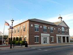 Bridgeport Borough Hall | |
 Location of Bridgeport in Montgomery County, Pennsylvania. | |
 Bridgeport Location of Bridgeport in Pennsylvania  Bridgeport Bridgeport (the US) | |
| Coordinates: 40°06′14″N 75°20′35″W / 40.10389°N 75.34306°WCoordinates: 40°06′14″N 75°20′35″W / 40.10389°N 75.34306°W | |
| Country | United States |
| State | Pennsylvania |
| County | Montgomery |
| Government | |
| • Type | Council-Manager |
| • Mayor | Mark Barbee |
| Area[1] | |
| • Total | 0.71 sq mi (1.85 km2) |
| • Land | 0.66 sq mi (1.71 km2) |
| • Water | 0.05 sq mi (0.14 km2) |
| Elevation | 108 ft (33 m) |
| Population (2010) | |
| • Total | 4,554 |
| • Estimate (2016)[2] | 4,561 |
| • Density | 6,921.09/sq mi (2,671.75/km2) |
| Time zone | UTC-5 (EST) |
| • Summer (DST) | UTC-4 (EDT) |
| ZIP Code | 19405 |
| Area code(s) | 610 and 484 |
| FIPS code | 42-08568 |
| Website | http://boroughofbridgeport.com |
Bridgeport is a borough in Montgomery County, Pennsylvania, 18 mi (29 km) north of Philadelphia on the Schuylkill River. Former industries included paper, flour, cotton, woolen mills, steel works, and brickyards. Bridgeport is 6 mi (9.7 km) east of Valley Forge, Pennsylvania. In 1777, during the American Revolutionary War, General George Washington and the Continental Army passed through Bridgeport on their way to their winter encampment in Valley Forge. 3,097 people lived in Bridgeport in 1900; 3,860 in 1910; and 5,904 in 1940. The population was 4,554 at the 2010 census.
Geography
According to the United States Census Bureau, the borough has a total area of 0.8 square miles (2.1 km2), of which 0.6 square miles (1.6 km2) is land and 0.1 square miles (0.26 km2) (13.33%) is water.
Climate
The climate in this area is characterized by hot, humid summers and generally mild to cool winters. According to the Köppen Climate Classification system, Bridgeport has a humid subtropical climate, abbreviated "Cfa" on climate maps.[3]
| Climate data for Bridgeport, Pennsylvania | |||||||||||||
|---|---|---|---|---|---|---|---|---|---|---|---|---|---|
| Month | Jan | Feb | Mar | Apr | May | Jun | Jul | Aug | Sep | Oct | Nov | Dec | Year |
| Average high °C (°F) | 4 (39) |
6 (42) |
11 (51) |
17 (63) |
23 (74) |
28 (83) |
31 (87) |
29 (85) |
26 (79) |
19 (67) |
13 (55) |
7 (44) |
18 (64) |
| Average low °C (°F) | −6 (22) |
−4 (25) |
0 (32) |
6 (42) |
11 (51) |
16 (61) |
18 (65) |
18 (64) |
14 (57) |
7 (45) |
2 (36) |
−3 (27) |
7 (44) |
| Average precipitation mm (inches) | 81 (3.2) |
80 (3) |
99 (3.9) |
99 (3.9) |
97 (3.8) |
91 (3.6) |
112 (4.4) |
109 (4.3) |
109 (4.3) |
89 (3.5) |
100 (4) |
99 (3.9) |
1,163 (45.8) |
| Source: Weatherbase [4] | |||||||||||||
Demographics
| Historical population | |||
|---|---|---|---|
| Census | Pop. | %± | |
| 1850 | 568 | — | |
| 1860 | 1,001 | 76.2% | |
| 1870 | 1,578 | 57.6% | |
| 1880 | 1,802 | 14.2% | |
| 1890 | 2,651 | 47.1% | |
| 1900 | 3,097 | 16.8% | |
| 1910 | 3,860 | 24.6% | |
| 1920 | 4,680 | 21.2% | |
| 1930 | 5,595 | 19.6% | |
| 1940 | 5,904 | 5.5% | |
| 1950 | 5,827 | −1.3% | |
| 1960 | 5,306 | −8.9% | |
| 1970 | 5,630 | 6.1% | |
| 1980 | 4,843 | −14.0% | |
| 1990 | 4,292 | −11.4% | |
| 2000 | 4,371 | 1.8% | |
| 2010 | 4,554 | 4.2% | |
| Est. 2016 | 4,561 | [2] | 0.2% |
| Sources:[5][6][7] | |||
As of the 2010 census, the borough was 79.8% White, 7.9% Black or African American, 0.3% Native American, 2.8% Asian, and 3.4% were two or more races. 12.8% of the population were of Hispanic or Latino ancestry .
As of the census[6] of 2000, there were 4,371 people, 1,983 households, and 1,070 families residing in the borough. The population density was 6,679.9 people per square mile (2,596.4/km2). There were 2,088 housing units at an average density of 3,190.9 per square mile (1,240.3/km2). The racial makeup of the borough was 91.44% White, 2.68% African American, 0.14% Native American, 2.43% Asian, 1.26% from other races, and 2.06% from two or more races. Hispanic or Latino of any race were 3.84% of the population.
There were 1,983 households, out of which 22.3% had children under the age of 18 living with them, 34.1% were married couples living together, 13.7% had a female householder with no husband present, and 46.0% were non-families. 38.4% of all households were made up of individuals, and 10.1% had someone living alone who was 65 years of age or older. The average household size was 2.20 and the average family size was 2.97.
In the borough the population was spread out, with 18.9% under the age of 18, 10.6% from 18 to 24, 34.3% from 25 to 44, 21.1% from 45 to 64, and 15.0% who were 65 years of age or older. The median age was 37 years. For every 100 females, there were 98.2 males. For every 100 females age 18 and over, there were 99.1 males.
The median income for a household in the borough was $36,899, and the median income for a family was $44,292. Males had a median income of $32,305 versus $27,523 for females. The per capita income for the borough was $19,420. About 5.4% of families and 7.5% of the population were below the poverty line, including 5.7% of those under age 18 and 7.8% of those age 65 or over.
Government
| Year | Republican | Democratic |
|---|---|---|
| 2016 | 34.2% 616 | 59.9% 1,080 |
| 2012 | 35.4% 593 | 62.1% 1,041 |
| 2008 | 35.4% 611 | 63.4% 1,093 |
| 2004 | 37.9% 606 | 61.6% 985 |
| 2000 | 37.8% 439 | 58.3% 678 |
Bridgeport has a city manager form of government with a mayor and a seven-member borough council. The borough manager is currently Keith S. Truman, and the mayor is Mark E. Barbee. Beginning in 2014, council contracted from nine to seven members (2 from each ward and 1 at-large seat).
The borough is part of the Thirteenth Congressional District (represented by Rep. Brendan Boyle), the 149th State House District (represented by Rep. Tim Briggs) and the 17th State Senate District (represented by Sen. Daylin Leach).
Education
Bridgeport Borough is part of the Upper Merion Area School District.
Infrastructure
The Bridgeport Bridge is a Historic American Engineering Record-documented Philadelphia & Western Railway bridge spanning the Schulykill River west of DeKalb Street. It is a single-track curving structure that was built in 1912. The structure, including trestle approaches and spans over the river, has been believed to be "perhaps the longest bridge on an American interurban railroad".[9]
Notable people
- Brad Scioli - former American football defensive end for the Indianapolis Colts of the National Football League (NFL).
- Leonard Tose - former owner of the Philadelphia Eagles of the National Football League (NFL).
Gallery
 War Memorial near Borough Hall.
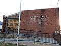 Bridgeport Post Office.
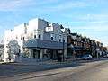 Bridgeport. West 4th Street.
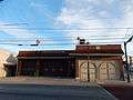 Bridgeport Fire Co No 1.
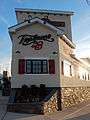 E. 4th St. Taphouse 23.
References
- ↑ "2016 U.S. Gazetteer Files". United States Census Bureau. Retrieved Aug 14, 2017.
- 1 2 "Population and Housing Unit Estimates". Retrieved June 9, 2017.
- ↑ Climate Summary for Bridgeport, Pennsylvania
- ↑ "Weatherbase.com". Weatherbase. 2013. Retrieved on October 24, 2013.
- ↑ "Census of Population and Housing". U.S. Census Bureau. Archived from the original on 12 May 2015. Retrieved 11 December 2013.
- 1 2 "American FactFinder". United States Census Bureau. Archived from the original on 2013-09-11. Retrieved 2008-01-31.
- ↑ "Incorporated Places and Minor Civil Divisions Datasets: Subcounty Resident Population Estimates: April 1, 2010 to July 1, 2012". Population Estimates. U.S. Census Bureau. Archived from the original on 17 June 2013. Retrieved 11 December 2013.
- ↑ "Montgomery County Election Results". Montgomery County, Pennsylvania. Retrieved January 16, 2017.
- ↑ "Philadelphia & Western Railway, Bridgeport Bridge, Spanning Schulykill River, west of DeKalb Street, Bridgeport, Montgomery County, PA". Library of Congress.
External links
| Wikimedia Commons has media related to Bridgeport, Pennsylvania. |
| Wikivoyage has a travel guide for Bridgeport (Pennsylvania). |