Gwynedd Valley, Pennsylvania
| Gwynedd Valley, Pennsylvania | |
|---|---|
| Unincorporated community | |
 Gwynedd Valley | |
| Coordinates: 40°11′03″N 75°15′23″W / 40.18417°N 75.25639°WCoordinates: 40°11′03″N 75°15′23″W / 40.18417°N 75.25639°W | |
| Country | United States |
| State | Pennsylvania |
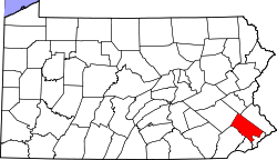
| County | Montgomery |
| Township | Lower Gwynedd |
| Elevation | 269 ft (82 m) |
| Time zone | UTC-5 (Eastern (EST)) |
| • Summer (DST) | UTC-4 (EDT) |
| ZIP code | 19437 |
| Area code(s) | 215 and 267 |
| GNIS feature ID | 1203737[1] |
Gwynedd Valley is an unincorporated community in Lower Gwynedd Township in Montgomery County, Pennsylvania, United States. Gwynedd Valley is located along Plymouth Road southwest of the Wissahickon Creek. It is served by the Gwynedd Valley station on SEPTA's Lansdale/Doylestown Line.[2]
See also
References
- ↑ "Gwynedd Valley". Geographic Names Information System. United States Geological Survey.
- ↑ Montgomery County, Pennsylvania Highway Map (PDF) (Map). PennDOT. 2015. Retrieved January 12, 2016.
This article is issued from
Wikipedia.
The text is licensed under Creative Commons - Attribution - Sharealike.
Additional terms may apply for the media files.