West Pottsgrove Township, Montgomery County, Pennsylvania
| West Pottsgrove Township | |
|---|---|
| Township | |
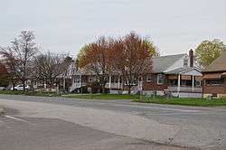 High Street in Stowe | |
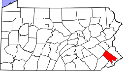
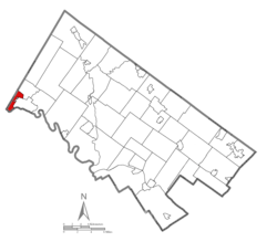 Location of West Pottsgrove Township in Montgomery County | |
.svg.png) Location of PA in the United States | |
| Coordinates: 40°15′17″N 75°40′42″W / 40.25472°N 75.67833°WCoordinates: 40°15′17″N 75°40′42″W / 40.25472°N 75.67833°W | |
| Country | United States |
| State | Pennsylvania |
| County | Montgomery |
| Area[1] | |
| • Total | 2.35 sq mi (6.10 km2) |
| • Land | 2.32 sq mi (6.02 km2) |
| • Water | 0.03 sq mi (0.08 km2) |
| Elevation | 220 ft (70 m) |
| Population (2010) | |
| • Total | 3,874 |
| • Estimate (2016)[2] | 3,882 |
| • Density | 1,670.40/sq mi (644.83/km2) |
| Time zone | UTC-5 (EST) |
| • Summer (DST) | UTC-4 (EDT) |
| Area code(s) | 610 |
West Pottsgrove Township is a township in Montgomery County, Pennsylvania, United States. The population was 3,874 at the 2010 census.
Geography
According to the United States Census Bureau, the township has a total area of 2.4 square miles (6.2 km2), of which 2.3 square miles (6.0 km2) is land and 0.1 square miles (0.26 km2), or 2.08%, is water. It is drained by the Schuylkill River, which separates it from Chester County. Its villages include Stowe and Upper Glasgow.
Neighboring municipalities
- Upper Pottsgrove Township (northeast)
- Pottstown (southeast)
- North Coventry Township, Chester County (south)
- Union Township, Berks County (tangent to the southwest)
- Douglass Township, Berks County (northwest)
Demographics
As of the 2010 census, the township was 83.7% White, 9.5% Black or African American, 0.3% Native American, 0.6% Asian, and 2.9% were two or more races. 3.3% of the population were of Hispanic or Latino ancestry.[4]
As of the census[5] of 2000, there were 3,815 people, 1,524 households, and 1,010 families residing in the township. The population density was 1,622.0 people per square mile (626.8/km2). There were 1,606 housing units at an average density of 682.8/sq mi (263.9/km2). The racial makeup of the township was 89.28% White, 7.21% African American, 0.18% Native American, 0.84% Asian, 0.03% Pacific Islander, 0.81% from other races, and 1.65% from two or more races. Hispanic or Latino of any race were 2.18% of the population.
There were 1,524 households, out of which 29.9% had children under the age of 18 living with them, 52.2% were married couples living together, 10.7% had a female householder with no husband present, and 33.7% were non-families. 27.2% of all households were made up of individuals, and 9.6% had someone living alone who was 65 years of age or older. The average household size was 2.50 and the average family size was 3.08.
In the township the population was spread out, with 24.6% under the age of 18, 7.7% from 18 to 24, 32.3% from 25 to 44, 22.0% from 45 to 64, and 13.5% who were 65 years of age or older. The median age was 36 years. For every 100 females there were 92.9 males. For every 100 females age 18 and over, there were 91.7 males.
The median income for a household in the township was $42,759, and the median income for a family was $52,177. Males had a median income of $32,912 versus $28,949 for females. The per capita income for the township was $18,413. About 5.8% of families and 7.7% of the population were below the poverty line, including 8.7% of those under age 18 and 7.3% of those age 65 or over.
Government and politics
| Year | Republican | Democratic |
|---|---|---|
| 2012 | 43.8% 623 | 53.8% 764 |
| 2008 | 37.2% 555 | 61.2% 912 |
| 2004 | 42.2% 589 | 57.2% 799 |
| 2000 | 42.2% 456 | 54.2% 585 |
| 1996 | 34.1% 324 | 49.3% 468 |
| 1992 | 32.4% 364 | 44.4% 498 |
References
- ↑ "2016 U.S. Gazetteer Files". United States Census Bureau. Retrieved Aug 14, 2017.
- 1 2 "Population and Housing Unit Estimates". Retrieved June 9, 2017.
- ↑ "Census of Population and Housing". Census.gov. Retrieved June 4, 2016.
- ↑ Census 2010: Pennsylvania. Usatoday.Com. Retrieved on 2013-07-21.
- ↑ "American FactFinder". United States Census Bureau. Retrieved 2008-01-31.