Montgomery Township, Montgomery County, Pennsylvania
| Montgomery Township | |
|---|---|
| Township | |
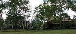 The Joseph Ambler Inn | |
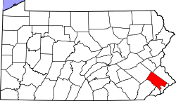
 Montgomery Township in Montgomery County, PA | |
 Montgomery Township Montgomery Township in Pennsylvania | |
| Coordinates: 40°15′03″N 75°15′05″W / 40.25083°N 75.25139°WCoordinates: 40°15′03″N 75°15′05″W / 40.25083°N 75.25139°W | |
| Country |
|
| State |
|
| County | Montgomery |
| Incorporated | 1714 |
| Government | |
| • Body | Board of Supervisors |
| Area[1] | |
| • Total | 10.63 sq mi (27.5 km2) |
| • Land | 10.63 sq mi (27.5 km2) |
| • Water | 0.00 sq mi (0.0 km2) |
| Elevation | 433 ft (132 m) |
| Population (2010) | |
| • Total | 24,790 |
| • Estimate (2016)[2] | 26,143 |
| • Density | 2,300/sq mi (900/km2) |
| Time zone | UTC-5 (EST) |
| • Summer (DST) | UTC-4 (EDT) |
| Postal Code | 19454 |
| Area code(s) | 215 |
| Website |
www |
Montgomery Township is a township in Montgomery County, Pennsylvania, United States.[3] It is the location of the Montgomery Mall, a regional shopping mall serving the Route 309 corridor of the Philadelphia suburbs. Much of Montgomery Township's development is suburban in character, with newer tract houses and strip shopping centers. Homes in Montgomery Township have North Wales and Lansdale (even though the township is distinct from those boroughs) addresses, but businesses that are located within the township boundaries are given the Montgomeryville ZIP code. The township is in the North Penn School District and is part of the North Penn Valley region that is centered around the borough of Lansdale.
Montgomery Township is the largest municipality in the North Penn area, the ninth largest municipality in Montgomery County, and the 59th largest municipality in Pennsylvania. Montgomery Township has its downtown along PA 309 in Montgomery Square. The township is largely developed with many suburban developments. It has an area of 10.7 square miles and a population of 24,790. It was incorporated on May 17, 1714. Montgomery Township is a large suburb of Philadelphia.
History
Montgomery Township was incorporated in 1714. Alexander Edwards was certainly one of the first settlers, and probably the very earliest in Montgomery. Originally from Wales, he died in 1712 and described himself in his will as "of Montgomery", showing that the township had been created before that time,[4] When old Philadelphia County was partitioned on September 10, 1784, Montgomery Township was included in Montgomery County. There were many Welsh within Montgomery and its surrounding townships, descendants of those who left Wales in the aftermath of the English Civil War, which led generations later to speculate that the new county was named for Montgomeryshire, Wales. But the county is more likely named for Richard Montgomery, the beloved Revolutionary War major general, although original documentation is misplaced or missing.
It is the birthplace of Civil War general Winfield Scott Hancock (1824–1886).
The Knapp Farm was listed on the National Register of Historic Places in 1976.[5]
Geography
According to the United States Census Bureau, the township has a total area of 10.7 square miles (27.6 km2), all of it land. It is in the Delaware watershed and is drained mainly by the Little Neshaminy Creek. Its villages include Christy (also in Bucks County), Colmar (also in Hatfield Township), Eureka (also in Bucks County and Horsham Township), Fortuna (also in Hatfield Township), Montgomery Square, and Montgomeryville. Pennsylvania Route 63 (Welsh Road) follows a portion of the southwestern boundary of the township.
Neighboring municipalities
- Horsham Township (southeast)
- Lower Gwynedd Township (south)
- Upper Gwynedd Township (southwest)
- Lansdale (west)
- Hatfield Township (northwest)
- New Britain Township, Bucks County (north)
- Warrington Township, Bucks County (northeast)
Demographics
| Historical population | |||
|---|---|---|---|
| Census | Pop. | %± | |
| 1930 | 850 | — | |
| 1940 | 951 | 11.9% | |
| 1950 | 1,566 | 64.7% | |
| 1960 | 2,700 | 72.4% | |
| 1970 | 3,936 | 45.8% | |
| 1980 | 5,718 | 45.3% | |
| 1990 | 12,179 | 113.0% | |
| 2000 | 22,025 | 80.8% | |
| 2010 | 24,790 | 12.6% | |
| Est. 2016 | 26,143 | [2] | 5.5% |
| [6] | |||
As of the 2010 census, the township was 76.7% White, 4.6% Black or African American, 0.1% Native American, 16.6% Asian, and 1.6% were two or more races. 2.2% of the population were of Hispanic or Latino ancestry.[7]
As of the census[3] of 2000, there were 22,025 people, 7,926 households, and 6,055 families residing in the township. The population density was 2,067.1 people per square mile (797.7/km2). There were 8,053 housing units at an average density of 755.8/sq mi (291.7/km2). The racial makeup of the township was 85.60% White, 3.87% African American, 0.07% Native American, 9.19% Asian, 0.01% Pacific Islander, 0.28% from other races, and 0.98% from two or more races. Hispanic or Latino of any race were 1.27% of the population.
There were 7,926 households, out of which 39.9% had children under the age of 18 living with them, 68.5% were married couples living together, 5.9% had a female householder with no husband present, and 23.6% were non-families. 19.7% of all households were made up of individuals, and 6.5% had someone living alone who was 65 years of age or older. The average household size was 2.74 and the average family size was 3.20.
In the township the population was spread out, with 28.4% under the age of 18, 4.0% from 18 to 24, 34.5% from 25 to 44, 21.8% from 45 to 64, and 11.3% who were 65 years of age or older. The median age was 37 years. For every 100 females, there were 93.3 males. For every 100 females age 18 and over, there were 89.2 males.
The median income for a household in the township was $78,953, and the median income for a family was $88,209 (these figures had risen to $84,026 and $102,174 respectively as of a 2007 estimate[8]). Males had a median income of $61,260 versus $40,858 for females. The per capita income for the township was $32,349. About 1.5% of families and 2.0% of the population were below the poverty line, including 1.5% of those under age 18 and 3.7% of those age 65 or over.
Government and politics
| Year | Republican | Democratic |
|---|---|---|
| 2012 | 47.0% 6,084 | 52.2% 6,755 |
| 2008 | 42.9% 5,557 | 56.5% 7,316 |
| 2004 | 48.9% 5,946 | 50.8% 6,173 |
| 2000 | 49.1% 4,870 | 48.7% 4,829 |
| 1996 | 44.2% 3,589 | 45.8% 3,715 |
| 1992 | 43.9% 3,031 | 35.8% 2,468 |
Public Safety
- Police Force: Montgomery Township Police Department
- Ambulance Corps: Volunteer Medical Service Corps of Lansdale
Fire Department
Provides fire services to the township as well as mutual aid to surrounding townships when needed. The department was founded in 2002. This particular department is a combination department, meaning that it is staffed weekdays with paid firefighters from 7:30 a.m. to 5:30 p.m. and the rest of the time, as well as holidays, it is covered by volunteers. Volunteer members may respond whenever they are available.[9] The department also has a fire police unit used to direct traffic and control the public while on calls.
Stations and Apparatus
References
- ↑ "2016 U.S. Gazetteer Files". United States Census Bureau. Retrieved August 14, 2017.
- 1 2 "Population and Housing Unit Estimates". Retrieved June 9, 2017.
- 1 2 "American FactFinder". United States Census Bureau. Retrieved January 31, 2008.
- ↑ Historical Collections Relating to Gwynedd, by Howard M. Jenkins. Second Edition, 1897. Chapter 17. Early Settlers in Montgomery.
- ↑ National Park Service (2010-07-09). "National Register Information System". National Register of Historic Places. National Park Service.
- ↑ http://www.dvrpc.org/data/databull/rdb/db82/appedixa.xls
- ↑ "Census 2010: Pennsylvania". Usatoday.Com. March 9, 2011. Retrieved October 10, 2017.
- ↑ US Census search Archived October 10, 2012, at the Wayback Machine.
- ↑ Sokil, Dan. "Board seeks grant money to hire more firefighters". PressReader. The Reporter of Lansdale, PA. Retrieved August 15, 2017.
- ↑ "Welcome to the online home of the Fire Department of Montgomery Township". Fdmt.org. May 20, 2011. Retrieved October 10, 2017.