West Conshohocken, Pennsylvania
| Borough of West Conshohocken | |
|---|---|
| Borough | |
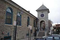 West Conshohocken Borough Hall | |
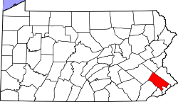
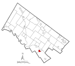 Location of West Conshohocken in Montgomery County, Pennsylvania. | |
 West Conshohocken Location of West Conshohocken in Pennsylvania  West Conshohocken West Conshohocken (the US) | |
| Coordinates: 40°04′10″N 75°18′57″W / 40.06944°N 75.31583°WCoordinates: 40°04′10″N 75°18′57″W / 40.06944°N 75.31583°W | |
| Country | United States |
| State | Pennsylvania |
| County | Montgomery |
| Incorporated | 1874 |
| Government | |
| • Type | Council-manager |
| • Mayor | Gregory Wesley-Lynch |
| Area[1] | |
| • Total | 0.90 sq mi (2.33 km2) |
| • Land | 0.86 sq mi (2.22 km2) |
| • Water | 0.04 sq mi (0.10 km2) |
| Elevation | 144 ft (44 m) |
| Population (2010) | |
| • Total | 1,320 |
| • Estimate (2016)[2] | 1,390 |
| • Density | 1,618.16/sq mi (625.05/km2) |
| Time zone | UTC-5 (EST) |
| • Summer (DST) | UTC-4 (EDT) |
| ZIP code | 19428 |
| Area code(s) | 610 and 484 |
| FIPS code | 42-82736 |
| Website |
www |
West Conshohocken is a borough in Montgomery County, Pennsylvania, United States. The population was 1,320 at the 2010 census.
Its sister community is Conshohocken, Pennsylvania, located across the Schuylkill River. Montgomery County's seat, Norristown, is located approximately two miles north of, and across the river from, West Conshohocken.
History
West Conshohocken Borough was incorporated October 6, 1874 from land taken almost equally from the Townships of Lower and Upper Merion. As a river borough, there existed a large number of mills and other industries utilizing water power. The Dougherty Quarry was a prosperous business, producing stone of superior quality known as Conshohocken or Merion Blue. It was much sought after for public buildings, and was shipped by rail throughout the East before supplies were exhausted in the mid-twentieth century.
Today, with its proximity to highways I-76 and I-476 (Blue Route), this small borough and its sister Conshohocken Borough have experienced moderate office and retail development. West Conshohocken is easily identified by the mid and high-rise commercial development along its waterfront, which in recent years has also spread across the river to Conshohocken's waterfront.
Geography
West Conshohocken is located at 40°4′10″N 75°18′57″W / 40.06944°N 75.31583°W (40.069509, -75.315755).[3]
According to the United States Census Bureau, the borough has a total area of 0.9 square miles (2.3 km2), of which, 1.0 square mile (2.6 km2) of it is land and 0.04 square miles (0.10 km2) of it (4.49%) is water.
The borough contains most of the I-76/I-476/PA-23 interchange, which also takes up a large portion of the borough's land. This is a regionally important interchange, carrying large volumes of traffic to and from the northern and western Philadelphia suburbs.
Climate
The climate in this area is characterized by hot, humid summers and generally mild to cool winters. According to the Köppen Climate Classification system, West Conshohocken has a humid subtropical climate, abbreviated "Cfa" on climate maps.[4]
Demographics
| Historical population | |||
|---|---|---|---|
| Census | Pop. | %± | |
| 1880 | 1,462 | — | |
| 1890 | 1,666 | 14.0% | |
| 1900 | 1,958 | 17.5% | |
| 1910 | 2,202 | 12.5% | |
| 1920 | 2,331 | 5.9% | |
| 1930 | 2,579 | 10.6% | |
| 1940 | 2,464 | −4.5% | |
| 1950 | 2,482 | 0.7% | |
| 1960 | 2,254 | −9.2% | |
| 1970 | 2,194 | −2.7% | |
| 1980 | 1,516 | −30.9% | |
| 1990 | 1,294 | −14.6% | |
| 2000 | 1,446 | 11.7% | |
| 2010 | 1,320 | −8.7% | |
| Est. 2016 | 1,390 | [2] | 5.3% |
| Sources:[5][6][7] | |||
As of the 2010 census, the borough was 90.1% White, 3.6% Black or African American, 0.5% Native American, 3.3% Asian, and 1.7% were two or more races. 3.6% of the population were of Hispanic or Latino ancestry [8]
As of the census[6] of 2000, there were 1,446 people, 600 households, and 342 families residing in the borough. The population density was 1,701.4 people per square mile (656.8/km2). There were 633 housing units at an average density of 744.8 per square mile (287.5/km2). The racial makeup of the borough was 93.91% White, 2.84% African American, 0.07% Native American, 1.80% Asian, 0.07% Pacific Islander, 0.21% from other races, and 1.11% from two or more races. Hispanic or Latino of any race were 1.04% of the population.
There were 600 households, out of which 17.5% had children under the age of 18 living with them, 41.7% were married couples living together, 11.5% had a female householder with no husband present, and 43.0% were non-families. 29.0% of all households were made up of individuals, and 6.7% had someone living alone who was 65 years of age or older. The average household size was 2.40 and the average family size was 3.01.
In the borough the population was spread out, with 17.6% under the age of 18, 12.6% from 18 to 24, 35.2% from 25 to 44, 22.2% from 45 to 64, and 12.4% who were 65 years of age or older. The median age was 35 years. For every 100 females there were 102.0 males. For every 100 females age 18 and over, there were 105.0 males.
The median income for a household in the borough was $56,111, and the median income for a family was $62,708. Males had a median income of $40,833 versus $31,696 for females. The per capita income for the borough was $30,627. About 3.5% of families and 7.3% of the population were below the poverty line, including 8.1% of those under age 18 and 2.7% of those age 65 or over.
Politics and government
| Year | Republican | Democratic |
|---|---|---|
| 2016 | 36.8% 304 | 57.1% 472 |
| 2012 | 43.2% 325 | 55.2% 415 |
| 2008 | 41.9% 340 | 57.8% 469 |
| 2004 | 42.8% 312 | 56.7% 413 |
| 2000 | 37.5% 220 | 60.2% 353 |
West Conshohocken has a city manager form of government with a mayor and a seven-member borough council.
The borough is part of the Thirteenth Congressional District (represented by Rep. Brendan Boyle), the 149th State House District (represented by Rep. Tim Briggs) and the 17th State Senate District (represented by Sen. Daylin Leach).
Public water is provided by Aqua of PA. Sewer facilities were sold in June of 2017 to the Borough of Conshohocken for around $9,500,500.00 (9.5 million) West Conshohocken sewers are now owned and managed by the Conshohocken Authority, and all payments go to Conshohocken. Residential trash pickup is still provided by West Conshohocken. A full-time police force serves the community, but fire protection is provided by a volunteer company, The George Clay Steam Fire Engine and Hose Company Number 1, Station 39. SEPTA bus lines provide access to the Norristown Transportation Center, and bus and rail lines connect the borough to other portions of Montgomery County and Philadelphia.
Education
West Conshohocken pupils are assigned to schools in the Upper Merion Area School District. Residents have access to the Conshohocken Free Library.
Healthcare
The area is served by two hospitals, Einstein Medical Center Montgomery and Suburban Community Hospital.
Companies and organizations
References
- ↑ "2016 U.S. Gazetteer Files". United States Census Bureau. Retrieved Aug 14, 2017.
- 1 2 "Population and Housing Unit Estimates". Retrieved June 9, 2017.
- ↑ "US Gazetteer files: 2010, 2000, and 1990". United States Census Bureau. 2011-02-12. Retrieved 2011-04-23.
- ↑ Climate Summary for West Conshohocken, Pennsylvania
- ↑ "Census of Population and Housing". U.S. Census Bureau. Retrieved 11 December 2013.
- 1 2 "American FactFinder". United States Census Bureau. Retrieved 2008-01-31.
- ↑ "Incorporated Places and Minor Civil Divisions Datasets: Subcounty Resident Population Estimates: April 1, 2010 to July 1, 2012". Population Estimates. U.S. Census Bureau. Retrieved 11 December 2013.
- ↑ "Census 2010: Pennsylvania".
- ↑ "Montgomery County Election Results". Montgomery County, Pennsylvania. Retrieved January 16, 2017.
External links
- Borough of West Conshohocken
- George Clay Steam Fire Engine and Hose Company, Station 39
- Montgomery County Pennsylvania website
- Pictorial History of the Conshohockens
- News/Gossip of West Conshohocken/Conshohocken