Cleveland National Forest
| Cleveland National Forest | |
|---|---|
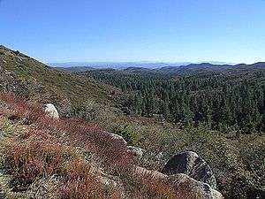 Cleveland National Forest from Laguna Mountain | |
 Map of the United States | |
| Location | San Diego / Riverside / Orange counties, California, United States |
| Nearest city | Ramona, California |
| Coordinates | 33°18′N 116°48′W / 33.3°N 116.8°WCoordinates: 33°18′N 116°48′W / 33.3°N 116.8°W[1] |
| Area | 720 sq mi (1,900 km2) |
| Governing body | U.S. Forest Service |
| Website | Cleveland National Forest |
Cleveland National Forest encompasses 460,000 acres (720 sq mi (1,900 km2)), mostly of chaparral, with a few riparian areas. A warm dry mediterranean climate prevails over the Forest. It is the southernmost National forest of California. It is administered by the United States Forest Service, a government agency within the United States Department of Agriculture. It is divided into the Descanso, Palomar and Trabuco Ranger Districts and is located in the counties of San Diego, Riverside, and Orange.
Cleveland National Forest was created on July 1, 1908 with the consolidation of Trabuco Canyon National Reserve and San Jacinto National Reserve by President Theodore Roosevelt and named after former president Grover Cleveland. It is headquartered in San Diego. The Cleveland National Forest was the site of both of the largest wildfires in California history, the 2003 Cedar Fire, and the Santiago Canyon Fire of 1889. Both fires widely consumed many sections of the area, and endangered many animal species as well.
Districts
- Trabuco Ranger District – the northernmost area
- Consists of most of the Santa Ana Mountains and is bisected by the Ortega Highway, which runs from San Juan Capistrano to Lake Elsinore. Its northern border is Corona.
- Palomar Ranger District – near the cities of Escondido and Ramona
- Includes the "Highway to the Stars" from State Route 76 to the top of Palomar Mountain.
- Descanso Ranger District – east of Alpine[2]
- Includes Sunrise Highway, a National Scenic Byway.
Use restrictions
A National Forest Adventure Pass is required for parking in designated areas of the Cleveland National Forest as well as other National Forests in Southern California, and may be obtained from local merchants, visitor centers, or online.
Available on the Cleveland National Forest Official Site under Current Conditions are road, campground, picnic area, and trail closures.
"Law Enforcement Activities" are a common reason given for closures in the southern portion of the forest. These closures are implemented to limit back road access in hopes of circumnavigating US Border Patrol checkpoints. Bear Valley Road coming up from Buckman Springs, Kitchen Creek Road and Thing Valley Road are among routes that are routinely restricted.[3]
Activities
Popular activities include picnic areas, hiking through the mountains on foot, exploring on horseback, trail mountain biking, camping overnight or driving on the Sunrise Scenic Highway. The Forest also includes Corral Canyon and Wildomar Off-Highway Vehicle Areas.
Besides climbers and wildlife advocates, the Forest also accommodates the needs of telecommunications companies, hunters, campers, utilities, off-road-vehicle enthusiasts, hikers, horse riders, neighbors and others.[4]
Camping
Hiking trails
- Sunset Trail - Sunset Trail is a 4.6 mile loop trail accessible from Meadows Trailhead off Sunrise Highway, mile marker 19.1.[7] The trail, which offers several connection options, winds through pine forest leading one to open meadows, ponds and small lakes, and a popular lookout to the Pacific Ocean. The surrounding habitat supports numerous flora and fauna including native black oaks, Engelmann oaks, giant Jeffrey pines, Acorn Woodpeckers (Melanerpes formicivorus), hawks and turkey vultures.[8] Dogs are not allowed off leash.[9]
Observatories
Fire lookout towers
There are currently two operational fire lookout towers in the Cleveland National Forest.
- High Point Lookout, Cleveland National Forest, Palomar Mountain[10]
- Los Pinos Lookout, Cleveland National Forest, near Lake Morena[11]
- Boucher Hill Lookout: While this fire lookout tower is also on Palomar Mountain, it actually sits inside the Palomar Mountain State Park and not the Cleveland National Forest. It is an operational tower and works in conjunction with the USFS but is owned by the State of California and is an historic building.
Wilderness areas
There are four official wilderness areas in Cleveland National Forest that are part of the National Wilderness Preservation System. One of them extends into land that is managed by the Bureau of Land Management.
- Agua Tibia Wilderness (partly BLM)
- Hauser Wilderness
- Pine Creek Wilderness
- San Mateo Canyon Wilderness
See also
References
- ↑ "Cleveland National Forest". Geographic Names Information System. United States Geological Survey. Retrieved 2012-12-26.
- ↑ Cleveland National Forest https://web.archive.org/web/20121125114156/http://www.fs.usda.gov/Internet/FSE_DOCUMENTS/stelprdb5259560.html. Archived from the original on 25 November 2012. Retrieved 26 December 2014. Missing or empty
|title=(help) - ↑ "Archived copy". Archived from the original on 2011-05-14. Retrieved 2011-05-17.
- ↑ Lee, M. (2008, June 29). Forest Marks 100 Years. San Diego Union-Tribune , pp. 1-4.
- 1 2 "Cleveland National Forest Official Site". fs.fed.us. Archived from the original on 17 May 2011. Retrieved 9 May 2018.
- ↑ Recreation.com Archived 2012-02-23 at the Wayback Machine.
- ↑ "Sunset trail". sandiegoreader.com. Archived from the original on 4 February 2018. Retrieved 9 May 2018.
- ↑ http://map.sdsu.edu/group2007spring/group2/Woodpeckers.htm%5Bpermanent+dead+link%5D
- ↑ "Archived copy". Archived from the original on 2015-10-11. Retrieved 2015-06-09.
- ↑ "High Point Lookout – Forest Fire Lookout Association". ffla-sandiego.org. Archived from the original on 6 July 2016. Retrieved 9 May 2018.
- ↑ "Los Pinos – Forest Fire Lookout Association". ffla-sandiego.org. Archived from the original on 14 July 2016. Retrieved 9 May 2018.
External links
| Wikimedia Commons has media related to Cleveland National Forest. |
- Cleveland National Forest Official Site
- In-depth article by the San Diego Historical Society
- Southern California Trails at Local Hikes
- The Nature Conservancy: Santa Ana Mountains
- Santa Ana Mountains Wild Heritage Project
- Center For Biological Diversity
- Santa Ana Mountains Natural History Association