Canyon Ferry Lake
Coordinates: 46°38′55″N 111°43′39″W / 46.64861°N 111.72750°W
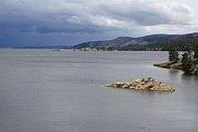


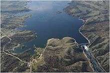
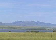
Canyon Ferry Lake is a reservoir on the Missouri River near Helena, Montana and Townsend, Montana. It is Montana's third largest body of water, covering 35,181 acres (142 km²) and 76 miles (122 km) of shore (1). It was formed by the building of Canyon Ferry Dam, which was completed in 1954 and has been used for electricity, irrigation, and flood controls since. The lake is a popular outdoor destination providing boating, fishing, wildlife habitat, and is nestled against the Big Belt Mountains of the Rocky Mountains. Canyon Ferry Lake has also become a leading ice boat venue for iceboat racing and iceboat world speed record attempts.[1][2] The former town of Canton lies beneath the lake, having been submerged following construction of the dam.
References
- ↑ "Archived copy". Archived from the original on 2007-06-28. Retrieved 2009-04-12.
- ↑ http://www.greenbird.co.uk/ice-record/the-location
External links
- U.S. Dept. of Interior Project page
- Bureau of Reclamation Current Reservoir Data
- Helena Chamber of Commerce
