Godmanchester
| Godmanchester | |
|---|---|
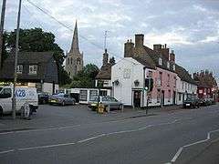 Post Street in Godmanchester | |
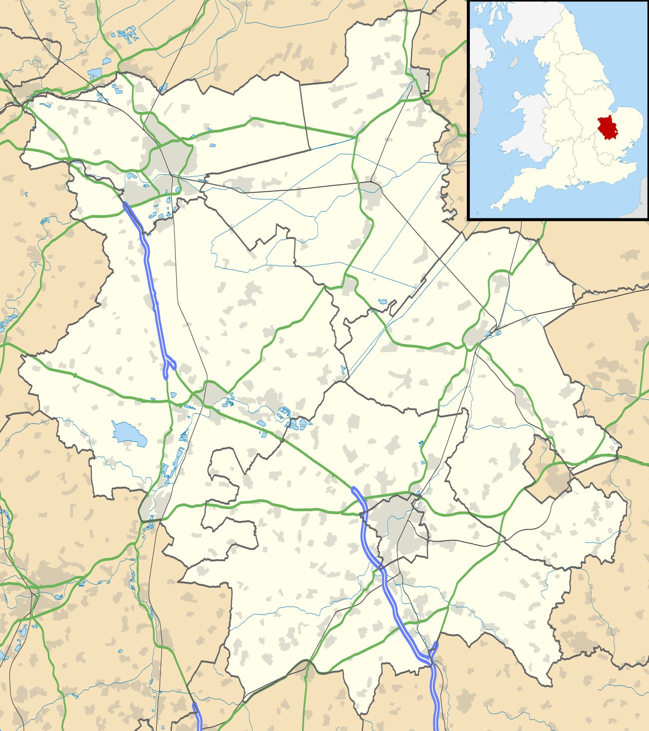 Godmanchester Godmanchester shown within Cambridgeshire | |
| Area | 1.983 km2 (0.766 sq mi) civil parish |
| Population | 6,711 (2011) |
| • Density | 3,384/km2 (8,760/sq mi) |
| OS grid reference | TL245704 |
| • London | 56 miles (90 km) |
| Civil parish |
|
| District | |
| Shire county | |
| Region | |
| Country | England |
| Sovereign state | United Kingdom |
| Post town | HUNTINGDON |
| Postcode district | PE29 |
| Dialling code | 01480 |
| Police | Cambridgeshire |
| Fire | Cambridgeshire |
| Ambulance | East of England |
| EU Parliament | East of England |
| UK Parliament | |
Godmanchester (/ˈɡɒdməntʃɛstər/ GOD-mən-ches-tər, traditionally /ˈɡʌmstər/ GUM-stər) is a small town and civil parish in the Huntingdonshire district of Cambridgeshire, in England. Within the parish its buildings are concentrated at the north end including a section of the south-to-east bank of the River Great Ouse facing the large Porthome flood meadow at the south end of the town of Huntingdon, and the urban to suburban core of the area is entirely south of the A14 arterial road.
History
The town is on the site of the Roman town of Durovigutum.[2] There is archaeological evidence of Celtic and earlier habitation prior to the establishment of a key Roman town and a Mansio (inn), so the area has probably been continuously occupied for more than 2,000 years. The settlement was at a crossroads of Roman roads Ermine Street, the Via Devana (from Cambridge, between Colchester and Chester) and a military road from Sandy, Bedfordshire. The Roman settlement was sacked by Anglo-Saxons in the third century. In contrast to Huntingdon archaeological finds have been extensive in the centre of Godmanchester, which has two conservation areas of early recognition[3] including many timber-framed Tudor houses, the largest being Tudor Farm, dating from 1600 and restored in 1995.
The Roman castra is mentioned in Godmanchester's name, which comes from Anglo-Saxon Godmundceaster, referring to a Roman fortified place or army camp of/belonging to Godmund, a typically Saxon name. The location is likely to have been originally settled due to the gravel beds providing a ford across the River Great Ouse.
The place was listed as Godmundcestre in the Domesday Book of 1086 in the Hundred of Leightonstone in Huntingdonshire.[4] The survey records that there were 26 ploughlands, with capacity for a further 31 and, in addition to the arable land, there was 160 acres (65 hectares) of meadows, 50 acres (20 hectares) of woodland and three water mills, a church and a priest.[5]
The town was first chartered by King John in 1212, though it had been a market town and royal manor for some years.
In 2003, Godmancheester had a population of about 5,500 in 3,500 homes, with the largest[6] increase in population occurring between 1981 and 1991 (81%) and more modest growth since.
Toponymy and pronunciation of place name
A rendering of Godmundceaster as Gunecestre occurs in formal text in 1399.[7] A minority of visitors, former residents and residents continue to pronounce the place as Gumster, though this has long-since been superseded by Godmunchester, with stress identified in the summary section IPA pronunciation guide to this article.[8][9][10][11]
Government
Godmanchester was in the county of Huntingdonshire until 1965 (also an administrative county from the creation of those entities in 1887). From 1965, the town was part of the new administrative county of Huntingdon and Peterborough. Since 1974, the former, relatively diminutive, county of Huntingdonshire has been a part of the administrative county of Cambridgeshire.[12]
The highest tier of local government is Cambridgeshire County Council, locally represented by two county councillors serving Godmanchester and Huntingdon East (electoral division)[13][14]
The second tier of local government, the planning authority and council-tax collecting body, is Huntingdonshire District Council, a non-metropolitan district, locally represented by two councillors elected for an eponymous ward.[13][15]
The third and lowest tier of local government is Godmanchester town council. The council comprises 16 councillors, including a mayor and a deputy mayor.[16]
At Westminster, the local Huntingdon seat and has been represented in the House of Commons since 2001 by Jonathan Djanogly (Con).[13]
Demography
Population
Since 1801, the population has been recorded every ten years by the UK census, the only exception being in 1941 due to the Second World War. In the 19th century, the population ranged from 1,573 (in 1801) to 2,438 (recorded in 1861).[17]
Population figures since 1911 are:
| Parish |
1911 |
1921 |
1931 |
1951 |
1961 |
1971 |
1981 |
1991 |
2001 |
2011 |
|---|---|---|---|---|---|---|---|---|---|---|
| Godmanchester | 2,130 | 2,035 | 1,993 | 2,502 | 2,955 | 5,255 | 5,996 | 6,711 | ||
All population census figures from report Historic Census figures Cambridgeshire to 2011 by Cambridgeshire Insight.[17]
In 2011, the parish covered an area of 4,900 acres (1,983 hectares)[17] and so the population density for Godmanchester in 2011 was 876.5 persons per square mile (338.4 per square kilometre).
Culture and community
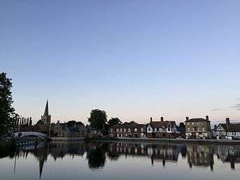
There are several bridges across the Great Ouse to Huntingdon, but until 1975 Old Bridge, Huntingdon, a medieval bridge, was the only one. It is now used only for light traffic, and a parallel footbridge has been built for pedestrians. Construction of the A14 bypass means that heavy traffic now flows over a modern bridge.
Between Godmanchester, Huntingdon and Brampton lies England's largest meadow, Portholme,[18] which remains an important flood plain but which has served as an equestrian racecourse and centre for early aviation.
South of the town centre is the headquarters and a large operational shelter of veterinary/rescue charity Wood Green Animal Shelters.
Original historical documents relating to Godmanchester, including the original church parish registers, local government records, maps, photographs and the surviving borough charters, are held by Cambridgeshire Archives and Local Studies at the County Record Office, Huntingdon.
In October 2003 BBC1's Songs Of Praise was hosted by the parish church of St Mary the Virgin and featured the new hymn tune Godmanchester, written by the vicar, Peter Moger.[19]
Landmarks
Chinese Bridge
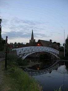
One of the town's largest public works of art and of landscaping is its Chinese Bridge which connects to a water meadow. Local legend has it that the bridge was built without the use of nails or other fixings. The bridge was removed by crane on 9 February 2010. A new replica was built off-site in two parts and was installed on 15–16 February 2010.[20] Today the Chinese Bridge does feature nails. The claims are believed to be false; a bridge in Queens' College, Cambridge had the same urban myth. Expert commentators write the original nails had corroded away masking their presence.
Sport and leisure
The non-League football club Godmanchester Rovers F.C. play at Bearscroft Lane whose teams play in various regional divisions.
Transport
Aside from the arterial road at the north end of the parish which connects the English Midlands to the port of Ipswich intersecting with two major north-south trunk routes in Cambridgeshire, the town is centred approximately 1.1 miles (1.8 km) from Huntingdon railway station, a semi-major stop on the East Coast Main Line. Huntingdon.
The town of Huntington is accessed via the expansive meadow and railway station by foot or cycle.
Huntingdon is at least every half hour in daytime (2 bph) linked by public buses (plus school buses). At least a frequency of 1 bph links Cambridge directly.
References
- ↑ "Godmanchester Town Council – Town Hall, Post Street, Godmanchester, Cambridgeshire. PE29 2NB". gmccouncil.com. Retrieved 9 November 2017.
- ↑ Rivet, A.L.F.; Smith, Colin (1979). The Place-Names of Roman Britain. London. p. 354.
- ↑ "Conservation Areas in Godmanchester (c) Stuart Bond 2002". godmanchester.net. Archived from the original on 9 January 2006.
- ↑ Dr Ann Williams, Professor G.H. Martin, eds. (1992). Domesday Book: A Complete Translation. London: Penguin Books. p. 1349. ISBN 0-141-00523-8.
- ↑ Professor J.J.N. Palmer, University of Hull. "Open Domesday: Place - Godmanchester". www.opendomesday.org. Anna Powell-Smith. Retrieved 25 February 2016.
- ↑ "Population - godmanchester.net (c) All rights reserved 1998-2006 - The authoritative site about Godmanchester and its residents, more than 330 pages about the town, forums and events". Stuart Bond.
- ↑ "Fifth entry, seen at the end of the first line, the home of Robert Bocher, accused of taking animals from the plaintiff". Plea Rolls of the Court of Common Pleas, Michaelmas Term, 1399. National Archives; CP 40/555.
- ↑ "Guide wrongly corrects the pronunciation of Godmanchester to Gumster - Cambridge News". 17 September 2016. Archived from the original on 17 September 2016. Retrieved 9 November 2017.
- ↑ "Talk:Godmanchester". Wikipedia. 2017-05-10.
- ↑ The 20 British place names most commonly mispronounced at dailymail.co.uk/travel, accessed 28 March 2017
- ↑ Candida Lycett Green, England: travels through an unwrecked landscape (1996), p. 74: "GODMANCHESTER Huntingdonshire... As a child I was taught to pronounce it 'Gumster'."
- ↑ Local Government Act 1972
- 1 2 3 "Ordnance Survey Election Maps". www.ordnancesurvey.co.uk. Ordnance Survey. Retrieved 23 February 2016.
- ↑ "Cambridgeshire County Council: Councillors". www.cambridgeshire.gov.uk. Cambridgeshirte County Council. Retrieved 15 February 2016.
- ↑ "Huntingdonshire District Council: Councillors". www.huntingdonshire.gov.uk. Huntingdonshire District Council. Retrieved 23 February 2016.
- ↑ "Godmanchester Town Council: Councillors". www.gmccouncil.com. Godmanchester Town Council. Retrieved 6 February 2016.
- 1 2 3 "Historic Census figures Cambridgeshire to 2011" (xlsx - download). www.cambridgeshireinsight.org.uk. Cambridgeshire Insight. Retrieved 12 February 2016.
- ↑ "Portholme Godmanchester (c) Stuart Bond 2002". godmanchester.net. Archived from the original on 27 May 2012.
- ↑ "St Mary the Virgin, Godmanchester - Archived Event". Archived from the original on 20 August 2008.
- ↑ Godmanchester Community Association The Bridge magazine, 2010
External links
- The Parish Church of Saint Mary the Virgin, Godmanchester
- Godmanchester Town Council
- Godmanchester Porch Museum
- Godmanchester Baptist Church
- Huntingdonshire District Council website for the town
- Godmanchester Community Association Web site featuring photo records in the 'scrapbook'
- The Roman Mansio in Godmanchester