Watson Peak (Custer County, Idaho)
| Watson Peak | |
|---|---|
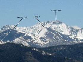 Watson Peak at left | |
| Highest point | |
| Elevation | 10,453 ft (3,186 m) |
| Prominence | 773 ft (236 m) [1] |
| Parent peak | White Cloud Peak 5 |
| Coordinates | 44°07′51″N 114°41′08″W / 44.1307446°N 114.6856261°WCoordinates: 44°07′51″N 114°41′08″W / 44.1307446°N 114.6856261°W [2] |
| Geography | |
 Watson Peak Custer County, Idaho, U.S. | |
| Parent range | White Cloud Mountains |
| Topo map | USGS Robinson Bar |
| Climbing | |
| Easiest route | Scrambling, class 3 |
Watson Peak at 10,453 feet (3,186 m) above sea level is a peak in the White Cloud Mountains of Idaho. The peak is located in Sawtooth National Recreation Area in Custer County 1.41 mi (2.27 km) south-southwest White Cloud Peak 5, its line parent. Bear Lake is in the basin northwest of the peak.[3][4]
References
- ↑ "Watson Peak". Peakbagger.com. Retrieved January 12, 2013.
- ↑ "Watson Peak". Geographic Names Information System. United States Geological Survey. Retrieved January 12, 2013.
- ↑ Sawtooth National Forest (Map) (1998 ed.). Sawtooth National Forest, U.S. Forest Service.
- ↑ "Watson Peak". Lists of John. Retrieved January 12, 2013.
This article is issued from
Wikipedia.
The text is licensed under Creative Commons - Attribution - Sharealike.
Additional terms may apply for the media files.