White Cloud Mountains
| White Cloud Mountains | |
|---|---|
 White Cloud Mountains | |
| Highest point | |
| Peak | Castle Peak |
| Elevation | 11,815 ft (3,601 m) |
| Coordinates | 44°02′22″N 114°35′07″W / 44.039558°N 114.585266°WCoordinates: 44°02′22″N 114°35′07″W / 44.039558°N 114.585266°W |
| Dimensions | |
| Length | 25 mi (40 km) N/S |
| Width | 32 mi (51 km) E/W |
| Area | 461 sq mi (1,190 km2) |
| Geography | |
 White Cloud Mountains | |
| Country | United States |
| State | Idaho |
| Parent range | Rocky Mountains |
| Borders on | Sawtooth Mountains and Boulder Mountains |
The White Cloud Mountains are part of the Rocky Mountains of the western United States, located in central Idaho, southeast of Stanley in Custer County. The range is located within the Sawtooth National Recreation Area (SNRA) and partially within the Cecil D. Andrus–White Clouds Wilderness.[1]
The White Cloud Mountains are located on National Forest land, with numerous trails in the area. Camping is permitted anywhere on the national forest land and there are no fees to access the area.[2] Primary access to the area is via State Highway 75, the Salmon River Scenic Byway, which accompanies the main Salmon River as it descends along the range's western and northern perimeter.
The highest peak in the White Cloud Mountains, and the SNRA, is Castle Peak at 11,815 ft (3,601 m).[3] The Sawtooth Mountains are about twenty miles (32 km) west of the White Clouds, on the west side of the river and highway, and the Boulder Mountains are directly south of the White Clouds.
Peaks
Lakes
Photos
 White Cloud Mountains viewed from Sawtooth Mountains
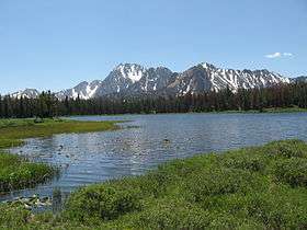
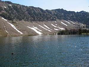 Washington Lake in the White Cloud Mountains
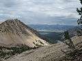 White Cloud Mountains in Distance across Sawtooth Valley
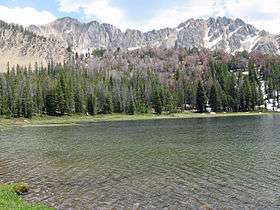 Fourth of July Lake in the White Cloud Mountains
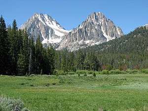
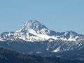 Castle Peak
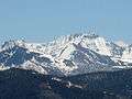 White Cloud Mountains
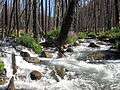 Warm Spring Creek in White Cloud Mountains
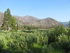 Warm Springs Meadow in White Cloud Mountains
 White Cloud Mountains
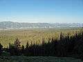 White Cloud Mountains across Sawtooth Valley
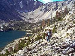 Hikers leaving Quiet Lake, which sits at the base of Castle Peak and Merriam Peak.
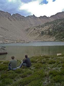 Hikers eating lunch at Shallow Lake with the Devil's Staircase on the horizon.
See also
| Wikimedia Commons has media related to White Cloud Mountains. |
References
- ↑ "White Clouds". Summitpost.org. Retrieved 2012-05-03.
- ↑ "Sawtooth National Forest". U.S. Forest Service. Retrieved 2012-05-03.
- ↑ "White Cloud Mountains". Peakbagger.com. Retrieved 2012-05-03.
- ↑ Sawtooth National Forest. "Sawtooth National Forest" [map].1:126,720, 1"=2 miles. Twin Falls, Idaho: Sawtooth National Forest, United States Forest Service, 1998.
- ↑ "White Cloud Peak List". Summitpost.org. Retrieved 2012-05-04.
External links
- Peak Bagger.com - White Cloud Mountains
- Visit Idaho.org - official state tourism site
- Idaho Summits.com - Castle Peak - 11,815 ft.