Andheri
| Andheri | |
|---|---|
| Neighbourhood | |
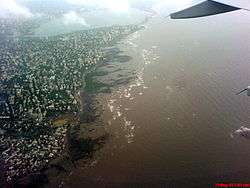
 Andheri Location in Mumbai metropolitan area | |
| Coordinates: 19°07′08″N 72°50′49″E / 19.119°N 72.847°ECoordinates: 19°07′08″N 72°50′49″E / 19.119°N 72.847°E | |
| Country | India |
| State | Maharashtra |
| District | Mumbai Suburban |
| City | Mumbai |
| Language | |
| • Official | Marathi |
| Time zone | IST GMT+530 |
| PIN | Andheri H.O. 400 053 |
| Vehicle registration | MH 02 |
Andheri is a locality of West Mumbai. Like most neighborhoods in Mumbai the railway station divides Andheri into Andheri East and Andheri West. Andheri West is home to residential areas with Juhu beach very close to it. Andheri East is mostly industrial area with very few residential areas.
The Andheri railway station is among the busiest railway stations in the city [1] The expansion of the Mumbai Metro in the Versova-Andheri-Ghatkopar corridor is part of the government's master transportation plan.[2]
Government
Andheri West comes under K/W ward of the Bombay Municipal Corporation while Andheri East comes under the K/E ward of the same.[3]
Railway
Andheri has a railway station on the Western Line and the Harbour Line of the Mumbai Suburban Railway, connecting it to Churchgate, Dahanu, Panvel and Chhatrapati Shivaji Maharaj Terminus via the new harbour line.
Mumbai Metro Line 1 of the Mumbai Metro spans the entire suburb of Andheri (Andheri metro station)[4][5] connecting Versova in the west to Ghatkopar in the Eastern Suburbs, covering a distance of 11.4 kilometres (7.1 mi).[6] It is fully elevated, and consists of 12 stations. 9 out of the 12 stations are in Andheri. Work on the corridor began on 8 February 2008. A cable stay bridge, spanning the Western railway line, on the project was completed at the end of 2012.[7] The line opened for service on 8 June 2014.[8] Latest statistics reveal that approximately 85 million passengers have used the metro line in the first 11 months since its launch.[9]
Airport
The international terminal of the city's Chatrapati Shivaji International Airport is located near Sahar village in Andheri East. There are two separate terminals operating the domestic and international operations.
Auto Rickshaw and Taxi
Auto rickshaw is a major source of transportation of people living in Andheri. People usually prefer travelling in auto for small distance. Auto is a very efficient mode of transportation in Andheri.The Auto fare starts from 18.00 rupees. Even Taxis ply as many office people have to travel to South Mumbai.
Buses
Government owned best buses are a major source of transportation. Many people commute through buses to reach Andheri station or Metro stations.Bus fare starts from 8 rupees.
See also
References
- ↑ "Authorities finding it difficult to decongest Andheri station area". Daily News and Analysis.
- ↑ Indian Economy - K. R. Gupta, J. R. Gupta - Google Books. Books.google.com. Retrieved on 2013-12-06.
- ↑ "District Census Handbook - Mumbai Suburban" (PDF).
- ↑ Mumbai Metro Archived 12 December 2013 at the Wayback Machine.. Mumbaimetroone.com. Retrieved on 2013-12-06.
- ↑ A Mumbai Metro train every three minutes - Mumbai - DNA. Dnaindia.com. Retrieved on 2013-12-06.
- ↑ "Know Your Metro - Features". Reliance Mumbai Metro. Retrieved 8 June 2014.
- ↑ "Metro ride in June '13? Work on crucial bridge completed". The Times of India. 26 December 2012. Retrieved 6 January 2013.
- ↑ "Maharashtra CM Prithivraj Chavan flags off Mumbai Metro". The Times of India. 8 June 2014. Retrieved 8 June 2014.
- ↑ "Over 8 crore commuters travelled in Metro since June 2014 - The Economic Times". Retrieved 2015-06-12.
Notes
- Shrivastava, Prabhat, and S. L. Dhingra. "Operational Integration Of Suburban Railway And Public Buses—Case Study Of Mumbai." Journal of Transportation Engineering 132.6 (2006): 518-522. Academic Search Premier. Web. 29 May 2012.