Aldinga Bay
| Aldinga Bay | |
|---|---|
 Aldinga Bay looking south from Sellicks Beach | |
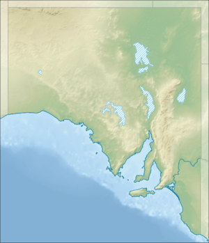 Aldinga Bay Location in South Australia | |
| Location | South Australia |
| Coordinates | 35°19′47″S 138°25′47″E / 35.32972°S 138.42972°ECoordinates: 35°19′47″S 138°25′47″E / 35.32972°S 138.42972°E[1] |
| Type | Bay |
| Basin countries | Australia |
| Max. length | about 13 km (8.1 mi)[2] |
| Max. width | about 4 km (2.5 mi)[2] |
| Max. depth | 16.4 m (54 ft)[2] |
| Settlements |
Aldinga Beach Sellicks Beach Myponga Beach |
Aldinga Bay is a bay located on the east coast of Gulf St Vincent in South Australia about 40 kilometres (25 miles) south-southwest of Adelaide city centre.
Extent & description
Aldinga Bay lies between Snapper Point in the suburb of Aldinga Beach at its northern extremity and ‘Myponga Jetty’ in the locality of Myponga Beach at its southern extremity.[3][4]
Ports and other settlements
The bay has no infrastructure for maritime use apart from access to the beach from the road network to launch and retrieve small boats at specific locations permitted by the local government authority, the City of Onkaparinga.[5] The following settlements are located along its coastline from north to south - Aldinga Beach and Sellicks Beach in the City of Onkaparinga and Myponga Beach in the District Council of Yankalilla.[6][4]
Protected areas
The waters of Aldinga Bay are within the Encounter Marine Park while the south eastern part of the Aldinga Reef Aquatic Reserve is within the bay.[7][8]
Citations and references
Citations
- ↑ "Aldinga Bay". Gazetteer of Australia online. Geoscience Australia, Australian Government.
- 1 2 3 DMH, 1985, chart 15
- ↑ NGA, 2012, pages 211
- 1 2 "Property Location Browser Report - Placename Details: Myponga Beach, LOCB". The Government of South Australia. Archived from the original on 12 October 2016. Retrieved 5 November 2014.
- ↑ "Vehicles on beaches". City of Onkaparinga. Archived from the original on 20 October 2014. Retrieved 5 November 2014.
- ↑ "City of Onkaparinga suburb boundaries map". City of Onkaparinga. 9 January 2014. Retrieved 8 October 2014.
- ↑ "MARINE PARK 15, Encounter" (PDF). Department of Environment, Water and Natural Resources. Retrieved 5 November 2014.
- ↑ Primary Industries and Regions South Australia (PIRSA) (2007), Aquatic Reserve: Aldinga Reef (PDF), Primary Industries and Regions South Australia, archived from the original (PDF) on 5 April 2015
References
- South Australia. Department of Marine and Harbors (DMH) (1985), The Waters of South Australia a series of charts, sailing notes and coastal photographs, Dept. of Marine and Harbors, South Australia, ISBN 978-0-7243-7603-2
- National Geospatial-Intelligence Agency (2010). Pub175, Sailing directions (enroute) north, west, and south coast of Australia (PDF) (10th ed.). National Geospatial-Intelligence Agency (NGA). Retrieved 16 May 2014.