Henley Beach, South Australia
| Henley Beach Adelaide, South Australia | |||||||||||||||
|---|---|---|---|---|---|---|---|---|---|---|---|---|---|---|---|
 Henley Beach jetty | |||||||||||||||
| Population | 5,562 (2011 census)[1] | ||||||||||||||
| • Density | 2,220/km2 (5,760/sq mi) | ||||||||||||||
| Established | c. 1860[2] | ||||||||||||||
| Postcode(s) | 5022[3] | ||||||||||||||
| Area | 2.5 km2 (1.0 sq mi) | ||||||||||||||
| Location | 9.7 km (6 mi) W of Adelaide city centre[3] | ||||||||||||||
| LGA(s) | City of Charles Sturt[4] | ||||||||||||||
| State electorate(s) | Colton (2011)[5] | ||||||||||||||
| Federal Division(s) | Hindmarsh (2011)[6] | ||||||||||||||
| |||||||||||||||
Henley Beach is a coastal suburb of Adelaide, South Australia in the City of Charles Sturt.
History
Henley Beach was named for the English town of Henley-on-Thames, the home town of Sir Charles Cooper, South Australia's first judge. Cooper had a residence in the area adjacent Charles Sturt's property "The Grange", for which Grange Beach was named. It has been asserted that Sturt's suggestion of "Cooper's Beach" was rejected by Cooper, who gave it the current name.[7]
The Town of Henley Beach was promoted in the South Australian Register in 1860 as being "free from all the noxious smells which have been cause of complaint elsewhere".[2] The Register again advertised the township in 1874:[2]
While admitted to be one of the finest in the colony, [it] has been somewhat neglected owing to the road not being made. The District Council and private enterprise, however, have overcome this...
— The Manning Index of South Australian History
Geography
Henley Beach lies between the suburbs of West Beach and Grange.
Demographics
The 2006 Census by the Australian Bureau of Statistics counted 5,405 persons in Henley Beach on census night. Of these, 49.9% were male and 50.1% were female.[8]
The majority of residents (73.6%) are of Australian birth, with a further 6.8% identifying England as their country of origin.[8]
Governance
Local government
Henley Beach is part of Henley Ward in the City of Charles Sturt local government area, being represented in that council by Jim Fitzpatrick and Robert Randall.[4] It was part of the Henley & Grange Council from 1915 until the merger with the City of Hindmarsh Woodville to create the City of Charles Sturt on 1 January 1997.[9][10]
State and federal
Henley Beach lies in the state electoral district of Colton[5] and the federal electoral division of Hindmarsh.[6] The suburb is represented in the South Australian House of Assembly by Paul Caica[5] and federally by Steve Georganas.
Schools
There are several schools in the suburb, including: Fulham Gardens Primary School, Fulham North Primary School, Henley High School, St Michael's College, Henley Beach Primary school, and Star of the Sea School
Parks
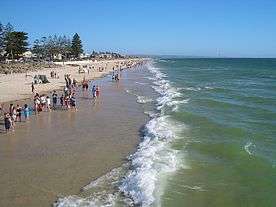
Henley Square is located behind Henley Jetty on the Esplanade. Other greenspace in the suburb is the Henley Grange Memorial Oval and John Mitchell Oval. Henley Beach extends the length of the suburb.
Transport
Henley Beach is serviced by Grange Road and Henley Beach Road, both connecting the suburb to Adelaide City Centre. Seaview Road runs along the coast.
Henley Beach is serviced by public transport run by the Adelaide Metro which provides bus services to the Adelaide city centre and Glenelg. The Grange railway line was extended to Henley Beach as the Henley Beach railway line in 1894 and the extension closed in 1957. There was a tram line from the city centre to Henley Beach. This was initially a horse-drawn tram, converted to electricity in the 1920s and ceased operation in the 1950s along with almost every other tram line in Adelaide.
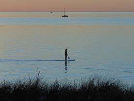
Gallery
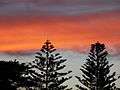 Araucaria trees at Henley Beach
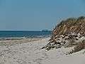 Henley Beach jetty
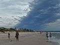 Cloudy summer weather
 Sunset
 The Ramsgate
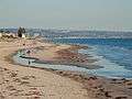 Henley Beach North
See also
| Wikimedia Commons has media related to Henley Beach, South Australia. |
References
- ↑ Australian Bureau of Statistics (31 October 2012). "Henley Beach (State Suburb)". 2011 Census QuickStats. Retrieved 5 October 2016.

- 1 2 3 Manning, Geoffrey. "Place Names of South Australia". The Manning Index of South Australian History. State Library of South Australia. Retrieved 1 February 2012.
- 1 2 "Henley Beach, South Australia (Adelaide)". Postcodes-Australia. Postcodes-Australia.com. Retrieved 1 February 2012.
- 1 2 "City of Charles Sturt Wards and Council Members" (PDF). City of Charles Sturt. Archived from the original (PDF) on 5 August 2011. Retrieved 1 February 2012.
- 1 2 3 "Electoral Districts - Electoral District for the 2010 Election". Electoral Commission SA. Archived from the original on 22 August 2011. Retrieved 1 February 2012.
- 1 2 "Find my electorate: Hindmarsh". Australian Electoral Commission. Archived from the original on 30 September 2011. Retrieved 1 February 2012.
- ↑ "Out Among the People". The Advertiser (Adelaide). 95, (29, 536). South Australia. 12 June 1953. p. 4. Retrieved 1 December 2017 – via National Library of Australia.
- 1 2 Australian Bureau of Statistics (25 October 2007). "Henley Beach (State Suburb)". 2006 Census QuickStats. Retrieved 1 February 2012.
- ↑ Marsden, S (1977). A History of Woodville. Corporation of the City of Woodville. p. 3. ISBN 0-9599828-4-1.
- ↑ "About Our City". The City of Charles Sturt. Retrieved 3 November 2015.
External links
- "City of Charles Sturt". Official website. City of Charles Sturt. Retrieved 1 February 2012.