Tazewell County (Virginia)
Tazewell County is een van de 95 county's in de Amerikaanse staat Virginia. Daarnaast kent Virginia 39 onafhankelijke steden die niet tot county's behoren.
| County in de Verenigde Staten | |||
 | |||
| Situering | |||
| Staat | Virginia | ||
| Tijdzone | Eastern Standard Time (UTC−5) | ||
| Coördinaten | 37°7'48"NB, 81°33'36"WL | ||
| Algemeen | |||
| Oppervlakte | 1.346 km² | ||
| - land | 1.346 km² | ||
| - water | 0 km² | ||
| Inwoners (2000) | 44.598 (33 inw./km²) | ||
| Overig | |||
| Zetel | Tazewell | ||
| FIPS-code | 51185 | ||
| Opgericht | 1799 | ||
| Foto's | |||
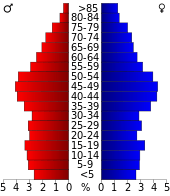 Bevolkingspiramide Tazewell County | |||
| Statistieken volkstelling Tazewell County | |||
| |||
De county heeft een landoppervlakte van 1.346 km² en telt 44.598 inwoners (volkstelling 2000). De hoofdplaats is Tazewell.
Bevolkingsontwikkeling
| Historische inwonertallen | |||
|---|---|---|---|
| Jaar | Inwoners | % ± | |
| 1900 | 23.384 | ||
| 1910 | 24.946 | 6,7% | |
| 1920 | 27.840 | 11,6% | |
| 1930 | 32.477 | 16,7% | |
| 1940 | 41.607 | 28,1% | |
| 1950 | 47.512 | 14,2% | |
| 1960 | 44.791 | −5,7% | |
| 1970 | 39.816 | −11,1% | |
| 1980 | 50.511 | 26,9% | |
| 1990 | 45.960 | −9,0% | |
| 2000 | 44.598 | −3,0% | |
| Bron: (en) Historical Decennial Census Population | |||

Tazewell County Courthouse
This article is issued from
Wikipedia.
The text is licensed under Creative
Commons - Attribution - Sharealike.
Additional terms may apply for the media files.