Zemplén County
Zemplén (Hungarian: Zemplén, Slovak: Zemplín, German: Semplin, Latin: Zemplinum) was an administrative county (comitatus) of the Kingdom of Hungary. The northern part of its territory is now situated in eastern Slovakia (Zemplín region), while a smaller southern portion of the former county belongs to Hungary, as part of Borsod-Abaúj-Zemplén County.
| Zemplén County | |
|---|---|
| County of the Kingdom of Hungary (11th-century-1946) County of the Second Hungarian Republic (1946-1949) County of the Hungarian People's Republic (1949-1950) | |
 Coat of arms
| |
 | |
| Capital | Zemplén; Sátoraljaújhely (1685-1950) |
| Area | |
| • Coordinates | 48°23′N 21°39′E |
• 1910 | 6,282 km2 (2,425 sq mi) |
• 1930 | 1,776 km2 (686 sq mi) |
| Population | |
• 1910 | 343194 |
• 1930 | 146318 |
| History | |
• Established | 11th century |
• Treaty of Trianon | 4 June 1920 |
• Merged into Borsod-Abaúj-Zemplén County | 16 March 1950 |
| Today part of | (4,506 km2) (1,776 km2) |
Geography

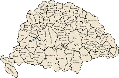
Zemplén county shared borders with Poland (during some periods the with the Austrian crownland Galicia) and the Hungarian counties Sáros, Abaúj-Torna, Borsod, Szabolcs and Ung. It was situated in the easternmost strip of what is now Slovakia (except for the region between Vihorlatské vrchy and the Latorica river), plus a strip along the Bodrog and Tisza rivers in present-day Hungary. The rivers Laborc and Bodrog flowed through the county. Its area was 6,269 km² around 1910.
Capitals
Initially, the capital of the county was the Zemplín Castle (Hungarian: Zempléni vár, Slovak: Zemplínsky hrad), in the 13th century also Sárospatak (in Slovak: Potok, hence the alternative name of the county comitatus de Potok). Since the Late Middle Ages the capital was the town of Zemplén, and since 1748 was Sátoraljaújhely (which is now divided between Slovakia and Hungary by the Ronyva/Roňava stream; the Hungarian part is known in Slovak as Nové Mesto pod Šiatrom and the Slovak part is now a separate village called Slovenské Nové Mesto).
History
Zemplén was one of the oldest counties of the Kingdom of Hungary. In the aftermath of World War I, in 1920 by the Treaty of Trianon the northern part of Zemplén county became part of newly formed Czechoslovakia. The southern half (including the bigger part of the divided Sátoraljaújhely) stayed in Hungary as the county of Zemplén. Following the provisions of the First Vienna Award, an additional part became part of Hungary again in November 1938. The Trianon borders were restored after World War II, and the Hungarian county Zemplén merged with Abaúj, the most of Borsod-Gömör and a little part of Szabolcs counties to form the present Borsod-Abaúj-Zemplén County.

Demographics
1900
In 1900, the county had a population of 327,993 people and was composed of the following linguistic communities:[1]
Total:
- Hungarian: 174,107 (53.1%)
- Slovak: 106,114 (32.4%)
- Ruthenian: 34,831 (10.6%)
- German: 8,072 (2.5%)
- Romanian: 144 (0.0%)
- Croatian: 44 (0.0%)
- Serbian: 1 (0.0%)
- Other or unknown: 4,680 (1.4%)
According to the census of 1900, the county was composed of the following religious communities:[2]
Total:
- Roman Catholic: 123,967 (37.8%)
- Greek Catholic: 101,053 (30.8%)
- Calvinist: 64,457 (19.7%)
- Jewish: 31,533 (9.6%)
- Lutheran: 6,807 (2.1%)
- Greek Orthodox: 127 (0.0%)
- Unitarian: 20 (0.0%)
- Other or unknown: 29 (0.0%)
1910

In 1910, the county had a population of 343,194 people and was composed of the following linguistic communities:[3]
Total:
- Hungarian: 193,794 (56.47%)
- Slovak: 92,943 (27.08%)
- Ruthenian: 39,033 (11.37%)
- German: 9,749 (2.84%)
- Romanian: 209 (0.06%)
- Croatian: 49 (0.01%)
- Serbian: 7 (0.0%)
- Other or unknown: 7,410 (2.16%)
According to the census of 1910, the county was composed of the following religious communities:[4]
Total:
- Roman Catholic: 132,395 (38.58%)
- Greek Catholic: 103,118 (30.05%)
- Calvinist: 67,557 (19.68%)
- Jewish: 33,041 (9.63%)
- Lutheran: 6,822 (1.99%)
- Greek Orthodox: 189 (0.06%)
- Unitarian: 30 (0.0%)
- Other or unknown: 42 (0.01%)
Subdivisions

In the early 20th century, the subdivisions of Zemplén county were:
| Districts (járás) | |
|---|---|
| District | Capital |
| Bodrogköz | Királyhelmec (now Kráľovský Chlmec) |
| Gálszécs | Gálszécs (now Sečovce) |
| Homonna | Homonna (now Humenné) |
| Mezőlaborc | Mezőlaborc (now Medzilaborce) |
| Nagymihály | Nagymihály (now Michalovce) |
| Sárospatak | Sárospatak |
| Sátoraljaújhely | Sátoraljaújhely |
| Szerencs | Szerencs |
| Szinna | Szinna (now Snina) |
| Sztropkó | Sztropkó (now Stropkov) |
| Tokaj | Tokaj |
| Varannó | Varannó (now Vranov nad Topľou) |
| Urban districts (rendezett tanácsú város) | |
| Sátoraljaújhely | |
The towns of Sátoraljaújhely, Sárospatak, Tokaj and Szerencs are now in Hungary, except for a small part (about a quarter by area) of Sátoraljaújhely to the north-east of the Ronyva (Roňava) stream in Slovakia, now a village of its own named Slovenské Nové Mesto.
References
- "KlimoTheca :: Könyvtár". Kt.lib.pte.hu. Retrieved 2012-06-26.
- "KlimoTheca :: Könyvtár". Kt.lib.pte.hu. Retrieved 2012-06-26.
- "KlimoTheca :: Könyvtár". Kt.lib.pte.hu. Retrieved 2012-06-26.
- "KlimoTheca :: Könyvtár". Kt.lib.pte.hu. Retrieved 2012-06-26.