Pozsony County
Pozsony county was an administrative county (comitatus) of the Kingdom of Hungary. Its territory is now mostly part of Slovakia, while a small area belongs to Hungary. In 1969, the three villages that remained in Hungary were combined to form Dunasziget.
| Pozsony County | |
|---|---|
| County of the Kingdom of Hungary (ca. 1000-1923) | |
.svg.png) Coat of arms
| |
 | |
| Capital | Pozsony |
| Area | |
| • Coordinates | 48°9′N 17°7′E |
• 1910 | 4,370 km2 (1,690 sq mi) |
| Population | |
• 1910 | 389750 |
| History | |
• Established | ca. 1000 |
• Treaty of Trianon | 4 June 1920 |
• Merged into Győr-Moson-Pozsony County | 1923 |
| Today part of | (4,323 km2) (47 km2) |
| Bratislava is the current name of the capital. | |
Its name changed along with that of the city of Pressburg (Hungarian: Pozsony, today's Bratislava). Its names around 1900 were Pozsony vármegye in Hungarian, Prešpurská župa in Slovak and Preßburger Gespanschaft in German.
Geography


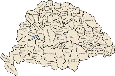
The county shared borders with the Austrian land of Lower Austria and the Hungarian counties Nyitra, Komárom, Győr and Moson. It was situated between the river Morava in the west, the river Danube in the south, and the river Váh (Hungarian: Vág) in the east. The southern part of the Little Carpathians divided the county into two. It also covered most of the island known today as Žitný ostrov (Hungarian: Csallóköz) between the Danube and the Little Danube. Its area was 4,370 km² around 1910.
Seats
The seats of Pozsony county were the Pozsony Castle (present-day Bratislava Castle) and Somorja (present-day Šamorín), and from the 18th century onwards the town of Pressburg.
History
A sort of predecessor to Pozsony county may be existed as early as the 9th century during the time of Great Moravia. After Pozsony county's territory had become part of the Kingdom of Hungary, the Hungarian comitatus was created around 1000 or even earlier. It was one of the first counties created in the Kingdom of Hungary. Its territory comprised roughly what is today Bratislava Region and Trnava Region. Throughout its history it was among the most prosperous territories of Hungary, and until the late 18th century it was particularly advanced and prosperous. In the 18th and 19th century, the population consisted of Germans (mainly in Pressburg and larger towns), Hungarians (mainly in the south, some suburbs of Pressburg[lower-alpha 1], Slovaks (mainly in the north and in the suburbs of Pressburg[lower-alpha 2] and Croats (mainly in the suburbs of Pressburg).
In the aftermath of World War I, most of Pozsony county became part of newly formed Czechoslovakia, as recognized by the concerned states in 1920 by the Treaty of Trianon. As Bratislava county, it continued to exist until 1927 in Czechoslovakia, but it had completely different powers and somewhat modified borders. A small part south of the river Danube remained part of Hungary and joined Győr-Moson-Pozsony county.
Following the provisions of the First Vienna Award, the southeastern part of the area (Žitný ostrov, Senec, Galanta) became part of Hungary again in November 1938. The approximate Trianon borders were restored after World War II.
Demographics
1900
In 1900, the county had a population of 367,417 people and was composed of the following linguistic communities:[2]
Total:
- Slovak: 164,585 (44.8%)
- Hungarian: 139,835 (38.1%)
- German: 56,358 (15.3%)
- Croatian: 2,448 (0.7%)
- Romanian: 71 (0.0%)
- Ruthenian: 85 (0.0%)
- Serbian: 37 (0.0%)
- Other or unknown: 4,083 (1.1%)
According to the census of 1900, the county was composed of the following religious communities:[3]
Total:
- Roman Catholic: 309,861 (84.3%)
- Lutheran: 26,112 (7.1%)
- Jewish: 22,246 (6.1)
- Calvinist: 8,854 (2.4%)
- Greek Catholic: 245 (0.0%)
- Greek Orthodox: 92 (0.0%)
- Unitarian: 24 (0.0%)
- Other or unknown: 68 (0.0%)
1910

In 1910, the county had a population of 389,750 people and was composed of the following linguistic communities:[4]
Total:
- Slovak: 166,017 (42.6%)
- Hungarian: 163,367 (41.9%)
- German: 53,822 (13.8%)
- Croatian: 1,934 (0.5%)
- Romanian: 81 (0.0%)
- Ruthenian: 42 (0.0%)
- Serbian: 31 (0.0%)
- Other or unknown: 4,456 (1.1%)
According to the census of 1910, the county was composed of the following religious communities:[5]
Total:
- Roman Catholic: 331,265 (85.0%)
- Lutheran: 26,456 (6.8%)
- Jewish: 22,588 (5.8)
- Calvinist: 8,924 (2.3%)
- Greek Catholic: 270 (0.0%)
- Greek Orthodox: 157 (0.0%)
- Unitarian: 20 (0.0%)
- Other or unknown: 70 (0.0%)
Subdivisions

In the early 20th century, the subdivisions of Pozsony county were:
| Districts (járás) | |
|---|---|
| District | Capital |
| Dunaszerdahely | Dunaszerdahely (now Dunajská Streda) |
| Galánta | Galánta (now Galanta) |
| Malacka | Malacka (now Malacky) |
| Nagyszombat | Nagyszombat (now Trnava) |
| Pozsony | Pozsony (now Bratislava) |
| Somorja | Somorja (now Šamorín) |
| Szenc | Szenc (now Senec) |
| Urban counties (törvényhatósági jogú város) | |
| Pozsony (now Bratislava) | |
| Urban districts (rendezett tanácsú város) | |
| Bazin (now Pezinok) | |
| Modor (now Modra) | |
| Nagyszombat (now Trnava) | |
| Szentgyörgy (now Svätý Jur) | |
Notes
- In 1900: particularly present-day Podunajské Biskupice and Vrakuňa (cca 90 %)
- In 1900: present-day Lamač, Dúbravka, Záhorská Bystrica - more than 93% of the population, present-day Vajnory (93 %) and Rača (75 %).[1]
References
- Buček, Ján; Pavol, Korec, eds. (2013). Moderná humánna geografia mesta Bratislava: priestorové štruktúry, siete a procesy [Modern Human Geography of Bratislava: spatial structures, networks and processes] (PDF). Bratislava: Univerzita Komenského, Prírodovedecká fakulta Katedra humánnej geografie a demografie. pp. 60–61. ISBN 978-80-223-3516-4.
- "KlimoTheca :: Könyvtár". Kt.lib.pte.hu. Retrieved 24 June 2012.
- "KlimoTheca :: Könyvtár". Kt.lib.pte.hu. Retrieved 24 June 2012.
- "KlimoTheca :: Könyvtár". Kt.lib.pte.hu. Retrieved 24 June 2012.
- "KlimoTheca :: Könyvtár". Kt.lib.pte.hu. Retrieved 24 June 2012.