The Californias
The Californias (Spanish: Las Californias), occasionally known as the Three Californias[1][2][3][4] or Two Californias,[5][6][7] are a region of North America spanning the United States and Mexico, consisting of the U.S. state of California and the Mexican states of Baja California and Baja California Sur.[8][9][10][11] Historically, the term Californias was used to define the vast northwestern region of Spanish America, as the Province of the Californias (Spanish: Provincia de las Californias), and later as a collective term for Alta California and the Baja California Peninsula.[12][13]
The Californias Las Californias | |
|---|---|
.png) | |
| Country |
|
| U.S. states | California |
| Mexican states | Baja California Baja California Sur |
| Principal cities | |
| Area | |
| • Total | 569,329 km2 (219,819 sq mi) |
| Population | |
| • Total | 43,636,740 |
| • Density | 77/km2 (200/sq mi) |
| Time zones | UTC-8 (Pacific Standard Time) |
| • Summer (DST) | UTC-7 (Pacific Daylight Time) |
| UTC-7 (Mountain Standard Time) | |
| • Summer (DST) | UTC-6 (Mountain Daylight Time) |
Originally a single, vast entity within the Spanish Empire, as the Californias became defined in their geographical limits, their administration was split various times into Baja California (Lower California) and Alta California (Upper California), especially during the Mexican control of the region, following the Mexican War of Independence. As a part of the Mexican–American War (1846–48), the American Conquest of Alta California saw the vast Alta California territory ceded from Mexico to the United States. The populated coastal region of the territory was admitted into the Union in 1850 as the State of California, while the vast, sparsely populated interior region would only later gain statehood as Nevada, Utah, and large parts of Arizona, Wyoming, Colorado and New Mexico.
Today, Californias is a collective term to refer to the American and Mexican states bearing the name California, which share geography, history, cultures, and strong economic ties.[14][15]
Etymology
There has been understandable confusion about use of the plural Californias by Spanish colonial authorities. California historian Theodore Hittell offered the following explanation:
In very early times, while the country was supposed to be an island or rather several islands, it was commonly known by the plural appellation of "Las Californias" (The Californias). Afterwards, when its peninsular character was ascertained, it was called simply California; but the territory so designated was unlimited in extent. When the expeditions for the settlement of San Diego and Monterey marched, it was understood that they were going, not out of California, but into a new part of it. The peninsula then began to be generally spoken of as Antigua or Old California and the unlimited remainder as Nueva or New California, subsequently more commonly called Alta or Upper California. At the same time the old plural name of The Californias was revived, but with a more definite signification than before.[16]
History
| Californias Las Californias | |||||||||
|---|---|---|---|---|---|---|---|---|---|
| Province of New Spain | |||||||||
| 1767–1804 | |||||||||
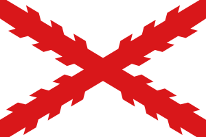 Flag
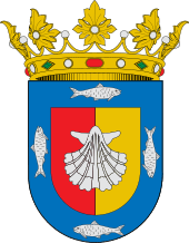 Coat of arms
| |||||||||
.png) The Californias within the Viceroyalty of New Spain | |||||||||
| Capital | Loreto (1768–1777) Monterey (1777–1804) | ||||||||
| Government | |||||||||
| • Type | Colonial government | ||||||||
| Gobernadores | |||||||||
• 1767–1770 | Gaspar de Portolá (first) | ||||||||
• 1800–1804 | José Joaquín de Arrillaga (last) | ||||||||
| History | |||||||||
• Established | 1767 | ||||||||
• Divided into Alta and Baja California provinces | 1804 | ||||||||
| |||||||||
| Today part of | |||||||||
The first attempted Spanish occupation of California was by the Jesuit missionary Eusebio Kino, in 1683. His Misión San Bruno failed, however, and it wasn't until 1697 that Misión de Nuestra Señora de Loreto Conchó was successfully established by another Jesuit, Juan María de Salvatierra. The mission became the nucleus of Loreto, first permanent settlement and first administrative center of the province. The Jesuits went on to found a total of 18 missions in the lower two-thirds of the Baja California Peninsula.
Province of New Spain
.JPG)
In 1767, the Jesuits were expelled from the missions, and Franciscans were brought in to take over. Gaspar de Portolá was appointed governor to supervise the transition. At the same time, a new visitador, José de Gálvez, was dispatched from Spain with authority to organize and expand the fledgling province.[17]
The more ambitious province name, Las Californias, was established by a joint dispatch to the King from Viceroy de Croix and visitador José de Gálvez, dated January 28, 1768. Gálvez sought to make a distinction between the Antigua ('old') area of established settlement and the Nueva ('new') unexplored areas to the north. At that time, almost the only explored and settled areas of the province were around the former Jesuit missions but, once exploration and settlement of the northern frontier began in earnest, the geographical designations Alta ('upper') and Baja ('lower') gained favor.
The single province was divided in 1804, into Alta California province and Baja California province.[18] By the time of the 1804 split, the Alta province had expanded to include coastal areas as far north as what is now the San Francisco Bay Area in the U.S. state of California. Expansion came through exploration and colonization expeditions led by Portolá (1769), his successor Pedro Fages (1770), Juan Bautista de Anza (1774–76), the Franciscan missionaries and others. Independent Mexico retained the division but demoted the former provinces to territories, due to populations too small for statehood.
Department of Mexico
In 1836, the designation Las Californias was revived, reuniting Alta and Baja California into a single departamento (department) as part of the conservative government reforms codified in the Siete Leyes (Seven Laws). The Seven Laws were repealed in 1847, during the Mexican–American War, and the split of the two Californias was restored.
Following Mexico's defeat in the war, most of the former Alta California territory was ceded on 2 February 1848 to the United States, under the terms of the Treaty of Guadalupe Hidalgo. The new Mexico–United States border was established slightly to the north of the previous Alta-Baja border, and the terms Las Californias and Alta California were no longer formally used. The areas in North America acquired by the U.S. were designated as unorganized "territory" under a military governor, pending re-establishment of civilian control and organization. California was the first section of the territory to achieve statehood, two years later.
Geography
The Baja California Peninsula is bordered on three sides by water, the Pacific Ocean (south and west) and Gulf of California (east); while Alta California had the Pacific Ocean on the west and deserts on the east. A northern boundary was established by the Adams–Onís Treaty of 1819. That boundary line remains the northern boundary of the U.S. states of California, Nevada, and the western part of Utah.
Inland regions were mostly unexplored by the Spanish, leaving them generally outside the control of the colonial authorities. Mountain ranges of the Peninsular Ranges, eastern Transverse Ranges, and the Sierra Nevada, along with the arid Colorado Desert, Mojave Desert, and Great Basin Desert in their eastern rain shadows, served as natural barriers to Spanish settlement. The eastern border of upper Las Californias was never officially defined under either Spanish or subsequent Mexican rule.[19] The 1781 Instrucciones and government correspondence described Alta California ("Upper California") as the areas to the west of the Sierra Nevada and the lower part of the Colorado River in the Lower Colorado River Valley (the river forms the present day border between the states of California and Arizona).[20]
See also
- List of governors in the Viceroyalty of New Spain
- Spanish missions in Baja California
- Spanish missions in California
- Indigenous peoples of California
- Ranchos of California
- History of California
- History of California through 1899
- Spanish colonization of the Americas
- The Canadas
- The Carolinas
- The Dakotas
- The Floridas
- The Virginias
References
- Wilson Center - Institute of the Three Californias
- Freemasons of California: Conference of the Three Californias
- The Magic Curtain: the Mexican-American Border in Fiction, Film, and Song
- Journal of the Legislative Assembly of California - March 2 2006
- JStor The Two Californias During World War II
- Two California, Three Religious Orders, and Fifty Missions
- Two Californias Meet at the Border to Demand Justice for Farm Workres
- the Californias... what we now refer to the states of Baja California, Baja California Sur and the State of California. in California Parks Department: Missions of the Californias
- Lieutenant-Governor of California: Commission of the Californias
- Cambridge Journal of the Americas - The Arrival of the Franciscans in the Californias
- LA Times - Is This the Last Beach in the Californias?
- Travels in the Californias, and Scenes in the Pacific Ocean
- Stanford Law - The Case of the Pious Fund of the Californias: United States of America Vs. Republic of Mexico
- MexicoMatters - Economy of the Three Californias
- LA Times - What the Baja Boom Means for Our State
- Hittell, Theodore Henry (1898). History of California. San Francisco: N.J. Stone & Company. p. 510. OCLC 21706930.
las californias.
- Richman, I. B. (1965). California under Spain and Mexico, 1535–1847: A contribution toward the history of the Pacific coast of the United States, based on original sources, chiefly manuscript, in the Spanish and Mexican Archives and other repositories, pp.64–66. New York: Cooper Square Publishers.
- Bancroft, H. H. (1970). History of California: Vol. II, 1801–1824, pp.20–21. Santa Barbara Calif.: Wallace Hebberd. (Note: Bancroft translated the names of the two new provinces as "Antigua" and "Nueva", but Richman uses Baja and Alta - as on the 1847 map of Mexico.)
- José Bandini, in a note to Governor Echeandía or to his son Juan Bandini, a member of the Territorial Deputation (legislature), noted that Alta California was bounded "on the east, where the Government has not yet established the [exact] borderline, by either the Colorado River or the great Sierra (Sierra Nevada Range)". A Description of California in 1828 by José Bandini (Berkeley, Friends of the Bancroft Library, 1951), 3. Reprinted in Mexican California (New York, Arno Press, 1976). ISBN 0-405-09538-4
- Chapman, Charles Edward (1973) [1916]. The Founding of Spanish California: The Northwestward Expansion of New Spain, 1687–1783. New York: Octagon Books. pp. xiii.
Further reading
- Bancroft, Hubert Howe (1884). History of California: 1542–1800. The Works of Hubert Howe Bancroft. 18. San Francisco: A. L. Bancroft & Company.
- Bancroft, Hubert Howe (1886). History of California: 1801–1824. The Works of Hubert Howe Bancroft. 19. San Francisco: A. L. Bancroft & Company.
- Beebe, Rose Marie (2001). Lands of Promise and Despair: Chronicles of Early California, 1535–1846. Berkeley: Heyday Books. ISBN 1-890771-48-1.
- Bouvier, Virginia Marie (2001). Women and the Conquest of California, 1542–1840: Codes of Silence. Tucson: University of Arizona. ISBN 978-0-8165-2446-4.
- Chapman, Charles E. (1916). The Founding of Spanish California: The Northwestward Expansion of New Spain, 1687–1783. New York: Macmilan.
- Chapman, Charles E. (1921). A History of California: The Spanish Period. New York: Macmillan.
- Forbes, Alexander (1919) [1839]. California: A History of Upper and Lower California from Their First Discovery to the Present Time. San Francisco: Thomas C. Russell.
- González Cruz, Edith; Altable, María Eugenia, eds. (2003). Historia general de Baja California Sur: Los procesos políticos. 2. Mexico City: Plaza y Valdes. ISBN 970-722-199-2.
- María Luisa Rodríguez-Sala, Karina Neria (2003). Los gobernadores de las Californias, 1767–1804: contribuciones a la expansión territorial y del conocimiento (in Spanish). Instituto de Investigaciones Sociales, UNAM. ISBN 978-9-703-20277-5.CS1 maint: uses authors parameter (link)
External links
| Wikimedia Commons has media related to Colonial California. |

| |
| |
| |
| |
| |
|
| |
|