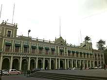
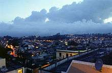
Xalapa
Xalapa (often spelled Jalapa, Spanish pronunciation: [xaˈlapa] (![]()
Xalapa Xalapa-Enríquez | |
|---|---|
Municipality and City | |
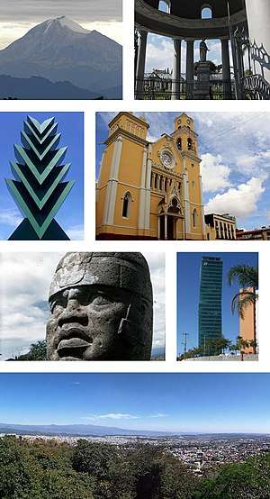 Clockwise, from upper left: Pico de Orizaba, General Juan de la Luz Enríquez Lara tomb, Araucaria sculpture, Xalapa Cathedral, Olmec colossal head from Museo de Antropología de Xalapa, cityscape, panoramic view from the Mountain of the Macuiltepetl | |
 Coat of arms | |
| Nickname(s): La Ciudad de las Flores ("The City of Flowers") | |
 Xalapa Xalapa | |
| Coordinates: 19°32′24″N 96°55′59″W | |
| Country | |
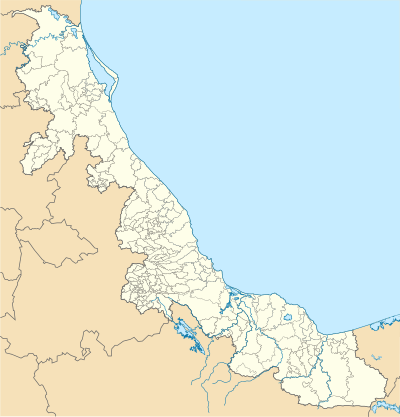
| State | Veracruz |
| Founded | 1313 |
| Declared as a city | 1791 |
| Government | |
| • Mayor | Dr. Pedro Hipólito Rodríguez Herrera (MORENA) |
| • Federal Deputies | Cuitláhuac García Jiménez (MORENA), Adolfo Hernández (PRI) |
| • Local Deputies | Tanya Carol Viveros Chávez (MORENA), Daniela Ceballos (MORENA) |
| Area | |
| • Municipality and City | 118.45 km2 (45.73 sq mi) |
| Elevation | 1,417 m (4,649 ft) |
| Population (2009 estimate) | |
| • Municipality and City | 525,147 |
| • Metro | 809,206 |
| Time zone | UTC−6 (CST) |
| • Summer (DST) | UTC−5 (CDT) |
| Website | www.xalapa.gob.mx |
Etymology
The name Xalapa comes from the Classical Nahuatl roots xālli [ʃaːlːi] "sand" and āpan [aːpan] "place of water", which means approximately "spring in the sand". It's classically pronounced [ʃalaːpan] in Nahuatl, although the final /n/ is often omitted; the sound /ʃ/ (like the English sh) was written x in the 16th century. This doesn't occur in contemporary Spanish, and its modern counterpart (the sound [x] or [h]) is normally written as j. The spelling Xalapa (like the word México) reflects the old pronunciation. Xalapa is pronounced [xalapa] or [halapa], the last pronunciation is used principally in dialects of Mexico's south, the Caribbean, a large part of Central America, some places in South America and the Canary Islands and western Andalusia in Spain, where [x] has evolved into a voiceless glottal fricative ([h]).
The complete name of the city is Xalapa-Enríquez, bestowed in honor of a governor from the 19th century, Juan de la Luz Enríquez. The city's nickname, City of Flowers (Spanish: La ciudad de las flores), was given by Alexander von Humboldt, who visited the city 10 February 1804. The reference is also related to the city's older colonial history. According to folklore, the Spanish believed that Jalapa was the birthplace and home of the world's most beautiful woman, la Florecita, which literally means "little flower". The residents of Xalapa are called Xalapeños or Jalapeños, which is the name given to the popular large peppers cultivated in this area.
History
The Totonacs first established themselves around Macuiltepetl ("fifth mountain" in Nahuatl).[3] This extinct volcano received its name because the Aztecs used it as the fifth reference mountain to get to the gulf of Mexico's shores. Today it is preserved in a park. During the 14th century, four indigenous peoples settled in the territory today known as Xalapa. Each built a small village: Xalitic (in the sand) was founded by the Totonacas; Techacapan (river of waste) was founded by the Chichimecas; in the northeast Tecuanapan (river of the beasts) was founded by the Toltecas, and Tlalnecapan was founded by the Teochichimecas.
Around 1313, the four villages grew together and joined, forming one large village named Xallapan. Moctezuma Ilhuicamina, the fifth Aztec emperor, invaded the territory during the second half of the 15th century. All the land was ruled as part of the Aztec Empire before the arrival and conquest of the Spanish conquistadores.
In 1519 Hernán Cortés passed through en route to Tenochtitlan.[4]:135 In 1555 Spanish Franciscans completed construction of a convent, an important event in the Nueva España of that time.
When the Spanish invaded, Xalapa was barely populated. The population rose after the conquest and colonial settlement. When the Spanish improved the Mexico-Orizaba-Veracruz route, Xalapa declined in importance as a transport hub, and its population stagnated in the 17th century.[5]
From 1720 on Xalapa became increasingly important, due to trade with merchants from New Spain arriving to buy and sell the products of the peninsula.[5] Numerous Spanish families from the nearby towns settled in Xalapa, so by 1760 the population had increased to over 1,000 inhabitants, including mestizo and Spanish. Among local items of commerce were botanical medicines particularly ipomoea purga source of a drug known in English as Jalap. The growth of Xalapa in population, culture, commerce and importance, increased dramatically in the 18th century. Responding to residents' requests, Carlos IV of Spain declared Xalapa a town on 18 December 1791.[5]
In 1772, construction of Xalapa Cathedral began. On 18 May 1784, José María Alfaro got the first air balloon in the Americas, airborne, in Xalapa. Due to the abundance of flowers growing in the region, Alexander von Humboldt, who visited the town on 10 February 1804, christened it the "city of the flowers".[5]
Since the beginning of the 19th century, Xalapa has been the scene of some important historical events. It supported independence from Spain. Ideas flowed freely in the town, and Xalapa was represented by many who put forward these ideas to those in Mexico City government meetings.[5] On 20 May 1821, shortly before Mexican Independence on 27 September the same year, Xalapa was attacked by the forces of Don Antonio López de Santa Anna. Together with Don Joaquin Leño, he forced Spanish captain Juan Horbregoso to surrender the town.[5] Independence was gained months later; the first emperor Agustín de Iturbide was not warmly received in Xalapa due to past differences.[5] On 9 May 1824, by decree of the President of the Republic Don Guadalupe Victoria, the first legislature of the state of Veracruz was established in Xalapa. That year, Xalapa was declared the state capital.
In the 1820s Xalapa and the surrounding area revolted when Vicente Guerrero replaced General Anastasio Bustamante. Veracruz was attacked by Isidro Barradas, who was attempting to reconquer parts of Mexico, and over 3,000 were deployed in the military defense of Veracruz, Córdoba and Orizaba.[5] Anastacio Bustamante, betraying the confidence put him, unsuccessfully revolted against the legitimate government with a new plan of Xalapa, signed on 4 December 1829.
On 29 November 1830 by decree, Xalapa was named a city. In 1843, Don Antonio María de Rivera founded the Normal School of Xalapa to train teachers. Today it operates as a preparatory school for students going to college.
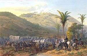
In 1847 in the Mexican–American War Santa Anna attempted to defeat the opposing forces near Xalapa in the Battle of Cerro Gordo. He led an army of more than 12,000 soldiers. Mexican troops suffered many casualties; around a thousand were killed and three thousand wounded on 18 April 1847. The US invaders occupied the city the following day.[5] Among them was Lt. Ulysses S. Grant, later the commanding general of the Union armies in the American Civil War. Grant's letters call Jalapa "decidedly the most beautiful place I ever saw in my life" and its climate "the best in the world."[6]
Xalapeños such as Ambrosio Alcalde and Antonio García fought bravely to defend the city of Veracruz, but were taken prisoner. They were released and paroled, but after rejoining the fighting against the US, they were recaptured near Teocelo, taken to Xalapa, sentenced to death and executed on 24 November 1847.[5] Today these two men are remembered as martyrs. An obelisk commemorates their sacrifice, between San Jose Church and Alcalde Market, named for Ambrosio Alcalde.[5] US forces marched on to capture Mexico City and departed after the Treaty of Guadaloupe Hidalgo.
In November 1862 Xalapa was attacked in the French invasion; foreigners temporarily took control of the state capital. On 27 November 1867 the corpse of emperor Maximilian I of Mexico, who had been executed in Querétaro, arrived and was held in San José, attended by the priest José María y Daza, then transferred to Veracruz the following day. The remains were shipped back to Austria for burial.[5]
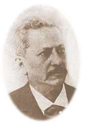
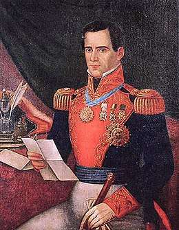
In 1885 General Juan de la Luz Enríquez increased the influence of Xalapa when he moved some legislative authority from Orizaba to Xalapa, in accordance with a decree issued in June 1884 by provisional Governor Juan Manuel Fernández de Jáuregui. Enríquez and Swiss teacher Enrique C. Rébsamen in 1886 founded the Normal School in Xalapa, the first school of this type in the country.[5]
Enríquez died in 1892, but the construction of the Normal School and founding of its other schools led to Xalapa becoming known as a center of learning, the "Athens of Veracruz".[5]
Under Enríquez, the old San Francisco convent was demolished, and the area developed into Parque Juárez. In June 1890 railroad construction brought the first locomotive on the Xalapa--Coatepec-Teocelo railroad to the city. The interoceanic railroad was completed in Veracruz in 1901.[5] The public lighting system was introduced in 1904.[7] In 1906 a clock was installed in the centre of the city on a building on Enríquez Street, which now houses the National Lottery agency.
On 18 May 1911, Francisco I. Madero visited Xalapa. On 21 June of the same year a minor conflict occurred between federal forces and revolutionaries.[5]
On 3 January 1920, a strong earthquake rattled the city, destroying several buildings. Years later in December 1923, Xalapa fell into the power of the huertístas, commanded by Guadalupe Sánchez.[5]
In 1940 the water building and agricultural house were constructed, today is occupied by the Agrarian League of Communities and Union Farmers of the State. On 11 September 1944 the Universidad Veracruzana was established, and Dr. Manuel Suárez became its first director. On 4 September 1978, by decree number 325, the Local Legislature declared that the official name of Xalapa Enríquez should be written with a "X" rather than a "J", to emphasize its derivation from Nahuatl.[5]
Xalapa is a thriving center for commerce and many multinational companies have large retail stores and franchise restaurants in the city. These include Wal-Mart, Superama, Sam's Club, The Home Depot, Liverpool, Sears, Costco, Office Depot, Office Max, Oxxo, Sanborns, C&A, McDonald's, Domino's Pizza, Pizza Hut, Subway, Starbucks, Kentucky Fried Chicken, Little Caesars, Hugo Boss, Pull and Bear, Carl's Jr., Prada, Tous, MINISO, etc.
Xalapa also has a number of cinemas, some of them of substantial size, such as the Cinepolis Museum (10 screens), Cinepolis the Americas (16 screens), and other cinemas, such as XTreme Cinemas in Crystal and Cinetix in Plaza Animas, which is a local movie theater. There are also several retail malls in Xalapa: Plaza Crystal, Plaza Museo, Plaza Animas (L.A. Fashion), Plaza Américas, and Plaza los Arcos.
Many people in Xalapa are employed by the government, since it is the state capital. Xalapa is also the head one of the five regional sections of the Tribunal Electoral (a level below the Supreme Court). This area encompasses 7 states: Campeche, Chiapas, Oaxaca, Quintana Roo, Tabasco, Veracruz and Yucatán. The other regional seats are Mexico City, Toluca, Monterrey and Guadalajara.
Culture
Xalapa is known as the "Athens of Veracruz" because of the strong cultural influence of its major university, Universidad Veracruzana (the main public university in the State of Veracruz). General Enriquez is known for policies encouraging the educational system in Xalapa.
Culturally, Xalapa has a wide variety of events associated with its theatres, museums, and street art. Many musicians and dancers frequently perform in the center in the nights, especially on special occasions and events of celebration or commemoration; they often dance the fandango.
Art has a keen following in Xalapa. The gallery, Pinacoteca Diego Rivera, located near the City Hall and Parque Juárez in downtown, has the most numerous collection of Diego Rivera's paintings in all of Mexico.[8]
Holidays
Feast day of San José, Feast of Santiago Apostle, Feast of the Immaculate Heart of Jesus, Conception of Maria, and Expo-Fair International are all celebrated in the city. An important religious holiday is on 8 December, the Feast of the Immaculate Conception, celebrating Mary the Mother of God patroness of the city. On 24 October San Rafael Guizar and Valencia are celebrated, with thousands of people from all over Mexico visiting their tomb that is in a chapel within the cathedral. The cathedral remains open all night and day during this event.
Cuisine
Xalapa is the place of origin of the famous Jalapeño peppers.[9] Dishes made with maize: gorditas, tostadas, pasties, enfrijoladas, and chicken are common. The desserts that are consumed in the region are typically sweet such as cake and cocadas and craft candies like candied fruit, dulce de leche and jamoncillo.
Notable city landmarks
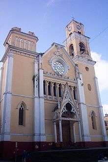

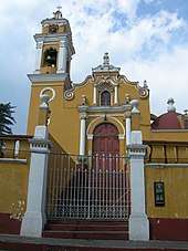
- The Xalapa Cathedral is a mix of Baroque and Neo-Gothic design built in 1773. It has a clock tower, the clock coming from England.
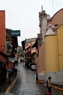
- Callejón Diamante (lit. Diamond Alley) is one of the more crowded streets at night because of its Bohemian atmosphere with cafes and an artists' colony. Callejón Jesús te Ampare is a cobblestone street next to the Church of San José .
- Patio Muñoz is a neighborhood built in the 19th century, with most of the original buildings intact. Here are held workshops in Veracruz-style painting, dance and music.
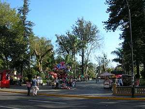
- Parque Juárez is a park in central Xalapa with a terrace-like appearance. The southern side of the park looks over the valley below, offering scenic views of the Sierra Madre Oriental mountains in the distance.[10] Parque Juárez was the location of the Monastery of San Francisco. It is located among the four oldest neighborhoods of the city. Its central garden features enormous monkey puzzle trees, art gallerys, an agora, workshops, an auditorium and a café.
- The Jardín de Esculturas (Sculpture Garden) is a museum dedicated to sculpture, exhibiting works by nationally and internationally recognized artists.
- The Museo Interactivo de Xalapa (Interactive Museum of Xalapa) features a planetarium with an IMAX screen, showing educational documentaries.[11]
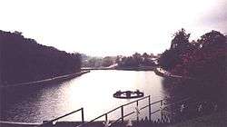
- In the Paseo de los Lagos, there used to be an ancient dam. Today it has footpaths surrounded by leafy trees, circling three lakes and a fresh-water spring.
- The Parque de los Tecajetes is in a natural depression or ravine of the same name in the center of the city. Underneath is a fresh-water spring that feeds the aqueducts, artificial pools and canals of the park.
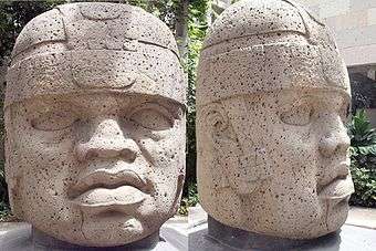
- The Museo de Antropología de Xalapa houses the largest collection of artifacts from Mexican Gulf Coast cultures such as the Olmec, the Huastec and the Totonac with more than 25,000 pieces. The most notable pieces in the museum are the giant Olmec heads and the smaller Totonac ones. Some of the pieces in the museum date back to the Early Pre-Classic Period from 1300 BC −900 BC.[12]
- Nearby is the Hacienda del Lencero Its first owner was Juan Lencero, a soldier of Hernán Cortés. In 1842 it was purchased by Antonio López de Santa Anna for 45,000 pesos.[13] Today, it is a museum which displays furniture and personal belongings dating from the 19th century. It also has a chapel, spacious gardens and a lake surrounding the property which include a sculpture by Gabriela Mistral who spent time there while in exile.
- The Jardín Botánico Clavijero (Clavijero Botanical Garden) has an important collection of regional plants with sections dedicated to Mexican ornamental flowers, reconstructed mountain environments in Xalapa, ferns and the most extensive variety of pines in Mexico.[14]
Parks and gardens
- Jardín Botánico de Xalapa
- Parque Juárez
- Parque Los Berros
- Parque Ecológico "Cerro del Macuiltépec"
- Paseo de Los Lagos
- Parque Ecológico "El Haya"
- Parque "Natura"
- Jardines de la Universidad Veracruzana
- Parque "Tejar Garnica"
- Jardín de las Esculturas
- Parque Ecológico de Los Tecajetes
- Parque María Enriqueta
- Parque Revolución
- Parque Bicentenario
- Stadium Xalapeño
Museums
|
Galleries
|
Theatres and auditoriums
|
Education
In Xalapa, the basic education is distributed by 195 establishments of pre-school, 196 primary schools and 97 secondary schools. In addition it has 86 institutions which offer baccalaureate, as well as a technical and professional training center (CONALEP). In addition it has several institutions of further education. Of the most important is the Universidad Veracruzana which is also the most important in the state of Veracruz and attracts students not only from across Mexico but worldwide.[15] Established in 1944, the current director of the university is Dr. Sara Ladrón de Guevara, a graduated of the University of Paris I: Panthéon-Sorbonne. Furthermore, it is associated with the North American Mobility Project, a transnational academic program that links it to Georgia Southern University in the United States and Wilfrid Laurier University in Canada.[16] High Schools ESTI 128 ESTI 97
Universities
- Universidad Anáhuac
- Universidad Atenas Veracruzana
- Universidad de América Latina
- Benemérita Escuela Normal Veracruzana "Enrique C. Rébsamen"
- Universidad Cálmecac
- Instituto Culinario de Xalapa
- Centro de Estudios Superiores Hispano-Anglo-Francés
- Universidad CLAES
- El Colegio de Veracruz
- Universidad IVES
- Escuela Libre de Ciencias Políticas y Administración Pública de Ote.
- Escuela de Diseño de Modas Sor Juana Inés de la Cruz
- Universidad Eurohispanoamericana
- Universidad Gestalt
- Universidad del Golfo de México, Campus Xalapa
- Universidad Hernán Cortés
- Instituto de Estudios Superiores Morelos
- Universidad Metropolitana Xalapa
- Instituto Superior de Música del Estado de Veracruz
- Instituto Tecnológico Superior de Xalapa
- Tecnológico de Xalapa
- Universidad Paccioli Xalapa
- Universidad Pedagógica Veracruzana
- Universidad Filadelfia
- Universidad Veracruzana
- Universidad de Xalapa
Sport
Xalapa is home to the Halcones UV Xalapa, a very successful professional basketball team. They play in the LNBP
- The team was created in 2003 and placed 3rd in the LNBP
- In 2004 they were champions of the south division, and got second overall in the LNBP
- In 2005 they were champions of the south division and champions of the LNBP
- In 2006 they were champions of the south division, and got second in the LNBP. They also placed second in the Copa Independencia LNBP
- In 2007 – 2008 they were champions of the south division and champions of the LNBP
- In 2008 – 2009 they were champions of the south division and champions of the LNBP. They also placed second in the FIBA de las Americas.
Xalapa also has many sporting facilities. As of 2005, the city has 25 soccer fields, 95 volleyball fields, 95 basketball courts, 36 baseball fields, and 29 multiple-use fields.[17]
Also, the city has 12 gymnasiums, 7 parks, and the notable Heriberto Jara Corona Stadium, inaugurated 1921–1925.[17]
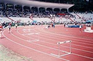
Sportspeople of note hailing from Xalapa include Armando Fernández (an Olympic wrestler), Eulalio Ríos Alemán (an Olympic swimmer and at some time butterfly-stroke record holder in the US, inducted into the Ft. Lauderdale's International Swimming Hall of Fame), and the track and field athlete Luis Hernández.
Every four years the Central American Games take place in cities all over Central America and the Caribbean. In 2012 Veracruz was chosen to host these games in 2014. Several events took place in Xalapa. The Track Cycling was held in the Velodrome, the Modern Pentathlon Swimming took place in the University Swimming Pool, the Athletics trials in the Hilberto Jara Corona Stadium, and Badminton and Table Tennis in the Omega Complex. All of this brought recognition in the sports world to Xalapa.
The Cuban athlete Sandra Mustelier, a member of the table tennis team, decided to flee the hotel where her team was staying two days before the opening of the Central American Games in Veracruz. The 28-year-old athlete did not collect her accreditation in Veracruz, a situation for which her teammates located her immediately by phone. When contacted, Mustelier herself informed her team of her defection. No investigation was undertaken by the Mexican authorities regarding this situation. Mustelier was considered to be a strong contender to win medals in table tennis.
Industry
Laguna Verde Nuclear Power Plant (LVNPP) in nearby Alto Lucero, Veracruz, produces about 4.5% of Mexico's electrical energy.
Transportation
The city is connected by the 140-D Highway with the cities of Veracruz, Puebla and Mexico City. Also the 140 Road provides a link between those cities.
The city has a central bus station (CAXA) which is a nodal point for many bus companies operating in the area, including AU, ADO, ADO-GL, OCC, Auto-Tour and Buses Sierra-Texcoco.
Several bus companies are based in Xalapa including Servicio Urbano de Xalapa (SUX);[18] Auto-Transportes Banderilla (ATB);[19] the yellow and green sets of Interbus,[20] Auto-Transportes Miradores Del Mar;[21] and Transportes Rápidos de Veracruz (TRV)[22] amongst many others.
There is also a bus service which exclusively takes passengers back and forth from Xalapa to Coatepec. These buses operate all over the city, with a cost per person ranging from 6.00 to 8.00 Mexican pesos; discount is offered to the elderly and to students who normally pay 5.00 Mexican pesos within the urban area. There are over 100 bus routes in the city.
The taxis that operate in Xalapa are easily recognizable by their white and green paintwork. The most abundant taxis are of the Nissan Tsuru model. Typically, taxi drivers do not charge based on taximeter.
The city of Xalapa is served by a small airport, El Lencero Airport,[23] located 15 minutes by road from the city. It is currently not served by any commercial airline.
Healthcare
The demand for medical services by the population of the municipality, is taken care of by publicly and privately owned institutions. The medical units in Xalapa provide external advisory services, general and specialized hospitalization that are equipped with laboratories for clinical medical analyses including X-rays, obstetrical, gynaecological and paediatric equipment.[24]
The public institutions of the health sector that provide services are:
- Instituto Mexicano del Seguro Social IMSS,
- Instituto de Seguridad y Servicios Sociales de los Trabajadores del Estado ISSSTE,
- Centro de Especialidades Médicas CEM,
- Petróleos Mexicanos PEMEX,
- Secretaría de la Defensa Nacional SDN
- Secretaría de Salud de Veracruz SESVER,
- Centro de Rehabilitación y Educación Especial de Veracruz CREEVER,
- Sistema para el Desarrollo Integral de la Familia DIF.[24]
In the private sector the municipality counts on important medical establishments such as:
- Sanatorio San Francisco,
- Clínica del American Hospital,
- Clínica de especialidades Las Palmas,
- Vital Clínica Hospital,
- Cruz Roja Mexicana,
- Centro Médico de Xalapa,
- Clínica Millenium
- Hospital Ángeles.[24]
Media
Newspaper
Notable newspapers produced or circulated in Xalapa include www.Xalapa.MX Diario de Xalapa, Diario AZ, Diario el Portal de Xalapa, Diario la Opinión, Periódico Marcha, Periódico Al Calor Político, Periódico Agronómica, Milenio and the Líder. As well, important agency of news on line, like RadioVer www.radiover.com and magazine Revista Era www.revistaera.com t
Radio
The city is served by numerous radio stations including:
FM:
- 90.5 Radio de la Universidad Veracruzana
- 91.7 Amor (Grupo Acir)
- 95.5 Sensación HD (Oliva Radio)
- 96.9 Digital 96.9 (AvanRadio)
- 97.7 La Máquina (AvanRadio)
- 98.5 ONE FM (AvanRadio)
- 104.9 El Patron FM (Oliva Radio)
- 107.7 Radio Más (Radio-Televisión de Veracruz)
AM:
- 550 W Radio (AvanRadio)
- 610 Ke Buena (AvanRadio)
- 1040 OK Radio (AvanRadio)
- 1130 Yo FM 1130 AM(Grupo Radio Capital)
- 1210 El Patrón (Oliva Radio)
- 1460 ABC Xalapa Radio (Grupo ABC)
- 1550 Radio Universidad Veracruzana
Television
Television channels include:
- XHGV-TV channel 4 – RTV
- XHAJ-TV channel 5 – Televisa Regional
- XHAH-TV channel 7 – Canal de las Estrellas
- XHAI-TV channel 9 – Canal 5
- XHCPE-TV channel 11 – Azteca 7
- XHIC-TV channel 13 – Azteca 13
- XHCLV-TV channel 22 – Galavisión
Cable services include:
- Megacable (Cable TV)
- Super Cable (Cable TV)
- UltraVisión (Cable TV)
- Sky (Satellite TV)
- Dish Network (Satellite TV)
Notable people from Xalapa
Politicians
Writers
- Sergio Armin Vásquez Muñoz
- Carlos Manuel Cruz Meza
- Jorge Lobillo
- José María Roa Bárcena
- Juan Díaz Covarrubias
- Julio Zarate
- Francisco Morosini
- Alicia Bazarte Martínez
Educators
- Enrique C. Rébsamen
- Sinforosa Amador (1788–1841)
- Soledad Ramos Enríquez
- Guillermo Fernández de la Garza
Athletes
- Barbara Bonola - Triathlete
- Martha Ángelica Blanco - Javelin throw
- Silvia García Ramírez - Judo
- Marcela García Ramírez - Judo
- Armando Fernández - Wrestler
- Alejandro Fernández Ávila - Shooting sport
- Luis Hernández - Athletics, 10,000 meters
- Eulalio Ríos Alemán - Swimmer
Artists
- Villalobos Brothers – composers, violinists
- Gabriel Orozco – artist
- Son de Madera – musical group
- Rey Alejandro Conde – conductor
Doctors
Benefactors
The municipality
Xalapa is situated in eastern-central Mexico, approximately 55 miles (89 km) northwest of Veracruz city.[25] and roughly 350 kilometres from Mexico City. The municipality of Xalapa has an area of 118.45 square kilometres which comprises 0.16% of Veracruz state. It borders to the north with Banderilla, Jilotepec and Naolinco, to the east with Actopan and Emiliano Zapata, to the south with Coatepec and the west with Tlalnelhuayocan.
The city of Xalapa is located beneath the volcanic peaks of the Sierra Madre Oriental, at an elevation that oscillates from 1400 metres to 1700 metres above sea level, and is surrounded in lush tropical vegetation.[26] This mountainous area of Mexico is volcanic, and in the area surrounding the city are places such as the Naolinco volcanic field. Located north of the city, it consists of a broad area of scattered quaternary pyroclastic cones and associated basaltic lava flows.
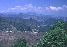
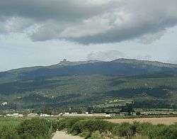
Situated east, about 50 km (31 mi) away along Mexican Federal Highway 140 is the Cofre de Perote National Park. The park covers an area of 117 km2 (29,000 acres), and consists of mainly forested mountains and hills. Its highest point of Cerro de Macuiltépetl rises 1522 metres above sea level. Other hills of prominence include the Cerro de Acalotépetl and the Cerro Colorado.
From Xalapa you can also see the Pico de Orizaba, the highest peak in Mexico (5,366m or 18,490 feet). It is also the third highest peak in North America.
Hydrographically, there are numerous streams and springs which are in the area around the city.[26] These include the rivers: Sedeño River, Carneros River, Sordo River, Santiago River, Zapotillo River, Castillo River and the Coapexpan River, 3 artificial lakes and the springs Chiltoyac, Ánimas, Xallitic, Techacapan and Tlalnecapan.[26] Jalcomulco is located 39 km (24 mi) southeast of Xalapa which has numerous natural features, such as the mouth of the Pescados River. Cascada de Texolo (Texolo Waterfall) is located 19 km (12 mi) southwest of Xalapa, in the town of Xico. It is an 80 meters (260 feet) waterfall that drops into a lush canyon, home to numerous animal species.
Geography
Climate
| Xalapa, Veracruz | ||||||||||||||||||||||||||||||||||||||||||||||||||||||||||||
|---|---|---|---|---|---|---|---|---|---|---|---|---|---|---|---|---|---|---|---|---|---|---|---|---|---|---|---|---|---|---|---|---|---|---|---|---|---|---|---|---|---|---|---|---|---|---|---|---|---|---|---|---|---|---|---|---|---|---|---|---|
| Climate chart (explanation) | ||||||||||||||||||||||||||||||||||||||||||||||||||||||||||||
| ||||||||||||||||||||||||||||||||||||||||||||||||||||||||||||
| ||||||||||||||||||||||||||||||||||||||||||||||||||||||||||||
Xalapa features a subtropical highland climate (Cfb) that borders on a humid subtropical climate (Cfa) under the Köppen climate classification. The climate in Xalapa is humid, but the city is relatively cool being located in the mountains over 1400 meters above sea level. The climate can be variable, having a maximum temperature of 37.3 °C and a minimum ranging from 0 °C to 10 °C, but on average the temperature does not fluctuate greatly all year round with an average annual temperature of 18 °C. The warmer season in Xalapa tends to fall between March and reaching a peak in May when the average high reaches 28 °C and low of 17 °C. The cooler season is late December, January and February with an average low of 11 °C and an average high of 22 °C. Travelers to Xalapa will generally find that the most comfortable weather occurs from the beginning of November to mid-April.
The average annual precipitation is 1509.1 mm.[28] During the cooler winter months rainfall is at a minimum, with Xalapa receiving only 42 millimeters in January and 38 millimetres in February on average. Snow, however, is common in winter outside the city at Perote, located around 35 minutes from Xalapa. Very early in the morning, Xalapa often has a mist, giving it a characteristic mountain atmosphere. The greatest rainfall occurs during the summer months, particularly in June, when on average rainfall reaches 328 millimeters, remaining relatively high until mid-September.
| Climate data for Xalapa (1951–2010) | |||||||||||||
|---|---|---|---|---|---|---|---|---|---|---|---|---|---|
| Month | Jan | Feb | Mar | Apr | May | Jun | Jul | Aug | Sep | Oct | Nov | Dec | Year |
| Record high °C (°F) | 32.4 (90.3) |
33.4 (92.1) |
37.4 (99.3) |
37.0 (98.6) |
38.4 (101.1) |
36.0 (96.8) |
31.5 (88.7) |
31.9 (89.4) |
32.4 (90.3) |
32.9 (91.2) |
33.0 (91.4) |
32.5 (90.5) |
38.4 (101.1) |
| Average high °C (°F) | 21.2 (70.2) |
22.5 (72.5) |
25.4 (77.7) |
27.2 (81.0) |
27.7 (81.9) |
26.3 (79.3) |
25.3 (77.5) |
26.0 (78.8) |
25.5 (77.9) |
24.3 (75.7) |
23.0 (73.4) |
21.7 (71.1) |
24.7 (76.5) |
| Daily mean °C (°F) | 15.8 (60.4) |
16.5 (61.7) |
19.2 (66.6) |
21.0 (69.8) |
21.9 (71.4) |
21.1 (70.0) |
20.3 (68.5) |
20.7 (69.3) |
20.5 (68.9) |
19.3 (66.7) |
17.7 (63.9) |
16.4 (61.5) |
19.2 (66.6) |
| Average low °C (°F) | 10.4 (50.7) |
10.5 (50.9) |
13.0 (55.4) |
14.8 (58.6) |
16.1 (61.0) |
15.9 (60.6) |
15.3 (59.5) |
15.4 (59.7) |
15.6 (60.1) |
14.3 (57.7) |
12.5 (54.5) |
11.0 (51.8) |
13.7 (56.7) |
| Record low °C (°F) | 0.2 (32.4) |
0.0 (32.0) |
2.8 (37.0) |
4.0 (39.2) |
7.0 (44.6) |
9.0 (48.2) |
9.0 (48.2) |
9.5 (49.1) |
9.8 (49.6) |
5.0 (41.0) |
−2.2 (28.0) |
0.9 (33.6) |
−2.2 (28.0) |
| Average precipitation mm (inches) | 41.2 (1.62) |
42.8 (1.69) |
44.7 (1.76) |
61.7 (2.43) |
100.7 (3.96) |
288.1 (11.34) |
219.4 (8.64) |
164.2 (6.46) |
249.6 (9.83) |
113.5 (4.47) |
64.6 (2.54) |
45.3 (1.78) |
1,435.8 (56.53) |
| Average precipitation days (≥ 0.1 mm) | 12.4 | 11.9 | 11.1 | 9.4 | 11.1 | 19.6 | 19.0 | 16.5 | 19.3 | 16.9 | 12.6 | 13.0 | 172.8 |
| Average relative humidity (%) | 67 | 63 | 63 | 60 | 63 | 68 | 67 | 66 | 69 | 69 | 67 | 68 | 66 |
| Mean monthly sunshine hours | 143 | 133 | 166 | 155 | 159 | 138 | 215 | 168 | 132 | 145 | 154 | 142 | 1,850 |
| Source 1: Servicio Meteorologico Nacional (humidity 1981–2000)[27][29] | |||||||||||||
| Source 2: Deutscher Wetterdienst (sun, 1961–1990)[30][lower-alpha 1] | |||||||||||||
Economy
Xalapa is often called the "Flower Garden of Mexico"[25] and flowers play an important role in the economy. Xalapa is one of the most important places for coffee production in Mexico due to its ideal climate, and coffee beans are grown on both small holdings and large estates in the surrounding mountains.[25] The tobacco industry also forms a part of the local economy with the process of producing cigarettes, and the growing of tropical fruits.[25] Processed foods and beverages are also produced in Xalapa.
The municipality has a total surface of 5,261,400 hectares, of which 3,457,363 hectares are seeded for agricultural production.[31] The main agricultural products in the municipality of Xalapa are maize, sugar cane, orange green chili and coffee.[31] Approximately 4,500 hectares is dedicated to cattle ranching, including the rearing of pigs, horses, and goats.[31] Bird-raising and avicultural farms have certain importance in Xalapa.[31] Warehouses and factories for making footwear, clothes, and books are also present in Xalapa. As of 2005, the municipality had 75 hotels, 223 restaurants, and 25 travel agencies.
The supermarket chain Chedraui is based in Xalapa.[31]
Employment structure in Xalapa in 2005:
| Industry sector | Typical professions | % of population |
|---|---|---|
| Primary Industry | Farming, cattle ranching, hunting and fishing | 4.21[31] |
| Secondary Industry | Petroleum Mining, extraction and natural gas, manufacturing, industry, electricity, water and construction | 19%[31] |
| Tertiary Industry | Commerce, transport and communications, financial, social and administrative services | 70%[31] |
| Unspecified | – | 2.9%[31] |
Sister cities

Books published about Xalapa
- Una excursión a Jalapa en 1875 by Guillermo Prieto
- El Libro Azul del Estado de Veracruz (1923). México, el País del Porvenir (bilingual, Spanish and English). México, Compañía Editorial Pan-Americana, S. A. Edición facsimilar de la Editora del Gobierno, 2007; reprint 2008.
- Arquilla Abierta (ca.1980) by Ana Güido de Icaza
- Xalapa de mis recuerdos (1986) by Aureliano Hernández Palacios
- Bocetos Antiguos de Xalapa (1991) by Rubén Pabello Acosta
- Trazos de una vida, bosquejos de una Ciudad. El pintor Carlos Rivera y Xalapa (2009) by Alicia Bazarte Martínez. México, Instituto Politécnico Nacional / Gobierno del Estado de Veracruz, 2009.
- Politics and Privilege in a Mexican City (Stanford University Press, 1972), by Richard Fagen and William S. Tuohy
References
- Chisholm, Hugh, ed. (1911). . Encyclopædia Britannica. 15 (11th ed.). Cambridge University Press. p. 131.
- Link to tables of population data from Census of 2005 Archived 6 April 2013 at the Wayback Machine INEGI: Instituto Nacional de Estadística, Geografía e Informática.
- (Macuilli: five, fifth; Tepetl: hill, mountain).
- Diaz, B., 1963, The Conquest of New Spain, London: Penguin Books, ISBN 0140441239
- "Xalapa:Historia". Enciclopedia de los Municipios de México. Instituto Nacional para el Federalismo y el Desarrollo Municipal. Archived from the original on 17 May 2007. Retrieved 13 October 2008.
- U.S. Grant (1990). Personal Memoirs of U.S. Grant; Selected Letters. Library of America. ISBN 0-940450-58-5.
. . . and from what I saw I would be willing to make Jalapa my home for life with only one condition [that his wife could join him].
(Letter to Julia Dent 24 April 1847) - See William K. Boone
- "Xalapa, Mexico:History". University of Texas, Austin. Archived from the original on 23 April 2008. Retrieved 14 October 2008.
- "Xalapa:Gastronomía". Enciclopedia de los Municipios de México. Instituto Nacional para el Federalismo y el Desarrollo Municipal. Archived from the original on 17 May 2007. Retrieved 13 October 2008.
- "Xalapa Sights:Parque Juárez". Lonely Planet. Archived from the original on 30 June 2012. Retrieved 14 October 2008.
- "Museo Interactivo de Xalapa". Museo Interactivo de Xalapa. October 2006. Retrieved 14 October 2008.
- "Museo Antropología". Xalapa.net. Retrieved 14 October 2008.
- "Museo del Lencero". Xalapa.net. Retrieved 14 October 2008.
- Triedo, Nicolas (February 2008). "Fin de semana en Xalapa". Guía México Desconocido. 372: 42–48.
- "Universidad Veracruzana". Universidad Veracruzana. Archived from the original on 3 August 2008. Retrieved 14 October 2008.
- "Projects funded under the Program for North American Mobility in Higher Education". Archived from the original on 20 November 2005. Retrieved 14 October 2008.
- "Xalapa:Deportes". Enciclopedia de los Municipios de México. Instituto Nacional para el Federalismo y el Desarrollo Municipal. Archived from the original on 17 May 2007. Retrieved 13 October 2008.
- "Busca tu ruta del Servicio Urbano". Sociedad Cooperativa Auto-Transportes de Camioneros del Servicio Urbano de Jalapa. Archived from the original on 27 September 2008. Retrieved 14 October 2008.
- "Secretaria de Trabajo" (PDF). Veracruz Gobierno del Estado. Archived from the original (PDF) on 21 July 2011. Retrieved 14 October 2008.
- "Interbus". Servicio Urbana Jalapa. Archived from the original on 21 November 2008. Retrieved 14 October 2008.
- "Informe del 12 al 18 de febrero de 2007". Gobierno de Mexico. 2007. Retrieved 14 October 2008.
- "Acervo Fotográfico Busexpress México". Busexpress México. October 2006. Retrieved 14 October 2008.
- "Lenecero Airport". World Aero Data. Retrieved 14 October 2008.
- "Xalapa:Salud". Enciclopedia de los Municipios de México. Instituto Nacional para el Federalismo y el Desarrollo Municipal. Archived from the original on 17 May 2007. Retrieved 13 October 2008.
- "Xalapa". Encyclopædia Britannica. Retrieved 14 October 2008.
- "Xalapa:Geografia". Enciclopedia de los Municipios de México. Instituto Nacional para el Federalismo y el Desarrollo Municipal. Archived from the original on 17 May 2007. Retrieved 13 October 2008.
- "Estado de Veracruz–Estacion: Jalapa de Enriquez (DGE)". NORMALES CLIMATOLÓGICAS 1951–2010 (in Spanish). Servicio Meteorológico National. Retrieved 7 May 2015.
- "Xalapa:Clima". Enciclopedia de los Municipios de México. Instituto Nacional para el Federalismo y el Desarrollo Municipal. Archived from the original on 17 May 2007. Retrieved 13 October 2008.
- "NORMALES CLIMATOLÓGICAS 1981–2000" (PDF) (in Spanish). Servicio Meteorológico Nacional. Retrieved 7 May 2015.
- "Station 76687 Jalapa, VER". Global station data 1961–1990—Sunshine Duration. Deutscher Wetterdienst. Retrieved 7 May 2015.
- "Xalapa:Economia". Enciclopedia de los Municipios de México. Instituto Nacional para el Federalismo y el Desarrollo Municipal. Archived from the original on 17 May 2007. Retrieved 13 October 2008.
Notes
- Station ID for Jalapa, VER. is 76539 Use this station ID to locate the sunshine duration
External links
- (in Spanish) Ayuntamiento de Xalapa Official website
- (in Spanish) La Universidad Veracruzana
| Wikimedia Commons has media related to Xalapa de Enríquez. |
|
| Authority control |
|
|---|