Santenay, Loir-et-Cher
Santenay is a commune in the Loir-et-Cher department in central France, located between Château-Renault and Blois.
Santenay | |
|---|---|
Commune | |
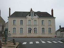 Town hall | |
Location of Santenay 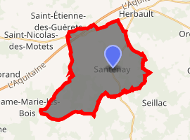
| |
 Santenay  Santenay | |
| Coordinates: 47°34′03″N 1°07′02″E | |
| Country | France |
| Region | Centre-Val de Loire |
| Department | Loir-et-Cher |
| Arrondissement | Blois |
| Canton | Onzain |
| Intercommunality | Beauce - Val de Cisse |
| Government | |
| • Mayor (2014–2020) | Élie Gilbert |
| Area 1 | 30.28 km2 (11.69 sq mi) |
| Population (2017-01-01)[1] | 290 |
| • Density | 9.6/km2 (25/sq mi) |
| Time zone | UTC+01:00 (CET) |
| • Summer (DST) | UTC+02:00 (CEST) |
| INSEE/Postal code | 41234 /41190 |
| Elevation | 94–144 m (308–472 ft) (avg. 115 m or 377 ft) |
| 1 French Land Register data, which excludes lakes, ponds, glaciers > 1 km2 (0.386 sq mi or 247 acres) and river estuaries. | |
Population
| Historical population | ||
|---|---|---|
| Year | Pop. | ±% |
| 1793 | 498 | — |
| 1806 | 588 | +18.1% |
| 1821 | 529 | −10.0% |
| 1831 | 611 | +15.5% |
| 1841 | 617 | +1.0% |
| 1851 | 643 | +4.2% |
| 1861 | 644 | +0.2% |
| 1872 | 600 | −6.8% |
| 1881 | 580 | −3.3% |
| 1891 | 657 | +13.3% |
| 1901 | 643 | −2.1% |
| 1911 | 579 | −10.0% |
| 1921 | 546 | −5.7% |
| 1931 | 475 | −13.0% |
| 1946 | 497 | +4.6% |
| 1954 | 411 | −17.3% |
| 1962 | 405 | −1.5% |
| 1968 | 360 | −11.1% |
| 1975 | 307 | −14.7% |
| 1982 | 262 | −14.7% |
| 1990 | 229 | −12.6% |
| 1999 | 254 | +10.9% |
| 2006 | 264 | +3.9% |
| 2015 | 297 | +12.5% |
See also
| Wikimedia Commons has media related to Santenay (Loir-et-Cher). |
| Authority control |
|
|---|
- "Populations légales 2017". INSEE. Retrieved 6 January 2020.
This article is issued from Wikipedia. The text is licensed under Creative Commons - Attribution - Sharealike. Additional terms may apply for the media files.