Saint-Ouen, Loir-et-Cher
Saint-Ouen is a commune in the Loir-et-Cher department in central France.
Saint-Ouen | |
|---|---|
Commune | |
.svg.png) Coat of arms | |
Location of Saint-Ouen 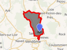
| |
 Saint-Ouen  Saint-Ouen | |
| Coordinates: 47°48′42″N 1°05′06″E | |
| Country | France |
| Region | Centre-Val de Loire |
| Department | Loir-et-Cher |
| Arrondissement | Vendôme |
| Canton | Vendôme |
| Intercommunality | Pays de Vendôme |
| Government | |
| • Mayor (2014–2020) | Jean Perroche |
| Area 1 | 11.3 km2 (4.4 sq mi) |
| Population (2017-01-01)[1] | 3,189 |
| • Density | 280/km2 (730/sq mi) |
| Time zone | UTC+01:00 (CET) |
| • Summer (DST) | UTC+02:00 (CEST) |
| INSEE/Postal code | 41226 /41100 |
| Elevation | 77–140 m (253–459 ft) (avg. 81 m or 266 ft) |
| 1 French Land Register data, which excludes lakes, ponds, glaciers > 1 km2 (0.386 sq mi or 247 acres) and river estuaries. | |
Geography
Saint-Ouen is situated on the left bank of the Loir. The town of Saint-Ouen is bisected by the RN10, a highway that runs between Paris and Bordeaux.
Population
| Historical population | ||
|---|---|---|
| Year | Pop. | ±% |
| 1793 | 307 | — |
| 1806 | 310 | +1.0% |
| 1821 | 347 | +11.9% |
| 1831 | 386 | +11.2% |
| 1841 | 413 | +7.0% |
| 1851 | 394 | −4.6% |
| 1861 | 526 | +33.5% |
| 1872 | 508 | −3.4% |
| 1881 | 620 | +22.0% |
| 1891 | 597 | −3.7% |
| 1901 | 624 | +4.5% |
| 1911 | 647 | +3.7% |
| 1921 | 640 | −1.1% |
| 1931 | 843 | +31.7% |
| 1946 | 1,012 | +20.0% |
| 1954 | 1,120 | +10.7% |
| 1962 | 1,248 | +11.4% |
| 1968 | 1,368 | +9.6% |
| 1975 | 1,880 | +37.4% |
| 1982 | 2,359 | +25.5% |
| 1990 | 2,958 | +25.4% |
| 1999 | 3,050 | +3.1% |
| 2006 | 3,363 | +10.3% |
| 2015 | 3,286 | −2.3% |
References
- "Populations légales 2017". INSEE. Retrieved 6 January 2020.
| Wikimedia Commons has media related to Saint-Ouen (Loir-et-Cher). |
| Authority control |
|
|---|
This article is issued from Wikipedia. The text is licensed under Creative Commons - Attribution - Sharealike. Additional terms may apply for the media files.