Saint-Lubin-en-Vergonnois
Saint-Lubin-en-Vergonnois is a commune in the Loir-et-Cher department of central France.
Saint-Lubin-en-Vergonnois | |
|---|---|
Commune | |
.svg.png) Coat of arms | |
Location of Saint-Lubin-en-Vergonnois 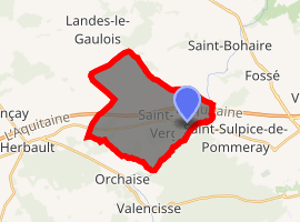
| |
 Saint-Lubin-en-Vergonnois  Saint-Lubin-en-Vergonnois | |
| Coordinates: 47°36′50″N 1°14′19″E | |
| Country | France |
| Region | Centre-Val de Loire |
| Department | Loir-et-Cher |
| Arrondissement | Blois |
| Canton | Onzain |
| Intercommunality | Blois |
| Government | |
| • Mayor (2014–2020) | Didier Pigoreau |
| Area 1 | 17.06 km2 (6.59 sq mi) |
| Population (2017-01-01)[1] | 718 |
| • Density | 42/km2 (110/sq mi) |
| Time zone | UTC+01:00 (CET) |
| • Summer (DST) | UTC+02:00 (CEST) |
| INSEE/Postal code | 41223 /41190 |
| Elevation | 80–132 m (262–433 ft) (avg. 87 m or 285 ft) |
| 1 French Land Register data, which excludes lakes, ponds, glaciers > 1 km2 (0.386 sq mi or 247 acres) and river estuaries. | |
Population
| Historical population | ||
|---|---|---|
| Year | Pop. | ±% |
| 1793 | 446 | — |
| 1806 | 421 | −5.6% |
| 1821 | 399 | −5.2% |
| 1831 | 434 | +8.8% |
| 1841 | 456 | +5.1% |
| 1851 | 548 | +20.2% |
| 1861 | 586 | +6.9% |
| 1872 | 553 | −5.6% |
| 1881 | 533 | −3.6% |
| 1891 | 564 | +5.8% |
| 1901 | 539 | −4.4% |
| 1911 | 529 | −1.9% |
| 1921 | 464 | −12.3% |
| 1931 | 468 | +0.9% |
| 1946 | 509 | +8.8% |
| 1954 | 449 | −11.8% |
| 1962 | 472 | +5.1% |
| 1968 | 450 | −4.7% |
| 1975 | 518 | +15.1% |
| 1982 | 515 | −0.6% |
| 1990 | 804 | +56.1% |
| 1999 | 743 | −7.6% |
| 2006 | 698 | −6.1% |
| 2015 | 791 | +13.3% |
References
- "Populations légales 2017". INSEE. Retrieved 6 January 2020.
| Wikimedia Commons has media related to Saint-Lubin-en-Vergonnois. |
| Authority control |
|
|---|
This article is issued from Wikipedia. The text is licensed under Creative Commons - Attribution - Sharealike. Additional terms may apply for the media files.