Saint-Cyr-du-Gault
Saint-Cyr-du-Gault is a commune in the Loir-et-Cher department of central France.
Saint-Cyr-du-Gault | |
|---|---|
Commune | |
Location of Saint-Cyr-du-Gault 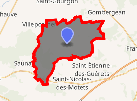
| |
 Saint-Cyr-du-Gault  Saint-Cyr-du-Gault | |
| Coordinates: 47°37′18″N 1°01′50″E | |
| Country | France |
| Region | Centre-Val de Loire |
| Department | Loir-et-Cher |
| Arrondissement | Blois |
| Canton | Onzain |
| Intercommunality | Beauce–Val de Cisse |
| Government | |
| • Mayor (2014–2020) | Michel Fesneau |
| Area 1 | 26.06 km2 (10.06 sq mi) |
| Population (2017-01-01)[1] | 174 |
| • Density | 6.7/km2 (17/sq mi) |
| Time zone | UTC+01:00 (CET) |
| • Summer (DST) | UTC+02:00 (CEST) |
| INSEE/Postal code | 41205 /41190 |
| Elevation | 108–149 m (354–489 ft) (avg. 120 m or 390 ft) |
| 1 French Land Register data, which excludes lakes, ponds, glaciers > 1 km2 (0.386 sq mi or 247 acres) and river estuaries. | |
Population
| Historical population | ||
|---|---|---|
| Year | Pop. | ±% |
| 1793 | 555 | — |
| 1806 | 579 | +4.3% |
| 1821 | 608 | +5.0% |
| 1831 | 573 | −5.8% |
| 1841 | 536 | −6.5% |
| 1851 | 549 | +2.4% |
| 1861 | 604 | +10.0% |
| 1872 | 527 | −12.7% |
| 1881 | 497 | −5.7% |
| 1891 | 553 | +11.3% |
| 1901 | 514 | −7.1% |
| 1911 | 529 | +2.9% |
| 1921 | 428 | −19.1% |
| 1931 | 423 | −1.2% |
| 1946 | 431 | +1.9% |
| 1954 | 361 | −16.2% |
| 1961 | 341 | −5.5% |
| 1968 | 314 | −7.9% |
| 1975 | 275 | −12.4% |
| 1982 | 247 | −10.2% |
| 1990 | 208 | −15.8% |
| 1999 | 195 | −6.2% |
| 2006 | 184 | −5.6% |
| 2015 | 176 | −4.3% |
References
- "Populations légales 2017". INSEE. Retrieved 6 January 2020.
| Wikimedia Commons has media related to Saint-Cyr-du-Gault. |
| Authority control |
|
|---|
This article is issued from Wikipedia. The text is licensed under Creative Commons - Attribution - Sharealike. Additional terms may apply for the media files.