Mont-près-Chambord
Mont-près-Chambord is a commune in the Loir-et-Cher department of central France.
Mont-près-Chambord | |
|---|---|
.svg.png) Coat of arms | |
Location of Mont-près-Chambord 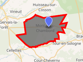
| |
 Mont-près-Chambord  Mont-près-Chambord | |
| Coordinates: 47°33′49″N 1°27′47″E | |
| Country | France |
| Region | Centre-Val de Loire |
| Department | Loir-et-Cher |
| Arrondissement | Blois |
| Canton | Chambord |
| Intercommunality | Pays de Chambord |
| Government | |
| • Mayor (2014–2020) | Gilles Clément |
| Area 1 | 28.51 km2 (11.01 sq mi) |
| Population (2017-01-01)[1] | 3,297 |
| • Density | 120/km2 (300/sq mi) |
| Time zone | UTC+01:00 (CET) |
| • Summer (DST) | UTC+02:00 (CEST) |
| INSEE/Postal code | 41150 /41250 |
| Elevation | 72–123 m (236–404 ft) (avg. 94 m or 308 ft) |
| 1 French Land Register data, which excludes lakes, ponds, glaciers > 1 km2 (0.386 sq mi or 247 acres) and river estuaries. | |
Population
| Historical population | ||
|---|---|---|
| Year | Pop. | ±% |
| 1793 | 1,230 | — |
| 1806 | 1,246 | +1.3% |
| 1821 | 1,243 | −0.2% |
| 1831 | 1,235 | −0.6% |
| 1841 | 1,422 | +15.1% |
| 1851 | 1,565 | +10.1% |
| 1861 | 1,538 | −1.7% |
| 1872 | 1,658 | +7.8% |
| 1881 | 1,633 | −1.5% |
| 1891 | 1,557 | −4.7% |
| 1901 | 1,422 | −8.7% |
| 1911 | 1,385 | −2.6% |
| 1921 | 1,218 | −12.1% |
| 1931 | 1,320 | +8.4% |
| 1946 | 1,196 | −9.4% |
| 1954 | 1,250 | +4.5% |
| 1962 | 1,249 | −0.1% |
| 1968 | 1,261 | +1.0% |
| 1975 | 1,643 | +30.3% |
| 1982 | 2,413 | +46.9% |
| 1990 | 2,786 | +15.5% |
| 1999 | 3,025 | +8.6% |
| 2007 | 3,242 | +7.2% |
| 2014 | 3,216 | −0.8% |
References
- "Populations légales 2017". INSEE. Retrieved 6 January 2020.
| Wikimedia Commons has media related to Mont-près-Chambord. |
| Authority control |
|
|---|
This article is issued from Wikipedia. The text is licensed under Creative Commons - Attribution - Sharealike. Additional terms may apply for the media files.