Puerto Rico Highway 3
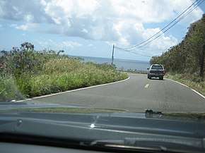
Puerto Rico Highway 3 (PR-3) at nearly 100 miles long,[1][2] is the second longest highway on Puerto Rico (after PR-2). It connects the San Juan neighborhood of Río Piedras to downtown Salinas indirectly around the eastern coast of the island.[3] Highway 3 ranges from a three lane urban avenue in San Juan to a one lane rural road past Fajardo. While other roads connect San Juan, it runs the coastline of Puerto Rico east of San Juan, beginning in Río Piedras near Santurce (where it is known as the Avenida 65 de Infantería) and goes to Fajardo where it goes south paralleling the coastline to Humacao and Maunabo. It goes up to a mountain-scenic route and goes west to Salinas, where it meets PR-1.[4][5]

| ||||
|---|---|---|---|---|
 | ||||
| Route information | ||||
| Maintained by Puerto Rico DTPW | ||||
| Length | 160.7 km[1][2] (99.9 mi) | |||
| Major junctions | ||||
| From | ||||
| ||||
| To | ||||
| Location | ||||
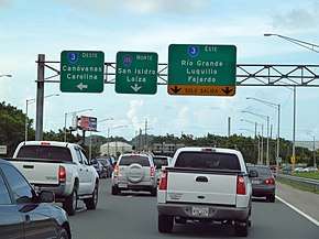
| Municipalities | Salinas, Guayama, Arroyo, Patillas, Maunabo, Yabucoa, Humacao, Naguabo, Ceiba, Fajardo, Luquillo, Río Grande, Canóvanas, Carolina, San Juan | |||
| Highway system | ||||
| ||||


Route description
San Juan to Río Grande
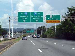
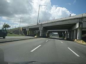
PR-3 begins at an intersection with PR-1 in San Juan as the three lane 65th Infantry Regiment Avenue. Heading east through San Juan, Highway 3 functions as an urban boulevard with both at-grade and grade-separated intersections becoming decidedly suburban in character past the PR-26/66 overpass near downtown Carolina. Recently, PR-66 was opened and it has controlled the high traffic on PR-3.
Río Grande to Fajardo
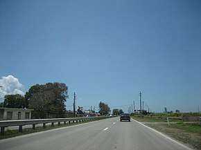
It is a divided highway to Fajardo, and the only main highway connecting Fajardo to Río Grande. In Fajardo, PR-53 begins and PR-3 becomes a one-lane per direction rural road, and keeps that way for the rest of its length, though there are some minor divided segments in Humacao near Junquito, a very small segment near Patagonia (close to its intersection with PR-30) and another segment in Arroyo and Guayama for about nearly 10 kilometers.
Puerto Rico Highway 53
Just like PR-22 parallels PR-2 and PR-52 parallels PR-1, PR-53 is the toll highway which parallels PR-3 and they have several exit intersections. Yet, PR-53 has not been completed and PR-3 serves as the main road in the southeastern part of Puerto Rico going from Yabucoa to Guayama, though PR-901 serves as a primary road (because it is shorter through it) between Yabucoa and Maunabo.
Municipalities in Puerto Rico
The following are the municipalities through which PR-3 passes:
Loíza is the only coastal municipality not served by PR-3 in its length through the east shore until its intersection with PR-1 in Salinas. PR-188 serves as the main artery from the highway to Loiza. The remaining coasts of Puerto Rico (west of San Juan and west of Salinas) are served by PR-1 (West Salinas, Santa Isabel, Juana Diaz and East Ponce) and PR-2 (the rest of the coastline though some municipalities are not directly served). In Maunabo and south Yabucoa, PR-3 is not the main "at-grade" artery since it goes up in the mountains. PR-901 is the main at grade road in this segment of about 10 kilometers.
Major intersections
| Municipality | Location | km[1][2] | mi | Exit | Destinations | Notes |
|---|---|---|---|---|---|---|
| Salinas | Salinas barrio-pueblo | 160.7 | 99.9 | Counterclockwise terminus of PR-3; northbound access via Calle Palmer | ||
| Aguirre | 159.7 | 99.2 | ||||
| Guayama | Guayama barrio-pueblo | 140.3 | 87.2 | |||
| 139.0 | 86.4 | One-way street; northbound access via Calle Ashford | ||||
| 138.0 | 85.7 | |||||
| Algarrobo | 135.3– 135.2 | 84.1– 84.0 | ||||
| Arroyo | Guásimas | 133.4 | 82.9 | |||
| Arroyo barrio-pueblo–Pitahaya– Palmas tripoint | 132.2 | 82.1 | ||||
| Palmas | 129.0 | 80.2 | ||||
| Patillas | Cacao Bajo | 127.0– 126.9 | 78.9– 78.9 | |||
| Patillas barrio-pueblo | 125.5 | 78.0 | One-way street | |||
| Pollos | 122.4 | 76.1 | ||||
| Maunabo | Talante–Emajagua– Maunabo barrio-pueblo tripoint | 108.0 | 67.1 | |||
| Maunabo barrio-pueblo–Talante– Quebrada Arenas tripoint | 106.9 | 66.4 | The Ruta Panorámica continues toward Yabucoa via Emajagua–Camino Nuevo | |||
| Yabucoa | Juan Martín | 99.0 | 61.5 | The Ruta Panorámica continues toward San Lorenzo | ||
| 97.8– 97.7 | 60.8– 60.7 | |||||
| Humacao | Candelero Arriba–Candelero Abajo– Buena Vista tripoint | 86.3 | 53.6 | PR-53 exits 35 and 35A | ||
| Humacao barrio-pueblo | 82.3 | 51.1 | ||||
| 81.7 | 50.8 | One-way street | ||||
| 80.9 | 50.3 | |||||
| Río Abajo | 80.5 | 50.0 | ||||
| 79.4– 79.3 | 49.3– 49.3 | PR-53 exit 31; partial cloverleaf interchange | ||||
| Naguabo | Río Santiago | 69.0 | 42.9 | Puente No. 122[6] | ||
| Húcares | 68.2 | 42.4 | ||||
| Mariana | 63.9– 63.8 | 39.7– 39.6 | ||||
| Ceiba | Quebrada Seca | 59.6– 59.5 | 37.0– 37.0 | PR-53 exit 10; diamond interchange | ||
| Fajardo | Quebrada Vueltas | 48.0 | 29.8 | Roundabout | ||
| 47.9 | 29.8 | |||||
| Fajardo barrio-pueblo | 46.4 | 28.8 | — | Diamond interchange | ||
| Quebrada Fajardo | 43.7 | 27.2 | ||||
| Luquillo | Luquillo barrio-pueblo | 38.1 | 23.7 | — | Diamond interchange | |
| Mata de Plátano | 36.0 | 22.4 | — | Diamond interchange | ||
| Río Grande | Mameyes II | 31.4 | 19.5 | |||
| Guzmán Abajo | 25.7– 25.6 | 16.0– 15.9 | ||||
| 25.1 | 15.6 | 25 | ||||
| Ciénaga Baja | 24.2– 24.1 | 15.0– 15.0 | ||||
| Canóvanas | Canóvanas | 18.9 | 11.7 | PR-66 exit 14 | ||
| Canóvanas barrio-pueblo | 17.3 | 10.7 | — | Partial cloverleaf interchange | ||
| Carolina | Río Grande de Loíza | 11.8– 11.6 | 7.3– 7.2 | Puente Julia de Burgos | ||
| Martín González | 10.5 | 6.5 | ||||
| San Antón | 8.4 | 5.2 | — | |||
| 7.9– 7.8 | 4.9– 4.8 | |||||
| San Juan | Sabana Llana Sur–Sabana Llana Norte line | 6.3 | 3.9 | — | Partial cloverleaf interchange | |
| 3.3 | 2.1 | |||||
| Sabana Llana Sur | 2.5 | 1.6 | Diamond interchange | |||
| Sabana Llana Sur–Pueblo line | 1.3 | 0.81 | ||||
| Pueblo–Hato Rey Sur line | 0.2 | 0.12 | — | |||
| Hato Rey Sur | 0.0 | 0.0 | — | Clockwise terminus of PR-3 | ||
1.000 mi = 1.609 km; 1.000 km = 0.621 mi
| ||||||
Related route
| |
|---|---|
| Location | Humacao |
| Length | 1.4 km[7] (0.87 mi) |
Puerto Rico Highway 3R (Spanish: Carretera Ramal 3, abbreviated Ramal PR-3 or PR-3R) is a bypass near downtown Humacao, Puerto Rico. This road is part of Nicanor Vázquez Boulevard.[8] The entire route is located in Humacao barrio-pueblo, Humacao.
| km[7] | mi | Destinations | Notes | ||
|---|---|---|---|---|---|
| 1.4 | 0.87 | Western terminus of Ramal PR-3 | |||
| 0.0 | 0.0 | Eastern terminus of Ramal PR-3 | |||
| 1.000 mi = 1.609 km; 1.000 km = 0.621 mi | |||||
See also
- Interstate Highways in Puerto Rico
- List of highways in Puerto Rico
- List of highways numbered 3
- Ruta Panorámica
References
- Google (29 March 2020). "PR-3 north" (Map). Google Maps. Google. Retrieved 29 March 2020.
- Google (29 March 2020). "PR-3 south" (Map). Google Maps. Google. Retrieved 29 March 2020.
- Puerto Rico Department of Transportation and Public Works. "Datos de Transito 2000-2009" (in Spanish). Retrieved 23 April 2019.
- Federal Highway Administration. National Highway System - Fajardo Map (PDF) (Map). Federal Highway Administration. Retrieved 21 February 2019.
- Federal Highway Administration. National Highway System - Puerto Rico Map (PDF) (Map). Federal Highway Administration. Retrieved 21 February 2019.
- Luis F. Pumarada O’Neill (1991). "Los Puentes Históricos de Puerto Rico" (PDF) (in Spanish). p. 135-136. Retrieved 29 March 2020.
- Google (28 February 2020). "PR-3R" (Map). Google Maps. Google. Retrieved 28 February 2020.
- National Geographic Maps (2011). Puerto Rico (Map). 1:125,000. Adventure Map. Evergreen, CO: National Geographic Maps. ISBN 978-1566955188. OCLC 756511572.
External links
![]()