Pocatello, Idaho
Pocatello (/ˈpoʊkəˈtɛloʊ/ (![]()
Pocatello, Idaho | |
|---|---|
| City of Pocatello | |
 Flag Logo | |
| Nickname(s): "U.S. Smile Capital", "The Gate City" | |
| Motto(s): "Gateway to the Northwest" | |
 Location of Pocatello in Bannock County and Power County, Idaho. | |
 Pocatello, Idaho Location in the United States | |
| Coordinates: 42°52′31″N 112°26′50″W | |
| Country | United States |
| State | Idaho |
| Counties | Bannock, Power |
| Established | 1889 |
| Government | |
| • Mayor | Brian Blad (R) |
| Area | |
| • City | 32.67 sq mi (84.6 km2) |
| • Land | 32.51 sq mi (84.2 km2) |
| • Water | 0.16 sq mi (0.4 km2) |
| Elevation | 4,462 ft (1,360 m) |
| Population | |
| • City | 54,255 |
| • Estimate (2019)[3] | 56,637 |
| • Density | 1,700/sq mi (640/km2) |
| • Metro | 90,656 |
| Time zone | UTC−7 (Mountain Standard Time (MST)) |
| • Summer (DST) | UTC−6 (Mountain Daylight Time (MDT)) |
| ZIP Code | 83201 |
| Area code(s) | 208, 986 |
| FIPS code | 16-64090 |
| GNIS feature ID | 0397053 |
| Website | www |
Pocatello is the fifth-largest city in the state, just behind Idaho Falls (population of 56,813). In 2007, Pocatello was ranked twentieth on Forbes list of Best Small Places for Business and Careers.[6] Pocatello is the home of Idaho State University and the manufacturing facility of ON Semiconductor. The city is at an elevation of 4,462 feet (1,360 m) above sea level and is served by the Pocatello Regional Airport.
History
Indigenous tribes
Shoshone and Bannock Indian tribes inhabited southeastern Idaho for hundreds of years before the trek by Lewis and Clark across Idaho in 1805. Their reports of the many riches of the region attracted fur trappers and traders to southeastern Idaho. The city is named after Chief Pocatello, a 19th-century Shoshone leader.
Permanent settlements
.jpg)
Nathaniel Wyeth of Massachusetts established one of the first permanent settlements at Fort Hall in 1834, which is only a few miles northeast of Pocatello. When over-trapping and a shift in fashion to silk hats put an end to the fur trade, Fort Hall became a supply point for immigrants traveling the Oregon Trail.
Although thousands of immigrants passed through Idaho, it was not until the discovery of gold in 1860 that Idaho attracted settlers in large numbers. The gold rush brought a need for goods and services to many towns, and the Portneuf Valley, home of Pocatello, was the corridor initially used by stage and freight lines. The coming of the railroad provided further development of Idaho's mineral resources and "Pocatello junction" became an important transportation crossroads as the Union Pacific Railroad expanded its service.
Gateway to the Northwest
After its founding in 1889, Pocatello became known as the "Gateway to the Northwest". As pioneers, gold miners and settlers traveled the Oregon Trail, they passed through the Portneuf Gap south of town. Stage and freight lines and the railroad soon followed, turning the community into a trade center and transportation junction.
Gold rush and agriculture
After the gold rush played out, the settlers who remained turned to agriculture. With the help of irrigation from the nearby Snake River, the region became a large supplier of potatoes, grain and other crops. Residential and commercial development gradually appeared by 1882.

Alameda consolidation
The adjacent city of Alameda was consolidated into Pocatello in 1962,[7][8] Chubbuck, further north, opposed a similar merger and remained a separate municipality.[8] In the 1960 census, Alameda had a population of 10,660 and Pocatello was at 28,534; the consolidation made Pocatello the state's largest city based on those numbers, passing Boise and Idaho Falls.[7][8]
Flag
The Pocatello flag used from 2001 to 2017 was considered by the North American Vexillological Association as the worst city flag in North America.[9] In April 2016, the city's newly created flag design committee met for the first time. Attending the meeting was Roman Mars – whose 2015 TED Talk made Pocatello's flag infamous.[10] On July 20, 2017, after a year and a half of work by the flag committee, the Pocatello City Council approved the adoption of a new flag with the informal name of "Mountains Left" out of a total of 709 designs.[11][12][13]
Geography
According to the United States Census Bureau, the city has a total area of 32.38 square miles (83.86 km2), of which 32.22 square miles (83.45 km2) is land and 0.16 square miles (0.41 km2) is water.[14]
A main water feature of Pocatello is the Portneuf River, which runs through the southeast side of the city. Since 1992, the city and the Portneuf Greenway Foundation have worked to create a system of trails that follow the river and connect to other trails in the greater Portneuf Valley. Currently, 15+ miles of trails have been constructed with 27 planned total miles.
Climate
Pocatello experiences a warm-summer humid continental climate (Köppen Dfb),[15] with winters that are moderately long and cold, and warm, dry summers.
| Climate data for Pocatello Regional Airport, Idaho (1981–2010 normals, extremes 1939–present) | |||||||||||||
|---|---|---|---|---|---|---|---|---|---|---|---|---|---|
| Month | Jan | Feb | Mar | Apr | May | Jun | Jul | Aug | Sep | Oct | Nov | Dec | Year |
| Record high °F (°C) | 60 (16) |
65 (18) |
75 (24) |
86 (30) |
97 (36) |
103 (39) |
104 (40) |
104 (40) |
98 (37) |
91 (33) |
75 (24) |
64 (18) |
104 (40) |
| Average high °F (°C) | 32.6 (0.3) |
37.5 (3.1) |
48.8 (9.3) |
58.3 (14.6) |
67.8 (19.9) |
77.8 (25.4) |
87.8 (31.0) |
87.1 (30.6) |
75.8 (24.3) |
61.0 (16.1) |
44.5 (6.9) |
32.8 (0.4) |
59.4 (15.2) |
| Average low °F (°C) | 16.0 (−8.9) |
19.2 (−7.1) |
27.1 (−2.7) |
32.9 (0.5) |
39.7 (4.3) |
46.5 (8.1) |
52.0 (11.1) |
50.7 (10.4) |
42.1 (5.6) |
33.0 (0.6) |
24.1 (−4.4) |
16.1 (−8.8) |
33.3 (0.7) |
| Record low °F (°C) | −31 (−35) |
−33 (−36) |
−12 (−24) |
12 (−11) |
20 (−7) |
28 (−2) |
34 (1) |
30 (−1) |
19 (−7) |
−6 (−21) |
−14 (−26) |
−29 (−34) |
−33 (−36) |
| Average precipitation inches (mm) | 0.99 (25) |
0.97 (25) |
1.26 (32) |
1.15 (29) |
1.46 (37) |
0.99 (25) |
0.64 (16) |
0.61 (15) |
0.84 (21) |
0.87 (22) |
1.11 (28) |
1.24 (31) |
12.13 (308) |
| Average snowfall inches (cm) | 8.8 (22) |
7.1 (18) |
5.4 (14) |
3.2 (8.1) |
0.8 (2.0) |
trace | 0.0 (0.0) |
0.0 (0.0) |
0.1 (0.25) |
1.6 (4.1) |
5.7 (14) |
10.7 (27) |
43.4 (110) |
| Average precipitation days (≥ 0.01 in) | 11.4 | 9.8 | 9.7 | 9.0 | 9.5 | 6.6 | 4.4 | 4.5 | 4.9 | 6.2 | 9.3 | 11.3 | 96.6 |
| Average snowy days (≥ 0.1 in) | 9.9 | 7.2 | 5.1 | 2.9 | 0.7 | 0.0 | 0.0 | 0.0 | 0.1 | 1.0 | 5.3 | 10.0 | 42.2 |
| Average relative humidity (%) | 75.2 | 72.3 | 65.0 | 53.8 | 51.8 | 49.2 | 41.3 | 40.4 | 46.7 | 54.5 | 68.8 | 75.3 | 57.9 |
| Mean monthly sunshine hours | 123.6 | 159.9 | 231.1 | 261.7 | 304.6 | 337.8 | 382.7 | 346.0 | 292.7 | 240.8 | 130.6 | 113.3 | 2,924.8 |
| Percent possible sunshine | 42 | 54 | 62 | 65 | 67 | 74 | 82 | 80 | 78 | 70 | 45 | 40 | 66 |
| Source: NOAA (sun and relative humidity 1961–1990)[16][17][18] | |||||||||||||
Demographics
| Historical population | |||
|---|---|---|---|
| Census | Pop. | %± | |
| 1900 | 4,046 | — | |
| 1910 | 9,110 | 125.2% | |
| 1920 | 15,001 | 64.7% | |
| 1930 | 16,471 | 9.8% | |
| 1940 | 18,133 | 10.1% | |
| 1950 | 26,131 | 44.1% | |
| 1960 | 26,534 | 1.5% | |
| 1970 | 40,036 | 50.9% | |
| 1980 | 46,340 | 15.7% | |
| 1990 | 46,080 | −0.6% | |
| 2000 | 51,466 | 11.7% | |
| 2010 | 54,255 | 5.4% | |
| Est. 2019 | 56,637 | [3] | 4.4% |
| U.S. Decennial Census[19] Alameda annexed in 1962.[7][8] | |||
2010 census
As of the census[2] of 2010, there were 54,255 people, 20,832 households, and 13,253 families living in the city. The population density was 1,683.9 inhabitants per square mile (650.2/km2). There were 22,404 housing units at an average density of 695.3 per square mile (268.5/km2). The racial makeup of the city was 90.5% White, 1.0% African American, 1.7% Native American, 1.6% Asian, 0.2% Pacific Islander, 2.3% from other races, and 2.8% from two or more races. Hispanic or Latino of any race were 7.2% of the population.
There were 20,832 households, of which 33.6% had children under the age of 18 living with them, 47.2% were married couples living together, 11.3% had a female householder with no husband present, 5.2% had a male householder with no wife present, and 36.4% were non-families. 27.5% of all households were made up of individuals, and 8.2% had someone living alone who was 65 years of age or older. The average household size was 2.53 and the average family size was 3.10.
The median age in the city is 30.2 years. 25.8% of residents were under the age of 18; 14.5% were between the ages of 18 and 24; 27.4% were from 25 to 44; 21.8% were from 45 to 64; and 10.7% were 65 years of age or older. The gender makeup of the city was 49.9% male and 50.1% female.
2000 census
As of the census[20] of 2000, there were 51,466 people, 19,334 households, and 12,973 families living in the city. The population density was 1,822.5 people per square mile (703.7/km2). There were 20,627 housing units at an average density of 730.4 per square mile (282.0/km2). The racial makeup of the city was 92.32% White, 0.72% African American, 1.35% Native American, 1.15% Asian, 0.20% Pacific Islander, 2.18% from other races, and 2.09% from two or more races. Hispanic or Latino of any race were 4.94% of the population. The top 5 ethnic groups in Pocatello are: English – 21%,[21] German – 16%, Irish – 9%, Danish – 4% and Swedish – 4%.
There were 19,334 households, out of which 34.5% had children under the age of 18 living with them, 52.6% were married couples living together, 10.5% had a female householder with no husband present, and 32.9% were non-families. 25.0% of all households were made up of individuals, and 7.8% had someone living alone who was 65 years of age or older. The average household size was 2.58 and the average family size was 3.10.
In the city, the population was spread out, with 26.6% under the age of 18, 16.7% from 18 to 24, 27.4% from 25 to 44, 18.9% from 45 to 64, and 10.4% who were 65 years of age or older. The median age was 29 years. For every 100 females, there were 96.9 males. For every 100 females age 18 and over, there were 93.3 males.
The median income for a household in the city was $34,326, and the median income for a family was $41,884. Males had a median income of $33,984 versus $22,962 for females. The per capita income for the city was $17,425. About 10.7% of families and 15.4% of the population were below the poverty line, including 16.9% of those under age 18 and 7.8% of those age 65 or over.
Religion
The religious affiliation is as follows:
- 55.4% Latter-day Saint
- 16.1% Catholic
- 26.5% Other (inc. Lutheran, Southern Baptist, United Methodist etc.)
Economy
.jpg)
Idaho Department of Correction operates the Pocatello Women's Correctional Center (PWCC) in Pocatello.[22]
The United States Postal Service operates the Pocatello,[23] Bannock,[24] and Gateway Station post offices.[25]
The Federal Bureau of Investigations is building a data center in Pocatello as part of an initiative to consolidate operations into three enterprise data centers.[26]
Top employers
According to Pocatello's 2014 Comprehensive Annual Financial Report,[27] the top employers in the city are:
| # | Employer | # of Employees |
|---|---|---|
| 1 | Idaho State University | 3,811 |
| 2 | Pocatello School District #25 | 1,716 |
| 3 | Portneuf Medical Center | 1,294 |
| 4 | ON Semiconductor | 700 |
| 5 | City of Pocatello | 654 |
| 6 | Concentrix | 564 |
| 7 | Allstate Insurance | 500 |
| 8 | Union Pacific Railroad | 470 |
| 9 | Bannock County | 410 |
Sports
Pocatello is home to Holt Arena, a multipurpose indoor stadium that opened in 1970 on the ISU campus. Known as the "Minidome" until 1988, Holt Arena was the home of the Real Dairy Bowl, a junior college football Bowl game. Holt Arena also plays host to the Simplot Games, the nation's largest indoor high school track-and-field meet.
The Pocatello Marathon and Half Marathon are held annually. Times from the course may be used to qualify for the Boston and New York marathons.[28]
Outdoor sports, both winter and summer, play an important role in the culture of Pocatello. Pebble Creek, Idaho is a ski resort located just south of Pocatello and offers skiing and snowboarding.[29]
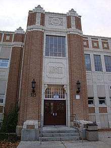
Education

from Red Hill on the ISU campus
Primary and secondary education
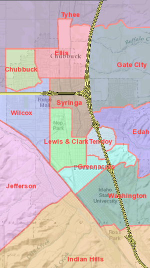
Pocatello is served by the Pocatello/Chubbuck School District#25. The district is home to three public high schools. Feeding the high schools are four public middle schools, thirteen public elementary schools, two public charter schools, and various alternative and church-based private schools and academies.
Middle schools
- Alameda Middle School
- Franklin Middle School
- Hawthorne Middle School
- Irving Middle School
Elementary schools
- Chubbuck Elementary School
- Edahow Elementary School
- Ellis Elementary School
- Gate City Elementary School
- Greenacres Elementary School
- Indian Hills Elementary School
- Jefferson Elementary School
- Lewis & Clark Elementary School
- Syringa Elementary School
- Tendoy Elementary School
- Tyhee Elementary School
- Washington Elementary School
- Wilcox Elementary School
Higher education
Idaho State University (ISU) is a public university operated by the state of Idaho. Originally an auxiliary campus of the University of Idaho and then a state college, it became the second university in the state in 1963. The ISU campus is in Pocatello, with outreach programs in Coeur d'Alene, Idaho Falls, Boise, and Twin Falls. The university's 123,000-square-foot (11,400 m2) L.E. and Thelma E. Stephens Performing Arts Center occupies a prominent location overlooking Pocatello and the lower Portneuf River Valley. The center's three venues provide performance space, including the Joseph C. and Cheryl H. Jensen Grand Concert Hall. Idaho State's athletics teams compete in the Big Sky Conference, the football and basketball teams play in Holt Arena.
Infrastructure
Transportation
Commercial air service is available via Pocatello Regional Airport. Pocatello Regional Transit provides bus service on five hourly routes, Monday through Saturday. There is currently no evening or weekend service.
Notable people
- Don Aslett, entrepreneur and founder of the town's Museum of Clean
- Jessica E. Jones, Grammy Award winning opera singer, The (R)evolution of Steve Jobs, Santa Fe Opera. https://en.m.wikipedia.org/wiki/The_(R)evolution_of_Steve_Jobs
- Billie Bird (1908–2002), comedian and actress
- Greg Byrne, athletic director at University of Alabama
- Shay Carl, vlogger, one of the original founders of Maker Studios, which was sold to Walt Disney Co. in 2014.[30]
- Gloria Dickson, actress
- Jan Broberg Felt, actress
- George V. Hansen, politician
- Taysom Hill, Special-Teamer and Backup Quarterback for the New Orleans Saints
- Merril Hoge, analyst for ESPN, NFL running back
- Bryan Johnson, NFL football player
- James Edmund Johnson, Medal of Honor recipient, posthumously, for valor in combat in the Korean War[31]
- Dirk Koetter, offensive coordinator for the Atlanta Falcons
- Wendy J. Olson, U.S. Attorney for the District of Idaho
- C. Ben Ross, Mayor of Pocatello and 15th Governor of Idaho
- Bill Salkeld, Major League Baseball catcher
- Richard G. Scott, member of the Quorum of the 12 Apostles, The Church of Jesus Christ of Latter-Day Saints[32]
- Neil L. Andersen, member of the Quorum of the 12 Apostles, The Church of Jesus Christ of Latter-Day Saints [33]
- Edward Stevenson, costume designer for numerous films including Citizen Kane and It's a Wonderful Life
- Celeste West, librarian and lesbian author, born Pocatello 1942[34]
- Jack Williams, Boston news anchor
- Benedicte Wrensted, photographer lived in Pocatello from 1895 to 1912[35]
In popular culture
- The Great Food Truck Race Season 4, Episode 3, "Potatoes in Pocatello". Pocatello, Idaho is the location of episode 3 food truck race challenge. Much of the city is shown, as well as the local foot traffic.[36]
- Judy Garland sings about being "born in a trunk at the Princess Theatre in Pocatello, Idaho" as Esther Blodgett in the film A Star is Born.
- The documentary Abducted in Plain Sight takes place in Pocatello
Rankings and recognition
Pocatello has been recognized by Forbes as a "Best Small Place for Business" 6 years in a row. Most recently Pocatello was ranked 2nd on Forbes Cost of Doing Business index. In addition, Pocatello has been ranked one of the top 10 small places to move and raise a family according to Primary Relocation and World ERC. Pocatello has also been ranked by the AARP as one of the top cities in the U.S. to retire and one of the Best Small Cities in America by NerdWallet.
References
- "2016 U.S. Gazetteer Files". United States Census Bureau. Retrieved July 26, 2017.
- "U.S. Census website". United States Census Bureau. Retrieved December 18, 2012.
- "Population and Housing Unit Estimates". Retrieved May 21, 2020.
- "Find a County". National Association of Counties. Retrieved June 7, 2011.
- U.S. Census Bureau Delivers Idaho's 2010 Census Population Totals, Including First Look at Race and Hispanic Origin Data for Legislative Redistricting Archived July 21, 2011, at the Wayback Machine Accessed March 17, 2011
- "Best Small Places For Business And Careers". Forbes. April 5, 2007.
- "Will Pocatello be Idaho's metropolis?". Lewiston Morning Tribune. (Idaho). (editorial). March 15, 1962. p. 4.
- "Pocatello, Alameda vote to join as biggest Idaho city". Lewiston Morning Tribune. (Idaho). Associated Press. March 21, 1962. p. 1.
- TED (May 14, 2015). "Why city flags may be the worst-designed thing you've never noticed – Roman Mars". YouTube. Retrieved August 25, 2017.
- http://www.washingtontimes.com, The Washington Times. "Pocatello starts effort to improve derided city flag". Washingtontimes.com. Retrieved August 25, 2017.
- "Pocatello City Council Approves Flag Resolution, New and Official City Flag to be Raised" (Press release). City of Pocatello, Idaho. July 20, 2017. Retrieved August 31, 2017.
- Inglet, Misty (July 21, 2017). "Pocatello officially has new city flag". KIFI-TV. Retrieved July 22, 2017.
- "Pocatello council approves new flag for Gate City". Idaho State Journal (Press release). July 20, 2017. Retrieved July 22, 2017.
- "US Gazetteer files 2010". United States Census Bureau. Archived from the original on July 2, 2012. Retrieved December 18, 2012.
- Peel, M. C., Finlayson, B. L., and McMahon, T. A.: Updated world map of the Köppen-Geiger climate classification Archived June 28, 2011, at the Wayback Machine, Hydrol. Earth Syst. Sci., 11, 1633–1644, 2007.
- "NowData – NOAA Online Weather Data". National Oceanic and Atmospheric Administration. Retrieved September 23, 2015.
- "ID Pocatello RGNL AP". National Oceanic and Atmospheric Administration. Retrieved September 23, 2015.
- "WMO Climate Normals for Pocatello/Municipal ARPT, ID 1961–1990". National Oceanic and Atmospheric Administration. Retrieved September 23, 2015.
- "Census of Population and Housing". Census.gov. Retrieved June 4, 2015.
- "U.S. Census website". United States Census Bureau. Retrieved January 31, 2008.
- "Pocatello – Pocatello – Ancestry & family history – ePodunk". Epodunk.com. Archived from the original on December 15, 2018. Retrieved August 25, 2017.
- "Static Printable Map of Pocatello & Chubbuck Archived September 27, 2011, at the Wayback Machine." City of Pocatello. Retrieved on June 4, 2011.
- "Post Office™ Location – POCATELLO Archived April 14, 2011, at the Wayback Machine." United States Postal Service. Retrieved on June 3, 2011.
- "Post Office™ Location – BANNOCK Archived April 14, 2011, at the Wayback Machine." United States Postal Service. Retrieved on June 3, 2011.
- "Post Office™ Location – GATEWAY STATION Archived April 14, 2011, at the Wayback Machine." United States Postal Service. Retrieved on June 3, 2011.
- Sverdlik, Yevgeniy (April 29, 2016). "FBI to Build Data Center in Idaho". Data Center Knowledge. Retrieved May 2, 2016.
- "City of Pocatello CAFR" (PDF). Pocatello.us. Archived from the original (PDF) on May 24, 2012. Retrieved August 25, 2017.
- "Pocatello Marathon – Event is held the Saturday of Labor Day Weekend: Sept. 2, 2017". Pocatellomarathon.com. Retrieved August 25, 2017.
- "Archived copy". Archived from the original on January 4, 2013. Retrieved January 25, 2013.CS1 maint: archived copy as title (link)
- "Maker Studios Founders, YouTubers Shay Carl, Lisa Nova & More React To $500 Million Walt Disney Co. Acquisition". Ibtimes.com. March 25, 2014. Retrieved August 25, 2017.
- Remembering James Edmund Johnson, USMC, by Terrence W. Barrett PhD
- https://www.churchofjesuschrist.org/church/leader/richard-g-scott?lang=eng
- https://www.churchofjesuschrist.org/learn/neil-l-andersen?lang=eng
- Toni Samek, Keller R. Roberto, Moyra Lang, eds. (2010). She Was a Booklegger: Remembering Celeste West. Library Juice Press. p. 81. ISBN 9781936117444. Retrieved January 13, 2016.CS1 maint: uses editors parameter (link)
- "Benedicte Wrensted: An Idaho Photographer in Focus" Archived July 15, 2010, at the Wayback Machine. Retrieved October 6, 2010.
- "Pocatello Is All About Potatoes, You Dig?". Food Network. Retrieved August 25, 2017.
External links
| Wikimedia Commons has media related to Pocatello, Idaho. |
Municipalities and communities of Bannock County, Idaho, United States | ||
|---|---|---|
| Cities | Map of Idaho highlighting Bannock County | |
| CDPs | ||
| Unincorporated communities | ||
| Indian reservation | ||
| Ghost town | ||
Municipalities and communities of Power County, Idaho, United States | ||
|---|---|---|
| Cities | Map of Idaho highlighting Power County | |
| CDP | ||
| Unincorporated communities | ||
| Indian reservation | ||
| Footnotes | ‡This populated place also has portions in an adjacent county or counties | |
Boise (capital) | ||
| Topics |
|  Seal of Idaho |
| Society | ||
| Regions | ||
| Larger cities | ||
| Smaller cities | ||
| Counties |
| |
| Authority control |
|
|---|