Canyon County, Idaho
Canyon County is a county located in the U.S. state of Idaho. As of the 2010 census, the population was 188,923,[1] making it the second-most populous county in Idaho. The county seat is Caldwell,[2] and its largest city is Nampa.
Canyon County | |
|---|---|
_(5).jpg) Boise River and Canal Bridge in Caldwell | |
 Seal | |
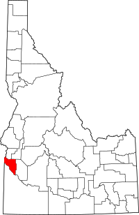 Location within the U.S. state of Idaho | |
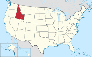 Idaho's location within the U.S. | |
| Coordinates: 43°38′N 116°43′W | |
| Country | |
| State | |
| Founded | March 7, 1891 |
| Seat | Caldwell |
| Largest city | Nampa |
| Area | |
| • Total | 604 sq mi (1,560 km2) |
| • Land | 587 sq mi (1,520 km2) |
| • Water | 16 sq mi (40 km2) 2.7% |
| Population (2010) | |
| • Total | 188,923 |
| • Estimate (2019) | 229,849 |
| • Density | 310/sq mi (120/km2) |
| Time zone | UTC−7 (Mountain) |
| • Summer (DST) | UTC−6 (MDT) |
| Congressional district | 1st |
| Website | www |
Canyon County is part of the Boise Metropolitan Statistical Area.
History
Hudson's Bay Company established Fort Boise in 1834 near what is now Parma,[3] but abandoned it in 1855. Emigrants traveled through Canyon County on the Oregon Trail.[4]
Discovery of gold in the Boise Basin in 1862 brought settlement to the region again.[3] The lower Boise River was fully contained within Boise County from 1863 until the formation of Ada County in 1864. Settlement of the lower Boise River west of Boise City was limited prior to the completion of the Oregon Short Line Railroad.[3] Middleton was the first settlement of Canyon County, starting in 1863.[5] The 1870 Census for Ada County listed 76 residents of the Boise Valley, excluding Boise City and the 1880 Census listed 44 residents at Middleton.[6][7] The arrival of the railroad at Caldwell led to the establishment of a town there as of August 1883.[8]
Businessmen James A. McGee and Alexander Duffes filed the plat for nearby Nampa in 1886.[9] Parma was settled around the same time, with the Old Fort Boise post office being moved to the town's location; it was incorporated in 1904.[10] Ada County established precincts for each of the settlements with a combined 1890 Census population of 2,311.[11] Significant settlement of Greenleaf and Notus started around 1904 with the two settlements listed as precincts at the 1910 census. Notus was incorporated in 1921 while Greenleaf was incorporated prior to 1980.[12][13] Melba was incorporated in 1912 while Wilder was incorporated in 1919.[14][15] The City of Star annexed a portion of territory in northeast Canyon County prior to 2007, becoming the county's ninth incorporated city. The majority of Star is located within Ada County.[16]
The Idaho Legislature created Canyon County from Ada County in an act approved March 7, 1891, effective at the November 26, 1892 election. Caldwell was established as the county seat. The county originally contained all of Canyon and Payette counties and part of Gem; Gem County formed in 1915 and Payette County in 1917.[17] Some sources attribute the name to the canyon of the Boise River near Caldwell, while western writers John Rees and Vardis Fisher believed it was named for the Snake River canyon, which forms a natural boundary with Owyhee County to the south and west.
Geography
According to the U.S. Census Bureau, the county has a total area of 604 square miles (1,560 km2), of which 587 sq mi (1,520 km2) is land and 16 sq mi (41 km2) (2.7%) is water.[18]
Adjacent counties
- Payette County - north
- Gem County - northeast
- Ada County - east
- Owyhee County - south
- Malheur County, Oregon - west
National protected areas
- Deer Flat National Wildlife Refuge (part)
- Snake River Birds of Prey National Conservation Area (part)
Demographics
| Historical population | |||
|---|---|---|---|
| Census | Pop. | %± | |
| 1900 | 7,497 | — | |
| 1910 | 25,323 | 237.8% | |
| 1920 | 26,932 | 6.4% | |
| 1930 | 30,930 | 14.8% | |
| 1940 | 40,987 | 32.5% | |
| 1950 | 53,597 | 30.8% | |
| 1960 | 57,662 | 7.6% | |
| 1970 | 61,288 | 6.3% | |
| 1980 | 83,756 | 36.7% | |
| 1990 | 90,076 | 7.5% | |
| 2000 | 131,441 | 45.9% | |
| 2010 | 188,923 | 43.7% | |
| Est. 2019 | 229,849 | [19] | 21.7% |
| U.S. Decennial Census[20] 1790-1960[21] 1900-1990[22] 1990-2000[23] 2010-2018[1] | |||
2000 census
At the 2000 census,[24] there were 131,441 people, 45,018 households and 33,943 families living in the county. The population density was 223/square mile (86/square km). There were 47,965 housing units at an average density of 81/square mile (31/square km). The racial makeup of the county was 83.10% White, 0.32% Black or African American, 0.85% Native American, 0.80% Asian, 0.13% Pacific Islander, 12.17% from other races, and 2.62% from two or more races. Hispanic or Latino of any race were 18.61% of the population. 15.9% were of German, 12.7% English, 10.3% American and 7.6% Irish ancestry.
There were 45,018 households of which 39.80% had children under the age of 18 living with them, 60.70% were married couples living together, 10.10% had a female householder with no husband present, and 24.60% were non-families. 19.80% of all households were made up of individuals and 8.40% had someone living alone who was 65 years of age or older. The average household size was 2.85 and the average family size was 3.28.
30.90% of the population were under the age of 18, 10.70% from 18 to 24, 28.30% from 25 to 44, 19.10% from 45 to 64, and 11.00% who were 65 years of age or older. The median age was 30 years. For every 100 females, there were 98.70 males. For every 100 females age 18 and over, there were 96.30 males.
The median household income was $35,884 and the median family income was $40,377. Males had a median income of $29,418 compared with $22,044 for females. The per capita income for the county was $15,155. About 8.70% of families and 12.00% of the population were below the poverty line, including 14.50% of those under age 18 and 10.70% of those age 65 or over.
2010 census
As of the 2010 United States Census, there were 188,923 people, 63,604 households, and 47,481 families living in the county.[25] The population density was 321.6 inhabitants per square mile (124.2/km2). There were 69,409 housing units at an average density of 118.2 per square mile (45.6/km2).[26] The racial makeup of the county was 83.0% white, 1.1% American Indian, 0.8% Asian, 0.6% black or African American, 0.2% Pacific islander, 11.4% from other races, and 3.0% from two or more races. Those of Hispanic or Latino origin made up 23.9% of the population.[25] In terms of ancestry, 18.8% were American, 17.4% were German, 13.0% were English, and 8.8% were Irish.[27]
Of the 63,604 households, 42.7% had children under the age of 18 living with them, 56.7% were married couples living together, 12.3% had a female householder with no husband present, 25.3% were non-families, and 20.1% of all households were made up of individuals. The average household size was 2.92 and the average family size was 3.36. The median age was 31.6 years.[25]
The median income for a household in the county was $43,218 and the median income for a family was $48,219. Males had a median income of $38,132 versus $28,356 for females. The per capita income for the county was $18,366. About 12.7% of families and 17.3% of the population were below the poverty line, including 23.8% of those under age 18 and 8.5% of those age 65 or over.[28]
Communities
Unincorporated communities
Politics
Like the majority of Idaho, Canyon County is reliably Republican. The last time a Democratic candidate carried the county was in 1936 by Franklin D. Roosevelt.
| Year | Republican | Democratic | Third parties |
|---|---|---|---|
| 2016 | 64.9% 47,222 | 23.2% 16,883 | 11.9% 8,680 |
| 2012 | 66.5% 44,369 | 29.8% 19,866 | 3.8% 2,512 |
| 2008 | 66.1% 42,752 | 31.1% 20,147 | 2.8% 1,807 |
| 2004 | 74.7% 41,599 | 24.1% 13,415 | 1.2% 684 |
| 2000 | 71.1% 30,560 | 24.6% 10,588 | 4.3% 1,852 |
| 1996 | 59.5% 23,988 | 29.3% 11,800 | 11.3% 4,540 |
| 1992 | 50.8% 19,220 | 24.0% 9,095 | 25.2% 9,534 |
| 1988 | 66.1% 21,426 | 31.5% 10,207 | 2.4% 763 |
| 1984 | 75.5% 24,613 | 23.1% 7,527 | 1.4% 447 |
| 1980 | 67.7% 24,375 | 25.5% 9,172 | 6.9% 2,469 |
| 1976 | 62.9% 17,263 | 34.5% 9,460 | 2.6% 718 |
| 1972 | 68.5% 18,383 | 21.0% 5,630 | 10.6% 2,844 |
| 1968 | 62.8% 14,995 | 23.9% 5,717 | 13.3% 3,186 |
| 1964 | 56.0% 13,466 | 44.1% 10,601 | |
| 1960 | 62.1% 15,865 | 37.9% 9,681 | |
| 1956 | 67.3% 15,483 | 32.8% 7,540 | |
| 1952 | 71.3% 17,065 | 28.5% 6,810 | 0.2% 48 |
| 1948 | 52.8% 9,700 | 43.0% 7,903 | 4.1% 760 |
| 1944 | 55.0% 9,215 | 43.6% 7,306 | 1.4% 241 |
| 1940 | 50.2% 8,776 | 49.4% 8,639 | 0.4% 63 |
| 1936 | 33.8% 4,910 | 57.0% 8,290 | 9.3% 1,347 |
| 1932 | 38.8% 5,065 | 53.2% 6,940 | 8.0% 1,049 |
| 1928 | 75.8% 7,293 | 22.7% 2,187 | 1.5% 139 |
| 1924 | 38.4% 3,820 | 9.7% 965 | 51.9% 5,163 |
| 1920 | 62.5% 5,633 | 37.5% 3,375 | |
| 1916 | 39.8% 3,570 | 50.0% 4,478 | 10.2% 912 |
| 1912 | 22.3% 1,842 | 29.4% 2,432 | 48.4% 4,005 |
| 1908 | 54.3% 4,023 | 37.6% 2,783 | 8.2% 605 |
| 1904 | 66.6% 3,172 | 21.5% 1,025 | 11.9% 568 |
| 1900 | 50.7% 1,350 | 49.3% 1,314 |
See also
References
- "State & County QuickFacts". United States Census Bureau. Retrieved June 28, 2014.
- "Find a County". National Association of Counties. Archived from the original on May 31, 2011. Retrieved June 7, 2011.
- Bird, Annie Laurie (May 3, 1962). "Canyon County has roots in a violent past". Lewiston Morning Tribune. (Idaho). p. 8, section 2.
- Idaho.gov - about Idaho - Canyon Co. Archived December 20, 2004, at the Wayback Machine accessed May 3, 2009
- "City of Middleton Comprehensive Plan" (PDF). City of Middleton. City of Middleton Planning and Zoning. Retrieved 5 February 2017.
- Ninth Census--Volume I: The Statistics of the Population of the United States (PDF). Washington: Government Printing Office. 1872. p. 107. Retrieved 5 February 2017.
- Statistics of the Population of the United States at the Tenth Census (PDF). Washington: Department of the Interior. June 1, 1880. p. 130. Retrieved 5 February 2017.
- "City of Caldwell 2030 Comprehensive Plan". City of Caldwell, Idaho. City of Caldwell, Idaho Planning and Zoning Department. Retrieved 5 February 2017.
- "Nampa 2035 Comprehensive Plan". City of Nampa, Idaho. City of Nampa, Idaho Planning and Zoning Department. Retrieved 5 February 2017.
- "History fan names Parma after town in Italy". Idaho Press. Idaho Press. Retrieved 5 February 2017.
- Report on Population of the United States at the Eleventh Census: 1890 (PDF). Washington: Department of the Interior. 1895. p. 99. Retrieved 5 February 2017.
- "The hazy history of Notus". Idaho Press. Idaho Press. Retrieved 5 February 2017.
- Thirteenth Census of the United States, Taken in the Year 1910 (PDF). Washington: Department of Commerce. 1913. p. 390. Retrieved 5 February 2017.
- "City of Wilder Comprehensive Plan" (PDF). City of Wilder. City of Wilder, Idaho.
- "History of Melba". cityofmelba.org. Melba Idaho. Archived from the original on 4 March 2016. Retrieved 5 February 2017.
- "The Comprehensive Plan for the City of Star". Star City. Star City, Idaho. Archived from the original on 19 October 2016. Retrieved 5 February 2017.
- Atlas of Idaho Historical County Boundaries. Chicago: The Newberry Library. 2010. pp. 66–68.
- "US Gazetteer files: 2010, 2000, and 1990". United States Census Bureau. February 12, 2011. Retrieved April 23, 2011.
- "Population and Housing Unit Estimates". Retrieved June 27, 2019.
- "U.S. Decennial Census". United States Census Bureau. Retrieved June 28, 2014.
- "Historical Census Browser". University of Virginia Library. Retrieved June 28, 2014.
- "Population of Counties by Decennial Census: 1900 to 1990". United States Census Bureau. Retrieved June 28, 2014.
- "Census 2000 PHC-T-4. Ranking Tables for Counties: 1990 and 2000" (PDF). United States Census Bureau. Retrieved June 28, 2014.
- "U.S. Census website". United States Census Bureau. Retrieved January 31, 2008.
- "DP-1 Profile of General Population and Housing Characteristics: 2010 Demographic Profile Data". United States Census Bureau. Archived from the original on 2020-02-13. Retrieved 2016-01-09.
- "Population, Housing Units, Area, and Density: 2010 - County". United States Census Bureau. Archived from the original on 2020-02-13. Retrieved 2016-01-09.
- "DP02 SELECTED SOCIAL CHARACTERISTICS IN THE UNITED STATES – 2006-2010 American Community Survey 5-Year Estimates". United States Census Bureau. Archived from the original on 2020-02-13. Retrieved 2016-01-09.
- "DP03 SELECTED ECONOMIC CHARACTERISTICS – 2006-2010 American Community Survey 5-Year Estimates". United States Census Bureau. Archived from the original on 2020-02-13. Retrieved 2016-01-09.
- Leip, David. "Dave Leip's Atlas of U.S. Presidential Elections". uselectionatlas.org. Retrieved 2018-04-04.
External links
| Wikimedia Commons has media related to Canyon County, Idaho. |
- Official website - Canyon County
- Western Canyon Chronicle - Official newspaper for Parma, Notus, Wilder & Greenleaf, in Canyon County, Idaho
Places adjacent to Canyon County, Idaho | ||||||||||
|---|---|---|---|---|---|---|---|---|---|---|
| ||||||||||
Municipalities and communities of Canyon County, Idaho, United States | ||
|---|---|---|
| Cities | Map of Idaho highlighting Canyon County | |
| Unincorporated communities | ||
Boise (capital) | ||
| Topics |
|  Seal of Idaho |
| Society | ||
| Regions | ||
| Larger cities | ||
| Smaller cities | ||
| Counties |
| |
| Authority control |
|
|---|