Hayden, Idaho
Hayden is a city in Kootenai County, Idaho, United States. Located in the northern portion of the state, it is a suburb of nearby Coeur d'Alene and its population was 13,294 at the 2010 census.
Hayden, Idaho | |
|---|---|
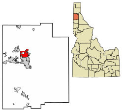 Location of Hayden in Kootenai County, Idaho. | |
 Hayden, Idaho Location in the United States | |
| Coordinates: 47°45′26″N 116°47′20″W | |
| Country | United States |
| State | Idaho |
| County | Kootenai |
| Area | |
| • Total | 10.39 sq mi (26.90 km2) |
| • Land | 10.37 sq mi (26.86 km2) |
| • Water | 0.01 sq mi (0.04 km2) |
| Elevation | 2,287 ft (697 m) |
| Population | |
| • Total | 13,294 |
| • Estimate (2019)[3] | 15,434 |
| • Density | 1,383.09/sq mi (534.01/km2) |
| Time zone | UTC−8 (Pacific (PST)) |
| • Summer (DST) | UTC−7 (PDT) |
| ZIP code | 83835 |
| Area code(s) | 208 |
| FIPS code | 16-36370 |
| GNIS feature ID | 0396630 |
| Website | www |
History
The Village of Hayden was incorporated in 1955 with a total of 440 acres with a population of around 700 people.[4]
According to legend, the name Hayden comes from a man named Matt Heyden, a pioneer who won the rights to name the lake, and therefore the city, by winning a game of “seven-up” against John Hager and John Hickey in 1878. The lake became known as Heyden's Lake, which was altered over time before eventually officially becoming Hayden Lake.
It is often confused as the former location of a 20-acre (8.1 ha) compound for the Aryan Nations, a neo-Nazi white supremacist group, whose compound was located just North in Kootenai County.
Geography
Hayden is located at 47°45′26″N 116°47′20″W (47.757112, -116.788877).[5]
According to the United States Census Bureau, the city has a total area of 9.61 square miles (24.89 km2), of which 9.60 square miles (24.86 km2) is land and 0.01 square miles (0.03 km2) is water.[6] It lies at the southwestern end of Hayden Lake, and the elevation of the city is 2,287 feet (697 m) above sea level.
Transportation
Hayden is located on U.S. Route 95 at the junction of Route 41. It is also four miles (6 km) north of Interstate 90 and Coeur d'Alene. The Coeur d'Alene airport is northwest of Hayden.
Demographics
| Historical population | |||
|---|---|---|---|
| Census | Pop. | %± | |
| 1960 | 901 | — | |
| 1970 | 1,285 | 42.6% | |
| 1980 | 2,586 | 101.2% | |
| 1990 | 3,744 | 44.8% | |
| 2000 | 9,159 | 144.6% | |
| 2010 | 13,294 | 45.1% | |
| Est. 2019 | 15,434 | [3] | 16.1% |
| U.S. Decennial Census[7] | |||
2010 census
At the 2010 census there were 13,294 people, 5,212 households, and 3,645 families living in the city. The population density was 1,384.8 inhabitants per square mile (534.7/km2). There were 5,563 housing units at an average density of 579.5 per square mile (223.7/km2). The racial makeup of the city was 95.1% White, 0.2% African American, 0.9% Native American, 0.9% Asian, 0.1% Pacific Islander, 0.7% from other races, and 2.1% from two or more races. Hispanic or Latino of any race were 4.2%.[2]
Of the 5,212 households 33.6% had children under the age of 18 living with them, 55.6% were married couples living together, 9.5% had a female householder with no husband present, 4.8% had a male householder with no wife present, and 30.1% were non-families. 24.9% of households were one person and 12.8% were one person aged 65 or older. The average household size was 2.54 and the average family size was 3.01.
The median age was 39.4 years. 25.6% of residents were under the age of 18; 7.1% were between the ages of 18 and 24; 25% were from 25 to 44; 25.1% were from 45 to 64; and 17.2% were 65 or older. The gender makeup of the city was 48.3% male and 51.7% female.
2000 census
At the 2000 census there were 9,159 people, 3,501 households, and 2,562 families living in the city. The population density was 1,167.5 people per square mile (450.5/km²). There were 3,714 housing units at an average density of 473.4 per square mile (182.7/km²). The racial makeup of the city was 96.09% White, 0.19% African American, 0.76% Native American, 0.55% Asian, 0.08% Pacific Islander, 0.94% from other races, and 1.40% from two or more races. Hispanic or Latino of any race were 2.43%.[8]
Of the 3,501 households 36.9% had children under the age of 18 living with them, 60.3% were married couples living together, 9.1% had a female householder with no husband present, and 26.8% were non-families. 21.6% of households were one person and 9.5% were one person aged 65 or older. The average household size was 2.60 and the average family size was 3.04.
The age distribution was 27.6% under the age of 18, 7.4% from 18 to 24, 30.3% from 25 to 44, 21.2% from 45 to 64, and 13.5% 65 or older. The median age was 35 years. For every 100 females, there were 94.9 males. For every 100 females age 18 and over, there were 91.9 males.
The median household income was $37,097 and the median family income was $40,875. Males had a median income of $35,339 versus $21,388 for females. The per capita income for the city was $16,387. About 5.8% of families and 9.2% of the population were below the poverty line, including 13.5% of those under age 18 and 4.5% of those age 65 or over.
Economy
Empire Airlines has its headquarters in Hayden.[9] Rollercoaster designer Rocky Mountain Construction is also headquartered in Hayden.
Notable people
- Patty Duke
- Matthew Inman
- Marshall Savage
- Don Larsen
References
- "2016 U.S. Gazetteer Files". United States Census Bureau. Retrieved Jul 26, 2017.
- "U.S. Census website". United States Census Bureau. Retrieved 2012-12-18.
- "Population and Housing Unit Estimates". Retrieved May 21, 2020.
- http://www.cityofhaydenid.us/community_history.php
- "US Gazetteer files: 2010, 2000, and 1990". United States Census Bureau. 2011-02-12. Retrieved 2011-04-23.
- "US Gazetteer files 2010". United States Census Bureau. Retrieved 2012-12-18.
- "Census of Population and Housing". Census.gov. Retrieved June 4, 2015.
- "U.S. Census website". United States Census Bureau. Retrieved 2008-01-31.
- "Contact Us Archived 2012-02-09 at the Wayback Machine." Empire Airlines. Retrieved on December 30, 2012. "11559 N Atlas Road Hayden, ID 83835"
External links
Municipalities and communities of Kootenai County, Idaho, United States | ||
|---|---|---|
| Cities | Map of Idaho highlighting Kootenai County | |
| CDPs | ||
| Unincorporated communities | ||
| Indian reservation | ||
| Footnotes | ‡This populated place also has portions in an adjacent county or counties | |