Troy, Montana
Troy is a city in Lincoln County, Montana, United States. The population was 938 at the 2010 census.
Troy, Montana | |
|---|---|
 Location of Troy, Montana | |
| Coordinates: 48°27′36″N 115°53′28″W | |
| Country | United States |
| State | Montana |
| County | Lincoln |
| Area | |
| • Total | 0.78 sq mi (2.02 km2) |
| • Land | 0.76 sq mi (1.97 km2) |
| • Water | 0.02 sq mi (0.05 km2) |
| Elevation | 1,800 ft (579 m) |
| Population | |
| • Total | 938 |
| • Estimate (2018)[3] | 930 |
| • Density | 1,200/sq mi (460/km2) |
| Time zone | UTC-7 (Mountain (MST)) |
| • Summer (DST) | UTC-6 (MDT) |
| ZIP code | 59935 |
| Area code(s) | 406 |
| FIPS code | 30-75025 |
| GNIS feature ID | 0792409 |
| Website | cityoftroymontana |
Geography
Troy is located at 48°27′36″N 115°53′28″W (48.459944, -115.890974).[4]
According to the United States Census Bureau, the city has a total area of 0.78 square miles (2.02 km2), of which, 0.76 square miles (1.97 km2) is land and 0.02 square miles (0.05 km2) is water.[1] Troy has an elevation of about 1,800 feet above sea level and is the lowest town in elevation in Montana. Troy is 12 miles from the border of Montana and Idaho. Troy's next closest city is Libby, which is 18 miles away.
The Troy Mine, which produced silver and copper, was scheduled for closure in February 2015.[5][6]
Climate
This climatic region is typified by large seasonal temperature differences, with warm to hot (and often humid) summers and cold (sometimes severely cold) winters. According to the Köppen Climate Classification system, Troy has a humid continental climate, abbreviated "Dsb" on climate maps.[7] Troy's annual mean temperature is 46.4 °F (8.0 °C) and its annual mean precipitation is 24.6" (624.8 mm).[8]
Demographics
| Historical population | |||
|---|---|---|---|
| Census | Pop. | %± | |
| 1920 | 763 | — | |
| 1930 | 498 | −34.7% | |
| 1940 | 796 | 59.8% | |
| 1950 | 770 | −3.3% | |
| 1960 | 855 | 11.0% | |
| 1970 | 1,046 | 22.3% | |
| 1980 | 1,088 | 4.0% | |
| 1990 | 953 | −12.4% | |
| 2000 | 957 | 0.4% | |
| 2010 | 938 | −2.0% | |
| Est. 2018 | 930 | [3] | −0.9% |
| U.S. Decennial Census[9][10] | |||


2010 census
As of the census[2] of 2010, there were 938 people, 454 households, and 240 families residing in the city. The population density was 1,234.2 inhabitants per square mile (476.5/km2). There were 490 housing units at an average density of 644.7 per square mile (248.9/km2). The racial makeup of the city was 94.3% White, 0.2% African American, 1.7% Native American, 0.5% Asian, 0.1% from other races, and 3.1% from two or more races. Hispanic or Latino of any race were 1.9% of the population.
There were 454 households of which 25.1% had children under the age of 18 living with them, 37.2% were married couples living together, 9.5% had a female householder with no husband present, 6.2% had a male householder with no wife present, and 47.1% were non-families. 37.4% of all households were made up of individuals and 13.8% had someone living alone who was 65 years of age or older. The average household size was 2.07 and the average family size was 2.71.
The median age in the city was 46.8 years. 20% of residents were under the age of 18; 5.5% were between the ages of 18 and 24; 21.9% were from 25 to 44; 35.7% were from 45 to 64; and 16.8% were 65 years of age or older. The gender makeup of the city was 49.3% male and 50.7% female.
Education
Troy has a public library, a branch of the Lincoln County Public Libraries.[11]
Notable people
- Rachel Dolezal, civil rights activist
- Blaine McElmurry, professional football player (retired)
Popular culture
Troy is featured in Max Brooks' post-apocalyptic zombie novel World War Z, as a safe zone for humanity.
References
| Wikimedia Commons has media related to Troy, Montana. |
- "US Gazetteer files 2010". United States Census Bureau. Archived from the original on 2012-07-02. Retrieved 2012-12-18.
- "U.S. Census website". United States Census Bureau. Retrieved 2012-12-18.
- "Population and Housing Unit Estimates". Retrieved February 22, 2020.
- "US Gazetteer files: 2010, 2000, and 1990". United States Census Bureau. 2011-02-12. Retrieved 2011-04-23.
- Chaney, Rob (2015-01-21). "Citing low metals prices, Revett closes Troy mine". Missoulian. Retrieved 2015-04-16.
- "Revett Places Troy Mine on Care and Maintenance". 2015-01-19. Retrieved 2015-04-16.
- Monthly Weather Averages for Troy, Montana
- http://www.wrcc.dri.edu/cgi-bin/cliMAIN.pl?mttroy
- "Census of Population and Housing". Census.gov. Retrieved June 4, 2015.
- "Census & Economic Information Center". Retrieved July 3, 2015.
- "Montana Public Libraries". PublicLibraries.com. Retrieved 14 June 2019.
External links
Municipalities and communities of Lincoln County, Montana, United States | ||
|---|---|---|
| Cities | 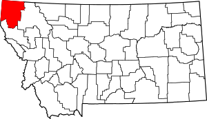 Lincoln County map | |
| Towns | ||
| CDPs | ||
| Other unincorporated communities | ||
| Authority control |
|---|