National Register of Historic Places listings in Grafton County, New Hampshire
This is a list of the National Register of Historic Places listings in Grafton County, New Hampshire.
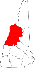
Location of Grafton County in New Hampshire
This is intended to be a complete list of the properties and districts on the National Register of Historic Places in Grafton County, New Hampshire, United States. Latitude and longitude coordinates are provided for many National Register properties and districts; these locations may be seen together in a map.[1]
There are 77 properties and districts listed on the National Register in the county, including one National Historic Landmark.
| Belknap - Carroll - Cheshire - Coos - Grafton - Hillsborough - Merrimack - Rockingham - Strafford - Sullivan |
- This National Park Service list is complete through NPS recent listings posted June 19, 2020.[2]
Current listings
| [3] | Name on the Register[4] | Image | Date listed[5] | Location | City or town | Description |
|---|---|---|---|---|---|---|
| 1 | Ashland Gristmill and Dam |  Ashland Gristmill and Dam |
December 10, 1979 (#79000317) |
Main St. 43°41′44″N 71°37′51″W |
Ashland | On the Squam River |
| 2 | Ashland Junior High School |  Ashland Junior High School |
April 8, 1983 (#83001137) |
12 School St. 43°41′50″N 71°38′06″W |
Ashland | Now a community center |
| 3 | Ashland Railroad Station |  Ashland Railroad Station |
November 10, 1982 (#82000617) |
39 Depot St. 43°41′26″N 71°38′04″W |
Ashland | Now a local museum |
| 4 | Ashland Town Hall | 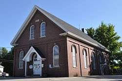 Ashland Town Hall |
March 24, 1983 (#83001138) |
10 Highland St. 43°41′48″N 71°37′57″W |
Ashland | |
| 5 | Bath Covered Bridge | .jpg) Bath Covered Bridge |
September 1, 1976 (#76000125) |
Off U.S. Route 302/NH 10 44°10′01″N 71°58′03″W |
Bath | Over Ammonoosuc River |
| 6 | Bedell Covered Bridge | Bedell Covered Bridge |
May 28, 1975 (#75002171) |
Crossed the Connecticut River between Haverhill and Newbury 44°02′42″N 72°04′27″W |
Haverhill | |
| 7 | Boulderwood |  Boulderwood |
April 9, 2018 (#100002300) |
Address Restricted |
Holderness | |
| 8 | Brick Store |  Brick Store |
November 7, 1985 (#85002780) |
21 Lisbon Road 44°10′00″N 71°58′00″W |
Bath | |
| 9 | Bristol Town Hall |  Bristol Town Hall |
September 29, 2015 (#15000668) |
45 Summer St. 43°35′33″N 71°44′08″W |
Bristol | |
| 10 | Burleigh Brae and Webster Boathouse |  Burleigh Brae and Webster Boathouse |
August 15, 2012 (#12000505) |
near NH 113 43°45′43″N 71°33′40″W |
Holderness | Part of the Squam Multiple Property Submission (MPS) |
| 11 | Burt-Cheney Farm |  Burt-Cheney Farm |
March 25, 1982 (#82001674) |
U.S. Route 302 44°17′33″N 71°45′24″W |
Bethlehem | |
| 12 | Camp Carnes |  Camp Carnes |
August 15, 2012 (#12000506) |
On an island in Carns Cove, Squam Lake 43°45′46″N 71°33′26″W |
Holderness | Part of the Squam MPS |
| 13 | Camp Mowglis | 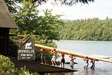 Camp Mowglis |
June 20, 2019 (#100004085) |
6 Mowglis Dr. 43°41′46″N 71°46′15″W |
Hebron | |
| 14 | Camp Ossipee |  Camp Ossipee |
April 10, 2013 (#13000154) |
11 & 13 Porter Rd. 43°44′39″N 71°32′57″W |
Holderness | Part of the Squam MPS |
| 15 | Canaan Meetinghouse |  Canaan Meetinghouse |
March 24, 1972 (#72001598) |
Canaan St. 43°39′55″N 72°02′34″W |
Canaan | |
| 16 | Canaan Street Historic District | 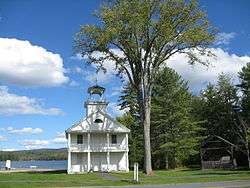 Canaan Street Historic District |
May 7, 1973 (#73000163) |
Canaan St. 43°39′56″N 72°02′32″W |
Canaan | |
| 17 | Daniel Carr House |  Daniel Carr House |
March 27, 1992 (#92000156) |
Northern side of Brier Hill Rd., 1.5 mi (2.4 km) from its junction with NH 10 44°06′32″N 72°00′11″W |
Haverhill | |
| 18 | Central Square Historic District | 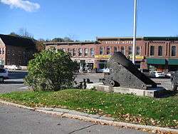 Central Square Historic District |
March 24, 1983 (#83001139) |
2-27 Central Square, 1 Summer St., 1-3 N. Main St., and 2 S. Main St. 43°35′29″N 71°44′11″W |
Bristol | |
| 19 | Centre Village Meeting House |  Centre Village Meeting House |
June 6, 1985 (#85001197) |
NH 4A 43°35′24″N 72°06′38″W |
Enfield | |
| 20 | Chapel of the Holy Cross |  Chapel of the Holy Cross |
September 7, 2005 (#05000971) |
45 Chapel Ln. 43°45′31″N 71°40′31″W |
Holderness | On the campus of the Holderness School |
| 21 | Chocorua Island Chapel | September 20, 2016 (#16000644) |
40 Chocorua Island, Squam Lake 43°45′20″N 71°32′34″W |
Holderness | ||
| 22 | Colburn Park Historic District |  Colburn Park Historic District |
January 10, 1986 (#86000782) |
N., S., E., and W. Park Sts., 3 Campbell St., 1 School St., 1 Bank St., and 9-10 Lebanon Mall 43°38′31″N 72°15′08″W |
Lebanon | |
| 23 | Dorchester Common Historic District |  Dorchester Common Historic District |
March 7, 1985 (#85000477) |
Roughly bounded by N. Dorchester 0.2-mile (0.32 km) northwest of its intersection with NH 118 43°45′25″N 71°56′59″W |
Dorchester | |
| 24 | Dorchester Community Church |  Dorchester Community Church |
November 25, 1980 (#80000284) |
Off NH 118 43°45′25″N 71°57′01″W |
Dorchester | |
| 25 | Dow Academy | 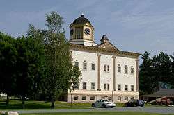 Dow Academy |
August 31, 1982 (#82001675) |
Dow Ave. 44°13′32″N 71°44′53″W |
Franconia | |
| 26 | Enfield Center Town House |  Enfield Center Town House |
July 17, 2017 (#100001318) |
1044 NH 4A 43°35′28″N 72°06′37″W |
Enfield | |
| 27 | Enfield Shaker Historic District |  Enfield Shaker Historic District |
November 7, 1979 (#79000198) |
NH 4A 43°37′13″N 72°08′49″W |
Enfield | |
| 28 | Enfield Village Historic District |  Enfield Village Historic District |
April 19, 2010 (#10000186) |
Main St, U.S. Route 4, High St, Balti St, Shaker Hill Rd, Wells St, Stevens, Union, & Pillsbury Sts, Shedd & Mill St. 43°38′31″N 72°08′42″W |
Enfield | |
| 29 | The Epic of American Civilization Murals |  The Epic of American Civilization Murals |
February 27, 2013 (#13000283) |
6025 Baker-Berry Library 43°42′18″N 72°17′21″W |
Hanover | |
| 30 | Felsengarten |  Felsengarten |
June 18, 1973 (#73002296) |
Southwest of Bethlehem on Lewis Hill Rd. 44°15′20″N 71°42′20″W |
Bethlehem | |
| 31 | First Free Will Baptist Church and Vestry |  First Free Will Baptist Church and Vestry |
April 8, 1983 (#83001140) |
57 Main St. 43°41′42″N 71°37′59″W |
Ashland | Currently the Ashland Baptist Church. |
| 32 | Frost Place | 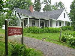 Frost Place |
November 30, 1976 (#76000126) |
South of Franconia off NH 116 on Ridge Rd. 44°12′46″N 71°45′27″W |
Franconia | |
| 33 | Goodall-Woods Law Office |  Goodall-Woods Law Office |
August 26, 1980 (#80000285) |
Northeast of Bath on U.S. Route 302 44°10′35″N 71°56′40″W |
Bath | |
| 34 | Great Hollow Road Stone Arch Bridge |  Great Hollow Road Stone Arch Bridge |
May 12, 1997 (#97000372) |
Great Hollow Rd. over Mink Brook, approximately 100 ft (30 m) north of its junction with Smith Ln. 43°41′13″N 72°14′00″W |
Hanover | |
| 35 | Abbie Greenleaf Library | 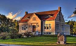 Abbie Greenleaf Library |
June 13, 2003 (#03000526) |
439 Main St. 44°13′36″N 71°44′43″W |
Franconia | |
| 36 | Hanover Town Library | 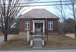 Hanover Town Library |
April 25, 1997 (#97000371) |
130 Etna Rd. 43°41′41″N 72°13′06″W |
Hanover | |
| 37 | Haverhill Corner Historic District |  Haverhill Corner Historic District |
August 27, 1987 (#87001415) |
NH 10 from N. Piermont to its bisection of NH 25 and Court St. 44°01′53″N 72°03′51″W |
Haverhill | |
| 38 | Haverhill-Bath Covered Bridge | .jpg) Haverhill-Bath Covered Bridge |
April 18, 1977 (#77000091) |
NH 135 44°09′16″N 72°02′12″W |
Woodsville and Bath | Over the Ammonoosuc River |
| 39 | Hebron Village Historic District |  Hebron Village Historic District |
March 7, 1985 (#85000492) |
Roughly bounded by the Hebron Village Cemetery, N. and W. Shore Rds., and Hobart Hill and Groton Rds. 43°41′38″N 71°48′21″W |
Hebron | |
| 40 | Hewitt House |  Hewitt House |
November 7, 1985 (#85002778) |
U.S. Route 4 43°38′41″N 72°08′37″W |
Enfield | |
| 41 | Holderness Free Library |  Holderness Free Library |
March 7, 1985 (#85000478) |
Junction of U.S. Route 3 and NH 113 43°43′55″N 71°35′18″W |
Holderness | |
| 42 | Holderness Inn | 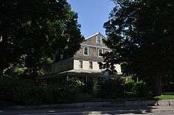 Holderness Inn |
December 13, 1984 (#84000523) |
U.S. Route 3 43°43′53″N 71°35′24″W |
Holderness | |
| 43 | Jeremiah Hutchins Tavern |  Jeremiah Hutchins Tavern |
September 7, 1984 (#84003194) |
Northeast of Bath on U.S. Route 302 44°10′41″N 71°56′40″W |
Bath | |
| 44 | Moses Kent House | 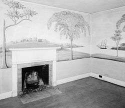 Moses Kent House |
June 7, 1984 (#84002808) |
River Road[6] 43°52′15″N 72°09′45″W |
Lyme | Noted for murals by Rufus Porter |
| 45 | Edward H. Lane House |  Edward H. Lane House |
December 8, 1980 (#80000286) |
16 Cottage St. 44°18′18″N 71°46′03″W |
Littleton | |
| 46 | Lisbon Inn |  Lisbon Inn |
December 1, 1980 (#80000287) |
Main St. 44°12′47″N 71°54′46″W |
Lisbon | |
| 47 | Littleton Town Building |  Littleton Town Building |
May 7, 1973 (#73000164) |
1 Union St. 44°18′21″N 71°46′12″W |
Littleton | |
| 48 | Lovett's by Lafayette Brook |  Lovett's by Lafayette Brook |
March 11, 1982 (#82001676) |
South of Franconia on Profile Rd. 44°12′16″N 71°43′25″W |
Franconia | |
| 49 | Lyme Center Historic District | 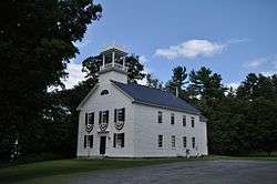 Lyme Center Historic District |
March 31, 1987 (#86003381) |
34-55 Dorchester Rd. 43°47′58″N 72°07′35″W |
Lyme Center | |
| 50 | Lyme Common Historic District |  Lyme Common Historic District |
September 1, 1988 (#88001435) |
Dorchester Rd., John Tomson Way, On the Common; Pleasant and Union Sts., E. Thetford Rd., Main and Market Sts. 43°48′40″N 72°09′28″W |
Lyme | |
| 51 | Lyme-East Thetford Bridge | March 27, 2020 (#100005159) |
VT 113 / East Thetford Rd. over the Connecticut R. 43°48′44″N 72°10′59″W |
Lyme | Extends into Orange County, Vermont | |
| 52 | Minot-Sleeper Library | 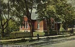 Minot-Sleeper Library |
September 15, 1988 (#88001434) |
35 Pleasant Street 43°35′28″N 71°44′16″W |
Bristol | |
| 53 | North Holderness Freewill Baptist Church-Holderness Historical Society Building |  North Holderness Freewill Baptist Church-Holderness Historical Society Building |
September 4, 1986 (#86002171) |
Rt. 3 43°43′56″N 71°35′10″W |
Holderness | Listed on Owl Brook Road; moved to present location in 1994[7] |
| 54 | Old Grafton County Courthouse | 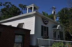 Old Grafton County Courthouse |
April 29, 1982 (#82001677) |
1 Court St. 43°45′29″N 71°41′21″W |
Plymouth | |
| 55 | Orford Street Historic District |  Orford Street Historic District |
August 26, 1977 (#77000163) |
Orford St. (NH 10) from NH 25A to Archertown Rd., including the cemetery to the east 43°54′16″N 72°08′07″W |
Orford | |
| 56 | Owls Head |  Owls Head |
September 29, 2015 (#15000669) |
289 W. Shore Rd. 43°40′43″N 71°47′23″W |
Hebron | |
| 57 | Norman and Marion Perry House | 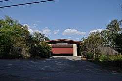 Norman and Marion Perry House |
September 25, 2012 (#12000821) |
352 Ellsworth Hill Road[8] 43°51′18″N 71°41′46″W |
Campton | c. 1960 Modernist house designed by Hugh Stebbins |
| 58 | Piermont Bridge |  Piermont Bridge |
June 6, 2001 (#01000630) |
NH 25 over the Connecticut River at the Vermont state line 43°58′40″N 72°06′45″W |
Piermont | Extends into Orange County, Vermont |
| 59 | Plymouth Historic District | 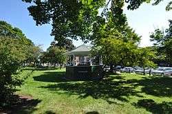 Plymouth Historic District |
March 14, 1986 (#86000343) |
Bounded by Court, Main, and Highland Sts. 43°45′26″N 71°41′17″W |
Plymouth | |
| 60 | Rocks Estate |  Rocks Estate |
September 7, 1984 (#84003197) |
West of Bethlehem on U.S. Route 302 44°16′52″N 71°44′03″W |
Bethlehem | |
| 61 | Rockywold-Deephaven Camps |  Rockywold-Deephaven Camps |
June 14, 2013 (#13000382) |
Pinehurst Rd. 43°46′35″N 71°32′36″W |
Holderness | Part of the Squam MPS |
| 62 | The Samuel Morey Memorial Bridge |  The Samuel Morey Memorial Bridge |
December 8, 1997 (#97001523) |
NH 25A over the Connecticut River 43°54′25″N 72°08′23″W |
Orford | Extends into Orange County, Vermont |
| 63 | Sawyer-Medlicott House |  Sawyer-Medlicott House |
December 6, 1991 (#91001757) |
Junction of Bradford and River Rds. 43°58′40″N 72°06′21″W |
Piermont | |
| 64 | Shepard Hill Historic District |  Shepard Hill Historic District |
October 8, 2014 (#14000843) |
109, 135, 177, 180, 200 Shepard Hill, 6, 19, 31, 33, 35, 41 Coxboro & all of Asquam Rds., 584 US 3 43°43′32″N 71°34′14″W |
Holderness | |
| 65 | Sphinx Tomb | 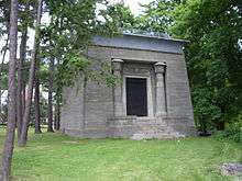 Sphinx Tomb |
March 17, 2005 (#05000173) |
Northeastern corner of the junction of E. Wheelock St. and Observatory Rd.[9] 43°42′13″N 72°17′06″W |
Hanover | |
| 66 | Spring Hill Farm |  Spring Hill Farm |
June 13, 2002 (#02000639) |
263 Meriden Rd. 43°37′30″N 72°13′31″W |
Lebanon | |
| 67 | St. Mark's Episcopal Church |  St. Mark's Episcopal Church |
December 13, 1984 (#84000522) |
6-8 Highland St. 43°41′48″N 71°37′57″W |
Ashland | |
| 68 | Stone Arch Underpass |  Stone Arch Underpass |
September 12, 1985 (#85002190) |
Glen Rd. 43°38′03″N 72°18′21″W |
Lebanon | |
| 69 | Swiftwater Covered Bridge | 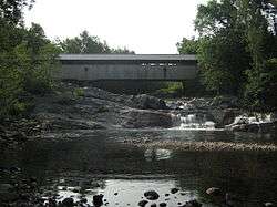 Swiftwater Covered Bridge |
November 21, 1976 (#76000127) |
South of Bath on Valley Rd. 44°08′03″N 71°57′05″W |
Bath | Over the Wild Ammonoosuc River |
| 70 | Thayer's Hotel |  Thayer's Hotel |
March 9, 1982 (#82001678) |
136 Main St. 44°18′23″N 71°46′28″W |
Littleton | |
| 71 | Trinity Church | 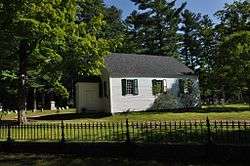 Trinity Church |
September 7, 1984 (#84003203) |
East of Plymouth on NH 175 43°45′24″N 71°40′11″W |
Holderness | |
| 72 | True Farm |  True Farm |
August 15, 2012 (#12000507) |
53, 64, and 70 True Farm Rd., and 884 NH 113 43°45′46″N 71°33′49″W |
Holderness | Part of the Squam MPS |
| 73 | US Post Office and Courthouse-Littleton Main | 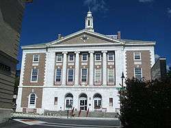 US Post Office and Courthouse-Littleton Main |
July 17, 1986 (#86002251) |
134 Main St.[10] 44°18′26″N 71°46′30″W |
Littleton | |
| 74 | Watch Rock Camp | December 24, 2013 (#13000973) |
Off NH 113 on the shore of Squam Lake Coordinates missing |
Holderness | Part of the Squam MPS | |
| 75 | Webster Estate |  Webster Estate |
June 9, 1989 (#89000448) |
NH 113 43°45′35″N 71°33′31″W |
Holderness | |
| 76 | Whipple House |  Whipple House |
December 13, 1978 (#78000338) |
4 Pleasant St. 43°41′40″N 71°37′54″W |
Ashland | |
| 77 | Woodsville Opera Building |  Woodsville Opera Building |
May 15, 1980 (#80000288) |
67 Central St. 44°09′08″N 72°02′18″W |
Woodsville |
See also
| Wikimedia Commons has media related to National Register of Historic Places in Grafton County, New Hampshire. |
References
- The latitude and longitude information provided in this table was derived originally from the National Register Information System, which has been found to be fairly accurate for about 99% of listings. Some locations in this table may have been corrected to current GPS standards.
- "National Register of Historic Places: Weekly List Actions". National Park Service, United States Department of the Interior. Retrieved on June 19, 2020.
- Numbers represent an ordering by significant words. Various colorings, defined here, differentiate National Historic Landmarks and historic districts from other NRHP buildings, structures, sites or objects.
- "National Register Information System". National Register of Historic Places. National Park Service. April 24, 2008.
- The eight-digit number below each date is the number assigned to each location in the National Register Information System database, which can be viewed by clicking the number.
- "Moses Kent House". Connecticut River Joint Commission. Retrieved 2013-10-10.
- Holderness Historical Society Driving Tour
- NH Register of Historic Places
- Although the NRIS lists the Sphinx as "address restricted", this Dartmouth College map shows its location clearly
- Address based on USPS website. Accessed March 27, 2016
| Topics | 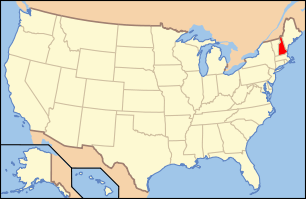 | |
|---|---|---|
| Lists by county | ||
| Other lists | ||
| ||
Municipalities and communities of Grafton County, New Hampshire, United States | ||
|---|---|---|
| City | Map of New Hampshire highlighting Grafton County | |
| Towns |
| |
| Township | ||
| CDPs | ||
| Other villages | ||
This article is issued from Wikipedia. The text is licensed under Creative Commons - Attribution - Sharealike. Additional terms may apply for the media files.