Wyoming, Rhode Island
Wyoming is a village and census-designated place[2] on the Wood River in southern Rhode Island, primarily in the town of Richmond, Rhode Island, but extending north across the river (which defines the town line) into the town of Hopkinton, Rhode Island.[3] It is the site of the Wyoming Village Historic District and a post office assigned ZIP code 02898.
Wyoming Village Historic District | |
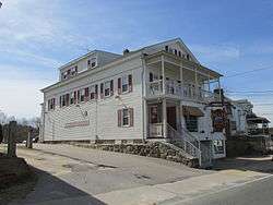 Wood River Inn | |
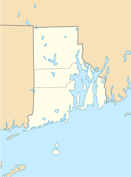  | |
| Location | Roughly bounded by RI 138, RI 3, Old Nooseneck Hill Rd., Bridge and Prospect Sts., Richmond, Rhode Island |
|---|---|
| Coordinates | 41°30′57″N 71°42′12″W |
| Architectural style | Greek Revival, Late Victorian, Federal |
| NRHP reference No. | 74000014[1] |
| Added to NRHP | May 2, 1974 |
History
The village was settled in 1757[4] and was the site of industrial activity early in its history due to the ready availability of hydropower from the river. Brand's Iron Works existed on the Hopkinton side of the river by 1787, and Brothers Cotton Mill was established on the Richmond side of Wyoming in 1814. The New London Turnpike (Rhode Island Route 3) was built through the area in 1815.[3][5] Also in 1815 a tavern was established on the Richmond side of the river to serve travelers on the turnpike. Two more textile mills were built on the Richmond, circa 1830 and 1845; they were later destroyed by fire.[3]
In 1970, Interstate 95 was constructed a short distance east of Wyoming, with an exit close to the village. Proximity to the highway has led to commercial and residential development in and near the village.[4]
Historic district
The Wyoming Village Historic District is a historic district roughly bounded by Rhode Island Routes 138 and 3, Old Nooseneck Hill Road, Bridge and Prospect Streets in Richmond. The district, which includes Brand's Ironworks, includes examples of Greek Revival, Late Victorian, and Federal architecture and was added to the National Register of Historic Places in 1974.[1] Prospect Street on the Hopkinton side of the river is a residential neighborhood that grew up in the mid-19th century in connection with the growth of the textile industry in Wyoming; it includes several Greek Revival houses built between 1846 and 1850.[3] The historic district covers properties in both the towns of Richmond and Hopkinton, with a total area of 570 acres (230 ha), almost one square mile.[1]
Demographics
The portion of Wyoming in the town of Hopkinton is included in the census-designated place of Hope Valley.
References
- "National Register Information System". National Register of Historic Places. National Park Service. March 13, 2009.
- U.S. Census Bureau. New Census Designated Places (CDPs) submitted by Census to USGS, July–August, 2010
- Hopkinton Preliminary Report, Rhode Island Historical Preservation Commission, October 1976
- Historic and Archaeological Resources of Richmond, Rhode Island: A Preliminary Report, Rhode Island Historical Preservation Commission, December 1977
- According to The Turnpikes of New England (Frederic James Wood (1919), The Turnpikes of New England and Evolution of the Same through England, Virginia, and Maryland, Marshall Jones Company. Pages 315-317.), a public stage road was completed in 1815 from the head of the Mystic River in Connecticut as far as Wyoming, and a franchise was proposed for building the New London Turnpike road covering the Providence to West Greenwich section, and the Providence and Pawcatuck Turnpike Company was chartered in 1816. The Groton and Stonington Turnpike (now Connecticut Route 184) was chartered in 1818. The Hopkinton and Richmond Turnpike was chartered in 1820.
External links
![]()
Municipalities and communities of Washington County, Rhode Island, United States | ||
|---|---|---|
| Towns |  Map of Rhode Island highlighting Washington County | |
| CDPs | ||
| Other villages |
| |
| Indian reservation | ||
| Topics | |
|---|---|
| Lists by state |
|
| Lists by insular areas | |
| Lists by associated state | |
| Other areas | |
| Related | |
| |