Kingston, Rhode Island
Kingston is a village and a census-designated place in the town of South Kingstown, Rhode Island, United States, and the site of the main campus of the University of Rhode Island. Much of the village center is listed on the National Register of Historic Places as Kingston Village Historic District. It was originally known as Little Rest.
Kingston, Rhode Island | |
|---|---|
 Kingston, Rhode Island Location in the state of Rhode Island  Kingston, Rhode Island Kingston, Rhode Island (the United States) | |
| Coordinates: 41°29′N 71°32′W | |
| Country | United States |
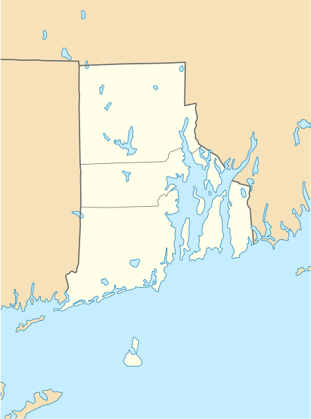
| State | Rhode Island |
| County | Washington |
| Area | |
| • Land | 1.57 sq mi (4.1 km2) |
| Elevation | 246 ft (75 m) |
| Population (2000) | |
| • Total | 5,446 |
| • Density | 3,474.6/sq mi (1,341.6/km2) |
| Time zone | UTC-5 (Eastern (EST)) |
| • Summer (DST) | UTC-4 (EDT) |
| ZIP code | 02881 |
| Area code(s) | 401 |
| FIPS code | 44-38980[1] |
| GNIS feature ID | 1217812[2] |
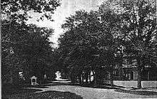
Kingston Village Historic District | |
.jpg) Kings County Court House (now a public library) where the Constitution was last voted against by Rhode Island in 1790 | |
| Area | 470 acres |
|---|---|
| Architectural style | Greek Revival, Late Victorian, Federal, Colonial |
| NRHP reference No. | 74000011[3] |
| Added to NRHP | May 1, 1974 |
.jpg)
History
Kingston was first settled in the late seventeenth century. For a time, starting in the late 1770s, the preacher Jemima Wilkinson, known as the Public Universal Friend resided and gave sermons in the town.[4] As late as the 1900s inhabitants of Kingston called a species of solidago "Jemima weed", because its appearance in the town coincided with the preacher's first visit to the area.[4][5][6] Originally known as Little Rest, the name was changed to Kingston in 1826. It was the county seat for Washington County (formerly Kings County) from 1752 until 1894, when a new courthouse was built in nearby West Kingston. West Kingston is also the site of the historic Kingston Railroad Station which opened in June, 1875. The station is served by Amtrak on its Northeast Corridor.
South Kingstown established the Kingston Historic District in 1959, and much of Kingston village became a National Register historic district in 1974 as Kingston Village Historic District. The historic district is located just outside the campus of the University of Rhode Island and contains many fine examples of 18th and 19th century architecture. The historic district includes 38 buildings.
The University of Rhode Island was established at Kingston in 1888 as the Rhode Island Agricultural School and Agricultural Experiment Station, by funding from the Hatch Act of 1887. In 1892 the Agricultural School became the Rhode Island College of Agriculture and Mechanic Arts with funding from the Second Morrill Land Grant Act of 1890, later becoming Rhode Island State College in 1909 and the University of Rhode Island in 1951.[7]
Economy
In addition to the university, major businesses in Kingston include APC by Schneider Electric and the Arnold Lumber Company.
Education
Public schools are operated by the South Kingstown School District. Educational institutions in Kingston include:
- The Compass School, a public K-8 charter school
- Kingston Hill Academy, a public K-5 charter school
- University of Rhode Island
- Gordon Research Conferences center[8]
Houses of worship
Religious denominations represented with churches, mosques, and synagogues in Kingston or on the university campus are Roman Catholicism, the United Church of Christ, Episcopalians, United Methodists, Baptists, Islam, and Judaism.
Climate
| Climate data for Kingston, Rhode Island | |||||||||||||
|---|---|---|---|---|---|---|---|---|---|---|---|---|---|
| Month | Jan | Feb | Mar | Apr | May | Jun | Jul | Aug | Sep | Oct | Nov | Dec | Year |
| Average high °F (°C) | 37.7 (3.2) |
38.6 (3.7) |
46.4 (8.0) |
56.7 (13.7) |
67.0 (19.4) |
75.5 (24.2) |
80.6 (27.0) |
79.3 (26.3) |
73.2 (22.9) |
63.6 (17.6) |
52.2 (11.2) |
41.4 (5.2) |
59.4 (15.2) |
| Average low °F (°C) | 18.9 (−7.3) |
19.6 (−6.9) |
27.2 (−2.7) |
35.4 (1.9) |
44.7 (7.1) |
53.8 (12.1) |
59.8 (15.4) |
58.5 (14.7) |
51.6 (10.9) |
41.0 (5.0) |
32.6 (0.3) |
23.0 (−5.0) |
38.8 (3.8) |
| Average precipitation inches (mm) | 4.5 (110) |
3.9 (99) |
5.0 (130) |
4.4 (110) |
3.8 (97) |
3.5 (89) |
3.1 (79) |
4.3 (110) |
3.9 (99) |
3.9 (99) |
4.7 (120) |
4.8 (120) |
49.6 (1,260) |
| Source: Weatherbase[9] | |||||||||||||
Nearby populated areas
- Wakefield, Rhode Island (3 miles)
- Peace Dale, Rhode Island (3 miles)
- Narragansett, Rhode Island (5 miles)
See also
- George Fayerweather Blacksmith Shop
- Great Swamp Fight
- Kingston (Amtrak station)
- South County History Center
- Tavern Hall Preservation Society/Elisha Reynolds House (1738)
- Tootell House
- Washington County Courthouse
- National Register of Historic Places listings in Washington County, Rhode Island
References
- "U.S. Census website". United States Census Bureau. Retrieved 2008-01-31.
- "US Board on Geographic Names". United States Geological Survey. 2007-10-25. Retrieved 2008-01-31.
- "National Register Information System". National Register of Historic Places. National Park Service. March 13, 2009.
- Wisbey, Herbert A. Jr (2009) [1965]. Pioneer Prophetess: Jemima Wilkinson, the Publick Universal Friend. Cornell University Press. pp. 39–47. ISBN 978-0-8014-7551-1.
- Christian M McBurney, Kingston : a forgotten history (1975), p. 32
- Philip Kittredge Taylor, "Little Rest", in The New England Magazine, vol. 28, no. 2 (April, 1903), p. 139 (a record from when the term "Jemima weed" was still in use).
- "University of Rhode Island History". Archived from the original on 2012-12-23. Retrieved 2009-04-25.
- "Gordon Research Conference Center". Retrieved 10 July 2009.
- "Weatherbase: Historical Weather for Kingston, Rhode Island". Weatherbase. 2011. Retrieved on November 24, 2011.
Further reading
- Images of America: Kingston by Betty J. Cotter. Charleston, SC: Arcadia Publishing, c. 1999 ISBN 978-0-7385-6364-0
- Lost South Kingstown : with a history of ten of its early villages by Kathleen Bossy and Mary Keane. Kingston, R.I. : Pettaquamscutt Historical Society, c. 2004
- A History of Kingston, R.I. 1700 – 1900: Heart of Rural South County by Christian M. McBurney. Kingston, R.I. : The Pettaquamscutt Historical Society, c. 2004
External links
| Wikimedia Commons has media related to Kingston, Rhode Island. |

- Town of South Kingstown, Rhode Island
- Kingston, Rhode Island at Curlie
| Topics | |
|---|---|
| Lists by state |
|
| Lists by insular areas | |
| Lists by associated state | |
| Other areas | |
| Related | |
| |
Municipalities and communities of Washington County, Rhode Island, United States | ||
|---|---|---|
| Towns | 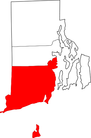 Map of Rhode Island highlighting Washington County | |
| CDPs | ||
| Other villages |
| |
| Indian reservation | ||
| Authority control |
|
|---|