Mount Auburn Historic District
Mount Auburn Historic District is located in the Mount Auburn neighborhood of Cincinnati, Ohio. It extends along both sides of Auburn Avenue roughly between Ringold Street and William H. Taft Road. The population of Mount Auburn was 4,904 at the 2010 census.[2]
Mount Auburn Historic District | |
.png) A map of Mount Auburn circa 1869. Visible are the house of Alphonso Taft (which is now the William Howard Taft National Historic Site), the Cincinnati Orphan Asylum and the Mount Auburn Young Ladies Institute. | |
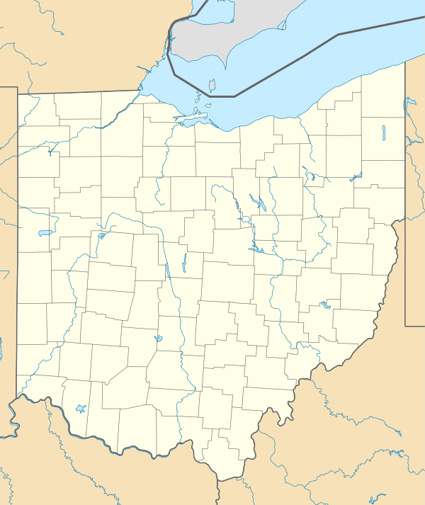  | |
| Location | Both sides of Auburn Ave. from Ringgold St. to Howard Taft Rd., Cincinnati, Ohio |
|---|---|
| Coordinates | 39°7′12″N 84°30′30″W |
| Area | 414 acres (1.68 km2), 31 buildings |
| Built | 1819 |
| Architectural style | Mid 19th Century Revival, Late Victorian |
| NRHP reference No. | 73001464[1] |
| Added to NRHP | March 28, 1973 |
The District was placed on the National Register of Historic Places on March 28, 1973 (No. 73001464). Mount Auburn was founded as a hilltop retreat for Cincinnati's social elite where wealthier people could escape the dirt, heat, smoke and crowded conditions of the lower city. Ornate historic mansions with incredible panoramic views still reflect this heritage.
The district contains notable houses of Federal, Greek Revival, Italian Villa, Romanesque Revival, and Georgian Revival styles. The houses date from 1819 to the turn of the century and are associated with the prominent Cincinnatians. Noted residents include President William Howard Taft.
History
Mt. Auburn was for a long time almost the only suburb of the city. It was at first called Keys' Hill,[3] after an old settler, and this name was used until 1837. By 1826 a number of prominent citizens had taken up residence there.[4]
Mount Auburn was platted as a town in 1837. It owes its name to the then newly established Mount Auburn Cemetery of Boston.[5] By 1842, it extended from Liberty Street (Liberty Street got its name because the city laws were not enforced north of it and it was the location of the "northern liberties" – gambling, drinking and carousing) to McMillan Street (note that the historic district only goes as far south as Ringold Street, the rest of the Mount Auburn neighborhood to the south is the Prospect Hill Historic District).[3] Mount Auburn was annexed to the City of Cincinnati in 1849.[6]
Television
Mount Auburn is the main major television broadcast facility location for the Cincinnati area.
Stations that transmit from Mount Auburn:
WLWT has their studios on Young Street, and their transmitter on Chickasaw Street
WKRC-TV has studios and Transmitter located on Highland Avenue.
WCPO-TV has their transmitter on Symes Street, the tower also holds WBQC-LD.
WCET (TV) Has their Transmitter Located on Chickasaw Street with WLWT.
Buildings and sites
- William Howard Taft National Historic Site
- The Mount Auburn Young Ladies Institute was established in 1856 to provide higher education to females. It was known for a strenuous curriculum, particularly in science and mathematics. The Institute was located on twenty-three acres of land that was landscaped by a gardener. Only four acres were cultivated for vegetable and flower gardens and a fruit orchard. The remainder was part of the landscaped area.
- Cincinnati Orphan Asylum
- Hopkins Park is a small hillside park in Mt. Auburn
- Inwood Park was created in 1904 after the purchase of a stone quarry. Its pavilion, built in 1910 in Mission style, is one of the earliest buildings extant in Cincinnati's parks.
- Jackson Hill Park
- Glencoe-Auburn Hotel and Glencoe-Auburn Place Row Houses
- Prospect Hill
Other notable architecture
- Mount Auburn Presbyterian Church, 103 William Howard Taft Road
- Former First District School, 412 Liberty Hill
- Mt. Auburn Cable Railway Building, Corner of Highland and Dorchester
- The William Howard Doane House (Sunny Side), 2223 Auburn Avenue
- Mt. Auburn Baptist Church, 2147 Auburn Avenue
- Adam Riddle House, 2021 Auburn Avenue
- The Henry Powell House, 2209 Auburn Avenue
Schools
- God's Bible School and College
- Mount Auburn Preparatory Academy
- William Howard Taft Elementary
- Christ College of Nursing
Medical institutions
- The Christ Hospital
- Planned Parenthood Elizabeth Campbell Surgical Center
Commentary
I was quite charmed with the appearance of the town, and its adjoining suburb of Mount Auburn: from which the city, lying in an amphitheatre of hills, forms a picture of remarkable beauty, and is seen to great advantage.
Behold the Fifth Avenue of Cincinnati! It is not merely the pleasant street of villas and gardens along the brow of the hill, though that is part of it. Mount to the cupola of the Mount Auburn Young Ladies' School, which stands near the highest point, and look out over a sea of beautifully formed, umbrageous hills, steep enough to be picturesque, but not too steep to be convenient, and observe that upon each summit, as far as the eye can reach, is an elegant cottage or mansion, or clust of tasteful villas, surrounded by groves, gardens and lawns. This is Cincinnati's Fifth Avenue.
— James Parton, Atlantic Monthly, August, 1867
Gallery
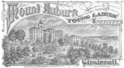 The cover of a catalog for the Mount Auburn Young Ladies Institute. The landscape of historic Mount Auburn is visible.
.png) Mount Auburn is seen here as e in this drawing from circa 1861.
Mount Auburn is seen here as e in this drawing from circa 1861.%2C_residence_of_William_Howard_Doane_in_Cincinnati%2C_Ohio.jpg) Sunny Side (1850), residence of William Howard Doane
Sunny Side (1850), residence of William Howard Doane
References
- "National Register Information System". National Register of Historic Places. National Park Service. January 23, 2007.
- "Mt. Auburn Statistical neighborhood approximation". City of Cincinnati. p. 2. Retrieved 27 January 2018.
- Rider, Peg (May 21, 1989). "Mt. Auburn". Prospect Hill, A Neighborhood Reborn (1807–present). Archived from the original on September 30, 2007. Retrieved 2007-06-24.
- Clarke, S. J. (1912). Cincinnati, the Queen City, 1788-1912, Volume 2. The S. J. Clarke Publishing Company. p. 531. Retrieved 2013-05-20.
- Stradling, David (Oct 1, 2003). Cincinnati: From River City to Highway Metropolis. Arcadia Publishing. p. 37. Retrieved 2013-05-25.
- Federal Writers' Project (1943). Cincinnati, a Guide to the Queen City and Its Neighbors. p. 357. Retrieved 2013-05-04.
External links
| Wikimedia Commons has media related to Mount Auburn, Cincinnati. |
- Mt. Auburn Community Website
- William Howard Taft National Historic Site (National Park Service)
- Mount Auburn Historic District
- Map Mount Auburn Historic District

| Lists by county |
|  |
|---|---|---|
| Lists by city | ||
| Other lists | ||