Luisiana, Laguna
Luisiana, officially the Municipality of Luisiana, (Tagalog: Bayan ng Luisiana), is a 4th class municipality in the province of Laguna, Philippines. According to the 2015 census, it has a population of 19,720 people.[3]
Luisiana Louisiana | |
|---|---|
| Municipality of Luisiana | |
 Downtown area | |
Nickname(s):
| |
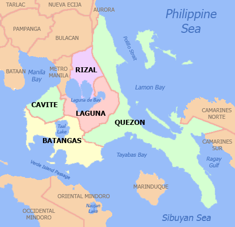
 Map of Laguna with Luisiana highlighted | |

| |
.svg.png) Luisiana Location within the Philippines | |
| Coordinates: 14°11′06″N 121°30′39″E | |
| Country | |
| Region | Calabarzon (Region IV-A) |
| Province | Laguna |
| District | 4th District |
| Founded | April 3, 1854 |
| Chartered | November 12, 1907 |
| Barangays | 23 (see Barangays) |
| Government | |
| • Type | Sangguniang Bayan |
| • Mayor | Nestor A. Rondilla |
| • Vice Mayor | Luibic Jacob |
| • Congressman | Benjamin C. Agarao Jr. |
| • Electorate | 14,689 voters (2019) |
| Area | |
| • Total | 73.31 km2 (28.31 sq mi) |
| Elevation | 388.9 m (1,275.9 ft) |
| Population (2015 census)[3] | |
| • Total | 19,720 |
| • Density | 270/km2 (700/sq mi) |
| • Households | 4,635 |
| Demonym(s) | Luisiense/Louisianian |
| Economy | |
| • Income class | 4th municipal income class |
| • Poverty incidence | 8.57% (2015)[4] |
| • Revenue (₱) | 71,854,320.02 (2016) |
| Time zone | UTC+8 (PST) |
| ZIP code | 4032 |
| PSGC | |
| IDD : area code | +63 (0)49 |
| Climate type | tropical monsoon climate |
| Native languages | Tagalog |
Locals call the town Little Baguio of Laguna because of its high elevation and cool climate like the City of Baguio.
History
During the 17th century, there was an area of land in Laguna known as Terreno de Nasonog (Lupaín ng Nasonog in Tagalog). In 1678, Terreno de Nasúnog was divided into three parts: Nasúnog de Lucban, Nasonog de Cavinti, and Nasúnog de Majayjay.
Nasonog de Majayjay later became the town of Luisiana. It was only on April 3, 1854 that ecclesiastical independence was granted to Nasonog by the Governor-General (the Marqués de Novaliches) with the corresponding approval from the Archbishop of Manila, having Don Marcos Bartolomé as its first interim parish priest. Because of the role of Don Luis Bernárdo, which was then regarded as the Father of Luisiana, and his wife Doña Ana, the town was named 'Luis y Ana', later changed to 'Luisiana'.
In 1948, Visita de Luisiana gained civil independence from Majayjay.
In 1903, the towns of Cavinti and Luisiana were combined, Pedro Villanueva of Cavinti was elected mayor and it was during his term that the Aglipay Church was founded in April, 1904. The Romana family funded the construction of a couple of Protestant churches. However, on November 12, 1907 under the leadership of Don Blas Oración, through the Civil Commission, Cavinti and Luisiana became independent towns.
Geography
109 kilometres (68 mi) away from Manila and 22 kilometres (14 mi) away from the provincial capital, Santa Crúz, the town of Luisiana is bounded on the north by Pagsánjan and Cavinti, on the west by Magdalena and Majayjay, on the south by Lucban, Quezon, and Sampaloc in the east.
Luisiana occupies 8,096.33 hectares (20,006.5 acres) on a plateau 1,400 feet (430 m) atop the Sierra Madre mountains.
Barangays
Luisiana is politically subdivided into 23 barangays. [2]
- De La Paz
- Barangay Zone I (Poblacion)
- Barangay Zone II (Poblacion)
- Barangay Zone III (Poblacion)
- Barangay Zone IV (Poblacion)
- Barangay Zone V (Poblacion)
- Barangay Zone VI (Poblacion)
- Barangay Zone VII (Poblacion)
- Barangay Zone VIII (Poblacion)
- San Antonio
- San Buenaventura
- San Diego
- San Isidro
- San José
- San Juan
- San Luis
- San Pablo
- San Pedro
- San Rafaél
- San Roque
- San Salvador
- Santo Domingo
- Santo Tomás
Climate
The climate is cold, humid, and tropical. The average yearly temperature is around 26 °C (78.8 °F).
| Climate data for Luisiana, Laguna | |||||||||||||
|---|---|---|---|---|---|---|---|---|---|---|---|---|---|
| Month | Jan | Feb | Mar | Apr | May | Jun | Jul | Aug | Sep | Oct | Nov | Dec | Year |
| Average high °C (°F) | 24 (75) |
25 (77) |
26 (79) |
29 (84) |
29 (84) |
28 (82) |
27 (81) |
27 (81) |
27 (81) |
26 (79) |
25 (77) |
24 (75) |
26 (80) |
| Average low °C (°F) | 20 (68) |
20 (68) |
20 (68) |
21 (70) |
22 (72) |
22 (72) |
22 (72) |
22 (72) |
22 (72) |
21 (70) |
21 (70) |
20 (68) |
21 (70) |
| Average precipitation mm (inches) | 58 (2.3) |
41 (1.6) |
32 (1.3) |
29 (1.1) |
91 (3.6) |
143 (5.6) |
181 (7.1) |
162 (6.4) |
172 (6.8) |
164 (6.5) |
113 (4.4) |
121 (4.8) |
1,307 (51.5) |
| Average rainy days | 13.4 | 9.3 | 9.1 | 9.8 | 19.1 | 22.9 | 26.6 | 24.9 | 25.0 | 21.4 | 16.5 | 16.5 | 214.5 |
| Source: Meteoblue [5] | |||||||||||||
Demographics
| Population census of Luisiana | ||
|---|---|---|
| Year | Pop. | ±% p.a. |
| 1903 | 4,174 | — |
| 1918 | 5,224 | +1.51% |
| 1939 | 6,963 | +1.38% |
| 1948 | 6,883 | −0.13% |
| 1960 | 8,746 | +2.02% |
| 1970 | 11,494 | +2.77% |
| 1975 | 12,346 | +1.44% |
| 1980 | 12,199 | −0.24% |
| 1990 | 14,241 | +1.56% |
| 1995 | 16,269 | +2.53% |
| 2000 | 17,109 | +1.09% |
| 2007 | 19,255 | +1.64% |
| 2010 | 20,148 | +1.66% |
| 2015 | 19,720 | −0.41% |
| Source: Philippine Statistics Authority[3][6][7][8] | ||
In the 2015 census, the population of Luisiana, Laguna, was 19,720 people,[3] with a density of 270 inhabitants per square kilometre or 700 inhabitants per square mile.
Economy
Luisiana is basically an agricultural town. At the población, there are only a few commercial establishments which cater to the basic services of the people. Most of them still go to Santa Crúz to do their shopping or marketing and to avail themselves of other services not available in their town.
Sources of income of the people of Luisiana are mainly focused on agriculture such as copra, pandan, palay, bamboo and bunliw, with light industry base and service-sector economy. Piggery and poultry farming are also an additional income.
Transportation
Going to Luisiana by private transportation from Manila, you will pass by the South Superhighway and enter the province via the Calamba exit. Another way is through the Manila East Road(Route 601, Route 602, Route 603 and Route 605)– Pagsánjan route or coming from Quezon, the Lucbán, Tayabas City, Lucena City and Pagbilao, Quezon Route Even from Bicol Region.
Luisiana is also accessible by public transportation taking the same routes as mentioned above. However, whichever route you take, a trip to Luisiana will still be long since it is one of the inner towns in Laguna.
From Manila via Calambâ, a bus will take you to Santa Cruz, Laguna. In Santa Cruz, jeepneys going to Luisiana can be found at the jeepney terminal. Just ask a tricycle driver to take you to the terminal of jeepneys going to Luisiana. Via Santa Crúz, you will pass by the town of Pagsanján before reaching Luisiana. You will easily know it when you have reached the town because the roads become zigzagged with lots of sharp twists and turns. This is one of the reasons why Luisiana is called the 'little Baguio of Laguna.'
Sites and events

At the centre of the town, some of the sites are the Roman Catholic Church, the monument of Don Luis Bernárdo (town’s founder) and a monument of Dr. José Protacio Rizal.
But one interesting site in town is the "guard dogs" at the stairs in front of the municipal building. Instead of lions which are common sites or designs in stairs of other buildings, the municipal building of Luisiana has two dogs, which look like Dalmatians, one in each side of the building. However, no one can tell why they are there or what is the story behind the presence of the dogs in the building. Some of them believe that the dogs might have been a part of the town’s history which is yet to be discovered.
Aside from the man-made attractions, Luisiana is also home to natural attractions like falls (such as Hulugan,[9] Bumbóngan, Malaog, Maapon, Limbun-limbón, Aliw,[10] Lagaslás and Botocán-Tiklingan) and caves (such as the caves of Simbahang Bato and Butás Kabag). Although most of these attractions are not yet fully developed commercially, they are open for the public to see in their natural state.
Town feast is celebrated on October 9 for the feast of Our Lady of the Holy Rosary. Another celebration in town is held every 3 April, which is in commemoration of the town’s establishment as a separate entity from Majáyjay. Luisiana also celebrates the Pandán Festival during this month and also the annual Miss Luisiana beauty pageant to select representative for Miss Laguna beauty pageant. Luisiana has 2 Miss Laguna crowns so far, in 1998 and in 2002.
Education
Secondary
- Liceo de Luisiana
- San Buenaventura Integrated National High School (main-BarangaySan Buenaventura)
- San Buenaventura Integrated National High School (annex-Town of Luisiana)
- Luis Bernardo Memorial High School Inc.
Primary
- Luisiana Central Elementary School
- Bonifacio Elementary School
- San Antonio Elementary School
- San Isidro Elementary School
- San Buenaventura Elementary School
- Saint Dominic Savio School (Closed)
- Santo Domingo Elementary School
- San Salvador Elementary School
- De La Paz San Pablo Elementary School
- Luisiana Adventist Elementary School
- San Rafael Elementary School
Sister cities

Gallery
 Plaza with Municipal Hall in background
 Luisiana Roman Catholic Church
 Liceo de Luisiana
 Bonifacio Elementary School
 Miss Luisiana 2005
References
- "Municipality". Quezon City, Philippines: Department of the Interior and Local Government. Retrieved 31 May 2013.
- "Province: Laguna". PSGC Interactive. Quezon City, Philippines: Philippine Statistics Authority. Retrieved 12 November 2016.
- Census of Population (2015). "Region IV-A (Calabarzon)". Total Population by Province, City, Municipality and Barangay. PSA. Retrieved 20 June 2016.
- "PSA releases the 2015 Municipal and City Level Poverty Estimates". Quezon City, Philippines. Retrieved 1 January 2020.
- "Luisiana: Average Temperatures and Rainfall". Meteoblue. Retrieved 11 May 2020.
- Census of Population and Housing (2010). "Region IV-A (Calabarzon)". Total Population by Province, City, Municipality and Barangay. NSO. Retrieved 29 June 2016.
- Censuses of Population (1903–2007). "Region IV-A (Calabarzon)". Table 1. Population Enumerated in Various Censuses by Province/Highly Urbanized City: 1903 to 2007. NSO.
- "Province of Laguna". Municipality Population Data. Local Water Utilities Administration Research Division. Retrieved 17 December 2016.
- Hulugan Waterfalls
- Aliw Waterfalls
External links
| Wikimedia Commons has media related to Luisiana, Laguna. |
- Luisiana Profile at PhilAtlas.com
- Philippine Standard Geographic Code
- Philippine Census Information
- Local Governance Performance Management System
Places adjacent to Luisiana, Laguna | ||||||||||
|---|---|---|---|---|---|---|---|---|---|---|
| ||||||||||
Santa Cruz (capital) | ||
| Municipalities |  | |
| Component Cities | ||
| Barangays | ||